
Dangerous and extreme heat will remain across portions of the southern U.S. this week. Heavy rainfall may bring significant flash flooding across portions of the Mid-Atlantic and Northeast through the night, and additional flash flooding concerns across New England on Wednesday. Monsoonal thunderstorms will bring a flash flood risk to the Four Corners region, especially in burn scar areas Read More >
Overview
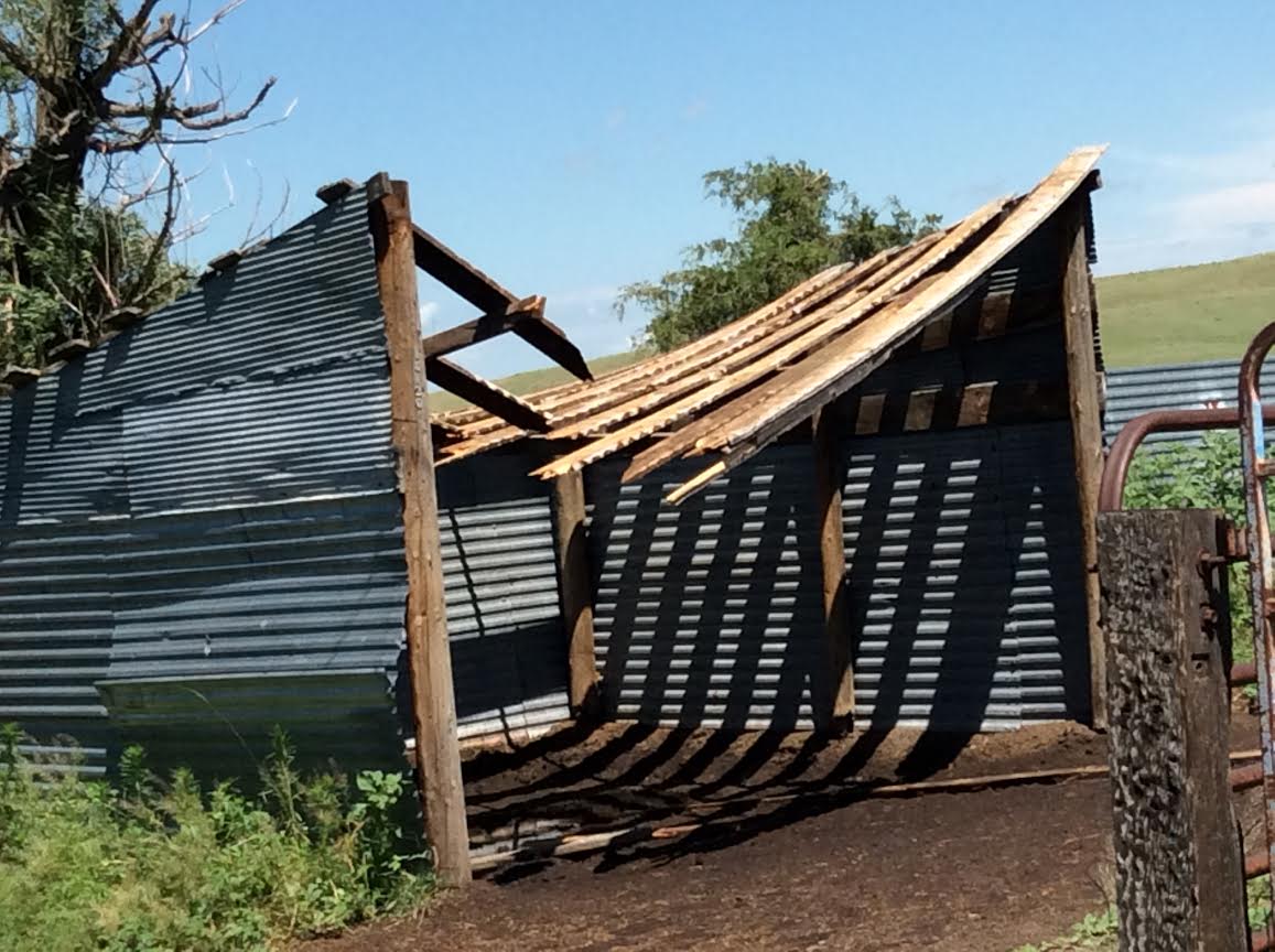
Two EF-1 tornadoes struck southwestern Cherry county on the evening of July 6th. The first tornado moved roughly west to east and damaged a horse barn and several outbuildings at two different ranches, as well as snapping several large trees. A second EF-1 tornado moved from east to west and partially lifted a roof off of a residence, as well as damaging several outbuildings.Tornadoes:
|
Tornado - 1
Track Map-Click to magnify 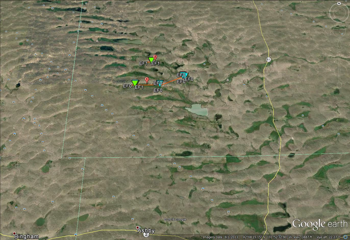 
Downloadable KMZ File |
||||||||||||||||
|
Tornado - 2
Track Map-Click to magnify
Downloadable KMZ File |
||||||||||||||||
The Enhanced Fujita (EF) Scale classifies tornadoes into the following categories:
| EF0 Weak 65-85 mph |
EF1 Moderate 86-110 mph |
EF2 Significant 111-135 mph |
EF3 Severe 136-165 mph |
EF4 Extreme 166-200 mph |
EF5 Catastrophic 200+ mph |
 |
|||||
Photos & Video:
 |
 |
 |
 |
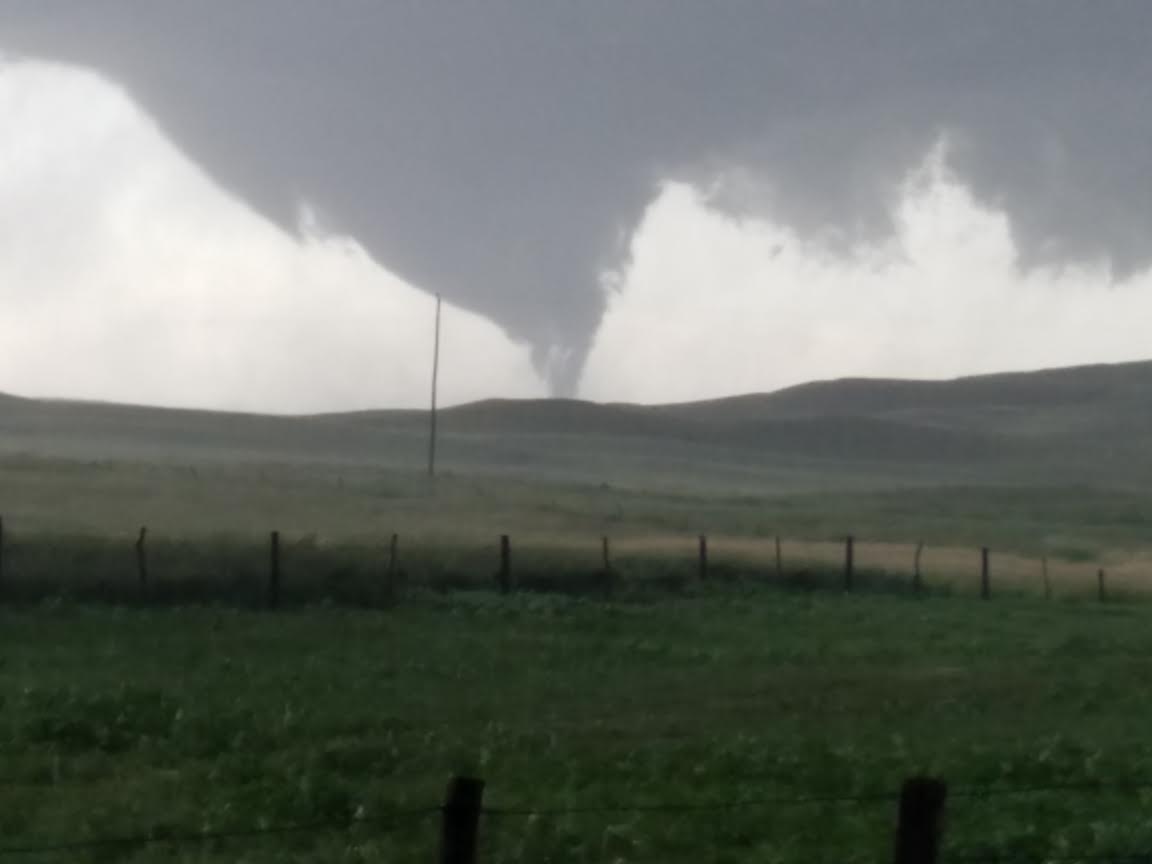
| EF1 Tornado in Southwest Cherry County (Courtesy of Jason Cogar) |
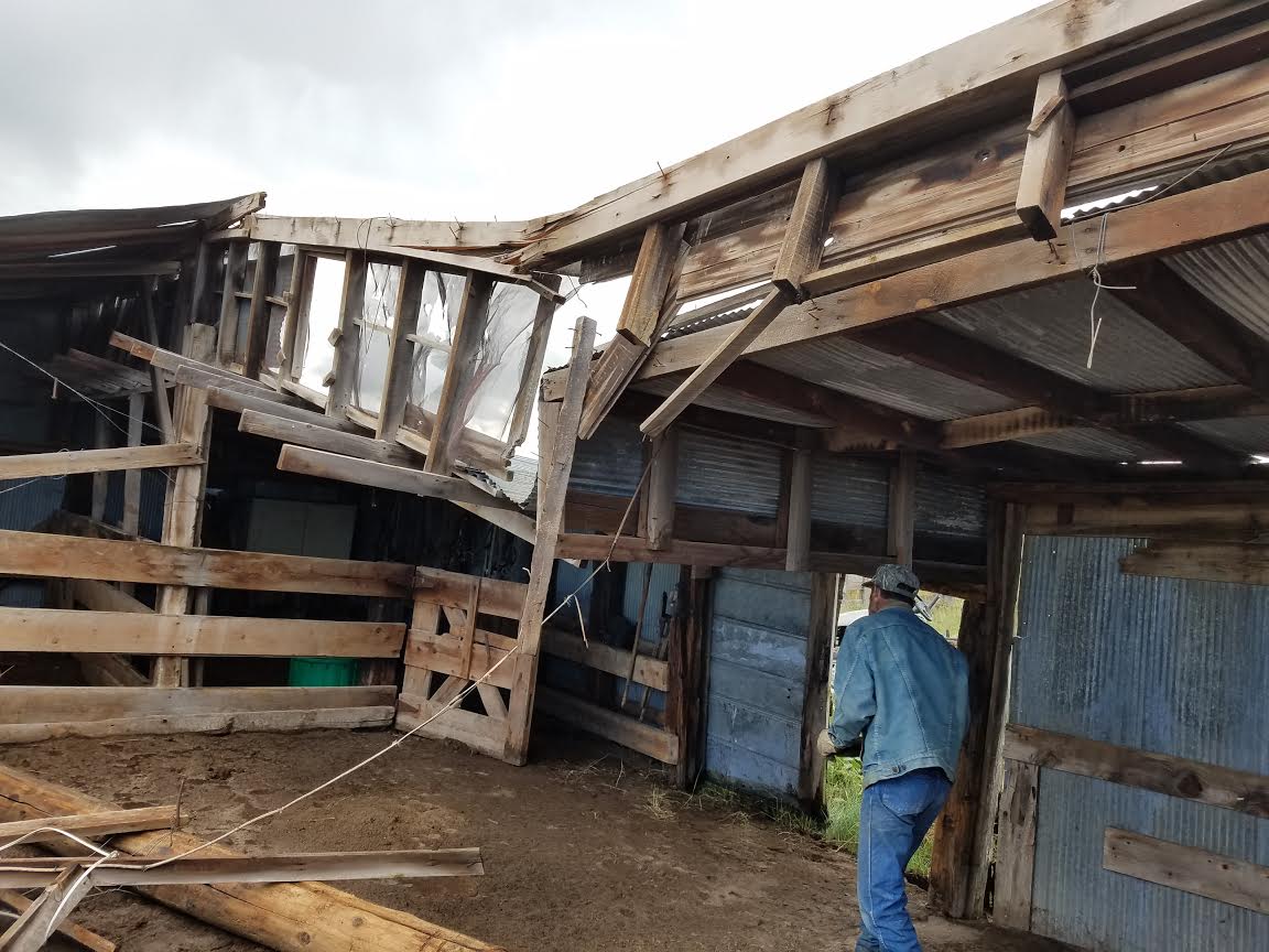
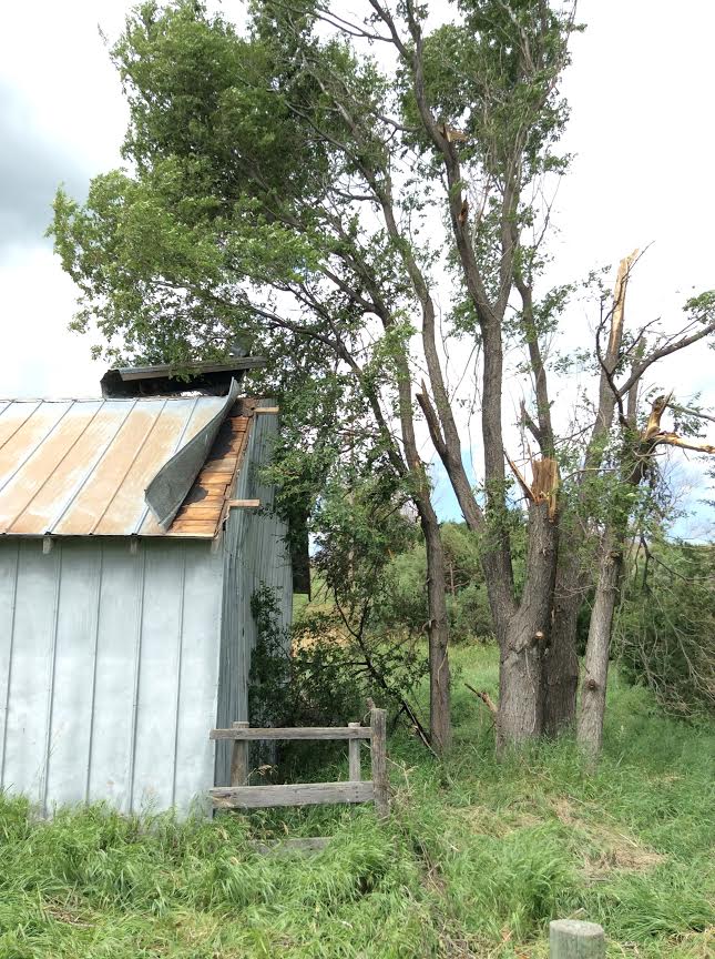
Destroyed Shed at the Bill Adam Ranch (Courtesy of Jason Cogar) |
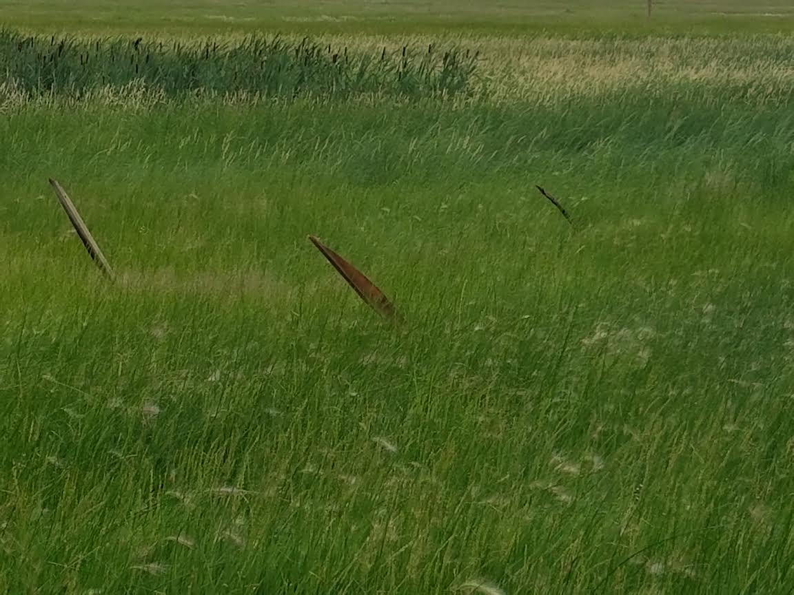
Wood driven into the ground (Courtesy of Jason Cogar) |
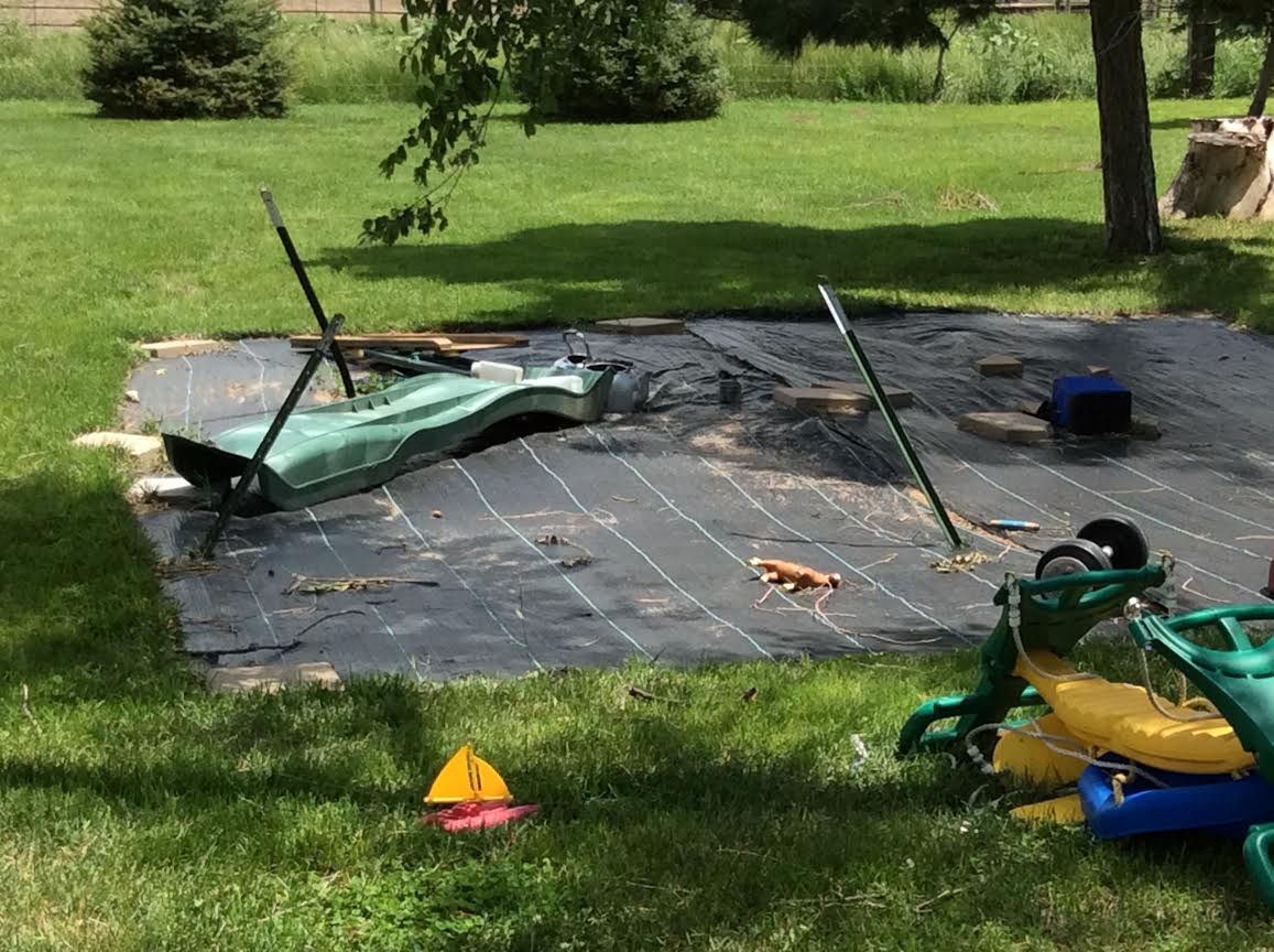
Swing set was anchored to the ground-now gone. (NWS) |
 |
 |
 |
 |
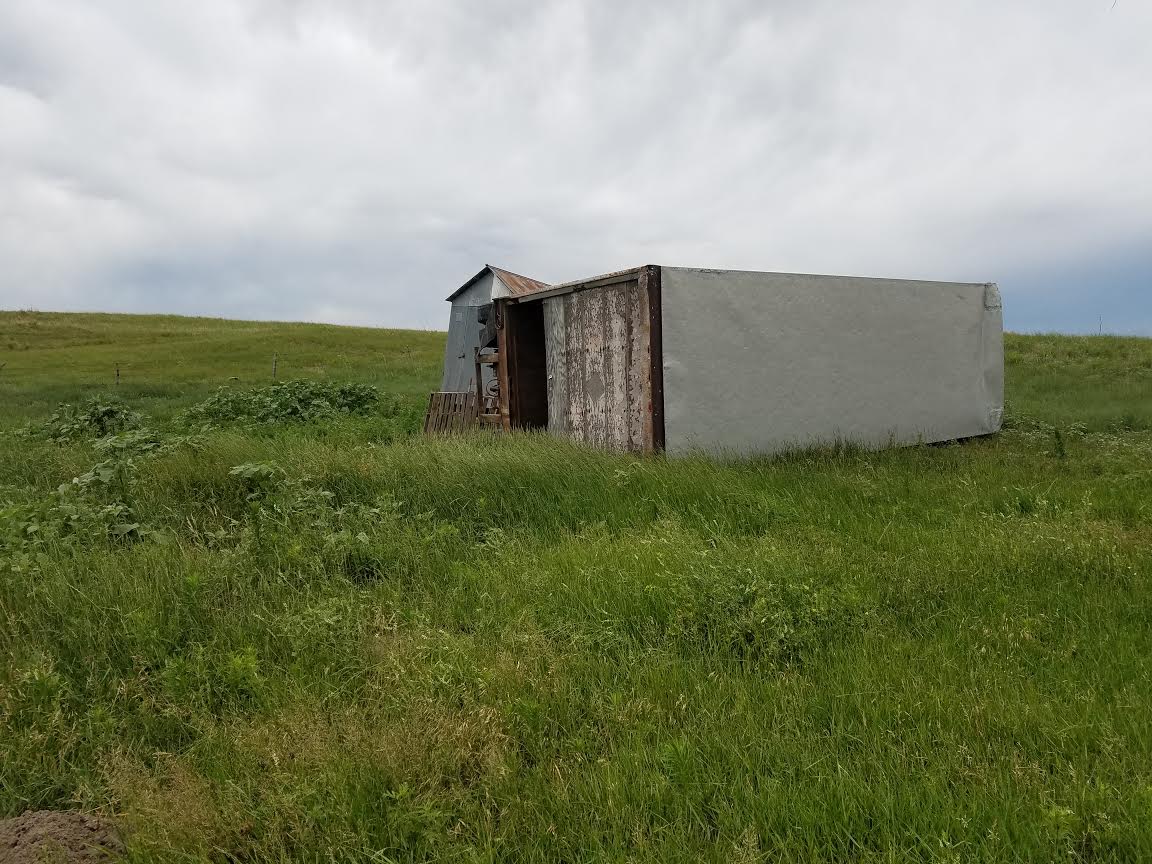
| Overturned trailer. (Courtesy of Jason Cogar) |
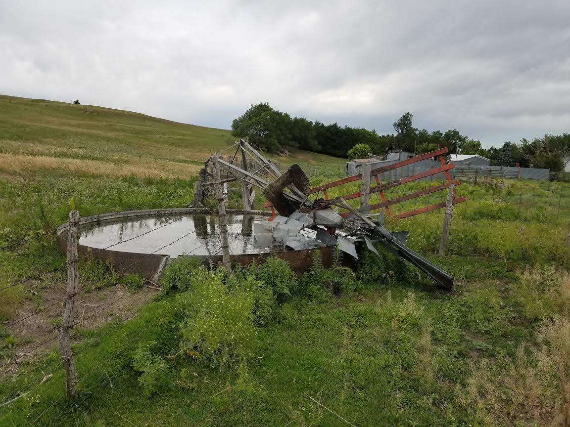
Destroyed windmill (Courtesy of Jason Cogar) |
Damage to an outbuilding (NWS) |
Outbuilding damage (NWS) |
 |
Media use of NWS Web News Stories is encouraged! Please acknowledge the NWS as the source of any news information accessed from this site. |
|

