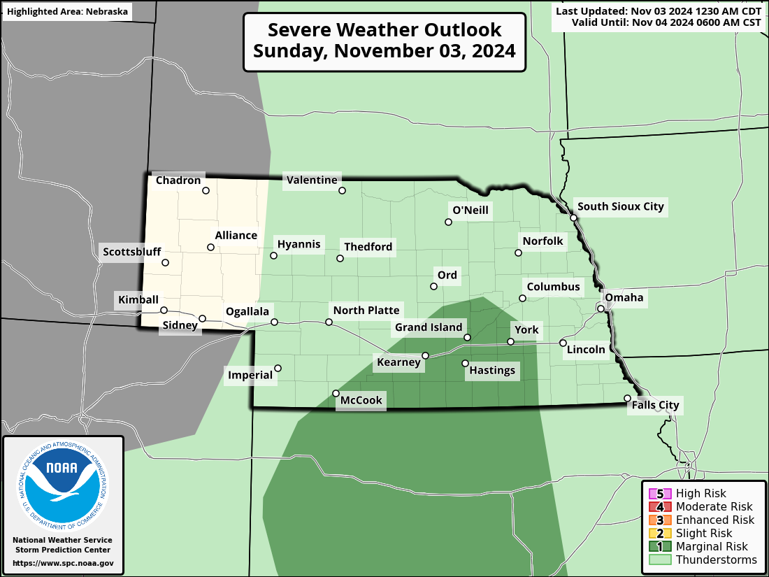
Scattered severe thunderstorms capable of damaging wind gusts and some hail are expected this afternoon and evening from the Upper Ohio River Valley into the Northeast, and from the Appalachians into the Mid-Atlantic States. Excessive rainfall from heavy thunderstorms may produce areas of flash flooding from southern New Mexico into the western and northern Gulf Coast into Wednesday. Read More >

|
|
|
|
|
|---|
|
Hazardous Weather Outlook
|
Graphical HWO
|
24 Hour Storm Report Map
|
Contact Us
|
Click on an image to expand and on the link in the image header (if available) for additional information
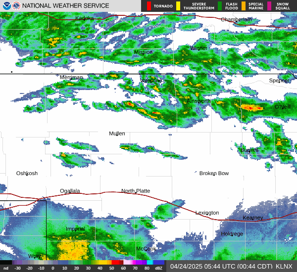
| Latest Nowcast (usually updated during active weather) | Regional Radar |

| Regional GeoColor Satellite | Regional Infrared Satellite |


| Regional Observations | National Surface Map |

| Local Heat Index Values | Local Wind Chill Values |
| Text Products and Helpful Links |
|
Hourly Weather Roundup |
|
Nebraska Max/Min Temp & Precip Summary |
|
Latest Public Information Statement |
|
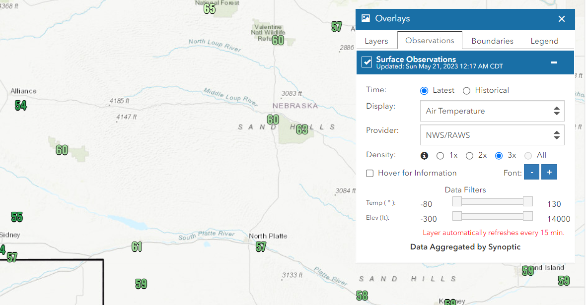
NWS Weather & Hazards Data Viewer (interactive map)
|
Nebraska Mesonet
|


|
Hourly Weather Graphs for Selected Cities
|
|
Valentine
|
Imperial
|
Ainsworth
|
Gordon
|
Forecast Discussion |
| Today's Overall Severe Weather Risk | Today's Tornado Risk |
 |
 |
| Today's Damaging Wind Risk | Today's Large Hail Risk |
 |
|
| Tomorrow's Severe Weather Risk | Tomorrow's Tornado Risk |


| Tomorrow's Damaging Wind Risk | Tomorrow's Large Hail Risk |


| Day 3 Severe Weather Risk |
|
|
|
 |
| Day 4 Severe Weather Risk | Day 5 Severe Weather Risk |


| Day 6 Severe Weather Risk | Day 7 Severe Weather Risk |


| Current Severe Thunderstorm & Tornado Watches |


| Today's Tornado, Wind & Hail Reports | Yesterday's Tornado, Wind & Hail Reports |


|
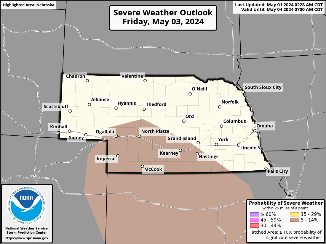
Storm Prediction Center
|
Submit a Storm Report
|
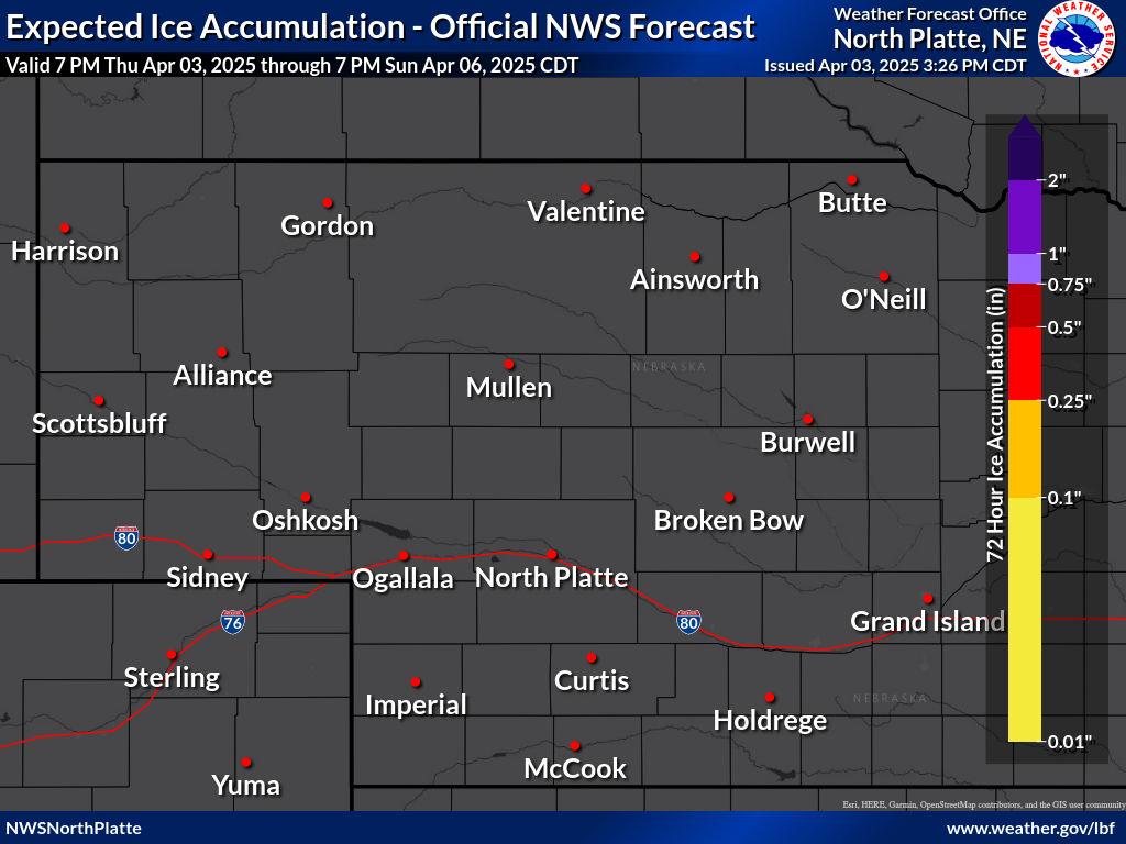
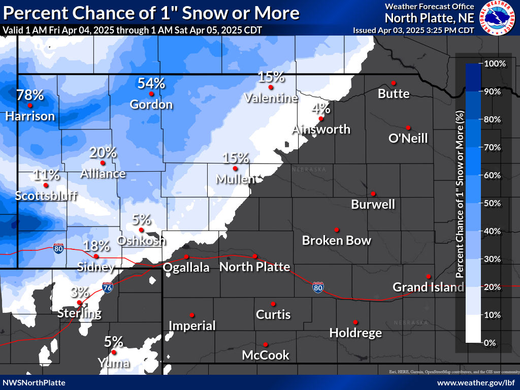
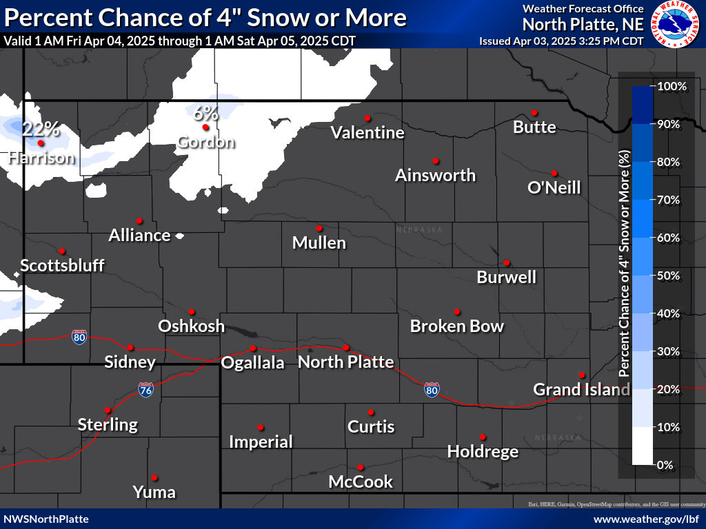
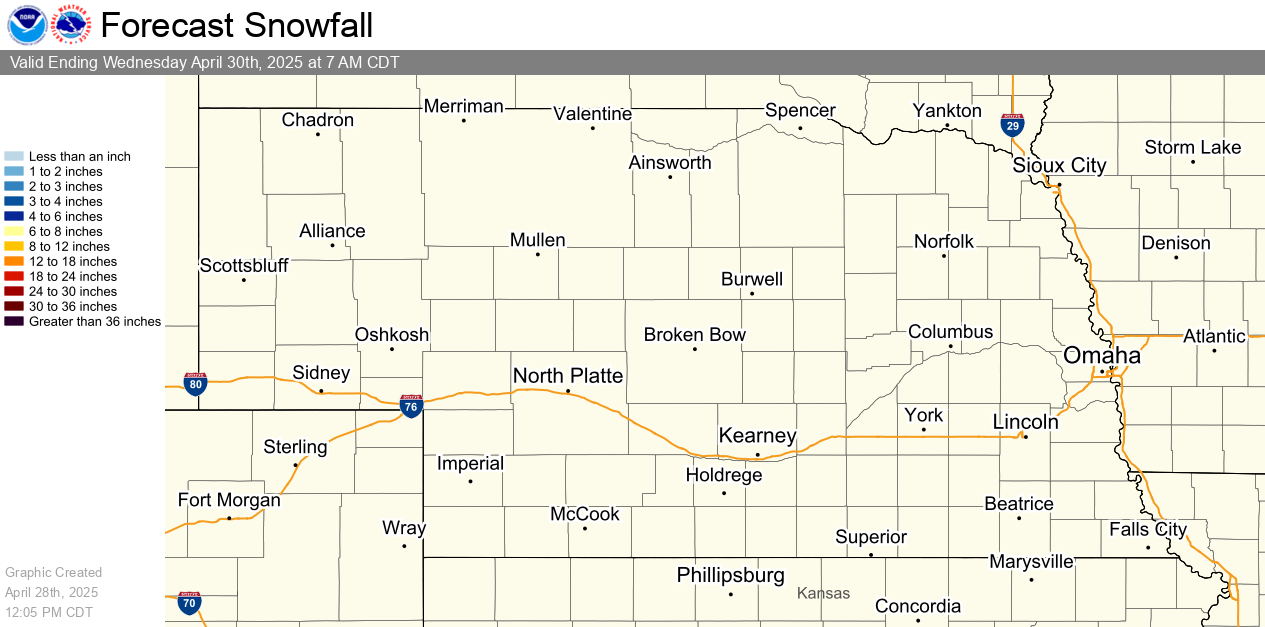
Snow and Ice Forecasts and Probabilities Through 72 Hours
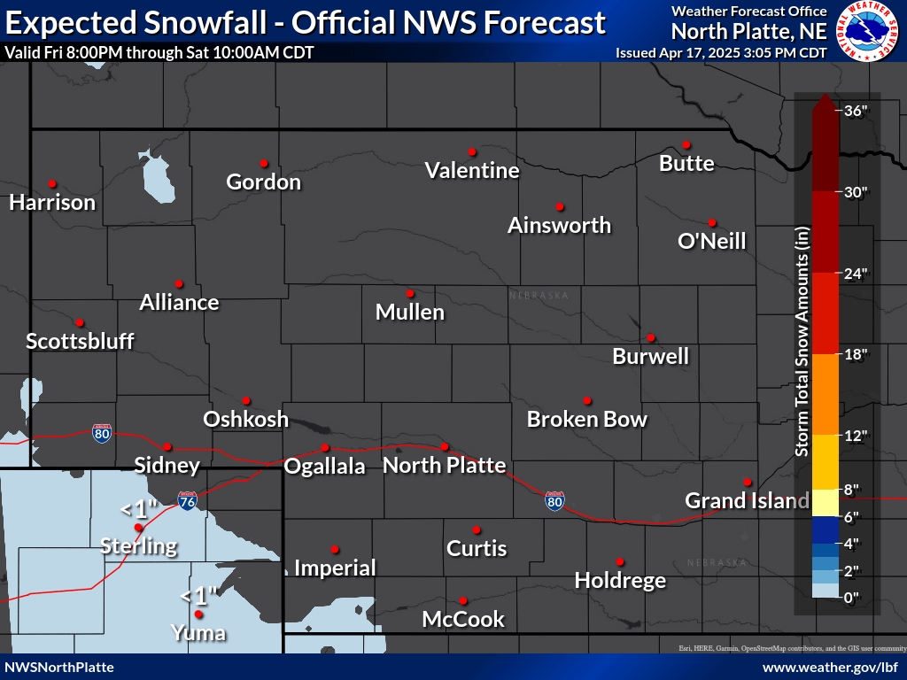
| Visit our Probabilistic Snow Website for more snowfall range and potential graphics |
| 12 Hour Snowfall Forecast | 24 Hour Snowfall Forecast | 48 Hour Snowfall Forecast |


Winter Storm Severity Index (through 72 hours)
| Snow Amount | Snow Load | Blowing Snow |


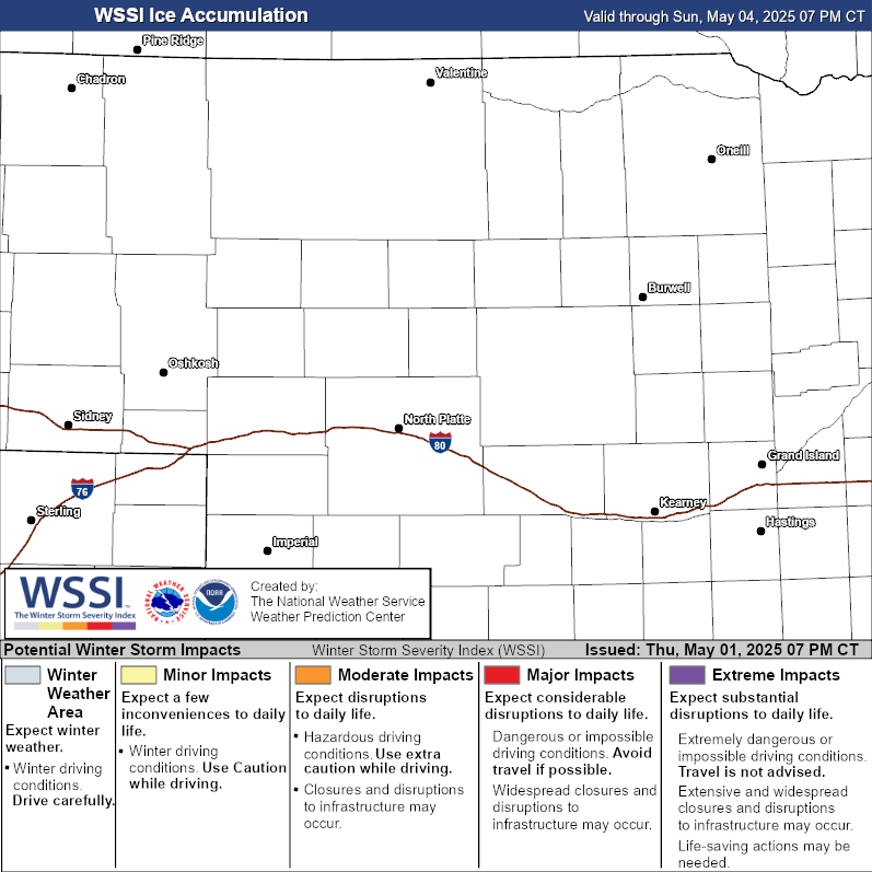
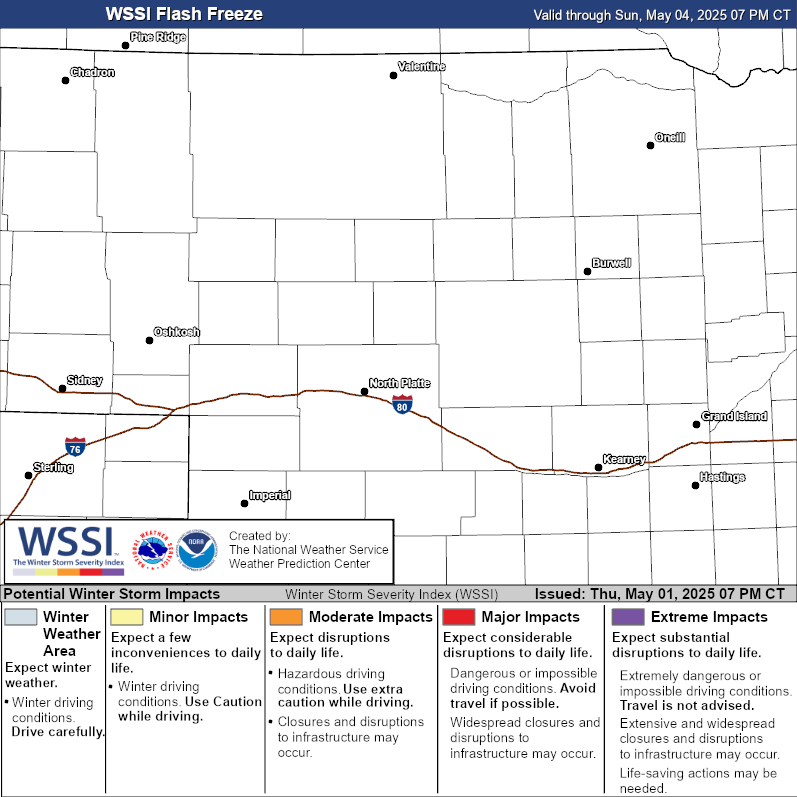
| Ground Blizzard | Ice Accumulation | Flash Freeze |

| Accumulating Snow Outlook - Day 4 | Accumulating Snow Outlook - Day 5 |


| Accumulating Snow Outlook - Day 6 | Accumulating Snow Outlook - Day 7 |


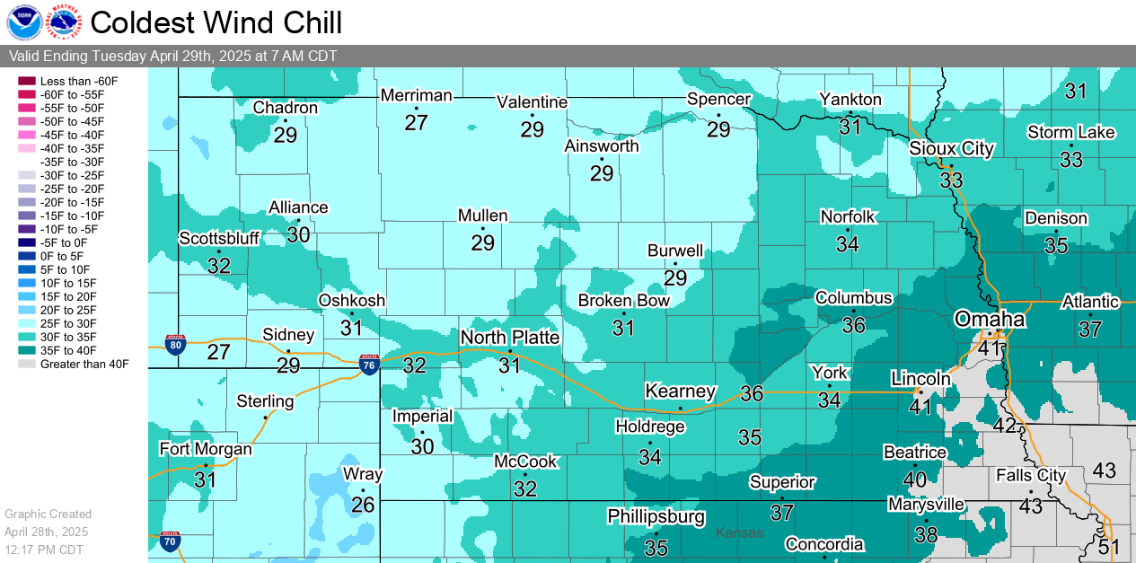
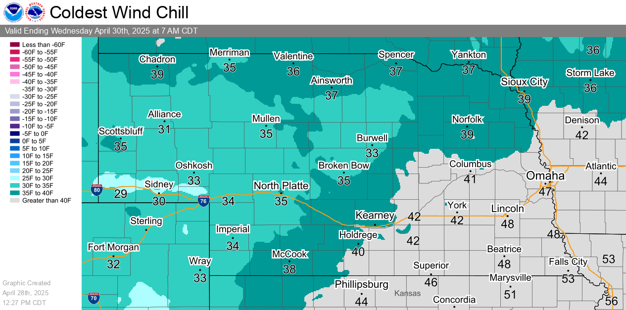
| Tonight's Wind Chill Forecast | Tomorrow Night's Wind Chill Forecast |
| Helpful Links and Other Local Resources |
|
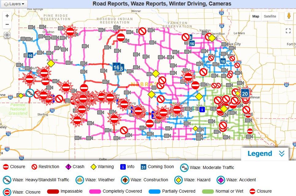
Road Conditions (Nebraska 511)
|
Surrounding states' roads |
Current Snow Depth
|
|
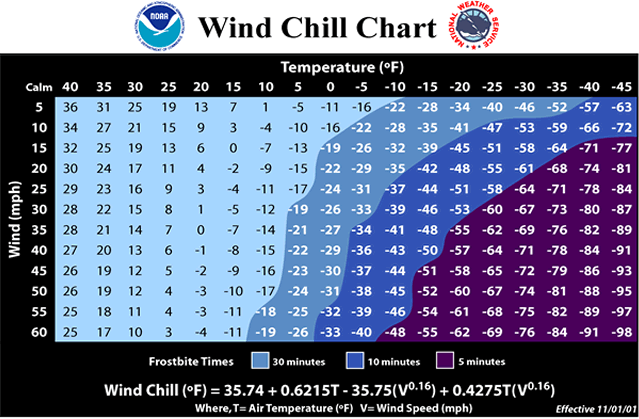
Wind Chill Chart & Frostbite Times
|
Wind Chill Calculator |
48 Hour Snow Report Map
|
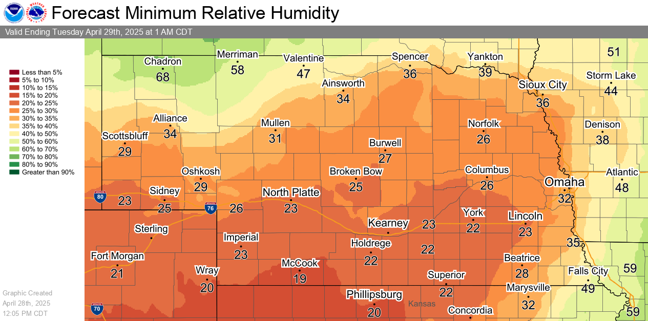
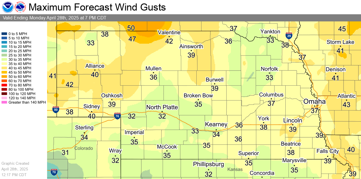
| Today's Minimum Relative Humidity | Today's Maximum Wind Gusts |
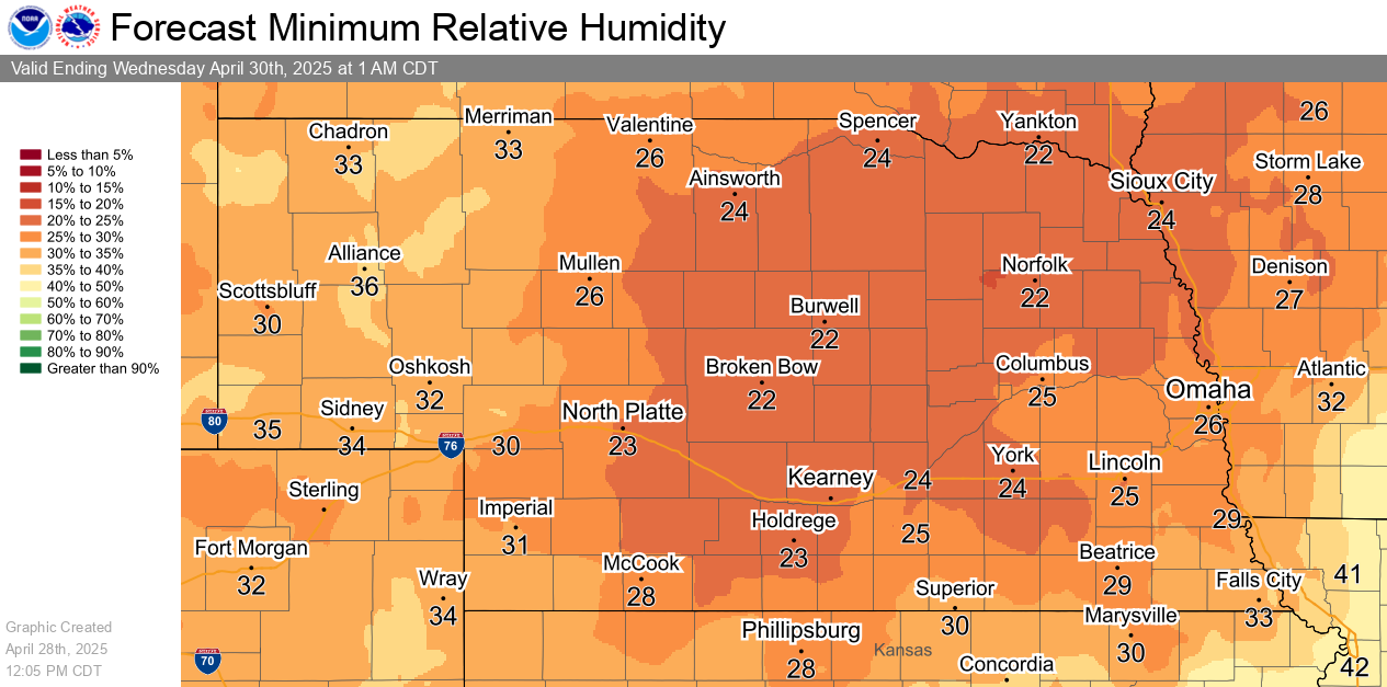
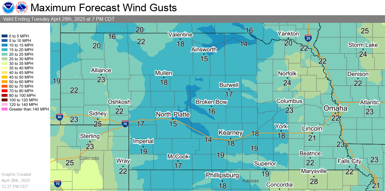
| Tomorrow's Minimum Relative Humidity | Tomorrow's Maximum Wind Gusts |
|
Red Flag Monitor (Latest Wind & Humidity Observations)
|
|
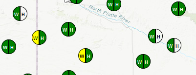
Fire Weather Forecast and Discussion
|
| Visit the NWS North Platte Fire Weather Page for additional local resources |
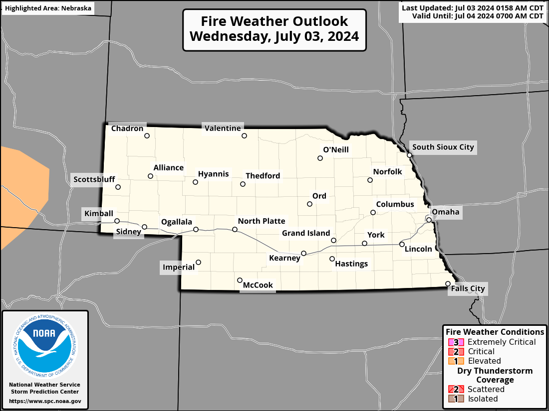
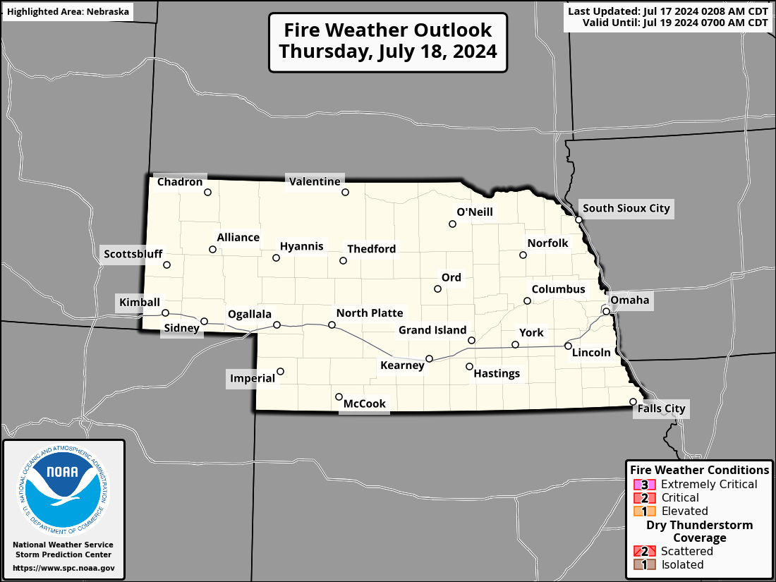
| Today's Fire Weather Risk | Tomorrow's Fire Weather Risk |
| Day 3 Fire Weather Risk | Day 4 Fire Weather Risk |


| Day 5 Fire Weather Risk | Day 6 Fire Weather Risk |


| This Month Wildland Fire Potential | Next Month Wildland Fire Potential |


| Month 3 Wildland Fire Potential | Month 4 Wildland Fire Potential |


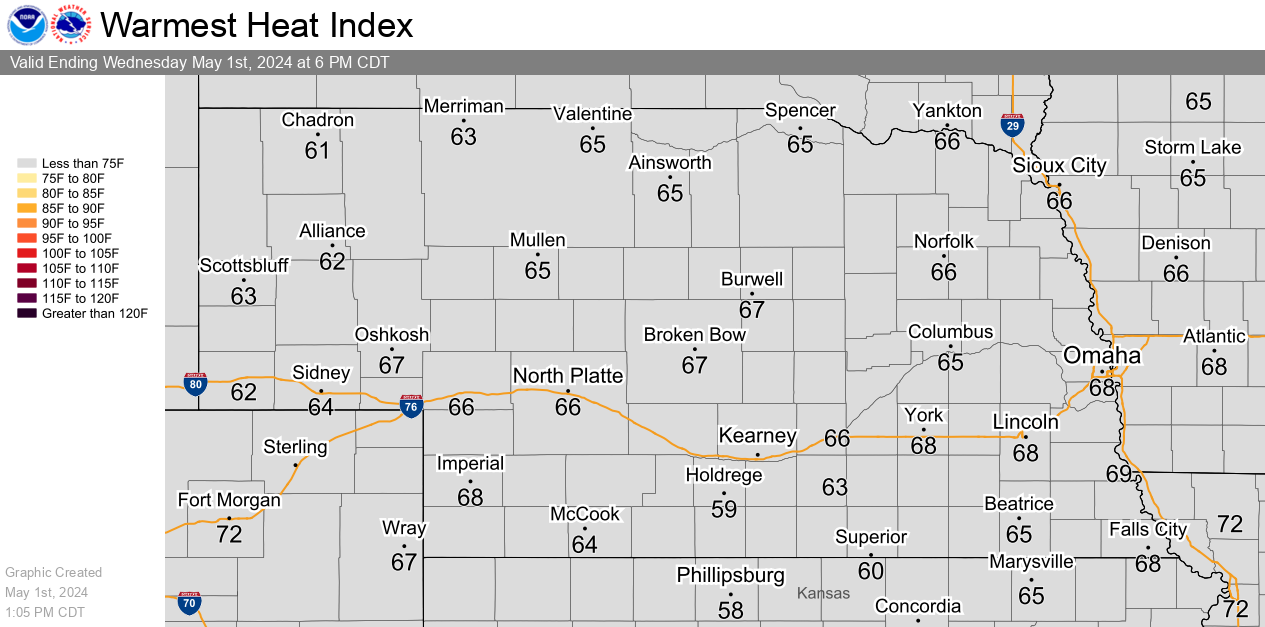
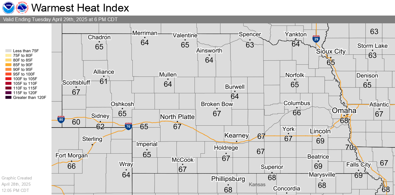
| Today's Maximum Heat Index | Tomorrow's Maximum Heat Index |
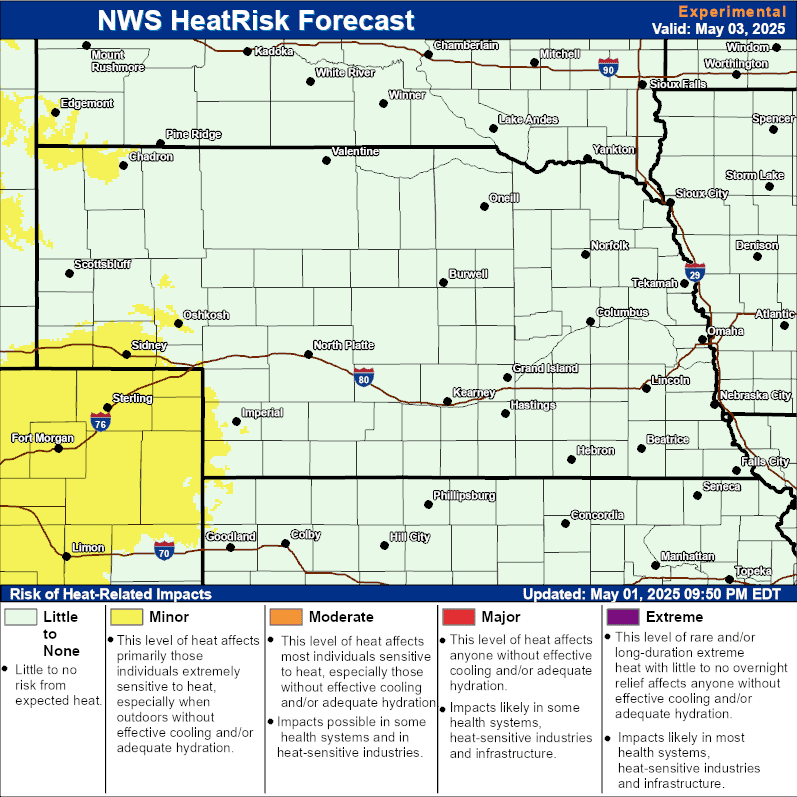
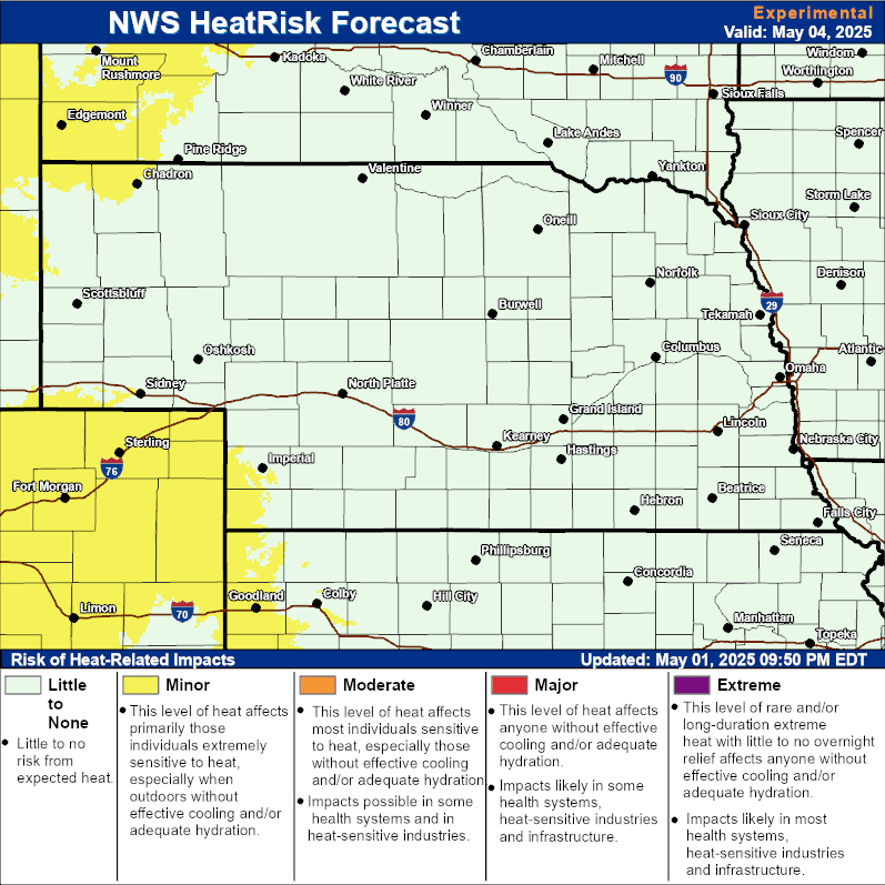
NWS Heat Risk interactive forecast and maps
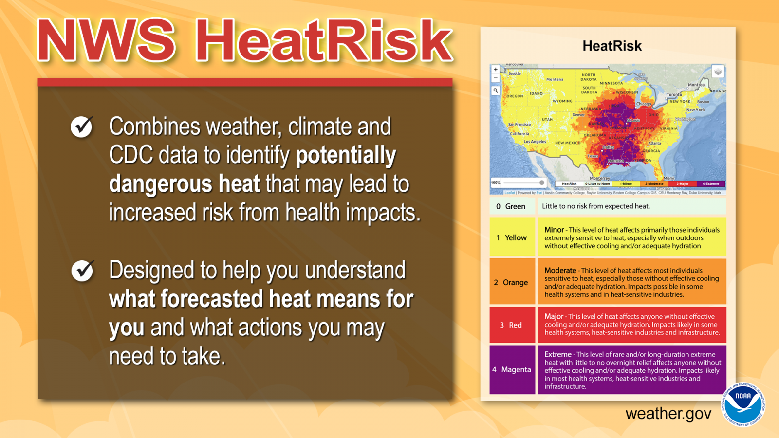
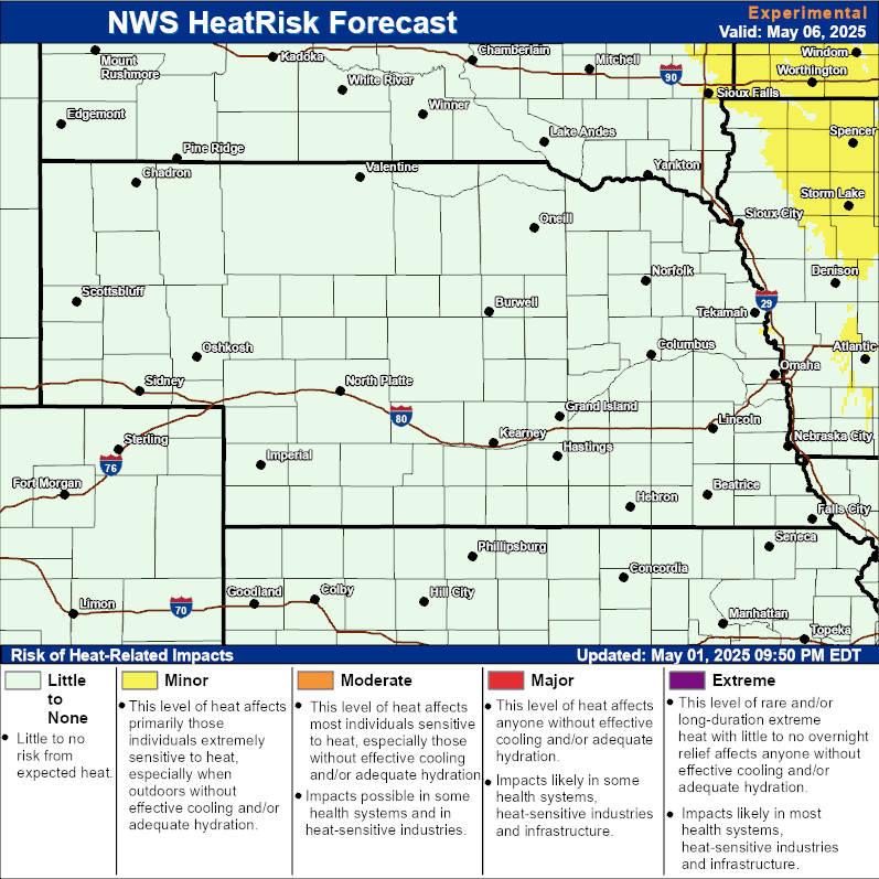
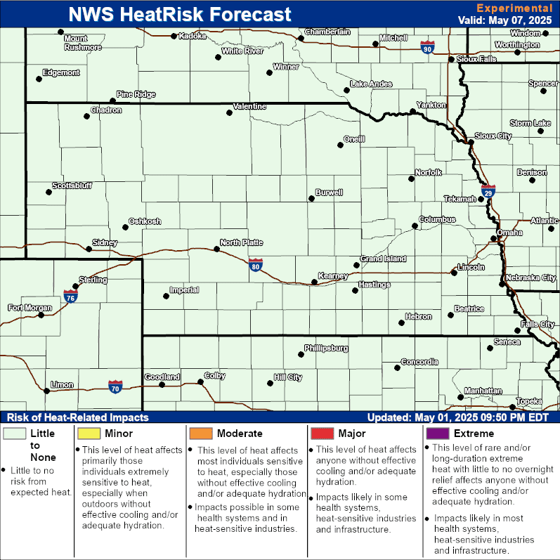
| Today's Heat Risk | Tomorrow's Heat Risk |

| Day 3 Heat Risk | Day 4 Heat Risk |
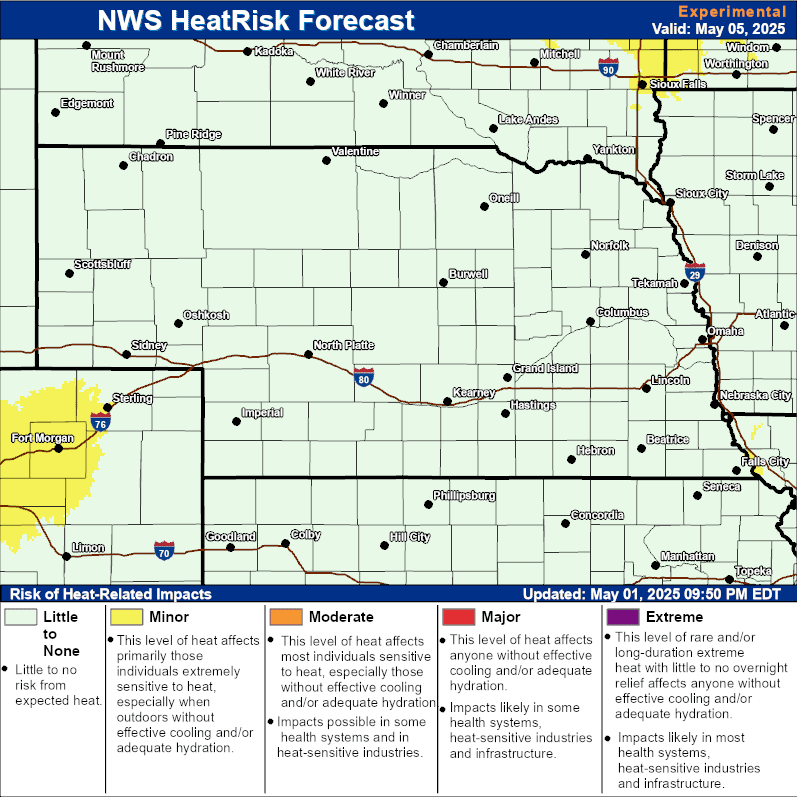
| Day 5 Heat Risk | Day 6 Heat Risk |
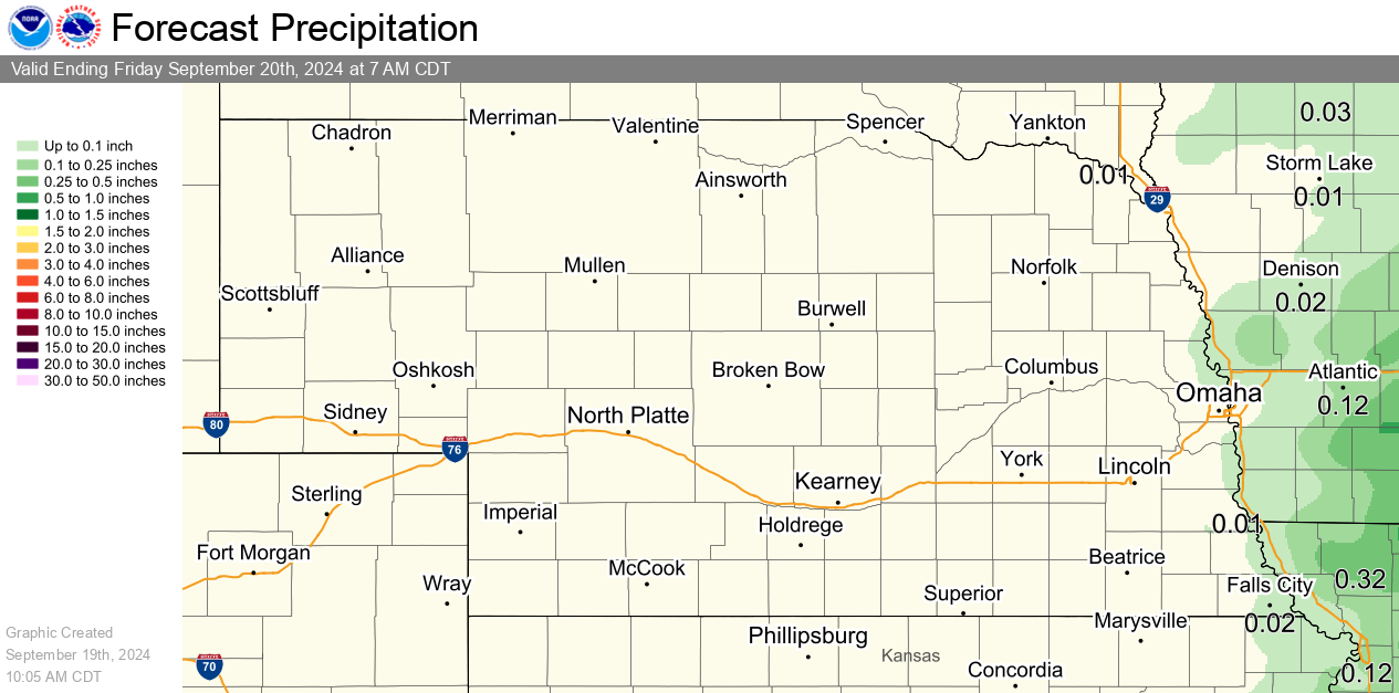
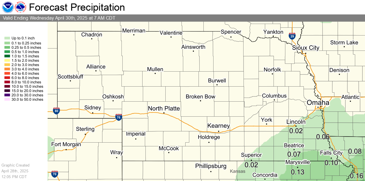
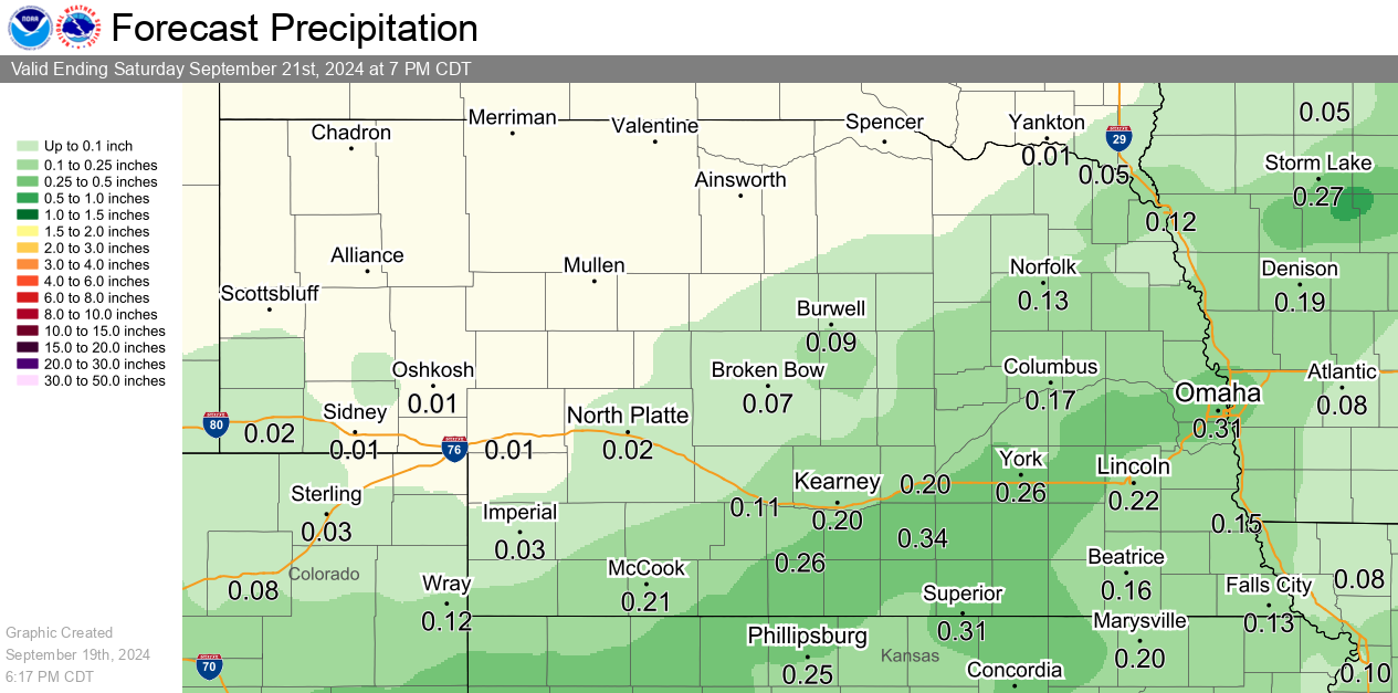
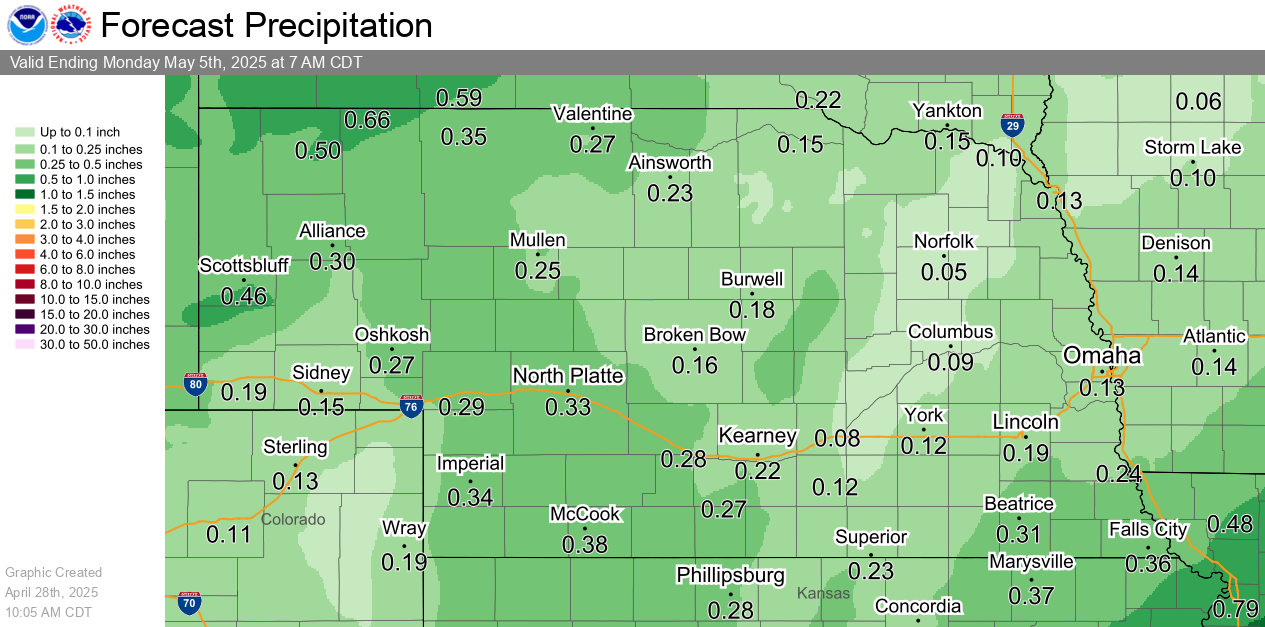
| 0-24 Hour Precip Forecast | 24-48 Hour Precip Forecast |
| 48-72 Hour Precip Forecast | 7 Day Precip Forecast |
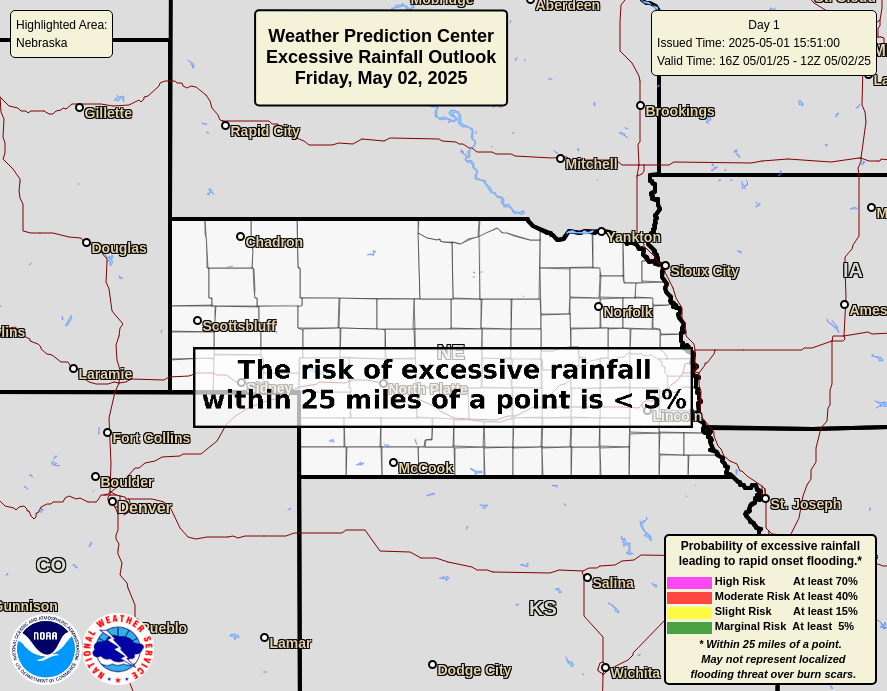
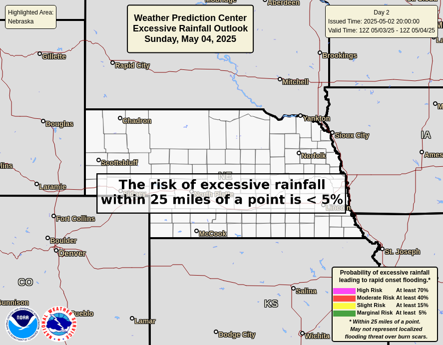
| Today's Flash Flooding Potential | Tomorrow's Flash Flooding Potential |
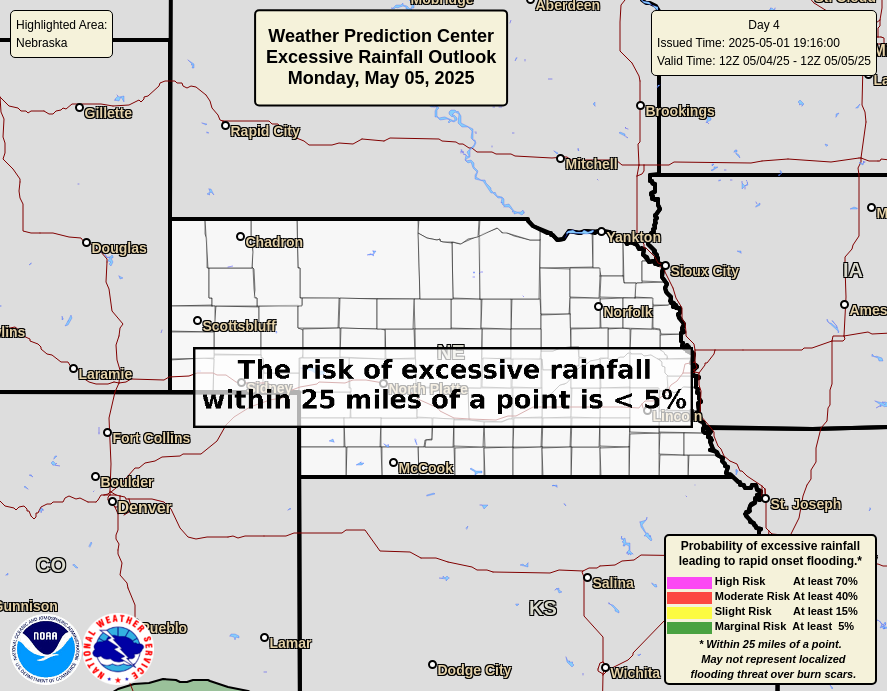
| Day 3 Flash Flooding Potential | Day 4 Flash Flooding Potential |
 |
 |
|
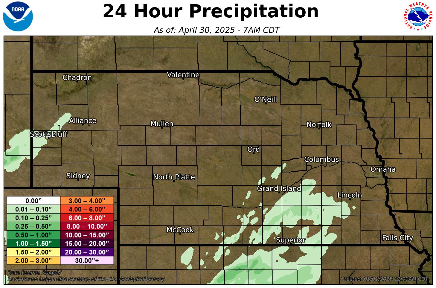
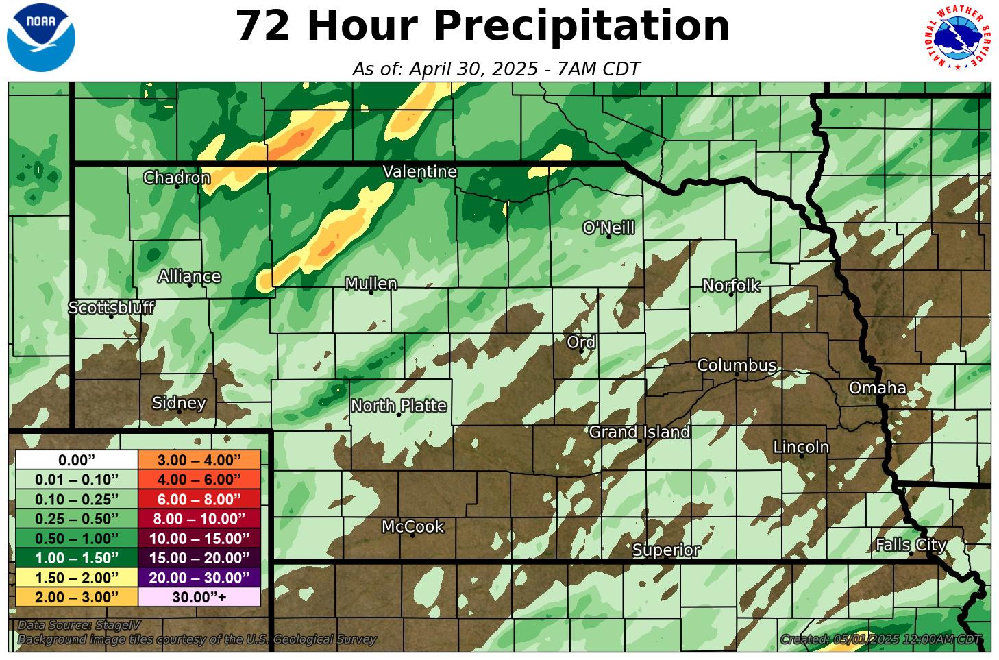
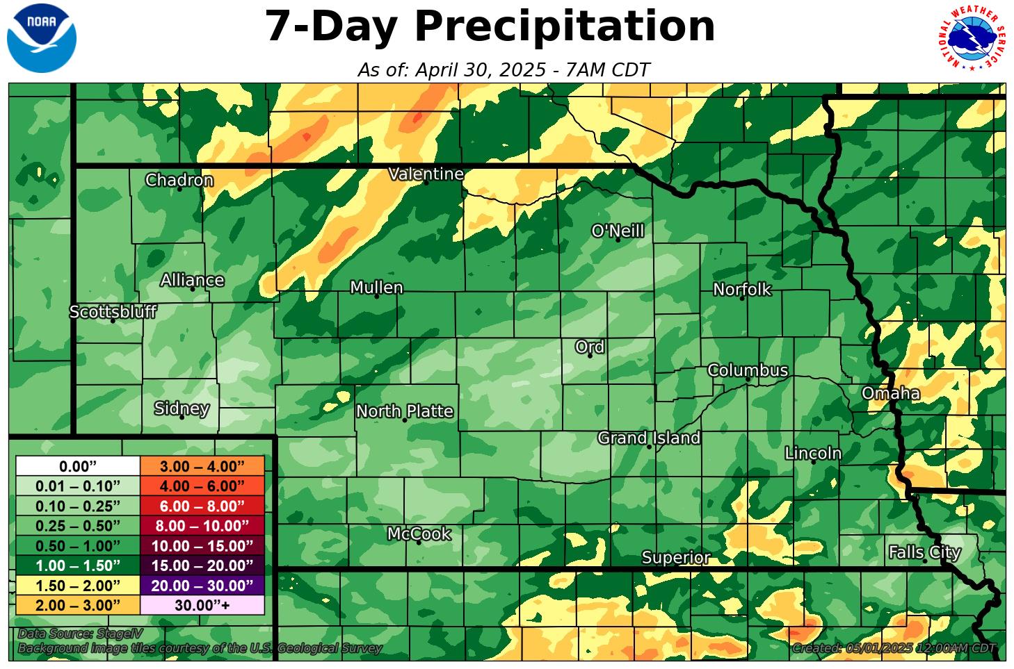
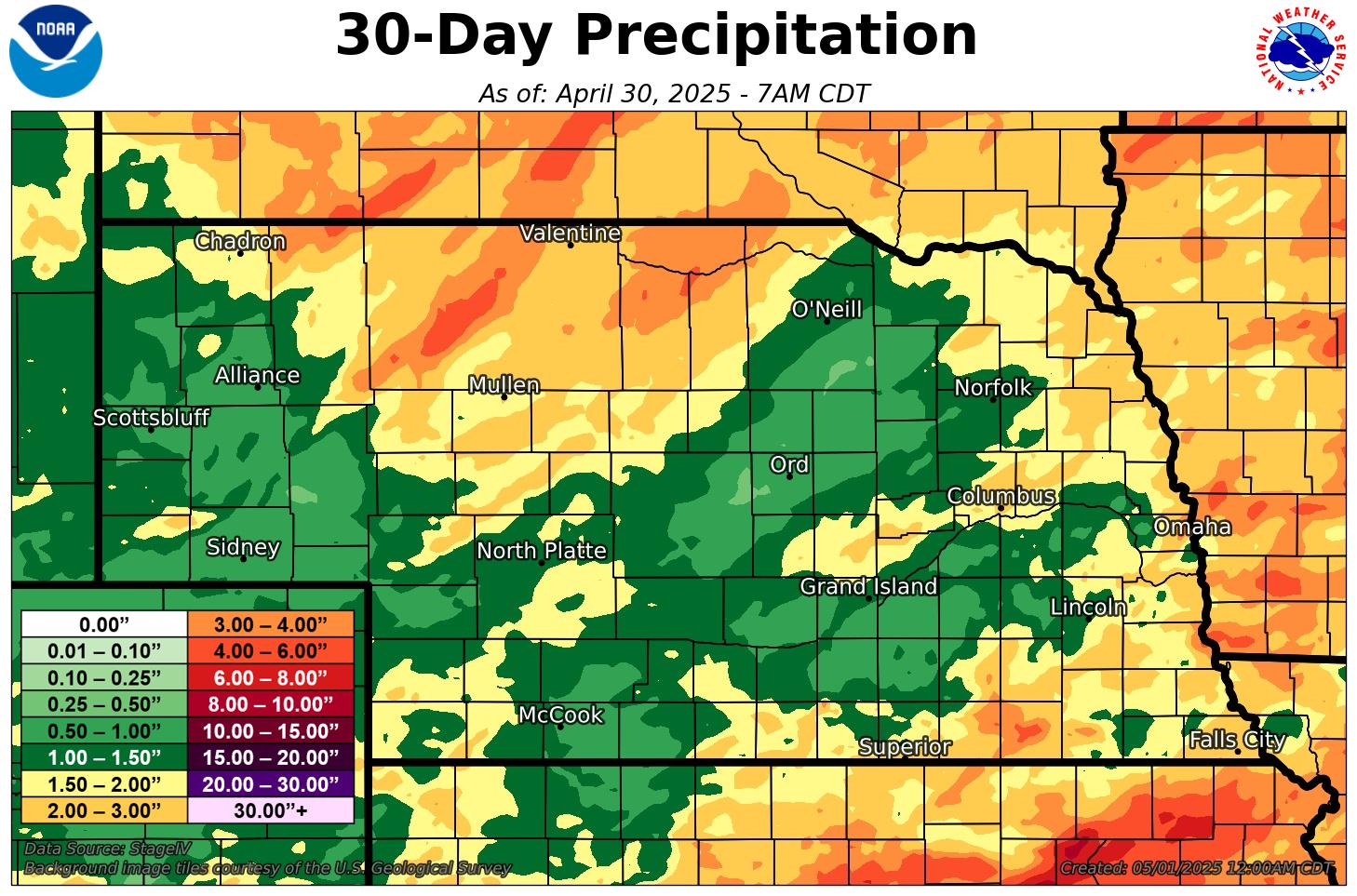
Observed Precipitation |
|
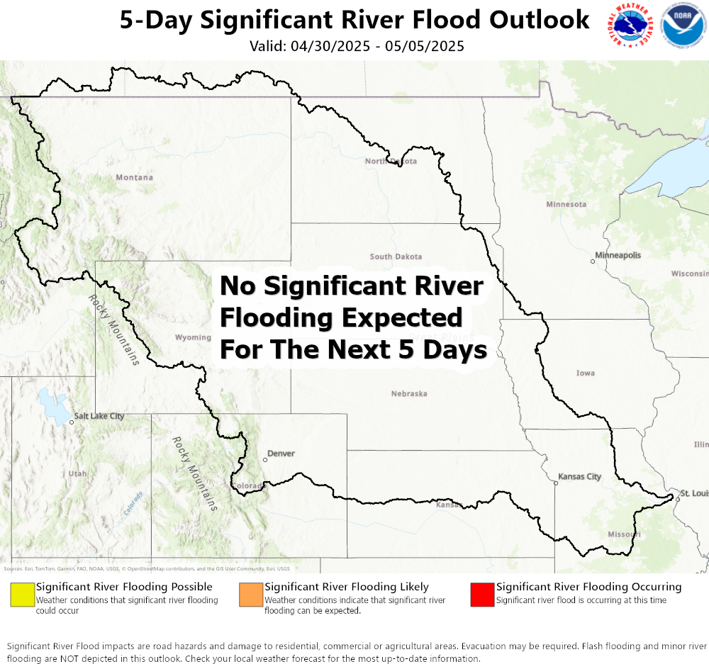
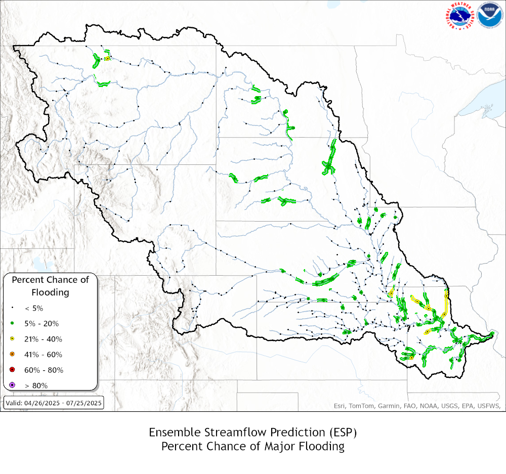
Click here for river and lake gauge readings and forecasts For more information about river forecasts and flooding potential, visit Missouri Basin River Forecast Center |
|
Other Resources Click on the image to zoom and click on the header to link to the webpage. |
|
|
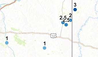
CoCoRaHS (Daily precip reports)
|
High Plains Regional Climate Center
|
| U.S. Drought Monitor | Seasonal Drought Outlook |


| Nebraska Current Drought Monitor | One Week Drought Change |


| One Month Drought Change | One Year Drought Change |


Interactive maps & additional information
Drought Monitor (Univ. Nebraska - Lincoln / NOAA / USDA)
Drought.gov (NOAA - National Integrated Drought Info System)


.png)
.png)


.png)