Dangerous heat will remain across portions of the southern U.S. through the weekend. A heat wave over the Southwest will intensify this week, peaking and expanding into the Intermountain West and northern High Plains this weekend. Severe thunderstorms will produce damaging winds and heavy rainfall over portions of the northern/central Plains into the mid/upper-Mississippi Valleys today. Read More >
Overview
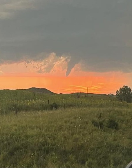
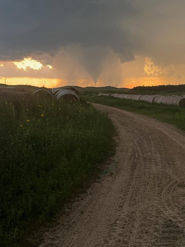
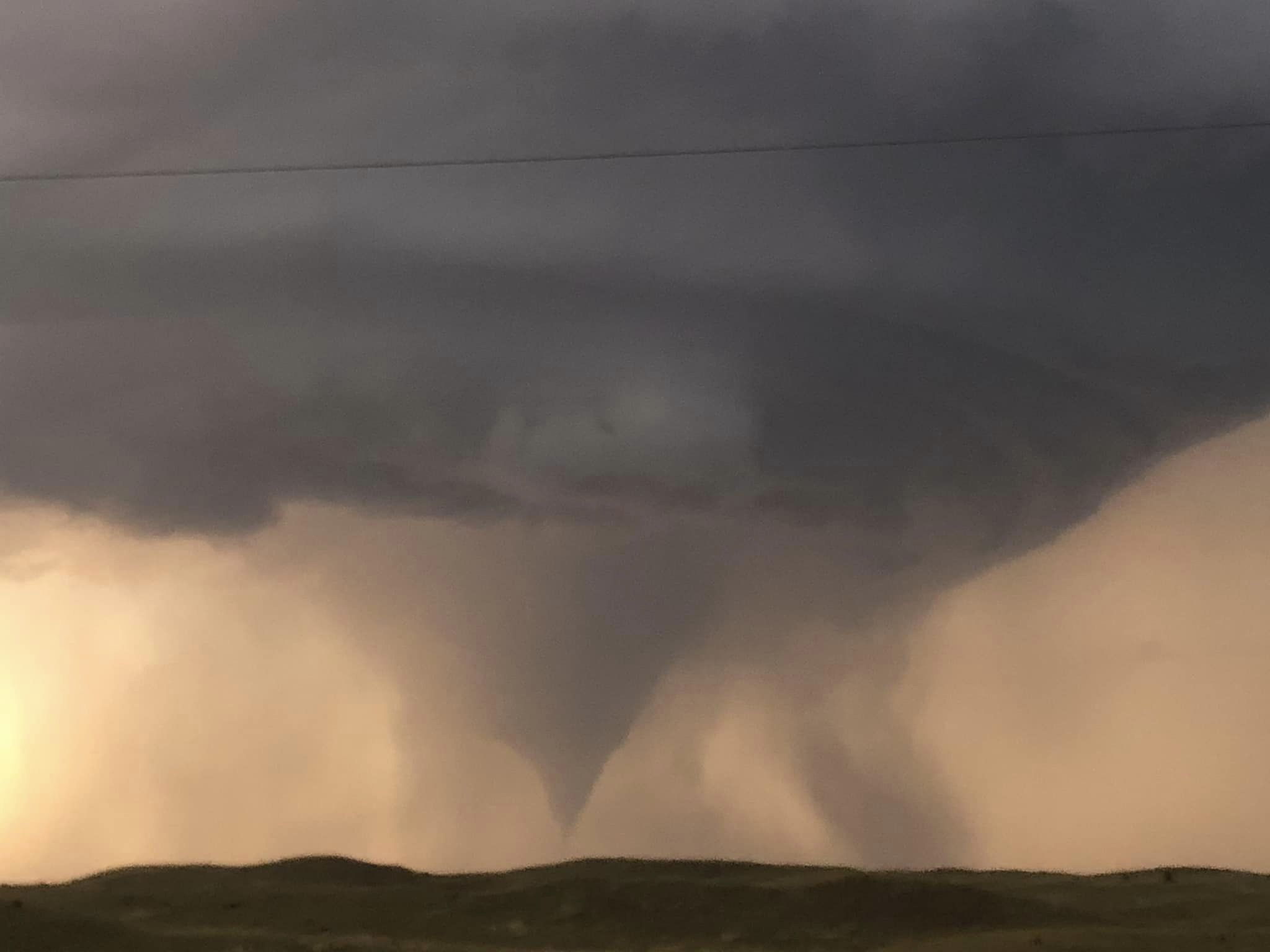
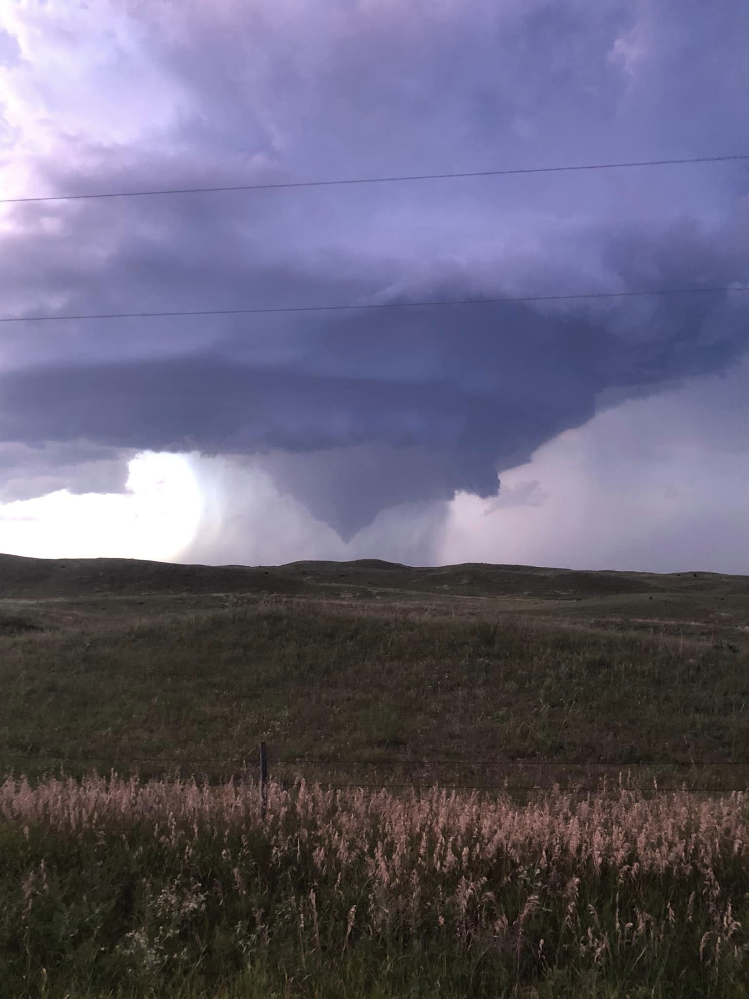
An isolated supercell developed in the mid-evening hours on July, 25 and produced a tornado in Loup County. The tornado remained over rural portions of the county, so thankfully outside of some broken tree limbs, very little damage was reported. The environment was favorable for rapid storm development. The supercell formed along a dry-line that advanced east across the Sandhills during the evening hours. The storm weakened as it moved to the southeast. The results of the survey are preliminary as the National Weather Service will continue to investigate any further report. If you have storm footage or damage reports from this event, please relay your report to the National Weather Service in North Platte.Tornadoes
|
Tornado - Loup County
Track Map 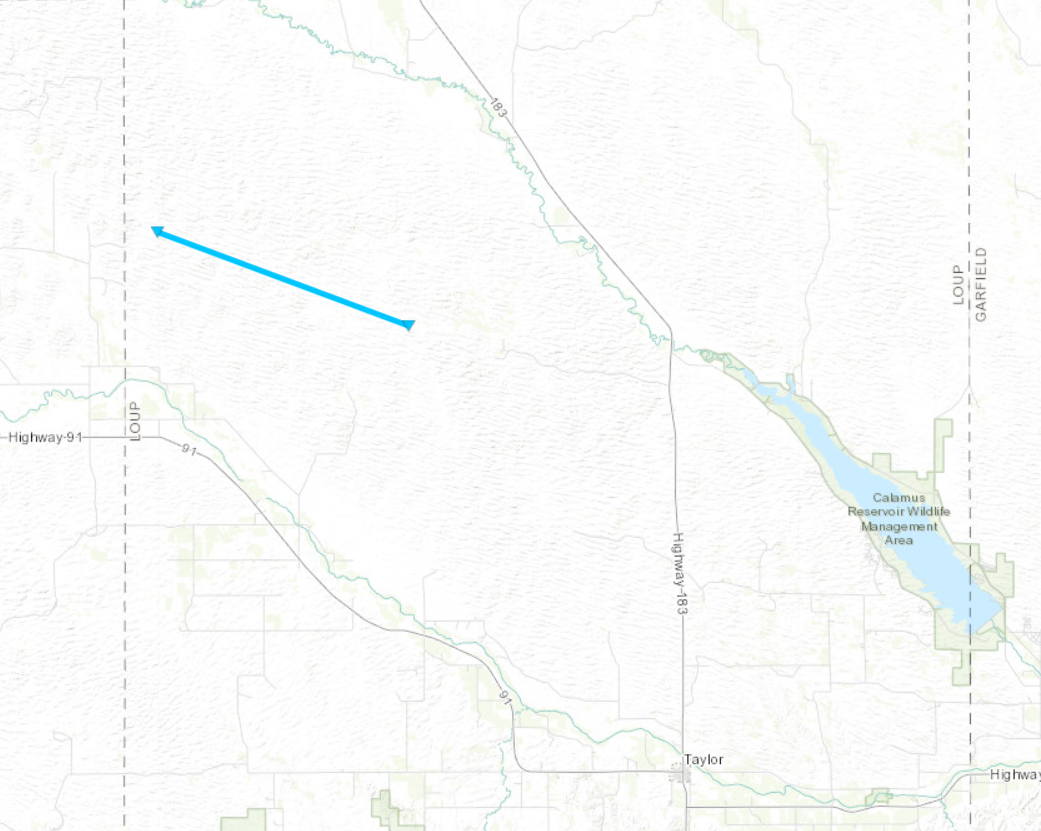 
Downloadable KMZ File |
||||||||||||||||
|
||||||||||||||||
The Enhanced Fujita (EF) Scale classifies tornadoes into the following categories:
| EF0 Weak 65-85 mph |
EF1 Moderate 86-110 mph |
EF2 Significant 111-135 mph |
EF3 Severe 136-165 mph |
EF4 Extreme 166-200 mph |
EF5 Catastrophic 200+ mph |
 |
|||||
 |
Media use of NWS Web News Stories is encouraged! Please acknowledge the NWS as the source of any news information accessed from this site. |
|