
Severe thunderstorms across Texas to the southern Appalachians pose risks of damaging winds, large hail, a couple of tornadoes, and potential flooding through Wednesday. A late-season snowstorm will continue to produce heavy snow over parts of the central Rockies, possibly resulting in travel disruptions, downed trees, and power outages. Read More >
North Platte, NE
Weather Forecast Office
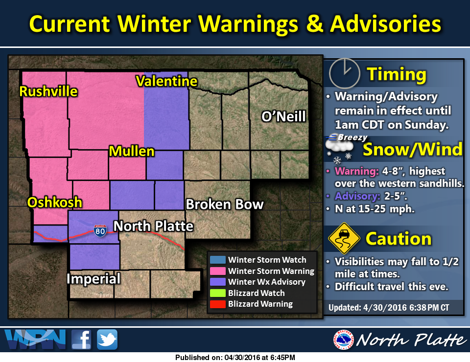
Spring Winter Storm Continues This Evening
Light to moderate snow will be possible this evening across the western sandhills and portions of the eastern Nebraska Panhandle. Winter storm warnings and advisories continue through 1 AM CDT Sunday morning.
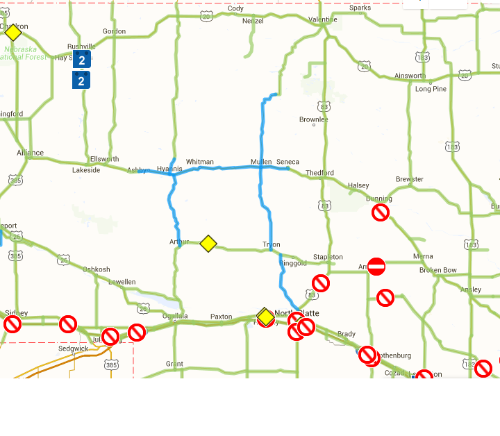
Road conditions as of 730 PM CDT Saturday across western and north central Nebraska remain mainly wet with partially snow covered roadways in the western Sandhills around Hyannis, Mullen, Arthur and Tryon. Map courtsey of the Nebr. Department of Roads.
 |
NWS Weather Forecast Office North Platte, NE |
 |
HAZARDS
Active Alerts
National Radar
National Hurricane Center
Storm Prediction Center
Weather Prediction Center
River Flooding
Decision Support
Submit a Storm Report
Recent Storm Reports
CURRENT CONDITIONS
CoCoRaHS
Enhanced Data Display
Local Radar
National Radar Mosiac
Observations
National Snow Cover
Precipitation Mapped
Regional Links
Satellite
Snowfall Analysis
FORECASTS
Area Forecast Discussion
Aviation Weather Center
Local Aviation Weather
Fire Weather
Recreation Forecast
National Graphical Forecast
Local Graphical Forecast
CLIMATE
Local Climate
National Climate
North Platte - Daily
North Platte - Monthly
Valentine - Daily
Valentine - Monthly
Broken Bow - Daily
Broken Bow - Monthly
Imperial - Daily
Imperial - Monthly
NIDIS Drought
NOAA Climate Science
Local Storm Reports
Local Drought Statement
US Dept of Commerce
National Oceanic and Atmospheric Administration
National Weather Service
North Platte, NE
5250 E. Lee Bird Drive
North Platte, NE 69101-2473
308-532-4936
Comments? Questions? Please Contact Us.

