
Dangerous and extreme heat will remain across portions of the southern U.S. this week. Heavy rainfall may bring significant flash flooding across portions of the Mid-Atlantic and Northeast through the night, and additional flash flooding concerns across New England on Wednesday. Monsoonal thunderstorms will bring a flash flood risk to the Four Corners region, especially in burn scar areas Read More >
Overview
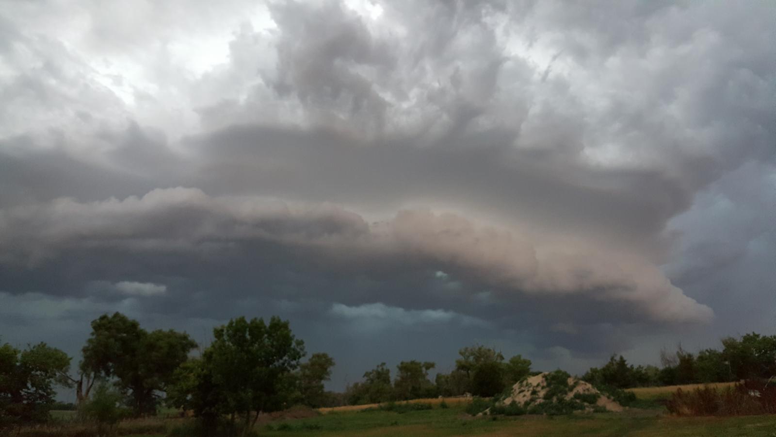
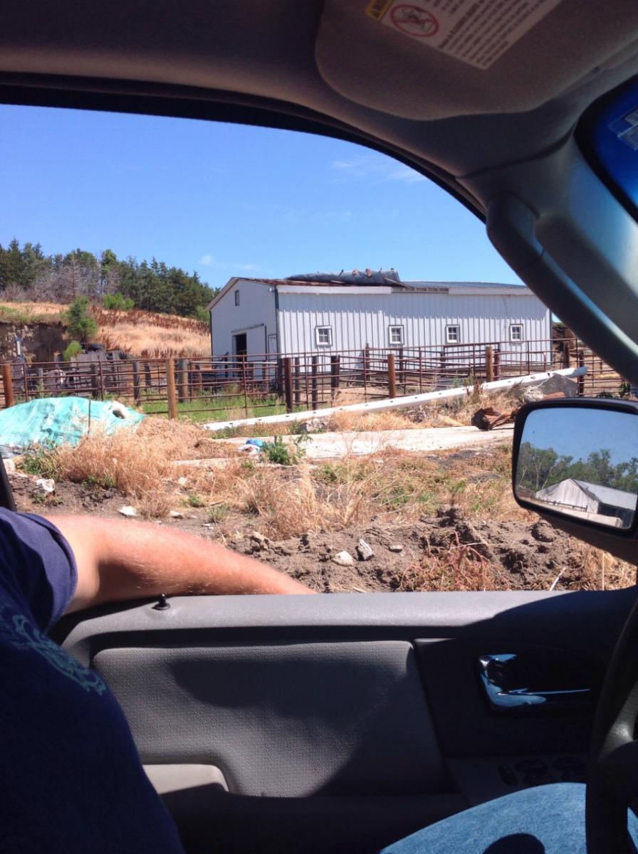
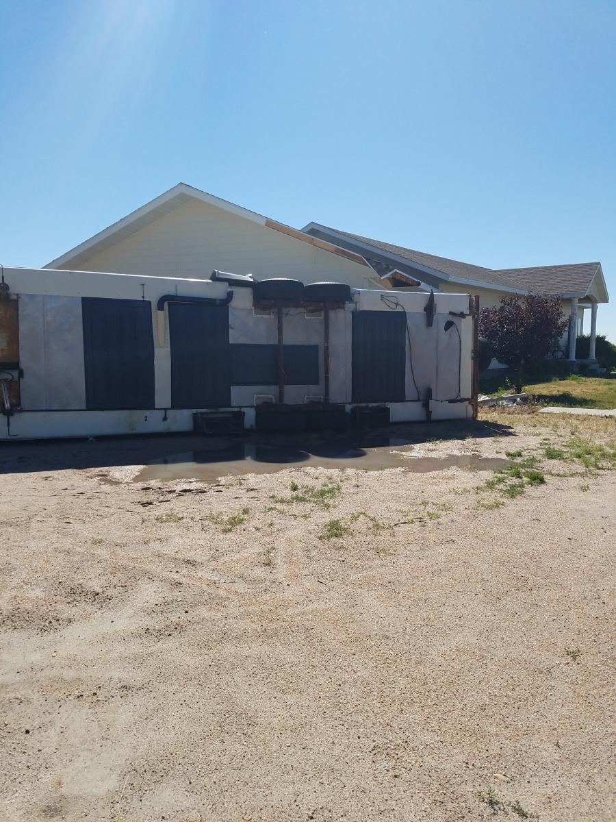
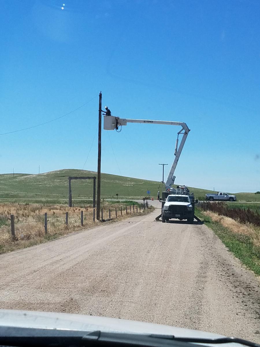
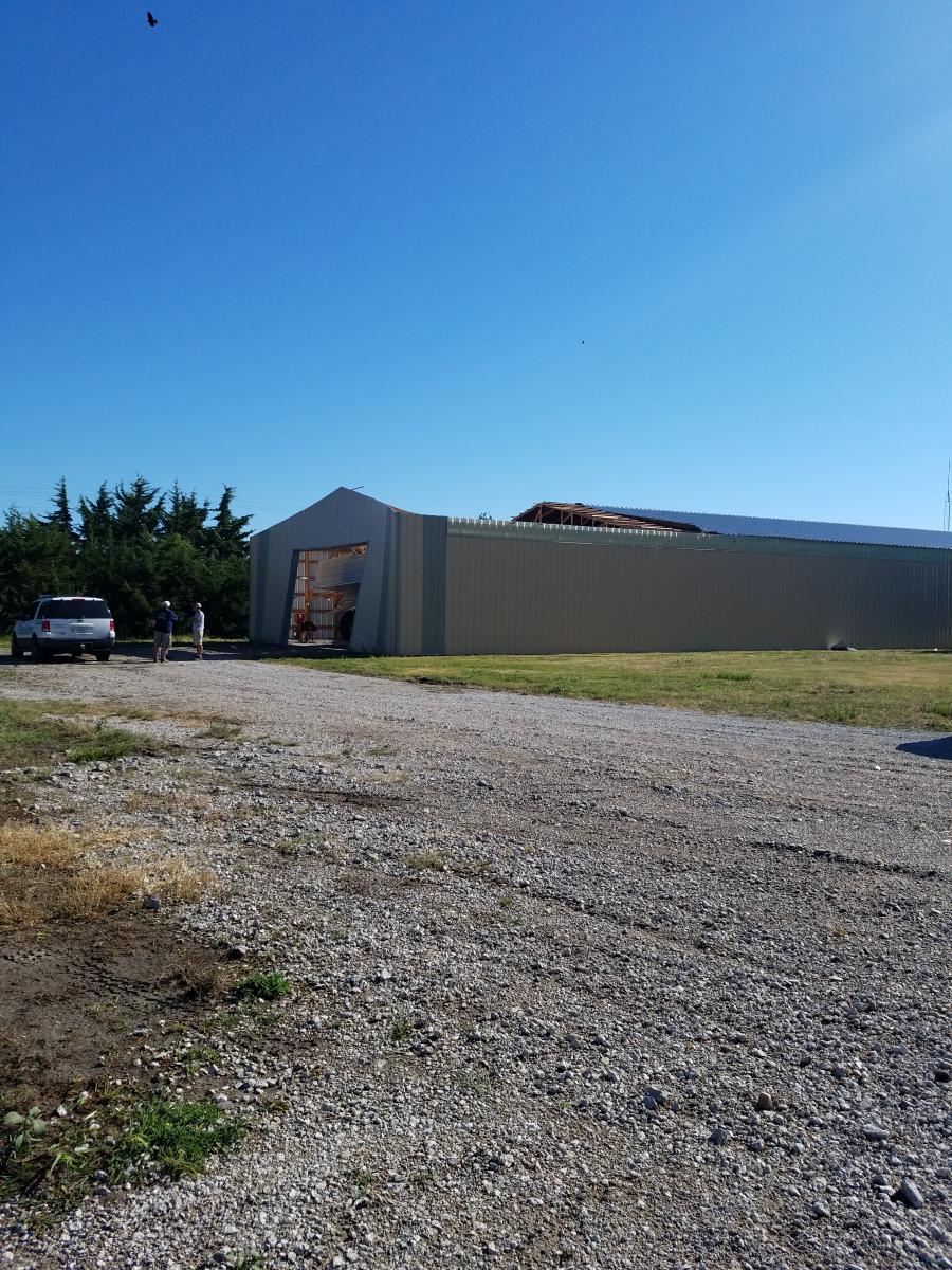
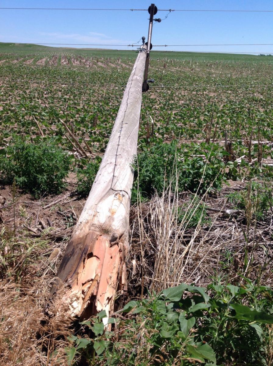
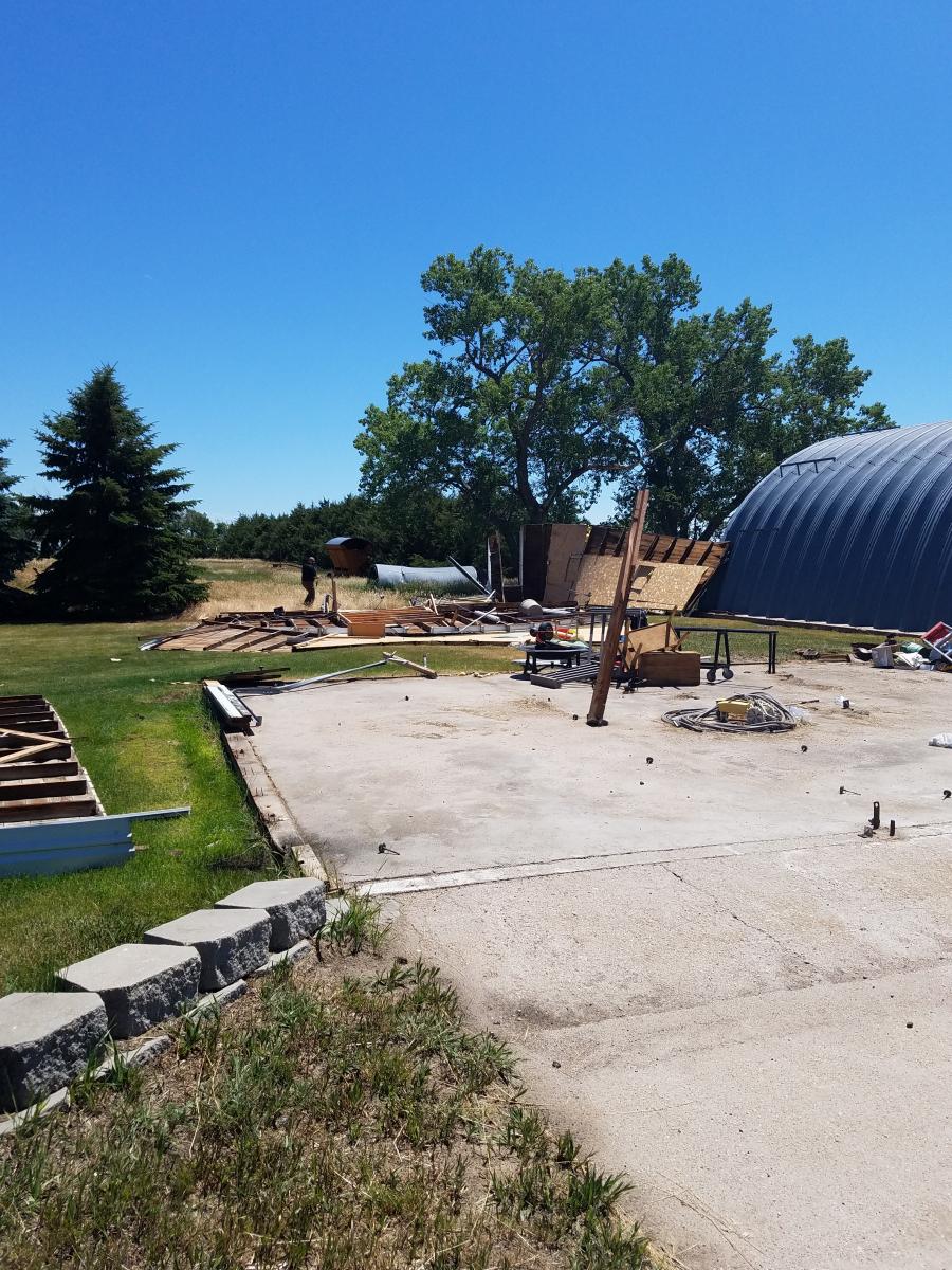
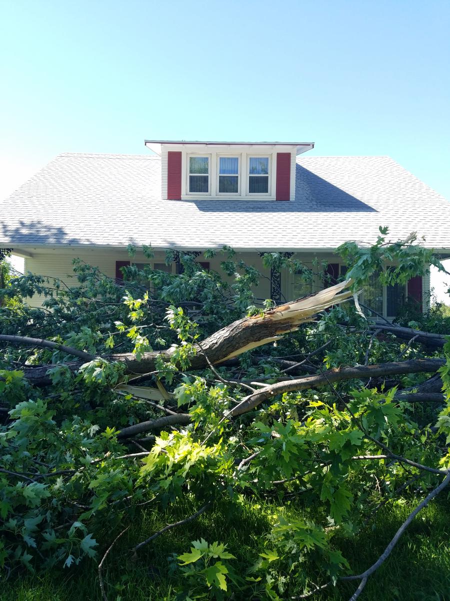
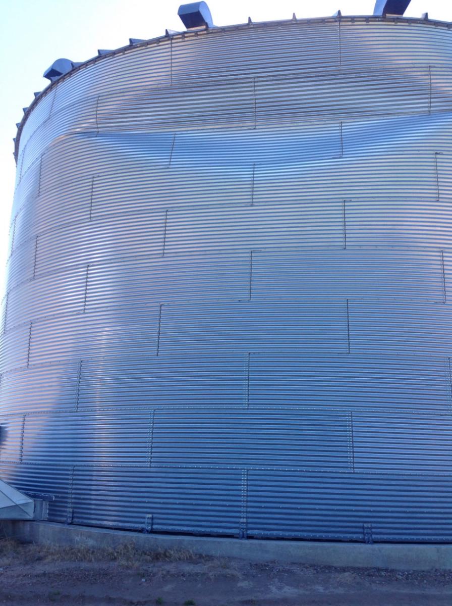
A line of severe thunderstorms moved through central Nebraska on Tuesday, June 27th. The storms moved
into northeastern Lincoln County and caused a 20 mile length of damage consistent with 80 to 110 mph wind
speeds  northeast into the community of Arnold, in west central Custer County. A storm damage survey observed
power poles were downed, many of which were snapped several feet up from the base of the pole and were
replaced within the past two years. Tree limbs were downed, a few trees uprooted or snapped at the trunk.
Several buildings sustained roof damage, some metal sheds lost large sections of siding and one shed destroyed.
These findings are preliminary and will be updated as additional information is provided.

Photos of storm damage taken by Warning Coordination Meteorologist Kelly Allen.
 |
 |
 |
| Supercell 8 SW Callaway Photo by Frank Potter | Storm Damage | Barn Roof Damage |
Wind Damage Photos:
Straightline wind damage occurred over a 20 mile by 10 mile area from northeast Lincoln County into west central Custer County, that reached from 17 miles southwest of Arnold into the Arnold community.
Wind
 |
 |
 |
 |
|
Limb down on car |
5th wheel trailer flipped |
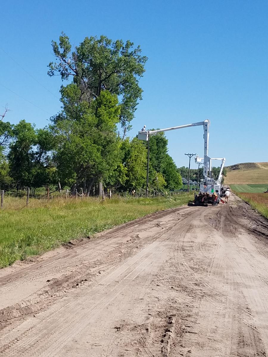
Power poles snapped |
Large barn damaged |
 |
 |
 |
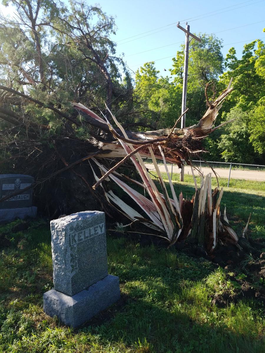 |
| Bins blown over | Power poles down | Power pole repairs | Tree damage in Arnold grave yard |
 |
 |
 |
 |
| Shed destroyed 17 SW Arnold |
Tree damage north side of Arnold | Grain bin damage | Shed damage |
Radar:
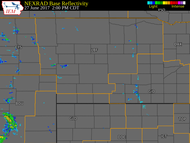 |
| Radar Loop Tuesday Evening June 27, 2017 |
Storm Reports
a list of storm reports from Tuesday evening.

..TIME...   ...EVENT...      ...CITY LOCATION...     ...LAT.LON...
..DATE...   ....MAG....      ..COUNTY LOCATION..ST.. ...SOURCE....
            ..REMARKS..
540 PM     HAIL             6 N HAY SPRINGS         42.77N 102.69W
06/27/2017  E1.00 INCH       SHERIDAN           NE   TRAINED SPOTTER

0600 PM     HAIL             12 NNW RUSHVILLE        42.87N 102.56W
06/27/2017  M1.75 INCH       SHERIDAN           NE   TRAINED SPOTTER

0627 PM     HAIL             8 NNE CHAPPELL          41.20N 102.41W
06/27/2017  E1.50 INCH       DEUEL              NE   PUBLIC

0716 PM     TSTM WND GST     KINGSLEY DAM            41.21N 101.66W
06/27/2017  M59.00 MPH       KEITH              NE   MESONET

0808 PM     TSTM WND GST     HERSHEY                 41.16N 101.00W
06/27/2017  E65.00 MPH       LINCOLN            NE   LAW ENFORCEMENT

            RELAYED TO SHERIFF DEPARTMENT LARGE TREE UPROOTED. WIND
            SPEEDS ESTIMATED AT 60 TO 70 MPH.

0816 PM     TSTM WND GST     5 N NORTH PLATTE        41.21N 100.77W
06/27/2017  M60.00 MPH       LINCOLN            NE   MESONET

0821 PM     TSTM WND GST     5 N NORTH PLATTE        41.21N 100.77W
06/27/2017  M72.00 MPH       LINCOLN            NE   MESONET

0826 PM     TSTM WND DMG     4 W NORTH PLATTE        41.13N 100.85W
06/27/2017                   LINCOLN            NE   NWS EMPLOYEE

            RELAYED FROM OFF DUTY NWS EMPLOYEE, NEIGHBOR HAD BAY
            WINDOW BROKEN BY LARGE TREE LIMB. ESTIMATED 70 MPH WINDS.


0827 PM     TSTM WND GST     4 NNE NORTH PLATTE      41.19N 100.74W
06/27/2017  M65.00 MPH       LINCOLN            NE   MESONET

0830 PM     TSTM WND GST     9 WSW STAPLETON         41.43N 100.67W
06/27/2017  E60.00 MPH       LOGAN              NE   PUBLIC

0830 PM     TSTM WND GST     7 NE NORTH PLATTE       41.20N 100.68W
06/27/2017  E70.00 MPH       LINCOLN            NE   EMERGENCY MNGR

            RELAYED FROM EMERGENCY MANAGER THAT 8 INCH PLUS TREE
            BRANCH DOWN. ESTIMATED WIND GUST OF 70 MPH.

0832 PM     TSTM WND GST     3 E NORTH PLATTE        41.13N 100.71W
06/27/2017  M64.00 MPH       LINCOLN            NE   ASOS

0838 PM     TSTM WND GST     8 S STAPLETON           41.36N 100.51W
06/27/2017  E70.00 MPH       LINCOLN            NE   FIRE DEPT/RESCUE

            STAPLETON FIRE DEPARTMENT REPORTED 8 TO 10 INCH DIAMETER
            TREE LIMBS DOWN. WINDS MAY HAVE BEEN IN EXCESS OF 70MPH.


0900 PM     TSTM WND GST     8 WSW CALLAWAY          41.25N 100.06W
06/27/2017  M92.00 MPH       CUSTER             NE   CO-OP OBSERVER

0900 PM     TSTM WND GST     W ARNOLD                41.42N 100.19W
06/27/2017  E85.00 MPH       CUSTER             NE   TRAINED SPOTTER

            ESTIMATED WIND SPEEDS OF 85 MPH. CORREGATED STEEL
            BUILDING BLOWN APART AND POWERLINES DOWN.

0900 PM     TSTM WND GST     1 E ARNOLD              41.42N 100.17W
06/27/2017  E100 MPH         CUSTER             NE   EMERGENCY MNGR

0900 PM     TSTM WND DMG     1 E ARNOLD              41.42N 100.17W
06/27/2017                   CUSTER             NE   EMERGENCY MNGR

            RELAYED BY EMERGENCY MANAGER THAT A PIVOT WAS TURNED
            OVER, LOTS OF TREES WERE DOWN, POWER LINES DOWN AND A
            QUARTER OF A BUILDING THAT WAS 100FT BY 80 FT DESTROYED.


0913 PM     TSTM WND GST     2 SE ANSELMO            41.60N 99.84W
06/27/2017  E60.00 MPH       CUSTER             NE   CO-OP OBSERVER

0931 PM     TSTM WND GST     BROKEN BOW              41.41N 99.64W
06/27/2017  M58.00 MPH       CUSTER             NE   ASOS

0941 PM     TSTM WND GST     12 E ANSELMO            41.62N 99.63W
06/27/2017  M59.00 MPH       CUSTER             NE   MESONET

1005 PM     TSTM WND GST     20 NE ELLSWORTH         42.26N 102.01W
06/27/2017  E60.00 MPH       CHERRY             NE   PUBLIC

            ESTIMATED WIND GUST OF 60 MPH AT ESTIMATED TIME OF 1005
            CDT

1048 PM     TSTM WND GST     4 W MULLEN              42.04N 101.12W
06/27/2017  E65.00 MPH       HOOKER             NE   LAW ENFORCEMENT

            WIND GUSTS ESTIMATED AT 60-70 MPH BY LAW ENFORCEMENT.

1100 PM     TSTM WND GST     19 SW EWING             42.06N 98.60W
06/27/2017  E60.00 MPH       WHEELER            NE   PUBLIC

1131 PM     TSTM WND GST     7 NE BROWNLEE           42.36N 100.53W
06/27/2017  M66.00 MPH       CHERRY             NE   DEPT OF HIGHWAYS

            NEDOR SITE 804 ON HIGHWAY 83
 |
Media use of NWS Web News Stories is encouraged! Please acknowledge the NWS as the source of any news information accessed from this site. |
|

