Widespread, life-threatening considerable flash flooding is expected in south-central Texas through at least Friday. Catastrophic river flooding and rapid rises on small streams, arroyos, and typically dry washes are expected in the Texas Hill Country. Wildfire smoke is impacting air quality across much of the Great Lakes region into the Northeast U.S. with Air Quality Alerts in effect. Read More >
North Platte, NE
Weather Forecast Office
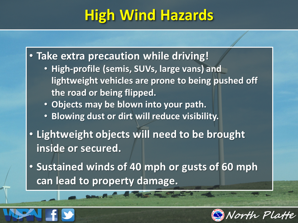
High Winds Possible Tonight
|
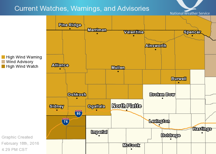
| A cold front will sweep through western Nebraska this evening with high winds to follow. Sustained west winds of 30 to 40 mph with brief winds gusts in excess of 55 mph will be possible. Headlines posted with a High Wind Warning in effect for portions of western and north central Nebraska overnight into tomorrow morrning. |
|
**SEND US your higest wind gust or observed damage via Storm Report**
|
| Latest Watch Warning and Advisories for Western and North Central Nebraska Through Noon CST |
|
Impacts Tonight into Friday Morning
|
|
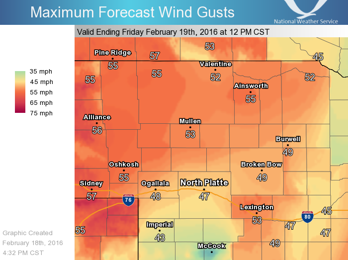
Wind Gusts Forecasted Tonight Through Noon CST Friday
|
|
|
| For more information about this Storm System see here |
HAZARDS
Active Alerts
National Radar
National Hurricane Center
Storm Prediction Center
Weather Prediction Center
River Flooding
Decision Support
Submit a Storm Report
Recent Storm Reports
CURRENT CONDITIONS
CoCoRaHS
Enhanced Data Display
Local Radar
National Radar Mosiac
Observations
National Snow Cover
Precipitation Mapped
Regional Links
Satellite
Snowfall Analysis
FORECASTS
Area Forecast Discussion
Aviation Weather Center
Local Aviation Weather
Fire Weather
Recreation Forecast
National Graphical Forecast
Local Graphical Forecast
CLIMATE
Local Climate
National Climate
North Platte - Daily
North Platte - Monthly
Valentine - Daily
Valentine - Monthly
Broken Bow - Daily
Broken Bow - Monthly
Imperial - Daily
Imperial - Monthly
NIDIS Drought
NOAA Climate Science
Local Storm Reports
Local Drought Statement
US Dept of Commerce
National Oceanic and Atmospheric Administration
National Weather Service
North Platte, NE
5250 E. Lee Bird Drive
North Platte, NE 69101-2473
308-532-4936
Comments? Questions? Please Contact Us.