|
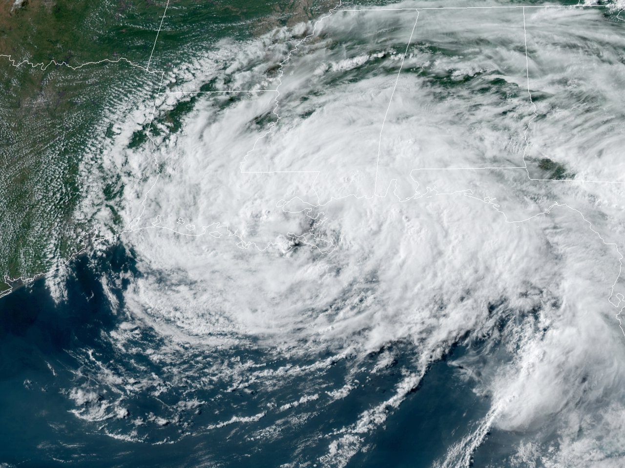
Above: GOES 16 GeoColor Satellite Image of Tropical Storm Cristobal coming ashore between the Mouth of the Mississippi River and Grand Isle, Louisiana around 5:00 PM CDT June 7, 2020.
Cristobal origin can be traced back to the remnant mid-level circulation of Eastern Pacific Tropical Storm Amanda that made landfall in Guatemala on May 31st. Amanda’s low-level circulation dissipated by the afternoon of May 31st with its mid-level circulation moving north and northwest to the Bay of Campeche on June 1st and developed into Tropical Depression Three later that afternoon.
By the late morning hours on June 2nd, an Air Force Hurricane Hunter Aircraft found it to have strengthened into Tropical Storm Cristobal. This also marked the earliest third named storm in the Atlantic, beating the record set by Tropical Storm Colin in 2016 of June 5th.
Cristobal slowly strengthened as it stayed nearly stationary in the Bay of Campeche. By the morning of June 3rd, Cristobal made landfall near Atasta, Mexico with sustained winds of 60 mph. Cristobal began to slowly weaken as it pushed further southeast into the Mexican state of Campeche. By the morning of June 4th, Cristobal weakened into a tropical depression.
Cristobal re-intensified into a tropical storm as it re-emerged into the Gulf north of the Yucatan peninsula on the afternoon of June 5th. As Cristobal moved further north away from the Yucatan peninsula, dry air and interaction with an upper-level trough to the east began inhibit any further strengthening of Cristobal.
Tropical Storm Cristobal made landfall between the Mouth of the Mississippi River and Grand Isle, Louisiana around 5:00 PM CDT June 7th with maximum sustained near 50 mph and a minimum central pressure of 990 millibars (29.23 inches). Cristobal was the second earliest tropical cyclone to make landfall in Louisiana, only behind Tropical Storm Arlene on May 30, 1959.
Cristobal moved along the Mississippi Valley afterward, passing over Arkansas, Missouri, Iowa and Illinois before being declared extratropical by the Weather Prediction Center by the evening of June 9th over Southern Wisconsin.
WINDS & PRESSURE:
For our region, minimal sustained tropical storm force winds were recorded across Vermilion & Atchafalaya Bays and the adjacent coastal waters, none recorded inland. The only tropical storm force gusts recorded inland were across lower St. Mary Parish, and near Alexandria when the center of the storm passed across Northeast Louisiana.
STORM SURGE:
Minor coastal flooding of 2.00-2.25 feet Mean Higher High Water (MHHW), or a rough estimate of the level above ground level, was noted near high tide along the immediate Louisiana coastline of Vermilion, Iberia, & St. Mary Parishes. Further west across Cameron Parish Louisiana and Jefferson County Texas, tides reached around 1.50 feet Mean Higher High Water (MHHW). No coastal flooding impacts were reported west of the Atchafalaya River.
RAINFALL:
Rainfall was relatively light for this tropical cyclone west of the Atchafalaya River, with most totals less than 2 inches. Many stations had less than one half of an inch, with some stations completely missing the rainfall altogether. However, much heavier rainfall was noted across Southeast Louisiana eastward across Southern Mississippi, Alabama, and the Florida Panhandle.
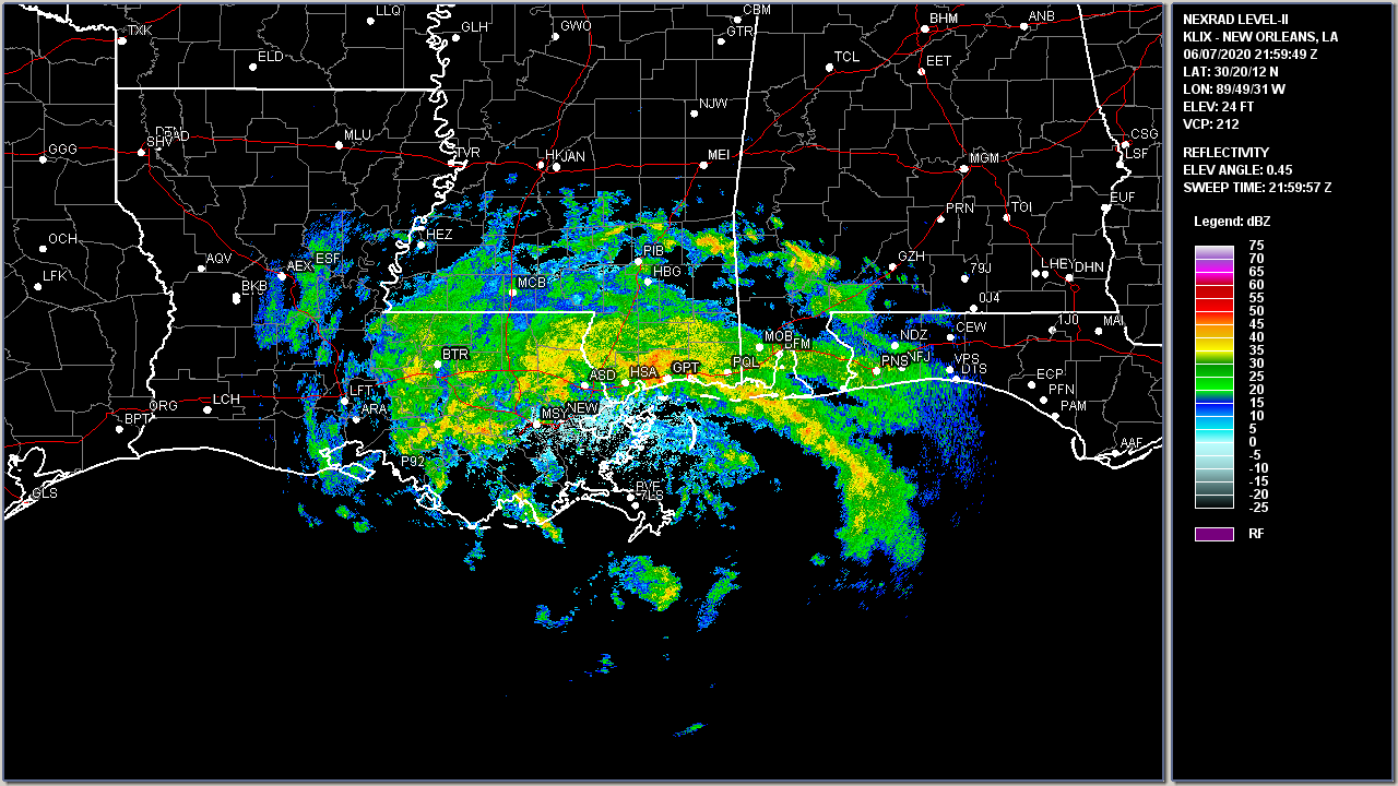
Above: Slidell, LA WSR-88D Radar Image of Tropical Storm Cristobal coming ashore between the Mouth of the Mississippi River and Grand Isle, Louisiana around 5:00 PM CDT June 7, 2020.
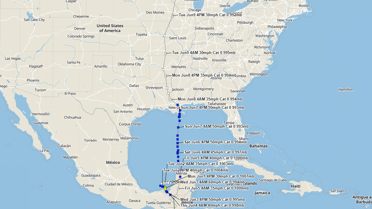
Above: Hurrevac track of Cristobal (U.S. & Gulf) from operational National Hurricane Center public advisories.
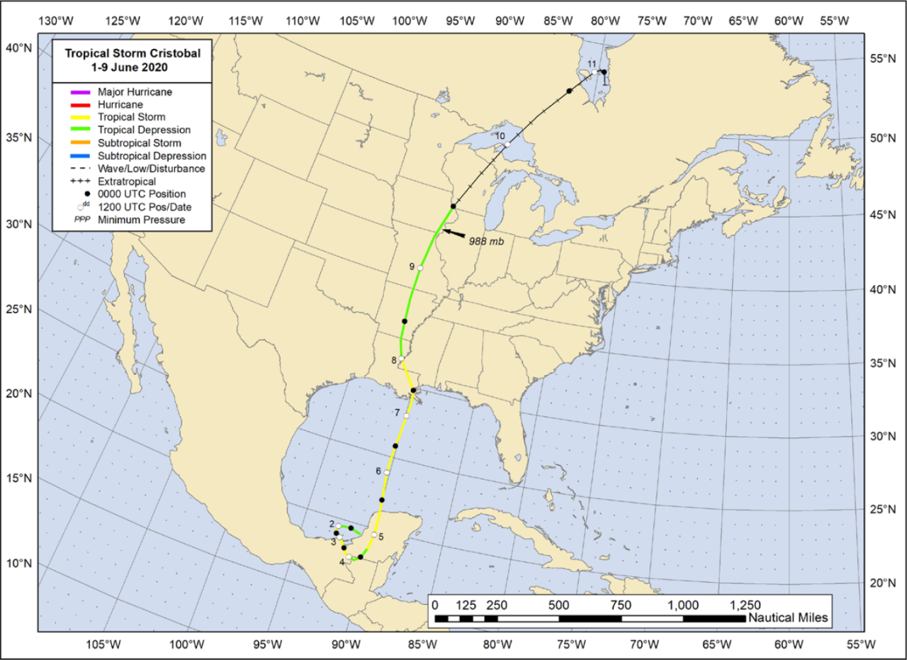
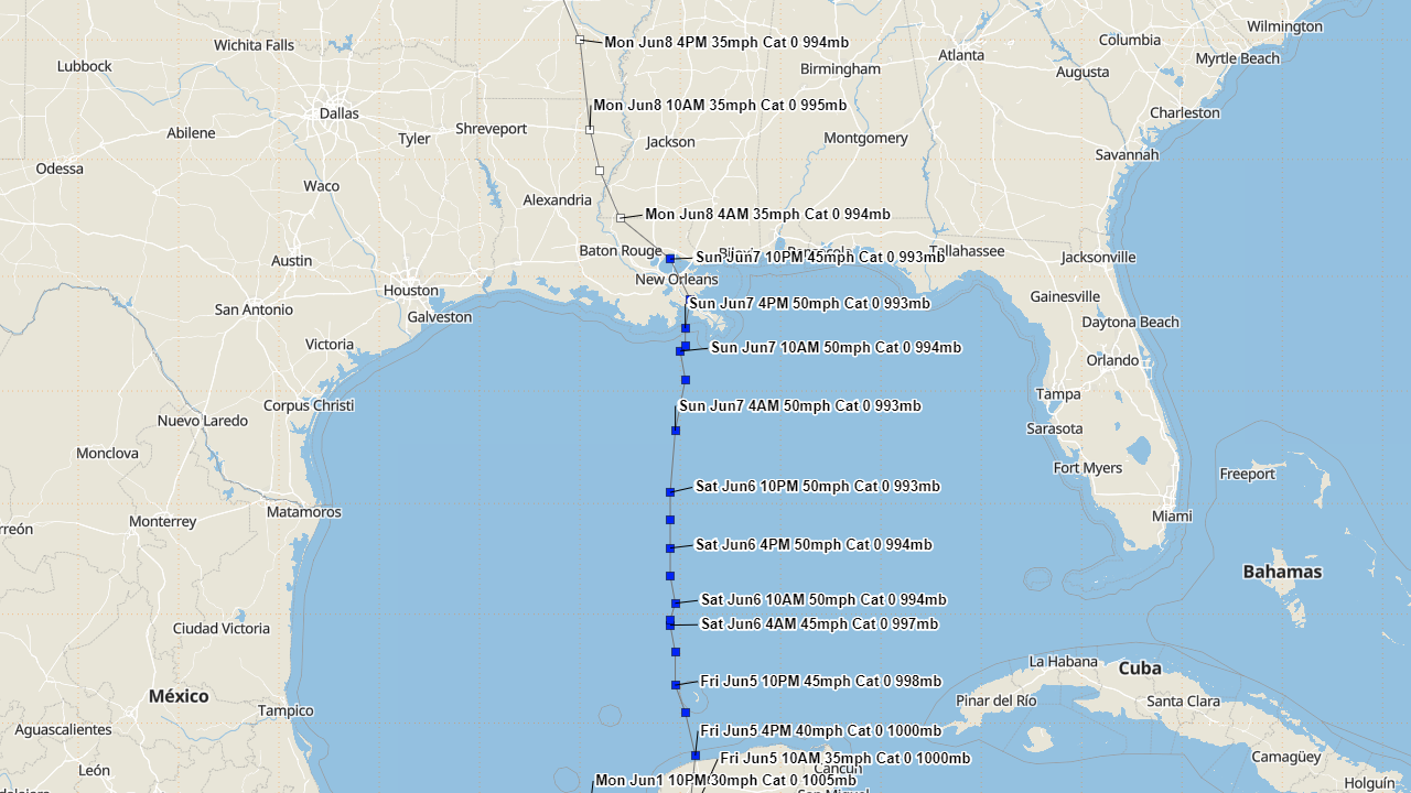
Above: National Hurricane Center best track of Tropical Storm Cristobal.
Listed below are post-storm reports and meteorological data gathered. All data is considered preliminary, and is subject to change at any time. Additional information will continue to be added to this page in the future.
Webpage design by: Donovan Landreneau
Content by: NWS Lake Charles staff, other sources as noted above.
|


