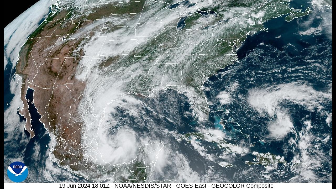
Dangerous and extreme heat will remain across portions of the central U.S. this week, persisting across the mid to lower Mississippi Valley, Gulf Coast, southern Plains and portions of Texas. A heat wave over the Southwest U.S. will peak this weekend. Heavy to excessive rainfall may produce flash flooding from the Delmarva Peninsula north into the Hudson Valley today and tonight. Read More >
| Tropical Storm Alberto | ||||||||||||||||||||||||||||||||||
| June 17-20, 2024 | ||||||||||||||||||||||||||||||||||
|
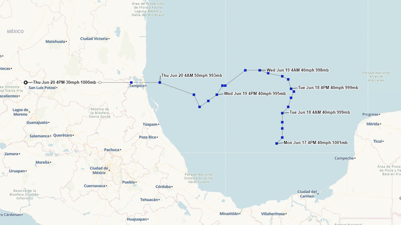
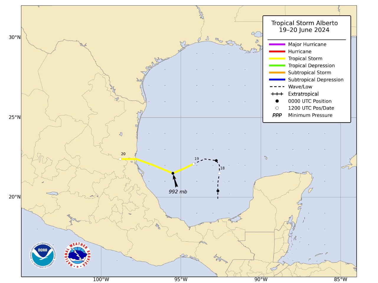
A large broad area of low pressure formed across the Bay of Campeche on June 17th. This large area of low pressure, coupled with a large surface high pressure over the Eastern United States, created a tight pressure gradient across the Northern Gulf, resulting in a large easterly wind fetch over this region. The broad low-pressure area drifted northward through the evening of June 18th in response of a mid to upper-level trough of low pressure across Texas and Northern Mexico. By June 19th, the mid to upper-level trough lifted northward with a mid to upper-level high pressure ridge building westward across the Southern U.S. This allowed for the broad area of low pressure to turn westward and gradually get better organized, being upgraded to Tropical Storm Alberto at 10 AM CDT June 19th. Tropical Storm Alberto gradually strengthened further and made landfall around Tampico, Mexico just before daybreak June 20th with maximum sustained winds of 50 mph (45 knots). Alberto continued to move quickly westward after landfall, dissipating across the mountains of Central Mexico later that afternoon. TORNADOES:
|
||||||||||||||||||||||||||||||||||