
A Nor'easter well off the East Coast will slowly track north this week and may gain some subtropical characteristics. Strong onshore winds will bring flooding, dangerous marine conditions, and beach erosion along the Mid-Atlantic coast. A Pacific storm will bring gusty winds, severe thunderstorms, and mountain snow to portions of California and the Southwest U.S. through Thursday. Read More >
Lake Charles, LA
Weather Forecast Office
| Event Summary |
Meteorological Setup |
Satellite and Radar Imagery |
Storm Total Rainfall |
Timeline | Sabine River | Neches River | Calcasieu River | Red River |
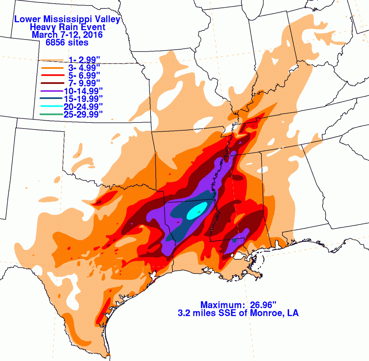
A cut off upper low over West Texas and a stalled frontal boundary over Southeast Texas produced multiple days of very heavy rainfall over the region. Widespread flash flooding occurred across the area with totals ranging from 10 to 20 inches. The highest rainfall total occurred at the Toledo Bend Dam with 15 to 20 inches of rainfall common over the reservoir. This pushed the lake level to an all time high of 174.36 feet which is over one foot higher than the previous record crest from 1989. This forced the floodgates to be fully opened on the 10th, except for two gates that were under maintenance. Downstream of the reservoir, a flood of record occurred along the Sabine River.
Forecasts
Forecaster's Discussion
Fire Weather
Graphical Forecasts
Wet Bulb Globe Temps
Aviation Weather
Activity Planner
Mardi Gras Decision Support
Marine Forecasts
Local Products
Model Data
Other Links
National Hurricane Ctr
Storm Prediction Ctr
Weather Prediction Ctr
Other Links
Office History
LCH StoryMap
Hazards
Severe Weather
Tropical Weather
National Outlooks
Local Storm Reports
Tropical Cyclone Reports
Current
Tide Data
Satellite Data
Observations
Hydrology
River/Lake Forecasts
Calcasieu Par. Network
Jefferson Co. DD6 Network
Radar
Shreveport (SHV)
New Orleans (LIX)
Fort Polk (POE)
Houston/Galveston (HGX)
Lake Charles (LCH)
Probabilistic Pages
Probabilistic DSS
Probabilistic Snowfall
Probabilistic Rainfall

US Dept of Commerce
National Oceanic and Atmospheric Administration
National Weather Service
Lake Charles, LA
500 Airport Boulevard
Lake Charles, LA 70607
(337) 477-5285 M-F 8a to 4p only
Comments? Questions? Please Contact Us.


 Follow us on X
 Follow us on Facebook
 Follow us on YouTube
 LCH RSS Feed