
Dangerous and extreme heat will remain across portions of the southern U.S. this week. Heavy rainfall may bring significant flash flooding across portions of the Mid-Atlantic and Northeast through the night, and additional flash flooding concerns across New England on Wednesday. Monsoonal thunderstorms will bring a flash flood risk to the Four Corners region, especially in burn scar areas Read More >
| Event Summary |
Meteorological Setup |
Satellite and Radar Imagery |
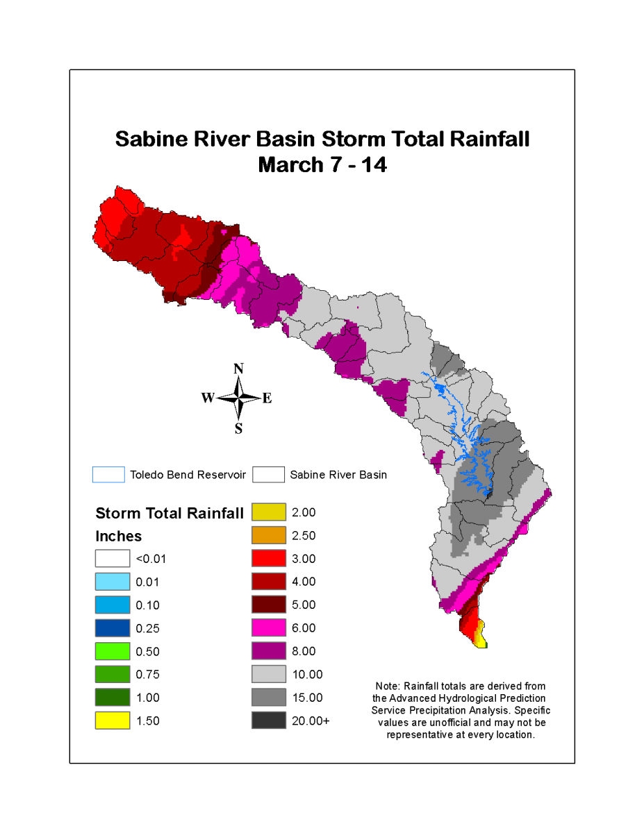
Storm Total Rainfall |
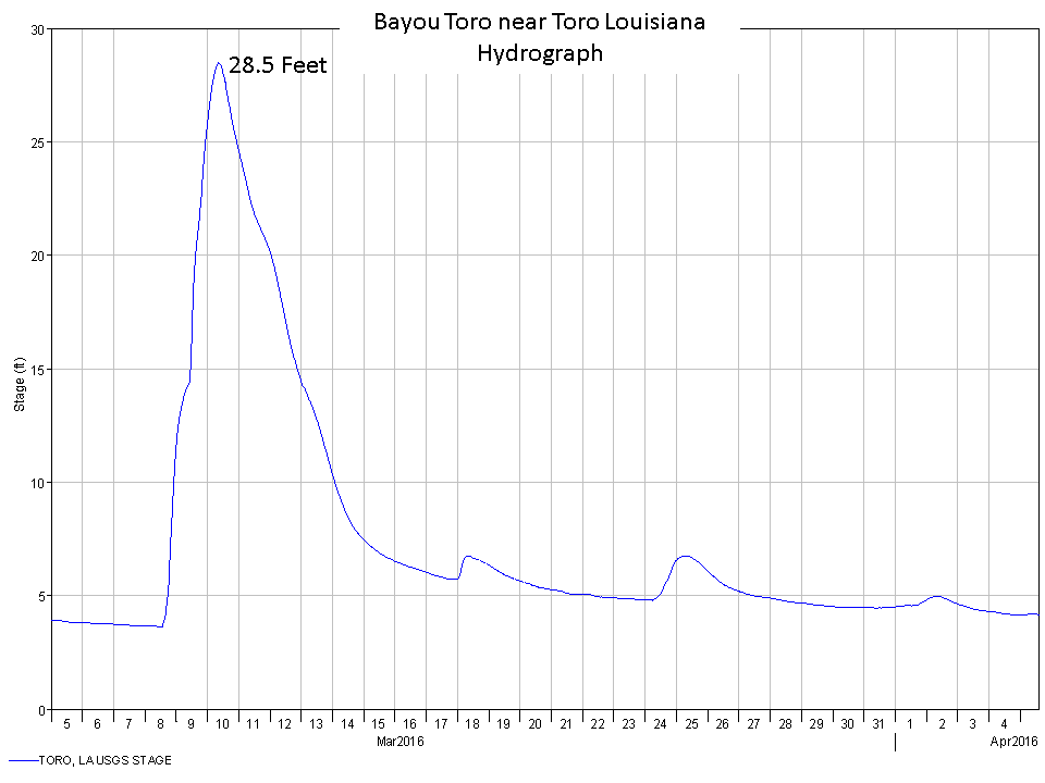
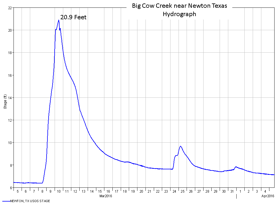
Timeline | Sabine River | Neches River | Calcasieu River | Red River |
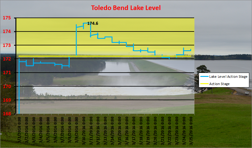
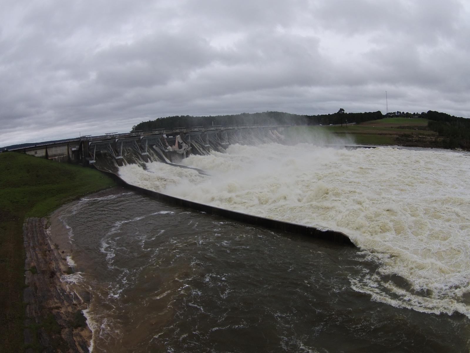
Toledo Bend Releases, Bill Hughes |
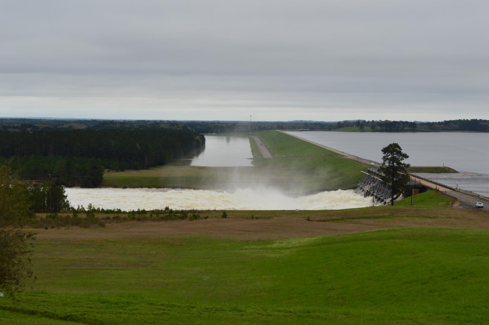
Toledo Bend Releases, Tim Humphrey |
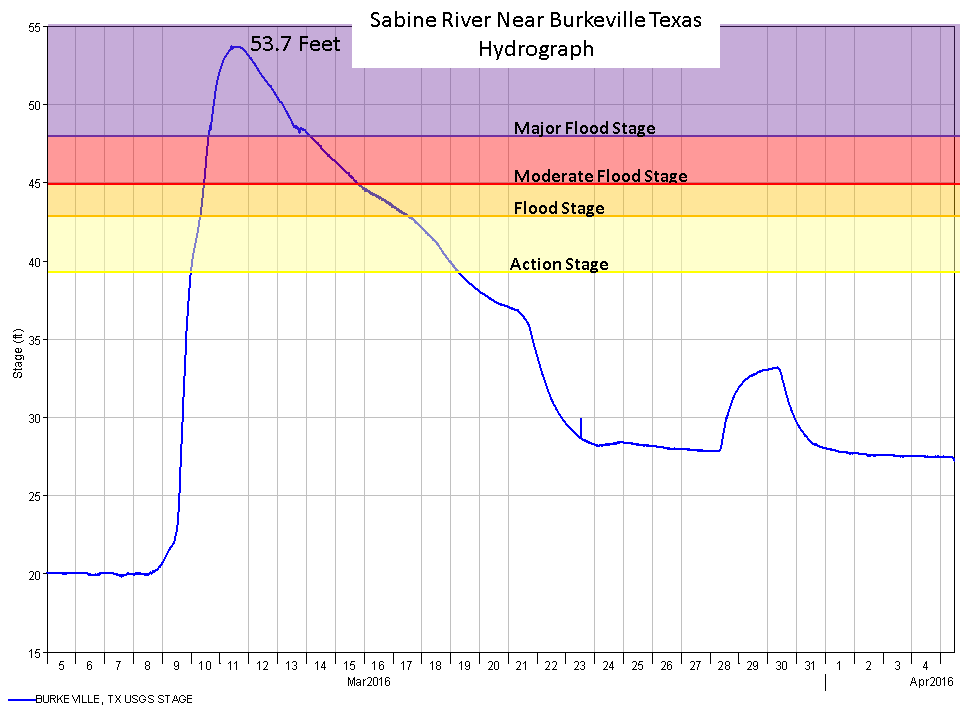
| Burkeville, TX Floods of Record | ||
| Height | Date | Comment |
| 53.82 ft | 3/11/2016 | Preliminary |
| 48.05 ft | 2/1/1999 | Previous official flood of record |
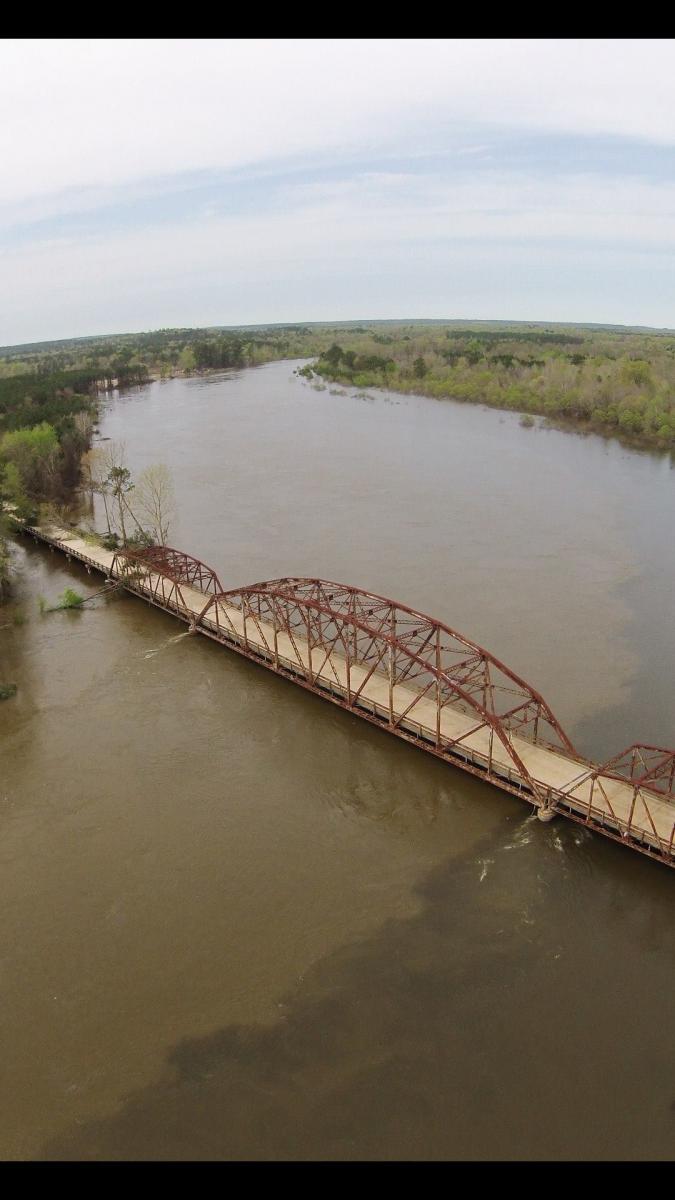
Burr Ferry Bridge, VPSO |
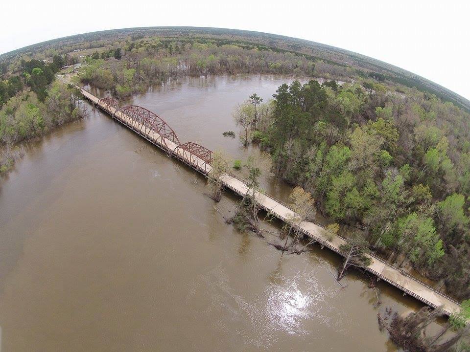
Burr Ferry Bridge, VPSO |
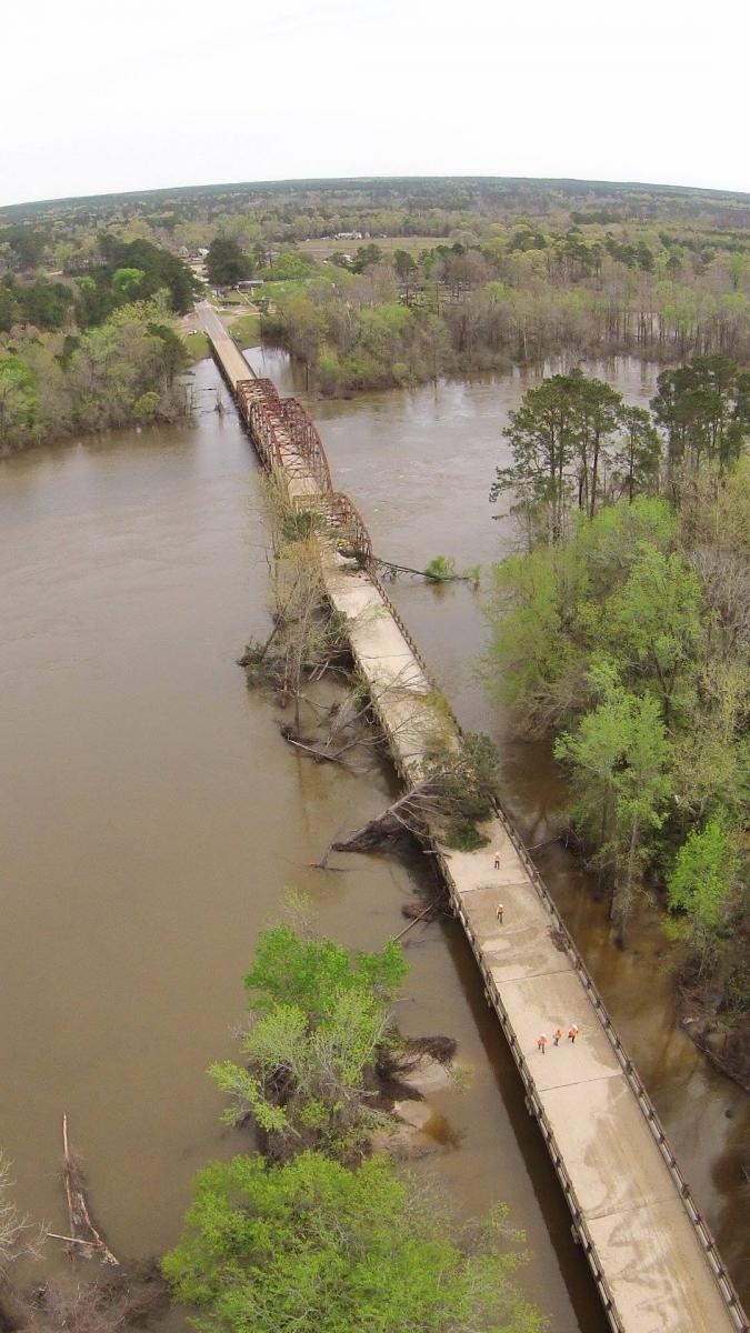
Burr Ferry Bridge, VPSO |

LA 8, LA DOTD |
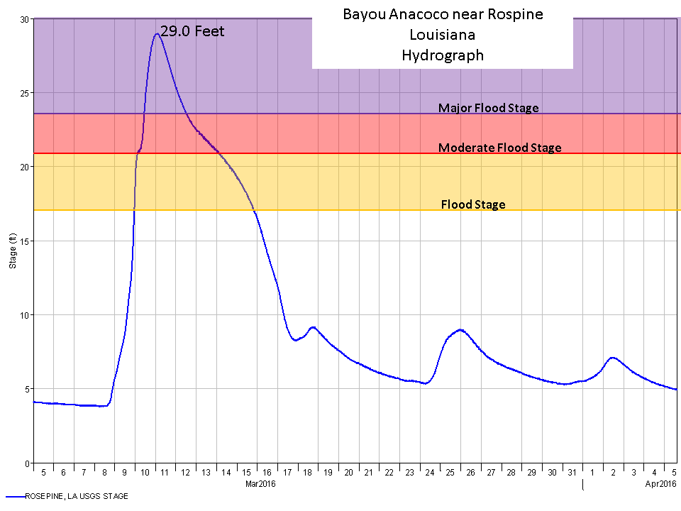
| Rosepine, LA Floods of Record | ||
| Height | Date | Comment |
| 29.0 ft | 3/11/2016 | Preliminary |
| 28.38 ft | 5/19/1953 | Previous official flood of record |
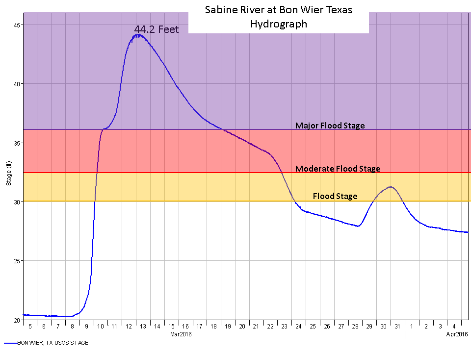
| Bon Wier, TX Floods of Record | ||
| Height | Date | Comment |
| 44.21 ft | 3/13/2016 | Preliminary |
| 43.5 ft | 4/23/1913 | Previous official flood of record |
US 190 Near Mile 3, Jonathan Brazzell |
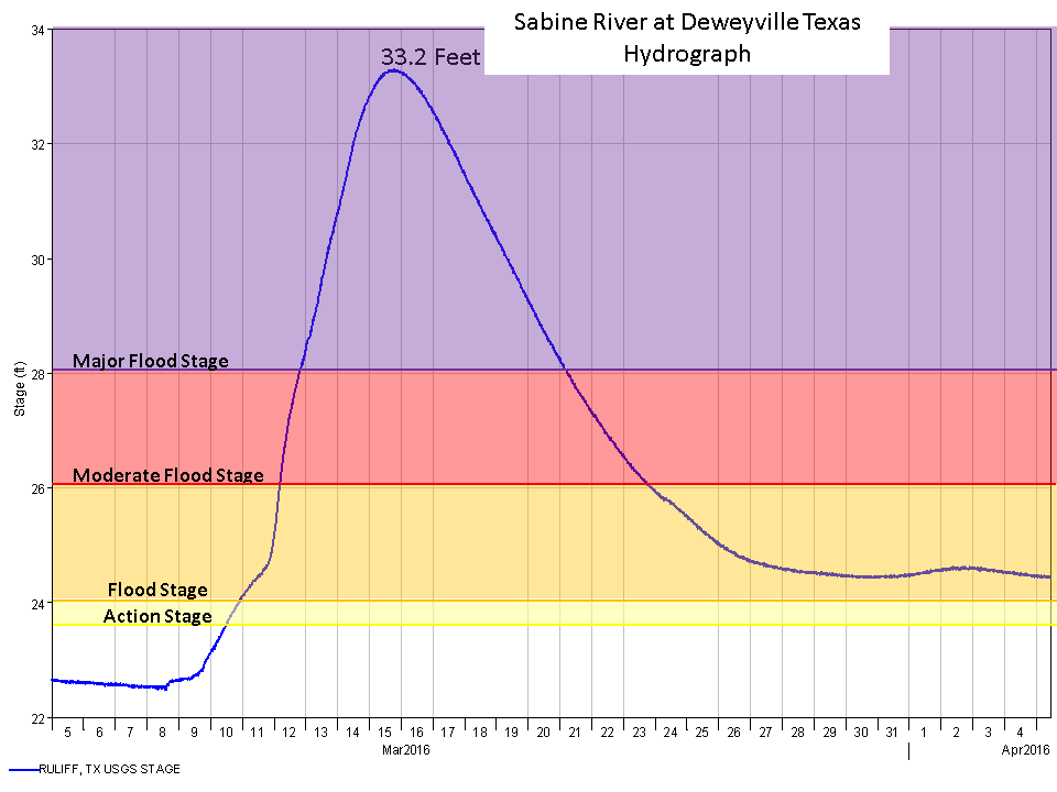
| Deweyville, TX Floods of Record | ||
| Height | Date | Comment |
| 33.24 ft | 3/15/2016 | Preliminary |
| 32.20 ft | 5/1/1884 | Previous highest unofficial gauge reading |
| 29.98 ft | 5/22/1953 | Previous official flood of record for Deweyville |
.JPG)
Niblett's Bluff Park, Tim Humphrey |
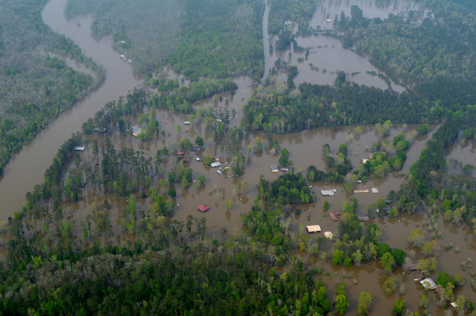
Niblett's Bluff Park, Tim Humphrey |
US 12 Near Starks, LA, Tim Humphrey |
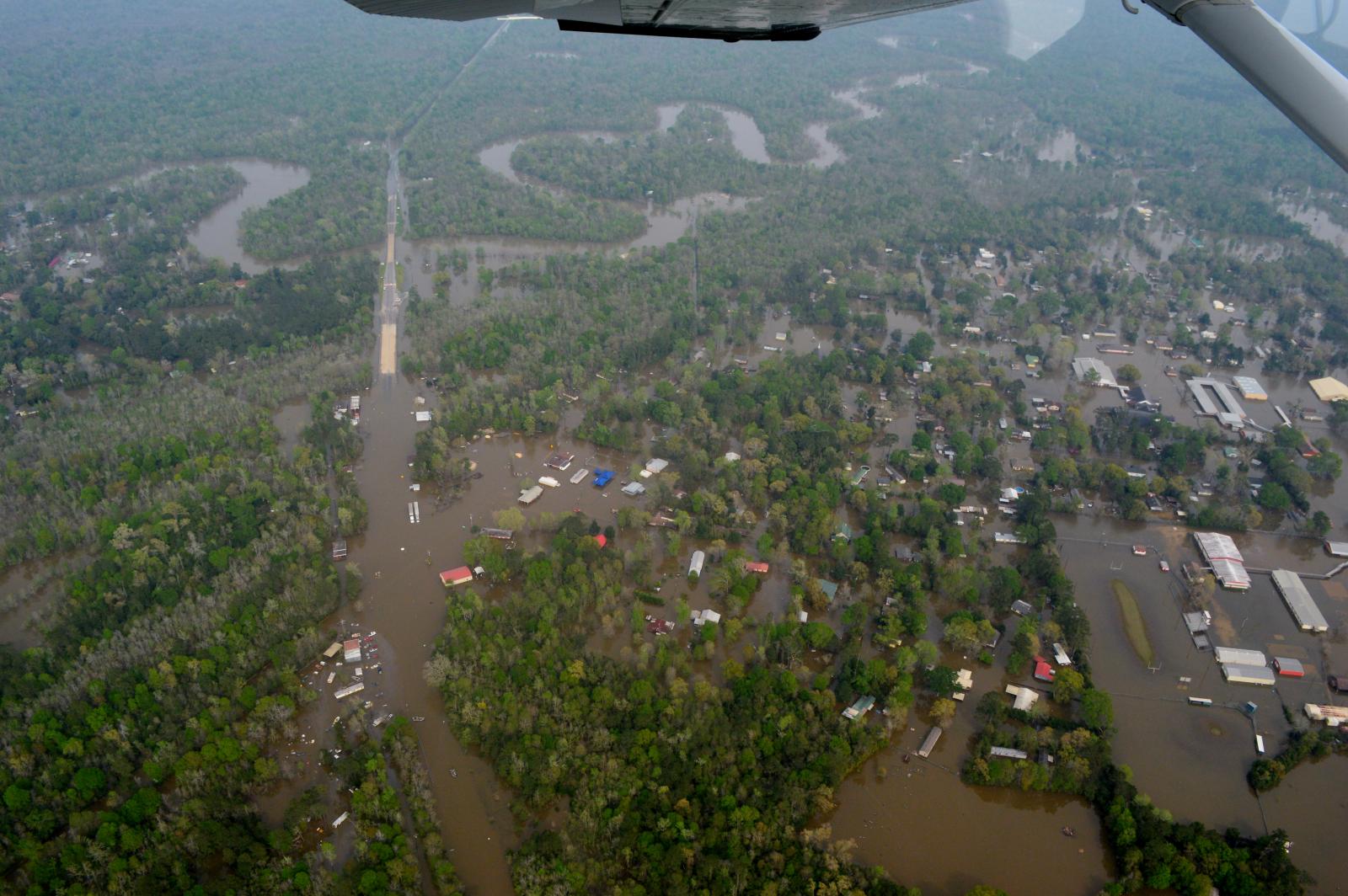
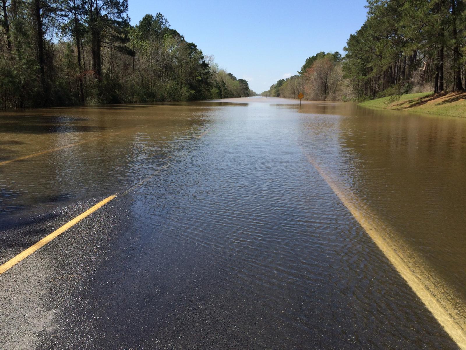
Deweyville, TX, Tim Humphrey |
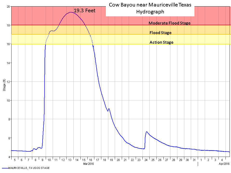
| Mauriceville, TX Floods of Record | ||
| Height | Date | Comment |
| 22.53 ft | 10/29/2006 | Official flood of record for Mauriceville |
| 19.3 ft | 3/13/2016 | Preliminary |
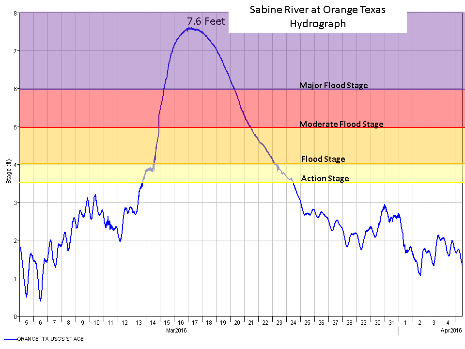
| Orange, TX Floods of Record | ||
| Height | Date | Comment |
| 9.86 ft | 9/13/2008 | Flooding due to storm surge from Hurricane Ike |
| 7.62 ft | 3/17/2016 | Preliminary |
| 6.27 ft | 4/25/1913 | Highest recorded flooding induced by rainfall |
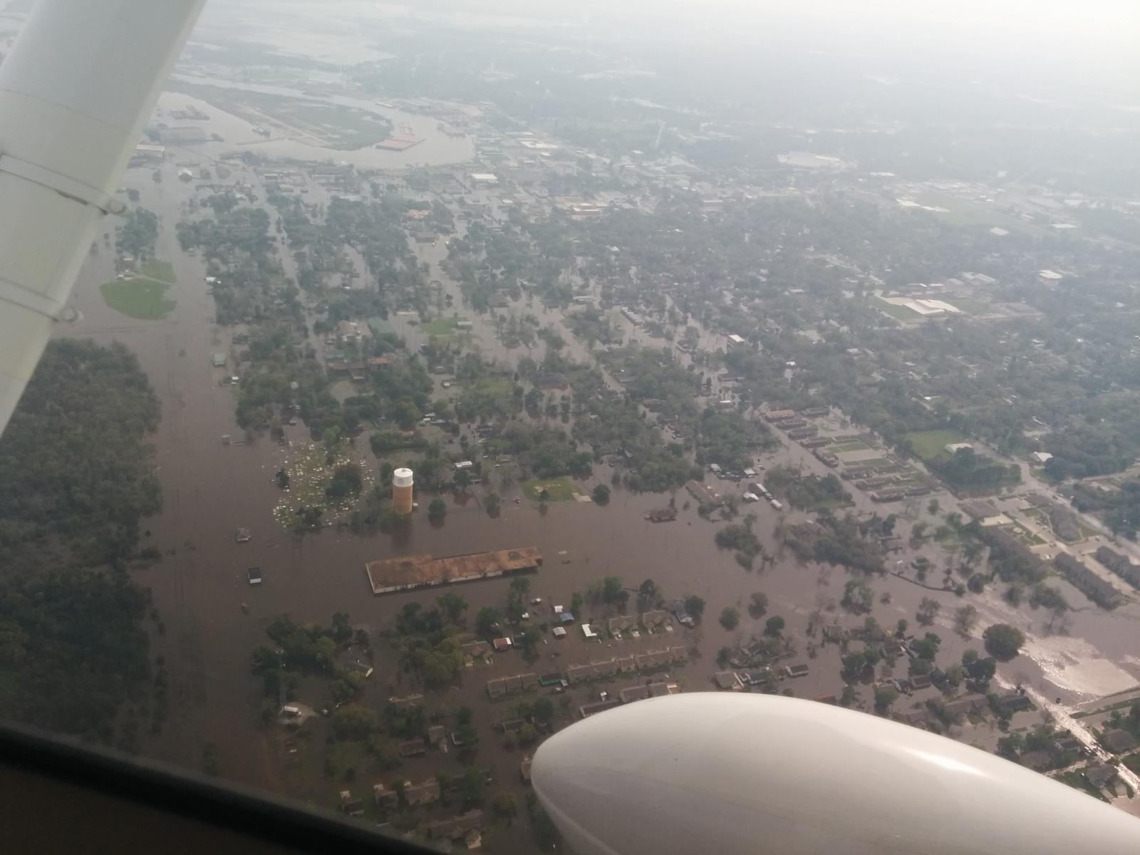
Orange, TX, Jonathan Brazzell |
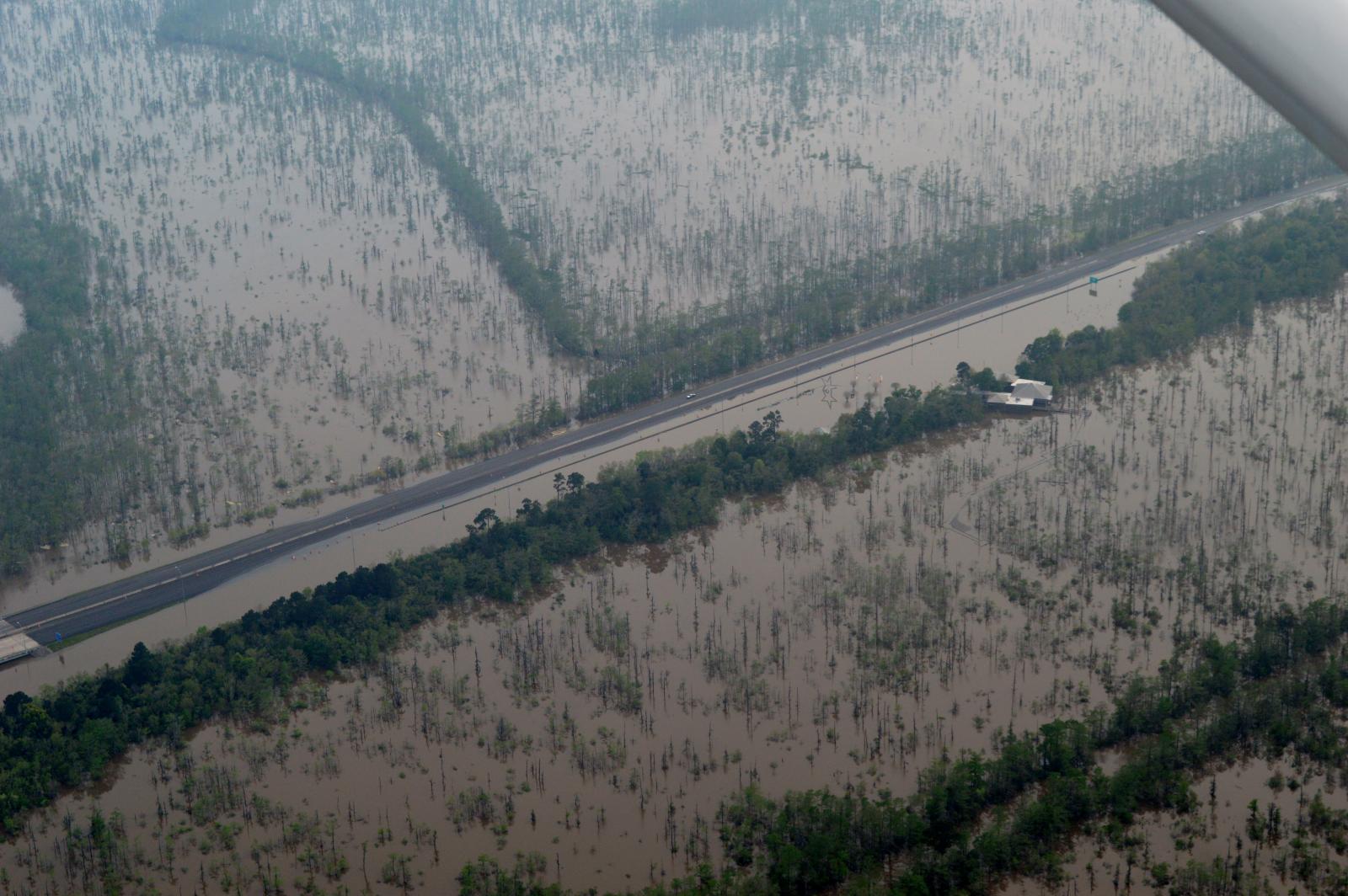
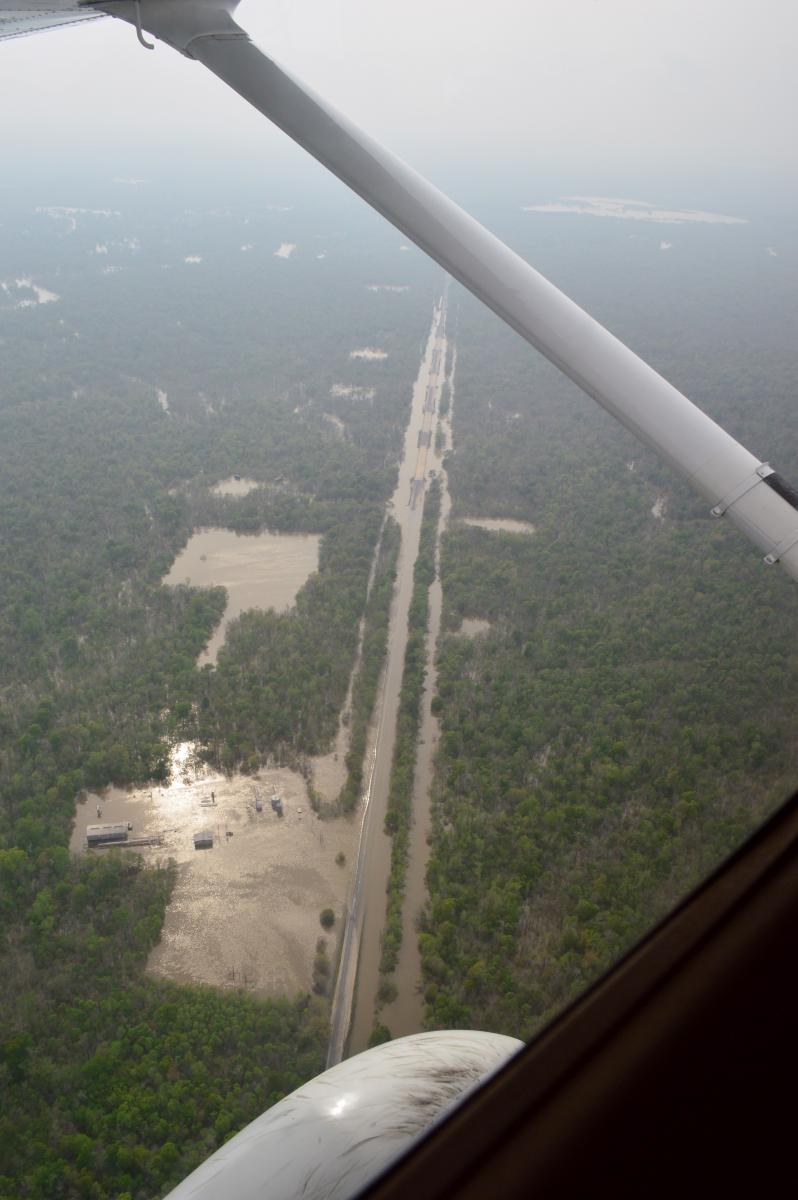
I-10 TX Welcome Center, Tim Humphrey |
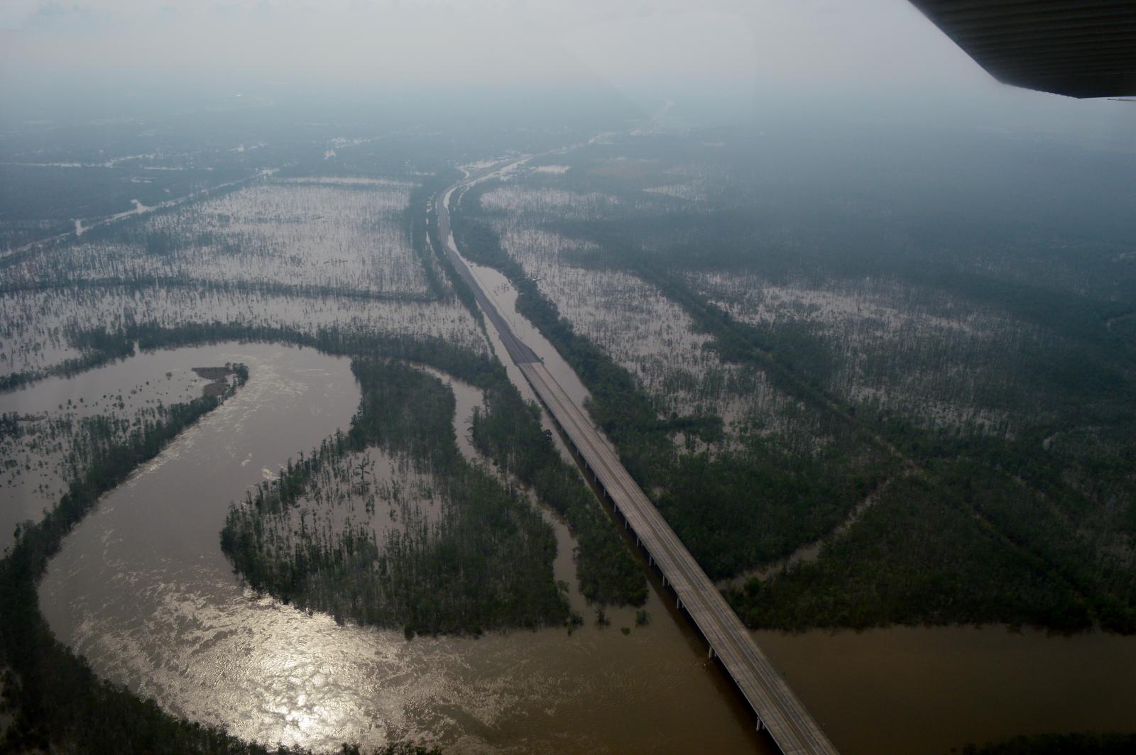
I-10 At TX/LA State Line, Tim Humphrey |
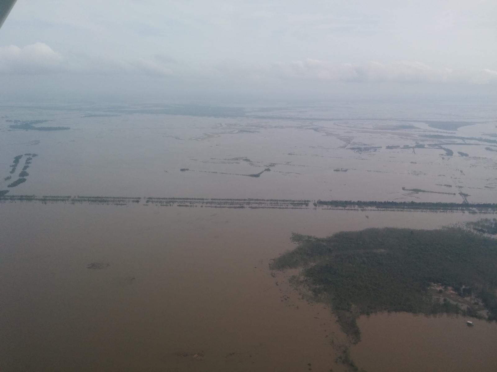
Marshes South of I-10, Jonathan Brazzell |

