
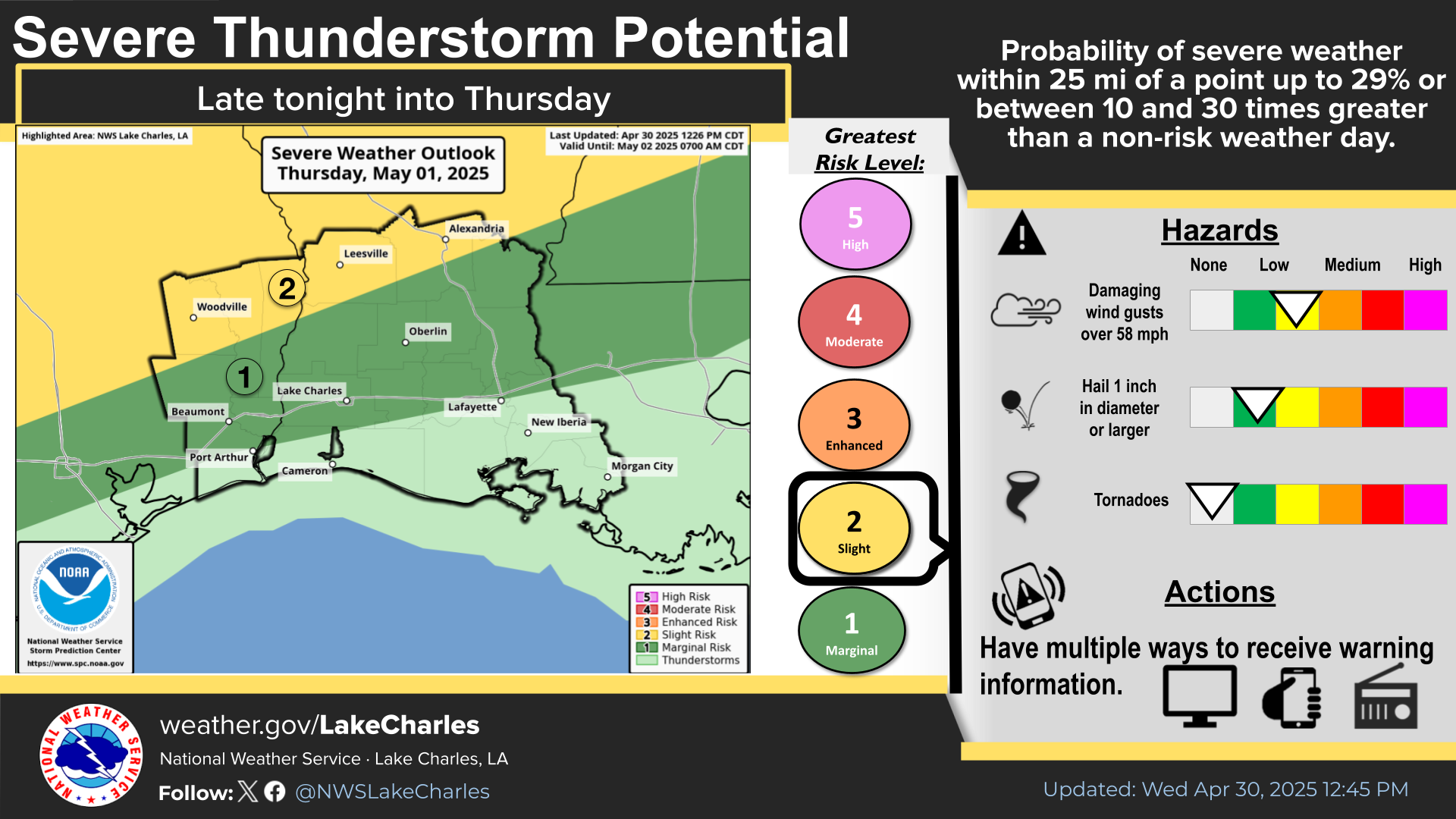
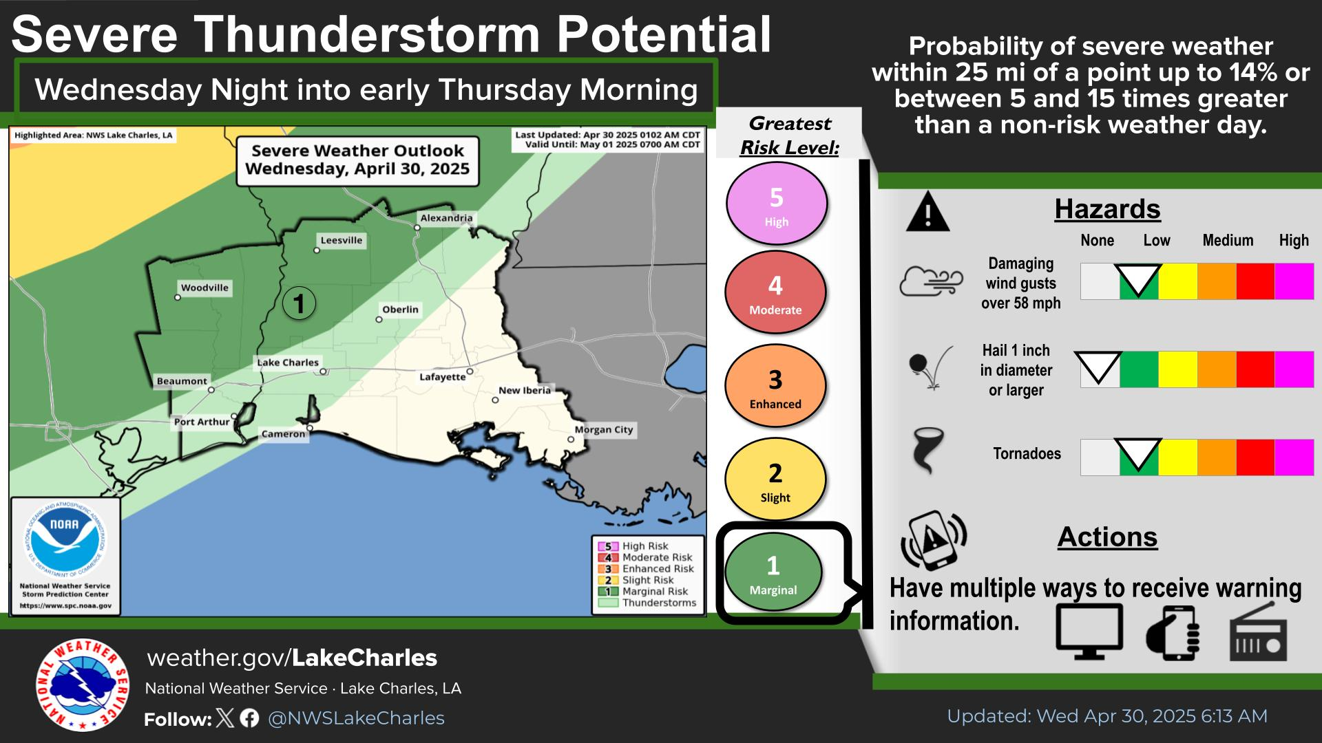
Dangerous and extreme heat will remain across portions of the southern U.S. this week. A heat wave over the Southwest U.S. will intensify this week, peaking and expanding into the Intermountain West and northern High Plains this weekend. Multiple rounds of thunderstorms will produce heavy to excessive rainfall with significant flash flooding across portions of southern New England today. Read More >
Last Map Update: Wed, Jul 29, 2026 at 3:58:18 pm CDT
| Latest Text Product Selector | |
|
||||||||||||||||||||||||||||||||||||||||||||||||||||||||||||||||||||||||||||||||||||||||||||||||||||||||||||||||||||||||||||||||||||||||||||||||||||||||||||||||||||||||
| Current Weather |
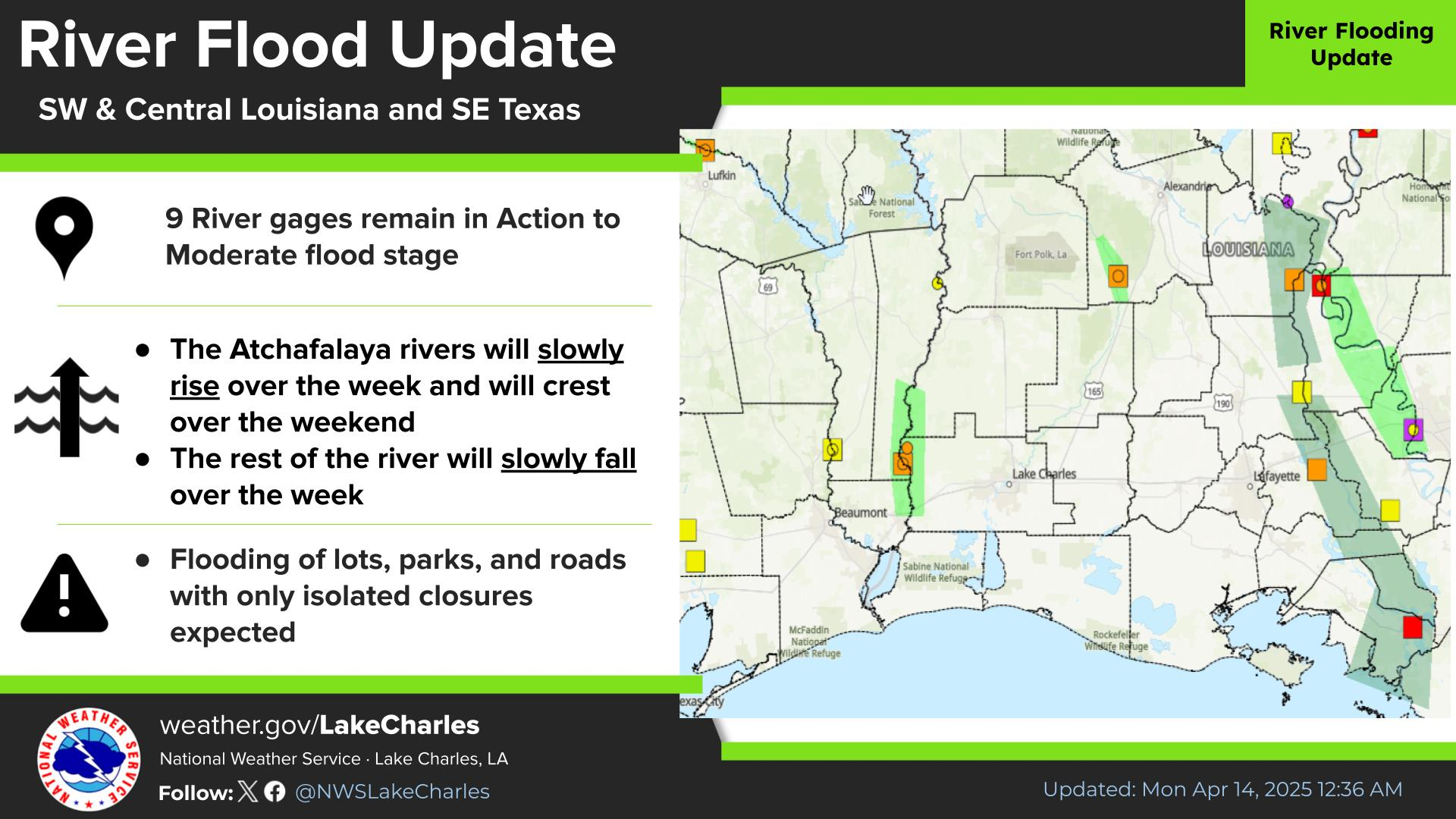
Rivers & Lakes |
Forecast Maps |
Hour By Hour Forecast |
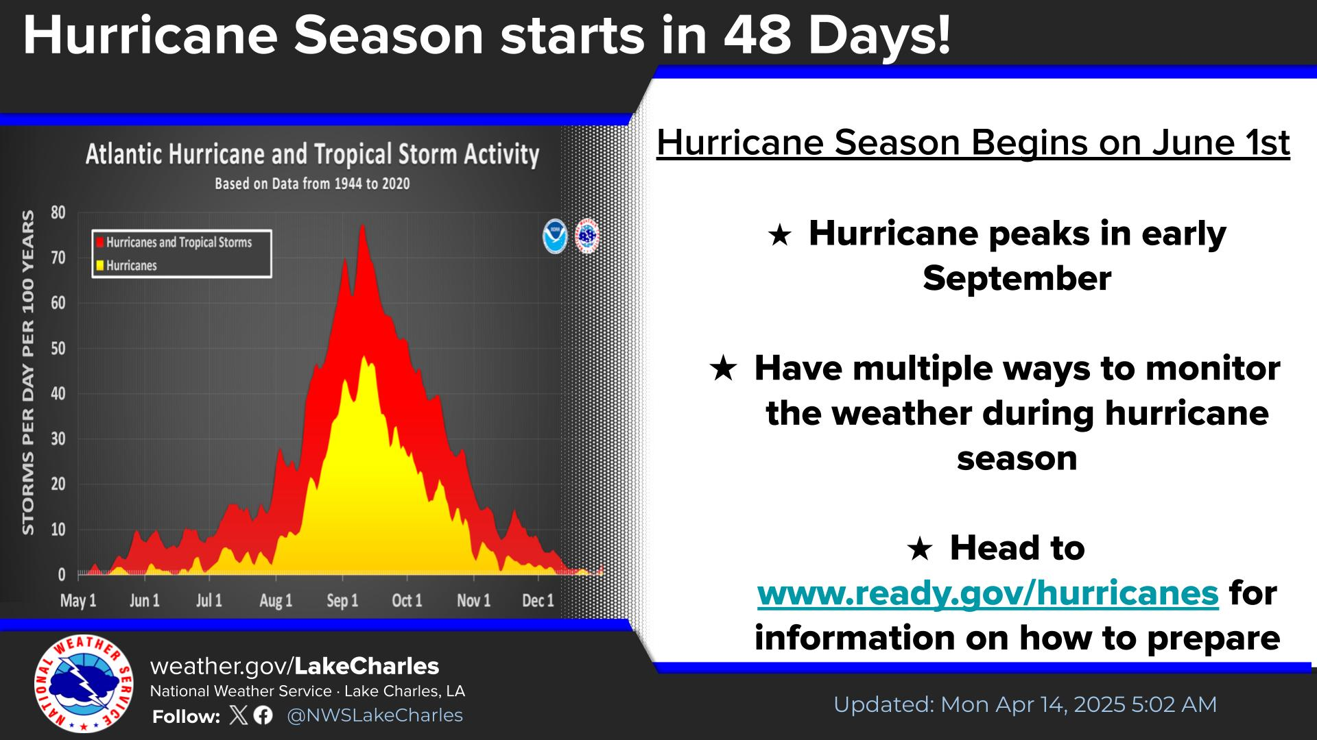
Tropical Weather |
| Marine Forecast |
Text Bulletins |
Forecast Discussion |
NOAA Weather Radio |
Submit Storm Report |


 Local Radar
 Regional Satellite
 Weather Map