Louisville, KY
Weather Forecast Office
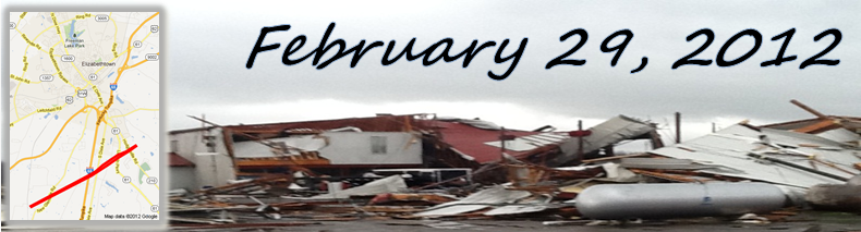
Strong low pressure moving from southern Minnesota to central Wisconsin pushed a cold front into the Ohio Valley during the late morning and afternoon hours of Leap Day 2012. Temperatures were 10 to 15 degrees warmer than normal, in the 60s, with moist air flowing northward from the Gulf of America. Meanwhile, winds aloft were coming in from the west at speeds over 100 mph from southern Missouri to southern Indiana. The atmosphere became very unstable and storms erupted early in the day. By the time the event was over, six tornadoes had touched down in central Kentucky.
(We are unable to display the track maps at this time. We apologize for the inconvenience. For a basic, general track map see here.)
Russell/Casey Counties
Metcalfe County
1st LaRue County
2nd LaRue County
Hardin County
We also received the following photo, from other storms that formed that day (click on the image for a larger version):
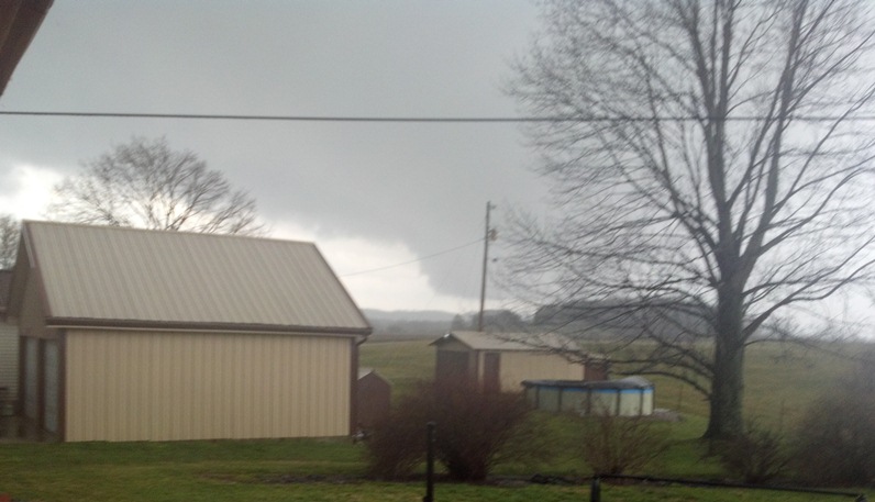 |
A wall cloud in Marion County. Tony Ballard |
Current Hazards
Hazardous Weather Outlook
Storm Prediction Center
Submit a Storm Report
Advisory/Warning Criteria
Radar
Fort Knox
Evansville
Fort Campbell
Nashville
Jackson
Wilmington
Latest Forecasts
El Nino and La Nina
Climate Prediction
Central U.S. Weather Stories
1-Stop Winter Forecast
Aviation
IDSS Forecast Points
Air Quality
Fire Weather
Recreation Forecasts
1-Stop Drought
Event Ready
1-Stop Severe Forecast
Past Weather
Climate Graphs
1-Stop Climate
CoCoRaHS
Local Climate Pages
Tornado History
Past Derby/Oaks/Thunder Weather
Football Weather
Local Information
About the NWS
Forecast Discussion
Items of Interest
Spotter Training
Regional Weather Map
Decision Support Page
Text Products
Science and Technology
Outreach
LMK Warning Area
About Our Office
Station History
Hazardous Weather Outlook
Local Climate Page
Tornado Machine Plans
Weather Enterprise Resources
US Dept of Commerce
National Oceanic and Atmospheric Administration
National Weather Service
Louisville, KY
6201 Theiler Lane
Louisville, KY 40229-1476
502-969-8842
Comments? Questions? Please Contact Us.


 Weather Story
 Weather Map
 Local Radar