
Dangerous heat will expand from the Gulf Coast into the Southern Plains and Desert Southwest through week's end. Additional extreme heat impacting the Pacific Northwest will shift to the northern Plains by the weekend. Tropical Storm Bertha is expected to continue to impact portions of the northern Gulf Coast from the western Florida Panhandle to southeastern Louisiana through tonight. Read More >
|
Upper-level storm system brings widespread snow |
||||||
|
|
||||||
|
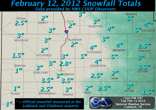
Snowfall totals received at our office from the Co-op observer network. Click on the map for a larger view. |
||||||
|
An upper-level trough pushed from the Great Basin across the central Rockies and into the Southern Plains region from the morning of Sunday, February 12th through the morning of Monday, Feburary 13th, bringing widespread snowfall to the entire Southern Plains region. A solid 2 to 4 inches of snow fell across a vast majority of the area, though some locations to the northeast of Lubbock (between Floydada and Childress) picked up 5 inches. A few areas to the southwest of Lubbock had lighter amounts of around 1 to 2 inches. |
||||||
|
|
||||||
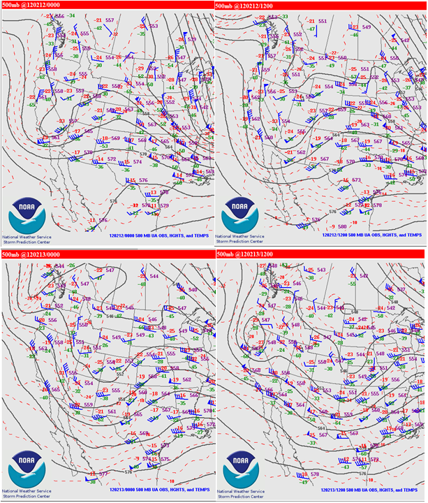
| Plot displaying the track of the upper level storm system (500 mb trough) that brought West Texas the bout of winter weather. Click on the map for a larger view. | ||||||
|
|
||||||
| The storm system was certainly weaker and faster moving than the intense closed upper-low that impacted that region last Christmas, but it still produced widespread, meaningful snowfall across the entire area. Additionally, some sleet and freezing rain also mixed in with the snow late in the event, which combined to create very hazardous travel conditions across the region. Most area roadways were extremely treacherous by about mid to late morning on Sunday the 12th. These conditions persisted through the Monday morning rush hour commute on the 13th. This resulted in a hundreds of accidents being reported across the Southern Plains region during this short 24-hour period. | ||||||
|
|
 |
|||||
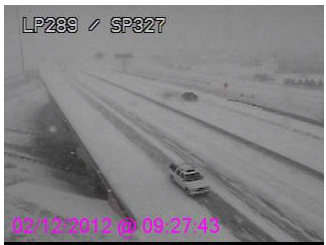
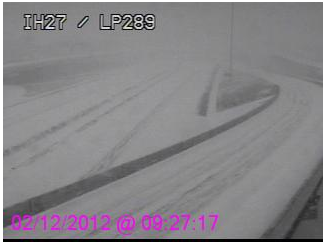
| Webcam images of the hazardous travel conditions present on roadways in Lubbock on Sunday morning (February 12th). Pictures courtesy of the Texas Department of Transportation. Click on the images for a larger view. | ||||||
|
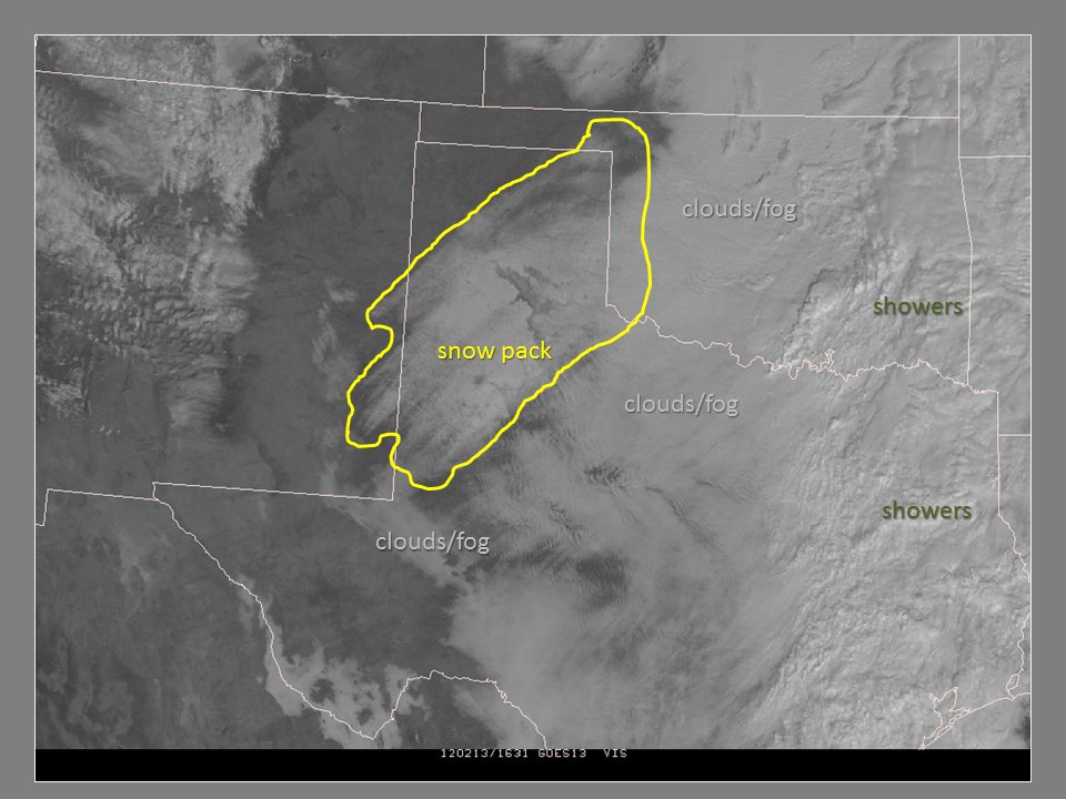
The above image shows what it looked like on area roadways in Lubbock during the morning of Sunday, February 12th. Below, you can see how this same scene looked from the next day (February 13th) from 438 miles above the earth. |
||||||
|
|
||||||
| Visible satellite image captured Monday morning (February 13, 2012). The large snowpack left behind by this storm system is visible across much of our area and is circled in yellow. Clouds and fog are present just east of the region. Click on the frame for a larger view. | ||||||
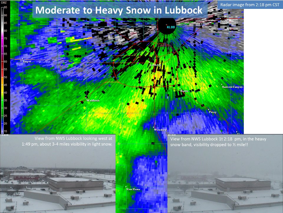
| Below is a snapshot from the Lubbock radar of a heavy snow band moving over the city of Lubbock. The other two images were taken from the roof of the Science Spectrum in Lubbock from our office's webcam. They show how significantly lower the visibility dropped during the passage of this snow band. | ||||||
 |
||||||
| Radar reflectivity image taken at 2:18 pm on February 12, 2012. The below images were taken from the NWS Office webcam at the Science Spectrum in Lubbock and show how visibility was reduced from 3-4 miles before the band passage to around 1/2 of a mile as the band pushed over. | ||||||
| Following are several radar images captured during this winter weather event. | ||||||
|
|
 |
|||||
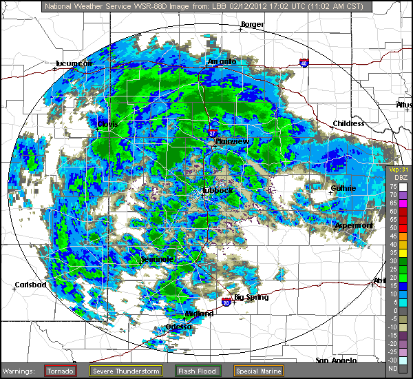
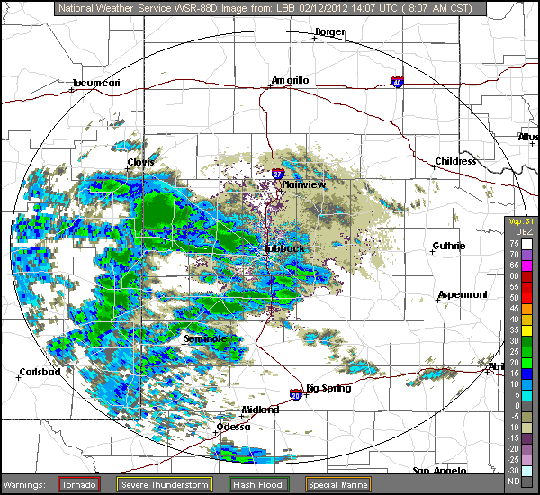
| Radar reflectivity images valid at 8:07 am and 11:02 am on February 12, 2012. | ||||||
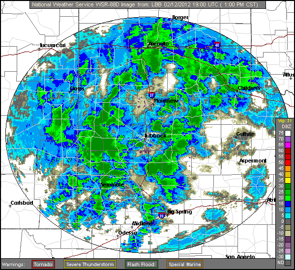
| The snow initially moved into the southwest South Plains and spread across the entire area throughout the course of the morning, dropping sleet and around 1/2 to 1 inch of snow in many locations as shown in the images above.The below images show additional bands of locally heavy snow pushing across the region during the early afternoon as enhanced lift from the storm system began to shift over the area, producing another 1-2" of snow. | ||||||
 |
 |
|||||
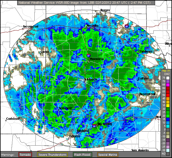
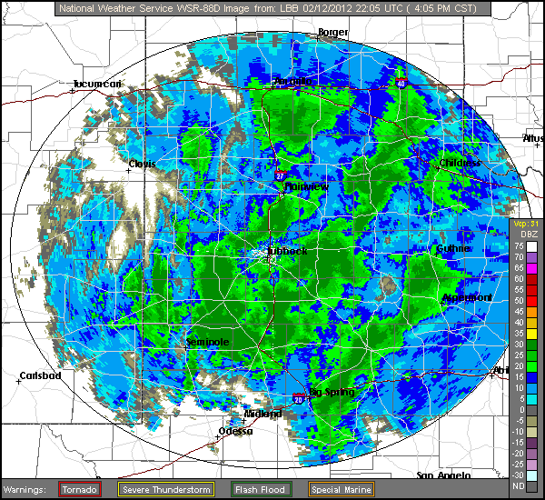
| Radar reflectivity images valid at 1:00 pm and 2:47 pm on Feburary 12, 2012. | ||||||
| Locally heavy snow bands continued to expand and move across the region during the late afternoon, producing some heavy snowfall across the central and eastern South Plains (below). | ||||||
|
|
 |
|||||
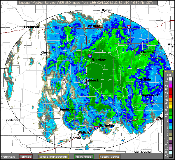
| Radar reflectivity images valid at 4:00 pm and 5:52 pm on February 12, 2012. | ||||||
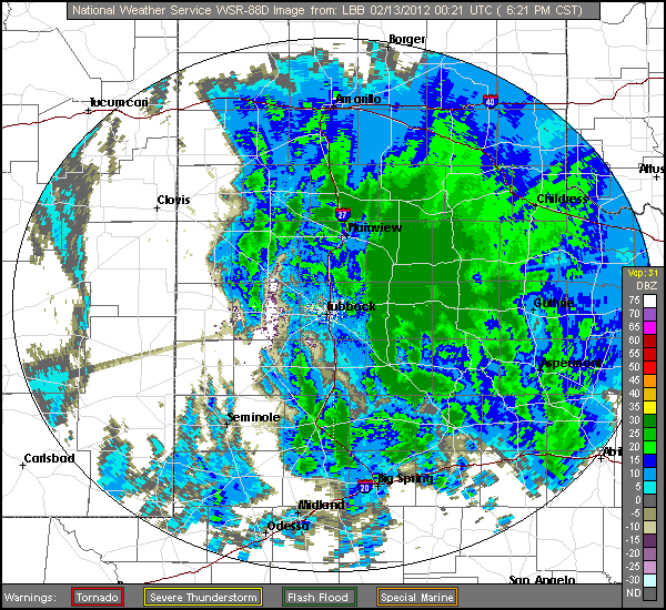
| The snow persisted across a good portion of the eastern South Plains, Rolling Plains, and southeast Panhandle into the evening hours before it finally tapered off. It was in these areas where the heaviest snowfall occurred as totals between 3 to 5 inches were common (see radar images below). Some additional light showers pushed across the area during the late evening and overnight hours and produced some sleet and freezing drizzle which further exasperated the already hazardous travel conditions. | ||||||
 |
 |
|||||
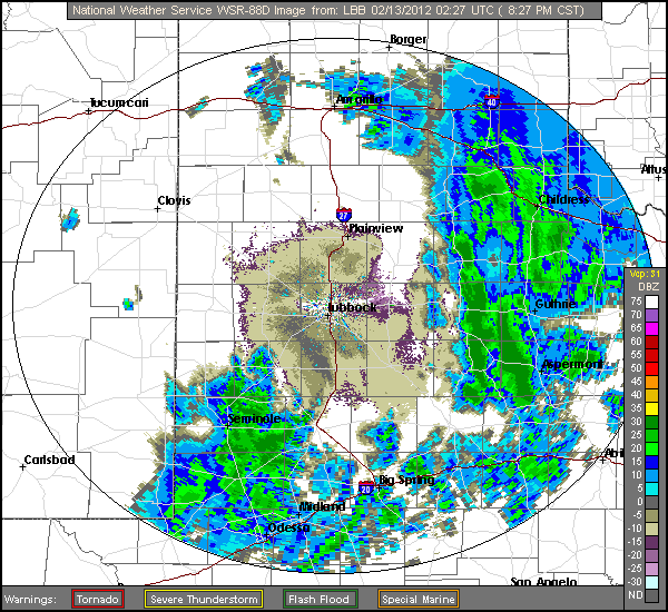
| Radar reflectivity images valid at 7:00 pm and 8:27 pm on February 12, 2012. | ||||||

