|
Wet and Messy Winter Storm Strikes |
|
 |
|
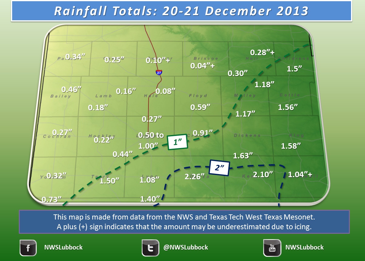
| Map of recorded precipitation across the region. Most of the precipitation fell as rain and freezing rain, though a little snow mixed in across the southern Texas Panhandle. The data are courtesy of the West Texas Mesonet and the National Weather Service. *Note: Amounts may be underestimated in places where ice fell due to freezing of the rain gauge. | |
| A strong winter storm moved through Texas bringing the welcome gift of widespread precipitation just in time for Christmas. This winter storm, similar to the last couple, brought a potpourri of precipitation types on Friday and Saturday, 20-21 December 2013. Most of the South Plains received a cold rain through much of the period, while temperatures were just cold enough for freezing rain for many spots off the Caprock. As the above map shows, the rainfall was widespread, with 1 to 2+ inches falling in a swath from the southeast South Plains through much of the Rolling Plains. The big winners were Jayton and Post who recorded 2.10" and 2.26", respectively. Thankfully, although the freezing rain did result in a glaze of ice on trees, vehicles and power lines in many spots off the Caprock, the ground was warm enough to keep roads wet, thus mitigating travel difficulties. | |
 |
|
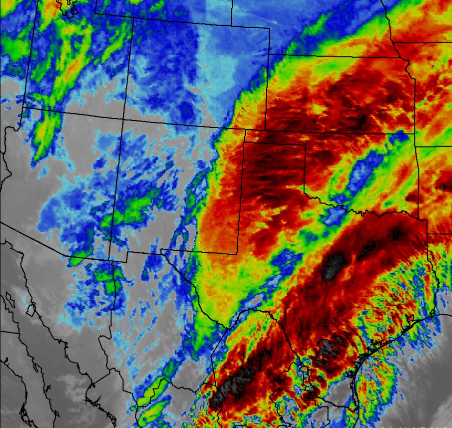
| Infrared satellite image taken at 10:01 pm on Friday, 20 December 2013. The darker oranges and reds indicate higher, colder cloud tops where often heavier precipitation is falling. Click for a larger view. | |
| The above satellite image shows widespread thick and moisture rich clouds streaming across much of Texas near the peak of the precipitation in West Texas on Friday evening. The below radar animation Friday evening also shows a well-defined band of moderate precipitation stretching from southwestern Texas through the South Plains and Rolling Plains and into Oklahoma. At this time, rain rates of 1/10 to 4/10 of an inch an hour were common in the heaviest bands. Temperatures at this time were mostly in the 30s, generally just above freezing on the Caprock and at or just below freezing in the Rolling Plains. | |
 |
|
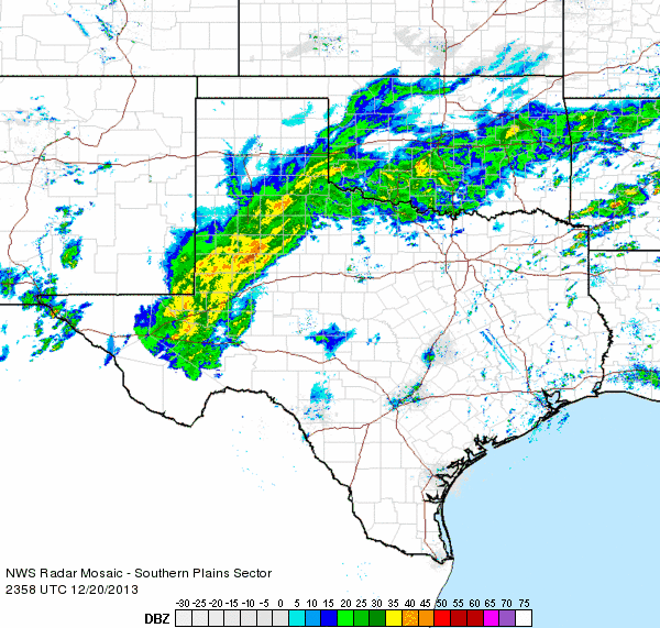
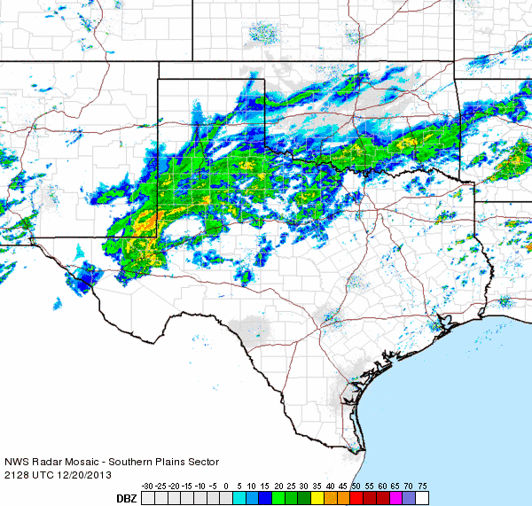
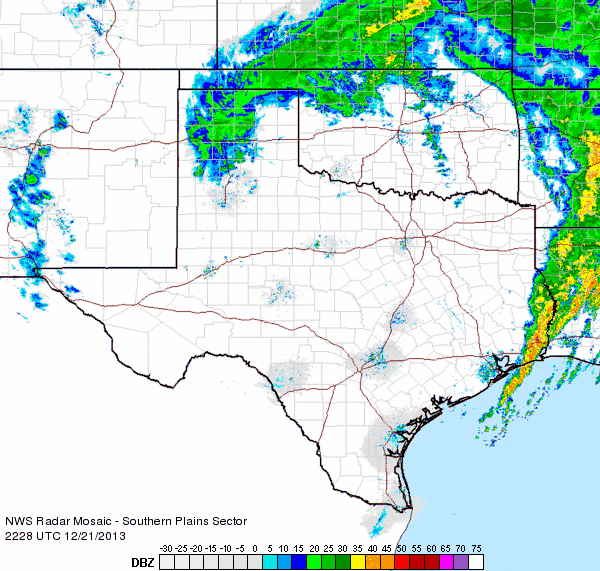
| Regional radar loop from 6:58 to 8:08 pm on Friday, 20 December 2013. An additional radar animation valid from 3:28 to 4:38 pm on the 20th can be FOUND HERE. | |
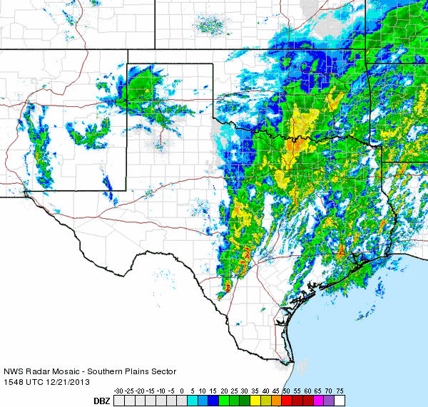
| A majority of the rain and freezing rain fell from Friday afternoon through early Saturday morning, well in advance of an upper level storm system approaching from the west. As the storm system moved directly over the South Plains on Saturday, drier air moved in and brought an end to the widespread precipitation on the South Plains. However, moisture, mostly in the form of snow, did form to the north of the upper level low across the Panhandles (see the below radar animation). Many locations across the Texas Panhandle received several inches of snowfall or more, though the far southern Texas Panhandle from Friona to Dimmit and Tulia only had light amounts. | |
 |
|
| Regional radar loop from 9:48 to 10:58 am on Saturday, 21 December 2013. An additional radar animation valid from 4:28 to 5:38 pm on the 21st can be FOUND HERE. | |
|
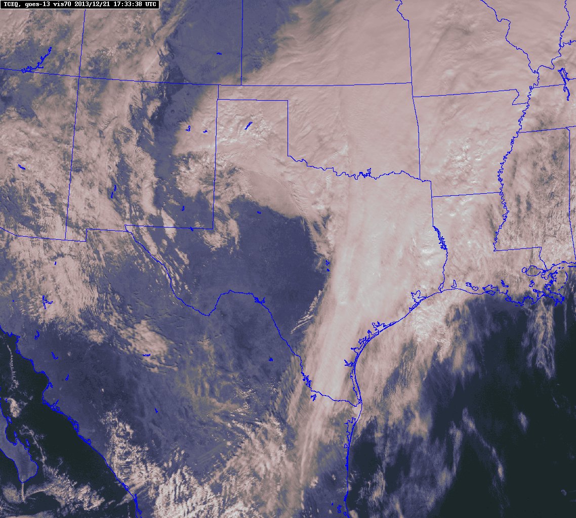
The below visible satellite image shows what the storm system looked like around midday Saturday from over 22,000 miles above the Earth. The cyclonic curl of the large storm system, with plenty of clouds and moisture wrapping from eastern and North Texas into the Panhandles.
|
|
 |
|
| Visible satellite image captured at 11:34 am on Saturday, 21 December 2013. Click on the image for a larger view. | |
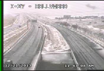
| Although precipitation was mostly liquid (rain and freezing rain) across the South and Rolling Plains, the below images show the wintry wonderland that was unfolding just to our north in the Texas Panhandle around midday on Saturday. | |
 |
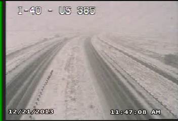 |
| Pictures of what it looked like in the Texas Panhandle around midday on Saturday, 21 December 2013. The left image was taken in Amarillo and the right image was taken at Vega. Images are courtesy of TXDOT. Click for larger views. | |
| Plotted below is the 48-hour total liquid precipitation recorded by the West Texas Mesonet stations, ending at 6 pm on Saturday. Be aware that some of the amounts may be under-reported where the freezing rain fell in the Rolling Plains because of the rain gauges icing up. In addition, the temperatures around 10 pm Friday, in the midst of the moderate rain, are also plotted. The readings show that temperatures were mostly in the middle 30s on the Caprock, with lower 30s (30-32 degrees) common in the Rolling Plains. | |
|
|
|||
|
Toggle 48 hour rainfall (inches) ending at 6 pm on Saturday, December 21, 2013
|
Toggle observed temperatures near the peak of the rainfall at 9:45 pm on Friday, December 20, 2013
|
||

