
Scattered thunderstorms with severe gusts, hail and a tornado risk are possible near a cold front from the Ohio Valley to the Mid-Atlantic tonight. Tropical Storm Bertha is expected to bring tropical storm conditions to portions of the Gulf Coast from the panhandle of Florida into Louisiana through Wednesday. Read More >
|
Very Cold with a Light Wintry Mix
2 March 2014 |
 |
|
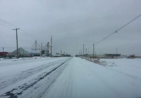
Wintry scene in Olton around midday on Sunday, 2 March 2014. Picture is courtesy of Alice Gunter. |
|
What a dramatic change a day can make. Many locations up on the Caprock experienced temperatures in the 80s for the first half of the first weekend of March (1 March 2014). However, where clouds and cool easterly winds persisted in the eastern Panhandle and northern Rolling Plains, highs only made it into the 40s, 50s and 60s. These cooler temperatures acted as foreshadowing as a much stronger surge of cold air, originating across the Arctic Ocean days earlier, brought frigid air to West Texas for the second half of the weekend. Temperatures by Sunday afternoon (2 March 2014) were only in the teens and lower 20s, a 60 degree change in a single day. Very impressive indeed! |
 |
| Regional radar loop valid from 11:48 am to 12:58 pm on 2 March 2014. |
| In addition to the bitter cold, an approaching upper level storm system brought a wintry mix to the South Plains region on Sunday. Although temperatures at ground level were well below freezing, much warmer air aloft resulted in a mix of freezing rain, sleet and snow. Precipitation amounts were generally, but did create some travel problems. A few higher reports that we received include a half of an inch of sleet in Littlefield and 1.5 inches of snow in Muleshoe. Lubbock official recorded 0.01 inches of melted liquid, which fell in the form of freezing rain, sleet and very light snow. |
|
|
|||
|
Toggle High Temperatures on Saturday, March 1, 2014
|
Toggle High Temperatures on Sunday, March 2, 2014
|
Toggle Wind Chills at 9:20 pm on March 2, 2014
|
Toggle Lows on the Morning of March 3, 2014
|
|
The above map shows the contrast between high temperatures on March 1st and March 2nd, as observed by the West Texas Mesonet sites around the region. Many of the highs on the 2nd actually occurred at or just after midnight, with colder temperatures the remainder of the day. Also shown are wind chills Sunday evening and the chilly morning lows the following morning. The atypically cold air combined with brisk winds to create dangerous wind chills as low as 0 to -15°F late Sunday and early Monday.
|
|||

