|
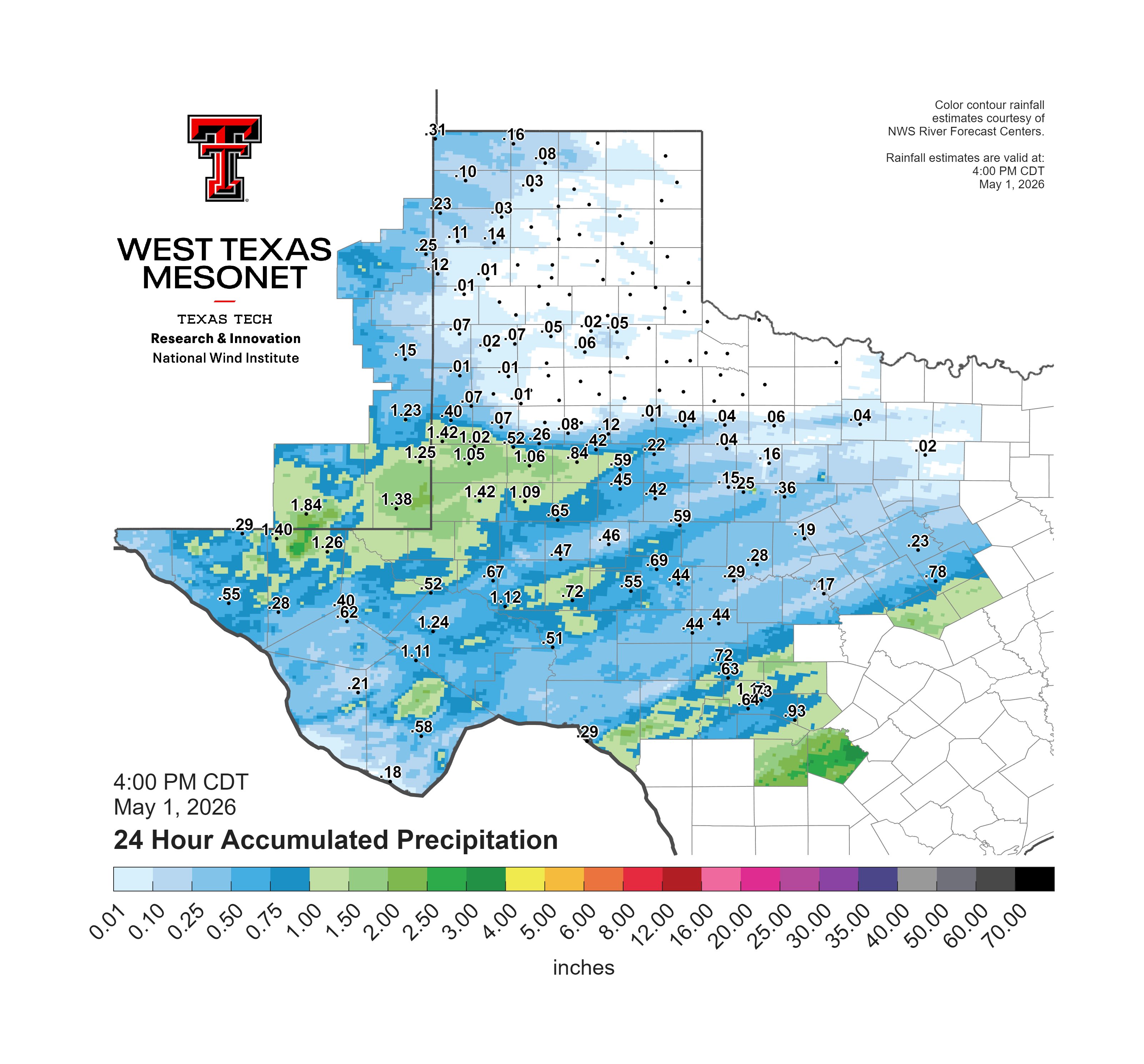
Southwestern South Plains receive beneficial rain 1 May 2026 |
|
 |
|
|
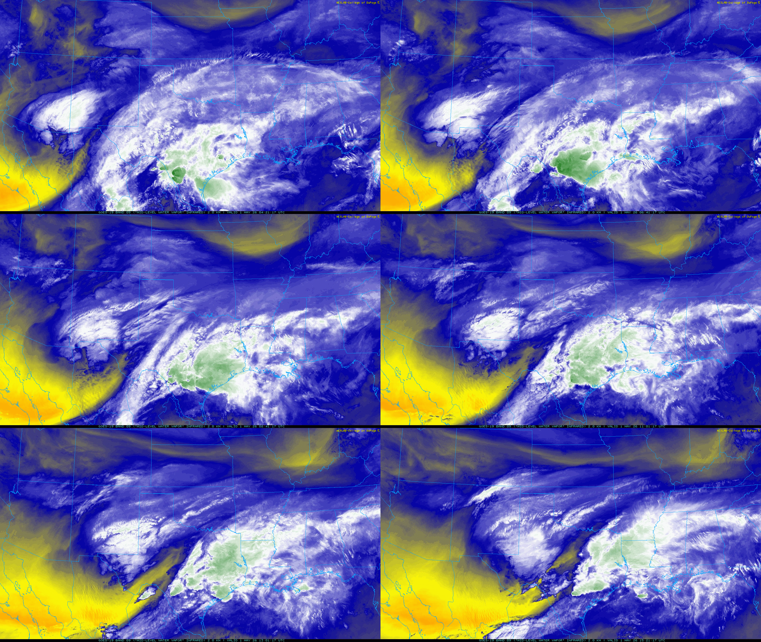
Mid-level water vapor loop valid from 11:21 pm on Thursday to 10:21 am on Friday (31 April -1 May 2026). |
|
|
May started on the unsettled side for West Texas, complete with cool temperatures and areas of rain. The two primary contributors to the changeable weather were a couple of shots of cooler air nosing in from the north and a potent mid-upper level disturbance that approached from the west. Ahead of the colder air, warm and very moist air had established itself over much of North, Central, East and South Texas. The moisture, in combination with cool air aloft, resulted in strong instability that fueled numerous intense thunderstorms downstate at the end of April and the first day of May. |
|
 |
|
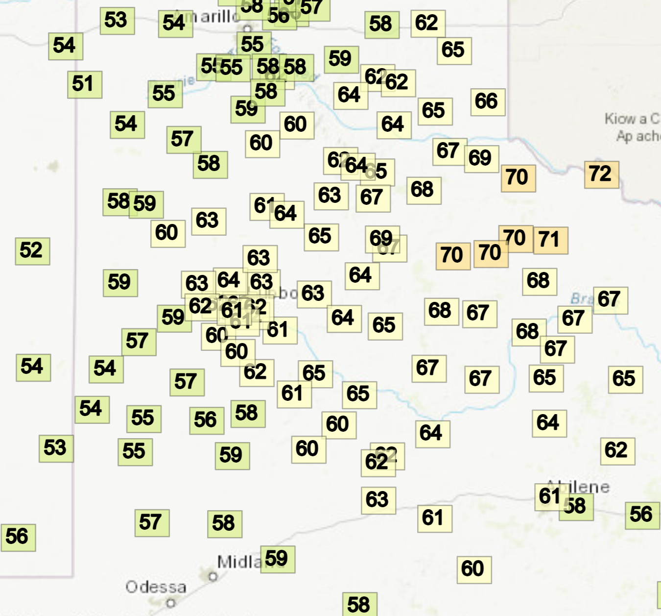
| High temperatures observed on Friday (1 May 2026). The data are courtesy of the West Texas Mesonet (WTM). | |
| Closer to home, low-level moisture was more limited, but did eventually improve modestly behind a couple of surges of cooler air that moved through the South Plains at the end of April. The initial frontal passages were dry locally. However, moisture gradually streamed up and over the cooler air, causing clouds to fill in. The clouds blossomed into a large area of rain over eastern New Mexico as an upper level disturbance provided lift as it approached via the Desert Southwest the final day of April. | |
 |
|
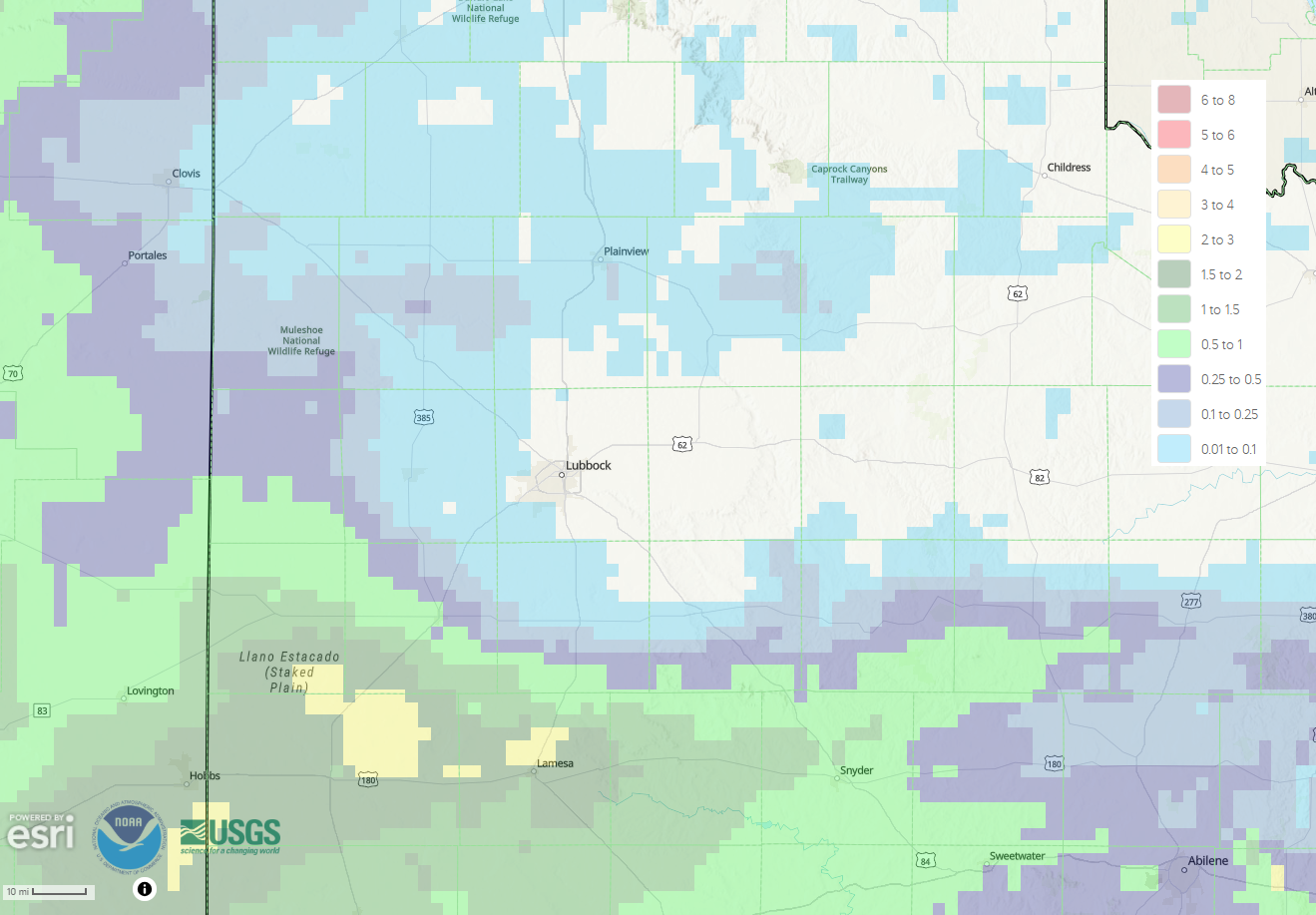
| Radar-estimated and bias-corrected 7-day rainfall ending at 7 am on Thursday (7 May 2026). Rain totals measured by the West Texas Mesonet (WTM) from 4 pm on Thursday to 4 pm on Friday (31 April - 1 May 2026) can be VIEWED HERE. | |
| Unfortunately (for those wanting widespread rain), the disturbance aloft tracked a bit farther south than was originally forecast, which resulted in the shield of rain shifting south too. Instead of targeting much or all of the South and Rolling Plains, the northern edge of the steady rain was confined to the southwestern and far southern South Plains. Much of Yoakum County and the southwest half of Terry County, including Plains and Denver City, saw a steady rain on Friday, with totals of 1/2 inch to over an inch measured. The northern end of the steady rain had a sharp cutoff, with little to no rain falling over the central and northern South and Rolling Plains. Officially, the Lubbock Airport reported a meager trace of rain for this event. | |
 |
|
| Regional radar animation valid from 8:05 am to 4:45 pm on Friday (1 May 2026). | |
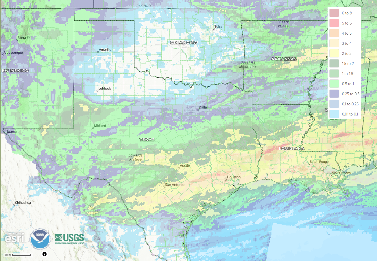
| Although a large portion of the South Plains region missed out on the beneficial rain, that wasn't the case over much of the rest of the state of Texas from late April into early May. Specifically, multiple rounds of showers and thunderstorms dumped 1 to 2+ inches of rain over much of the central and southeastern part of Texas. A large swath of 2 to 4+ inches of rain fell from around San Antonio and Austin through Houston and much of central and southern Louisiana. | |
 |
|
| Radar-estimated and bias-corrected 7-day rainfall ending at 7 am on Thursday (7 May 2026). | |
| Runoff from the heavy rain downstate did create areas of flash flooding, but it also helped to alleviate and even irradicate the drought in portions of the state. | |
 |
|
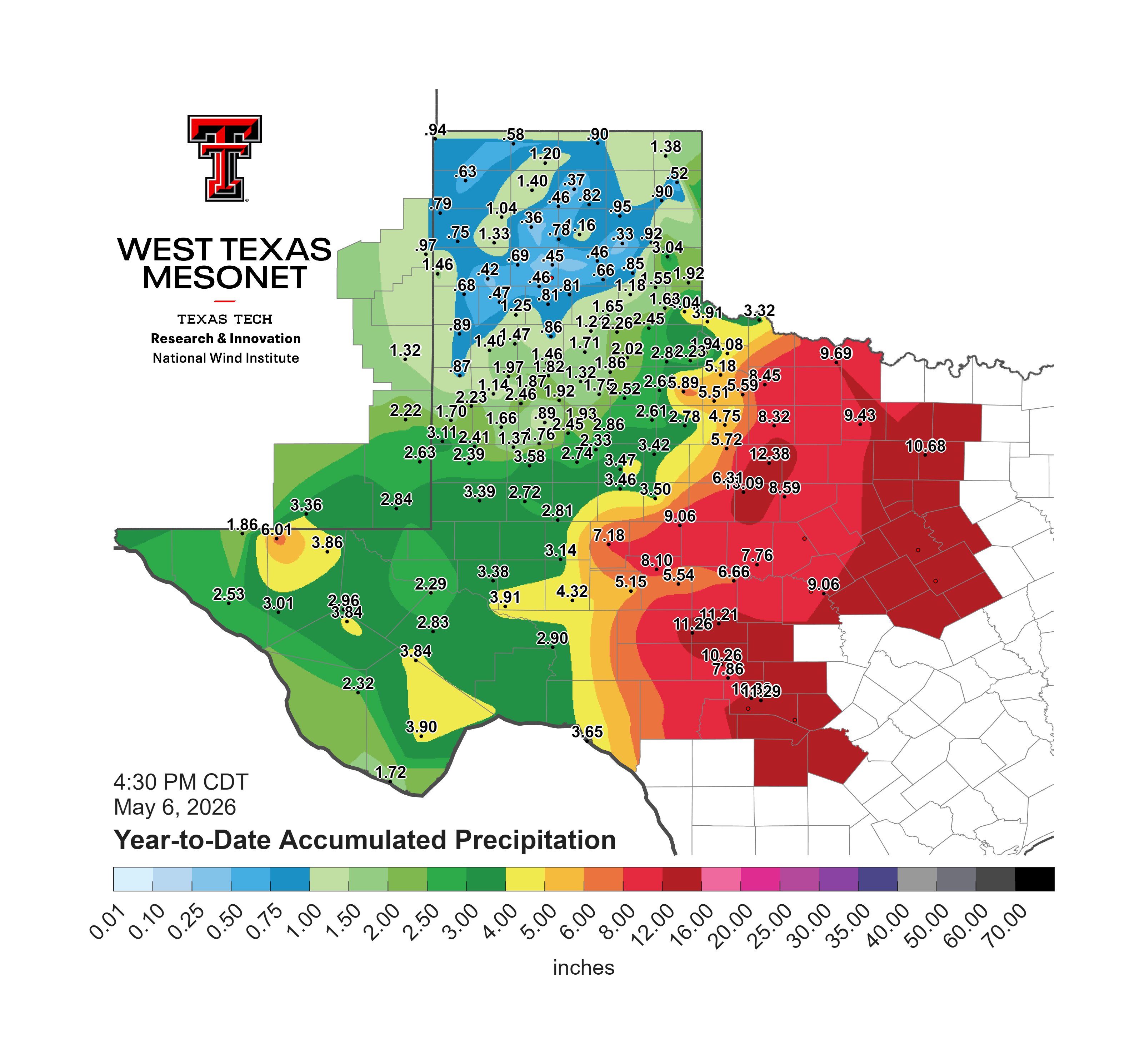
| Year-to-date rainfall total for much of the western half of Texas, valid through 4:30 pm on Wednesday (6 May 2026). The data are courtesy of the West Texas Mesonet. | |
|
As illustrated above, difference between the haves and have nots has not been confined to late April and early May. Instead, expanding back to the beginning of 2026, locations south and east of the Texas Panhandle and South Plains regions have generally fared much better with regards to rainfall so far in 2026. While the northwestern portion of Texas remains mired in drought and heightened fire weather concerns, vibrant green conditions dominated much of the remainder of the state. |
|



 Follow us on X
 Follow us on Facebook
 Follow us on YouTube
 LUB RSS Feed