
Scattered thunderstorms with severe gusts, hail and a tornado risk are possible near a cold front from the Ohio Valley to the Mid-Atlantic tonight. Tropical Storm Bertha is expected to bring tropical storm conditions to portions of the Gulf Coast from the panhandle of Florida into Louisiana through Wednesday. Read More >
 |
||||||
 |
||||||
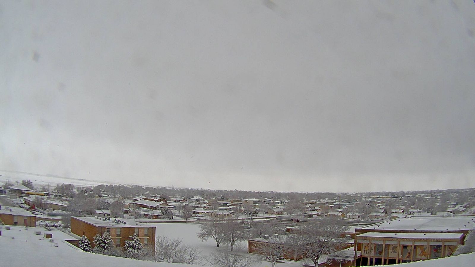
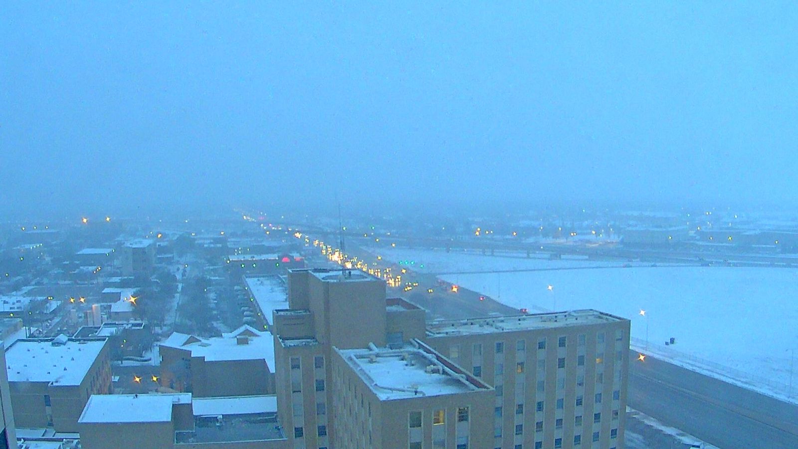
| Fresh snowfall on the Texas Tech University campus the morning of Friday January 23, 2015. Photo courtesy of Madison Schwab and Alex Weaver. | ||||||
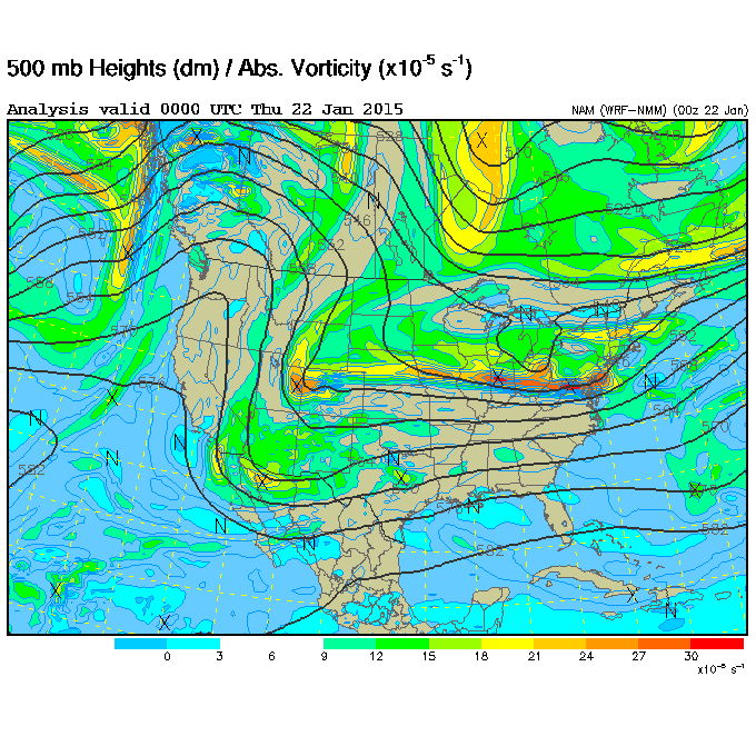
| A pair of upper level disturbances phased together on Wednesday, January 21, across the lower Rockies, serving as the large scale lifting mechanism for precipitation formation. Both of these systems brought an abundant increase in moisture as colder air drifted in from the north. | ||||||
 |
||||||
| The upper level weather pattern at 6 pm Wednesday January 21, 2015, showing two disturbances getting set to combine across New Mexico. | ||||||
|
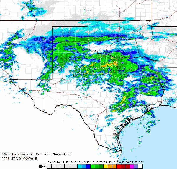
The animation below shows a large shield of precipitation across much of the northern half of Texas during the evening hours of Wednesday, January 21st. One very distinct and slow-moving band of precipitation is noted very near I-40, stretching from the central Texas Panhandle into central Oklahoma. Where this band was all snow, upwards of a foot of snow fell, including in and around Amarillo. Read more about the heavy snow in the Amarillo area HERE. The northern area of precipitation was ahead of the disturbance dropping southward through the central and southern Rockies. Further south showers that blossomed across the South Plains and Rolling Plains were produced out ahead of the southern upper level trough. Temperatures during the afternoon of the 21st warmed into the 40s and 50s across most of the South and Rolling Plains, which kept precipitation a cold rain initially during the afternoon and early evening hours. However, the rain did transition to snow for most locations through the evening hours as the air cooled. |
||||||
 |
||||||
| Regional radar animation valid from 8:08 to 9:18 pm CST on Wednesday January 21, 2015. An additional radar animation valid from 4:58 to 6:08 am CST on Thursday January 22, 2015 can be VIEWED HERE. | ||||||
| Snow, mostly on the light side but with heavier bands from time to time, continued into the evening and overnight hours through much of the day Thursday, January 22nd, across much of the southern Texas Panhandle and South Plains. In the Rolling Plains and southeast Texas Panhandle, temperatures remained warm enough to keep precipitation mainly in the form of rain though some light snow mixed in periodically. The precipitation finally tapered off late Thursday night as the upper level storm system shifted off to the southeast of the region. | ||||||
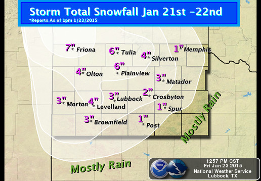
| Below are snowfall totals based on NWS Lubbock Cooperative Observer reports through the duration of the event. Amounts ranged from 4 to 7 inches from western to central portions of the southwestern and south-central Texas Panhandle through the northern to central South Plains. Areas farther south and east on the Caprock mainly fell in the 1 to 4 inch range while locations in the Rolling Plains and southeast Texas Panhandle received up to near 1 inch. Accumulations were held to trace amounts or less into the southeastern Rolling Plains where the majority of precipitation fell as rain. | ||||||
 |
||||||
| Snowfall totals from Wednesday January 21st through Thursday January 22nd based on NWS Lubbock Cooperative Observer reports. | ||||||
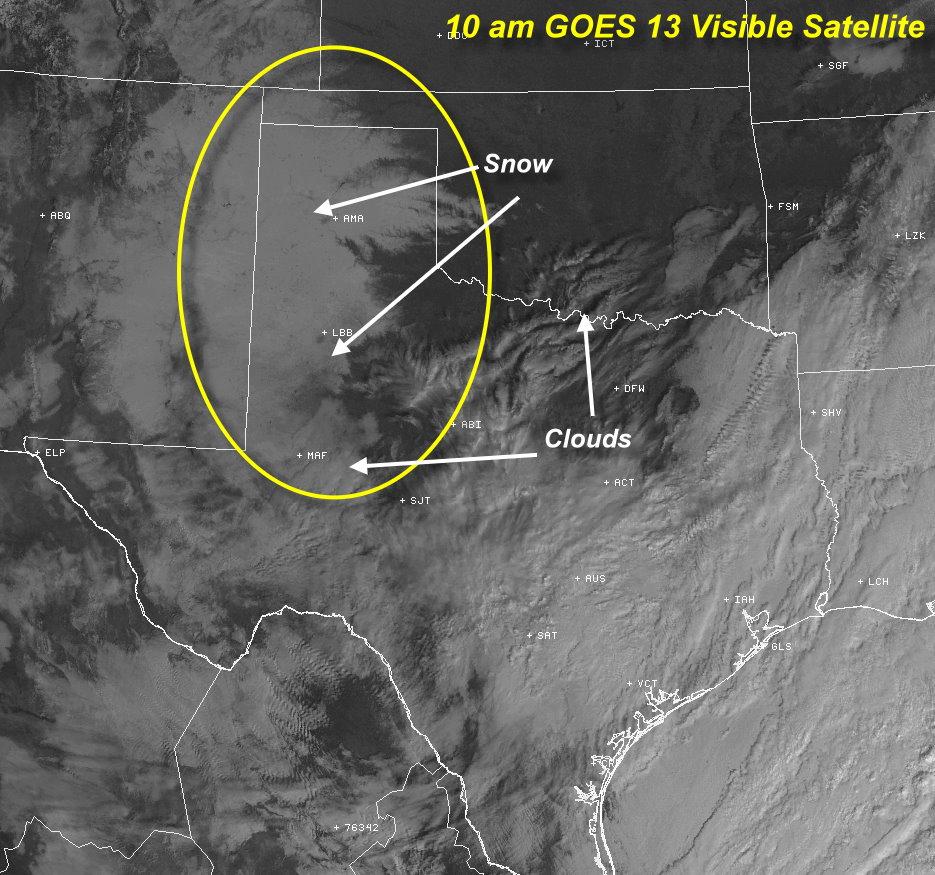
| The following visible satellite image depicts the extent of snow cover on the morning of Friday January 23rd. With skies clearing, snow is visible on the Caprock while clouds continue clearing out across the Permian Basin and Rolling Plains into the Red River Valley. | ||||||
 |
||||||
| Visible satellite imagery from the morning of Friday January 23, 2015. | ||||||
| The snow did reduce visibilities, and minor blowing and drifting was also reported as northeast winds of 15 to 25 mph blew the fresh snow around on Thursday. However, temperatures through Wednesday night and Thursday hovered very near the freezing mark, which did help mitigate travel troubles, except where the heaviest snows fell. Winds did drop off Thursday night, and with some clearing early Friday it allowed temperatures to plummet. Many locations on the Caprock saw temperatures fall into the single digits and teens early Friday. The West Texas Mesonet site near Friona made it down to a bone-chilling 4 degrees. | ||||||
 |
 |
|||||
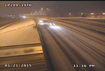
| What it looked like in Plainview during the height of the snow (left - 10 pm on January 21st), and the following morning (right - 10 am on January 22nd). The images are courtesy of KAMC. | ||||||
| The rain and snow did bring another round of much appreciated moisture to West Texas. Many locations recorded liquid water equivalents of one quarter to three quarters of an inch. Below are several more pictures of what it looked like around the Lubbock area late Wednesday and early Thursday. | ||||||
|
||||||
| Pictures of the snow from around Lubbock late on the 21st and early on the 22nd of January 2015. The pictures are courtesy of TXDOT and KAMC. | ||||||


