National Weather Service United States Department of Commerce

Severe Thunderstorms Tonight in the Mid-Atlantic; Tropical Storm Bertha in the Gulf

Scattered thunderstorms with severe gusts, hail and a tornado risk are possible near a cold front from the Ohio Valley to the Mid-Atlantic tonight. Tropical Storm Bertha is expected to bring tropical storm conditions to portions of the Gulf Coast from the panhandle of Florida into Louisiana through Wednesday. Read More >

Christmas Day 2016 brings some rain, followed by wind and blowing dust

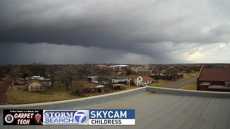
Thunderstorm approaching Childress Sunday morning.
A thunderstorm approaching Childress on Sunday morning.


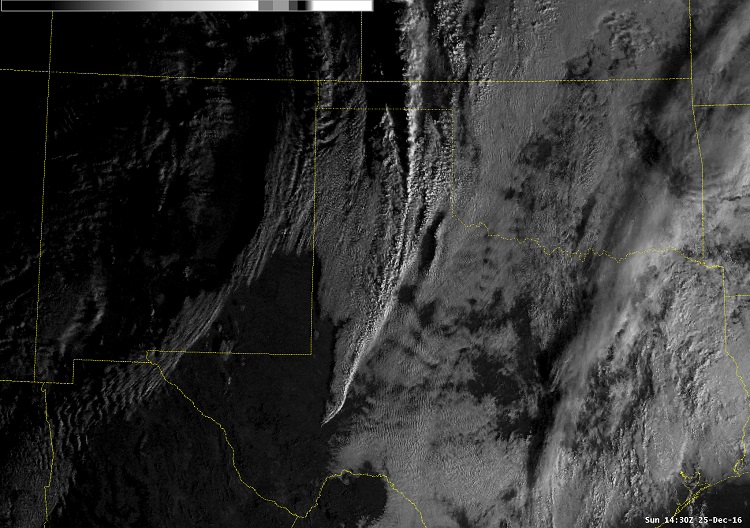
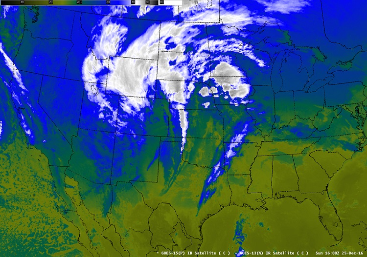
On December 25, 2016, a potent upper-level storm system moved from New Mexico northeast into the central plains, brushing West Texas. The storm produced blizzard conditions from Idaho through the Dakotas, and thunderstorms from the Texas Panhandle through Oklahoma, Kansas and even into Nebraska.

Satellite image on Sunday, December 25, 2016.
Satellite image at 1 pm CST, December 25,2016.

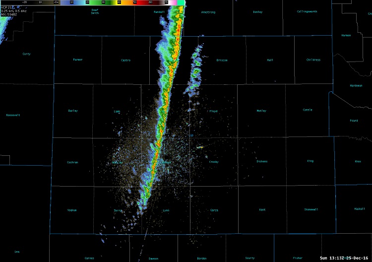
On the southern end of the storm system, a thin line of rain showers and a few weak thunderstorms developed and marched east across the Texas South Plains. Rainfall in our area was very light, ranging from just a trace up to about a tenth of an inch. Below is a radar image of the line as it moved through the Lubbock area.
 
Radar image around 11 am on December 25, 2016
Radar image from the Lubbock WSR-88D around 7 am on 25 December, 2016.


The satellite image below shows how the thin line of showers and thunderstorms extended from Kansas south through much of West Texas Sunday morning.

Satellite image on Sundey, December 25, 2016
Visible satellite image at 8:30 am CST on 25 December, 2016

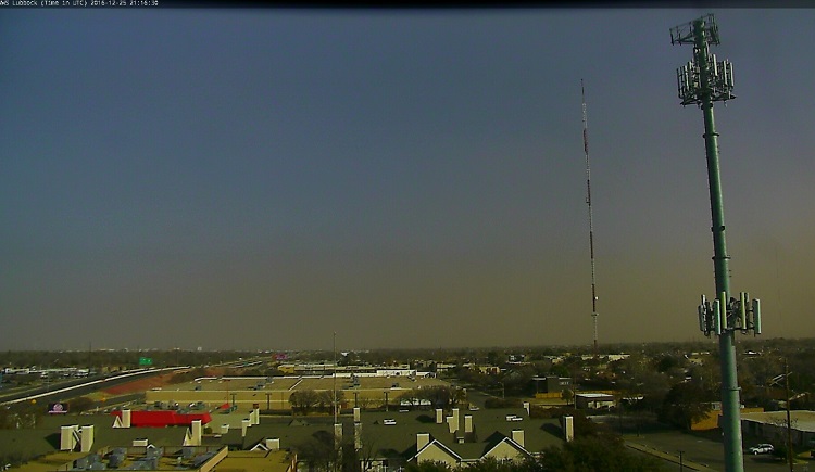
After the line of showers moved east of the area, strong west-southwest winds spread out of New Mexico. The winds were generally in the range of 30 to 40 mph with gusts to around 50 mph through the afternoon. Even higher wind gusts to around 60 mph were reported farther north in the Oklahoma Panhandle. Unfortunately, the winds were strong enough to pick up some blowing dust and the sky across the South Plains became tinted with orange and brown - a far cry from a white Christmas!
 
Picture of brown skies across the Lubbock area on the afternoon of Sunday, December 25th, 2016
A webcam image looking east from Lubbock and the brown-tinged sky Sunday afternoon.

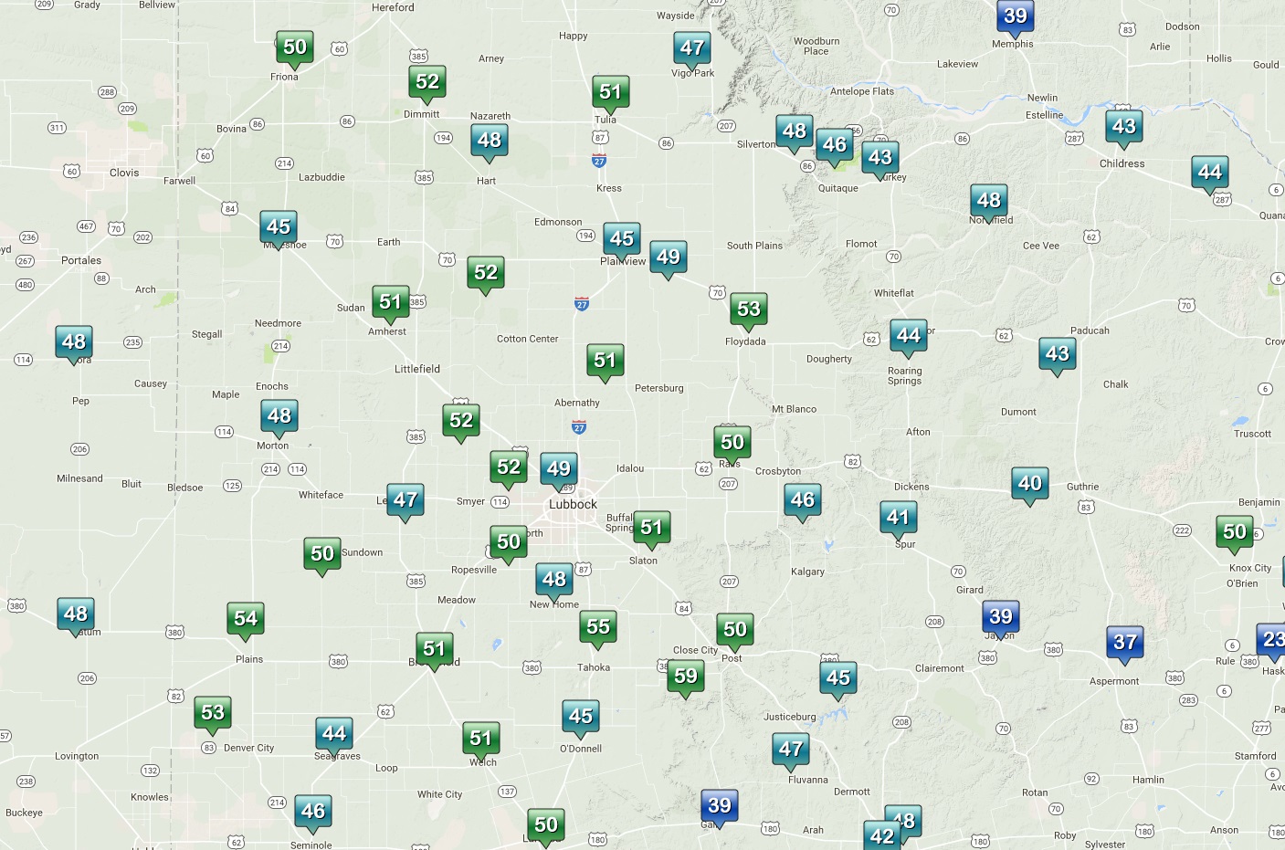
The image below shows the peak wind gusts reported across the South Plains area on Christmas:
 
Highest wind gusts across the South Plains area on December 25, 2016
Peak wind gusts across the region for Sunday, December 25 from the West Texas Mesonet (Click on the image for a larger view)