
Dangerous heat will expand from the Gulf Coast into the Southern Plains and Desert Southwest through week's end. Additional extreme heat impacting the Pacific Northwest will shift to the northern Plains by the weekend. Tropical Storm Bertha is expected to continue to impact portions of the northern Gulf Coast from the western Florida Panhandle to southeastern Louisiana through tonight. Read More >
| The New Year Starts on the Active Side 1 January 2017 |
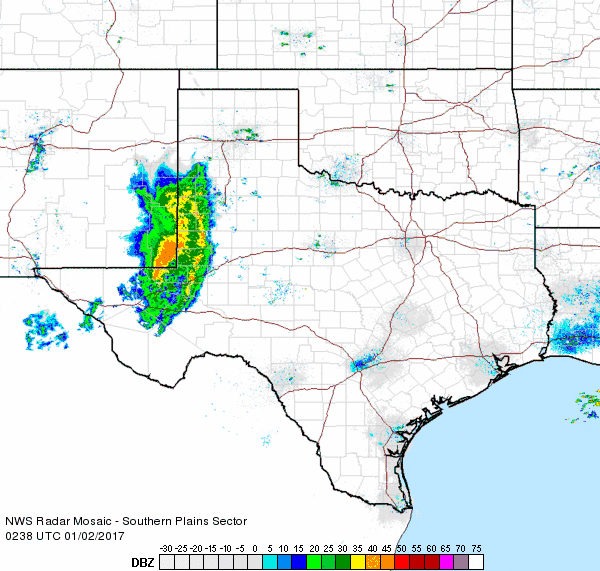 |
| Regional radar animation valid from 8:38 pm to 9:48 pm on 1 January 2017. |
|
A quick moving but potent storm system combined with sufficient moisture and instability to bring a round of showers and thunderstorms to the South Plains region during the evening and overnight hours of the first day of 2017. The complex of thunderstorms moved out of southeastern New Mexico during the evening hours, then raced across the South Plains and Rolling Plains through the overnight hours. The strongest storms were accompanied by occasional lightning, brief heavy rain and strong wind gusts. The strongest winds impacted the southwestern South Plains. The Denver City West Texas Mesonet site measured a wind gust to 64 mph at 7:55 pm. The winds weren't quite as strong as they swept eastward, though they did still down power lines in portions of Brownfield. |
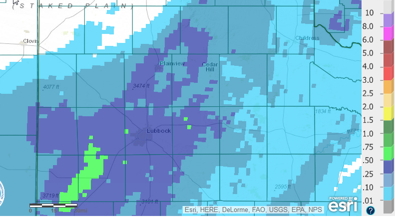 |
| Radar-estimated and bias-corrected 24 hour rainfall total ending at 6 am on 2 January 2017. |
| The heaviest rainfall affected the central and southern South Plains where a third to half inch of rain was common. Rain totals were lighter with eastern/northern extent, though most of the region did record at least a little rain. Officially, the Lubbock Airport recorded 0.38 inches, which is over half the 0.65 of an inch that January averages. Hopefully this is promising sign of a wet year to come. |
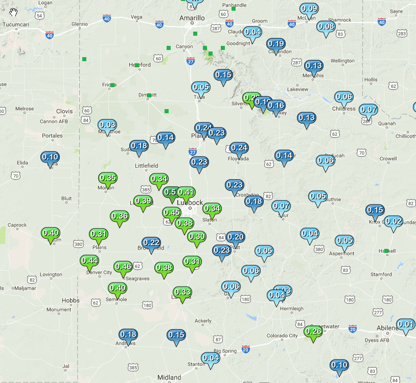 |
| Rain totals measured by the West Texas Mesonet from 1-2 January 2017. |

