| Severe thunderstorms bring wind, hail and torrential rain 30 June - 2 July 2017 |
||
 |
||
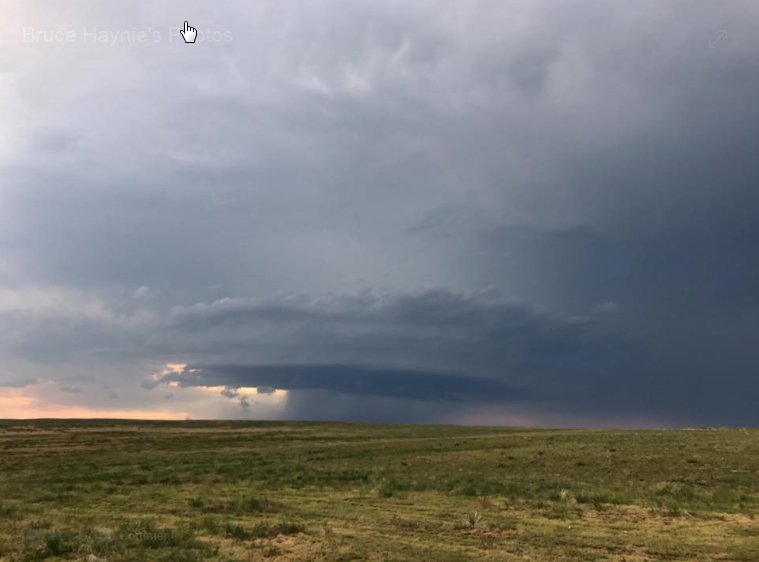
| Storm west of Channing, TX, captured Friday (30 June 2017) evening. The picture is courtesy of Bruce Haynie. | ||
| The final day of June brought active weather to northwestern Texas. This occurred as a weak cold front sagged into the region during the day Friday, before stalling. South of the front and ahead of a diffuse dryline temperatures climbed back into the triple digits over the Rolling Plains. This heat proved enough to pop a broken line of storms across the southeast Texas Panhandle into the Rolling Plains late Friday afternoon into the evening hours, while additional thunderstorms developed over the higher terrain of New Mexico. | ||
 |
||
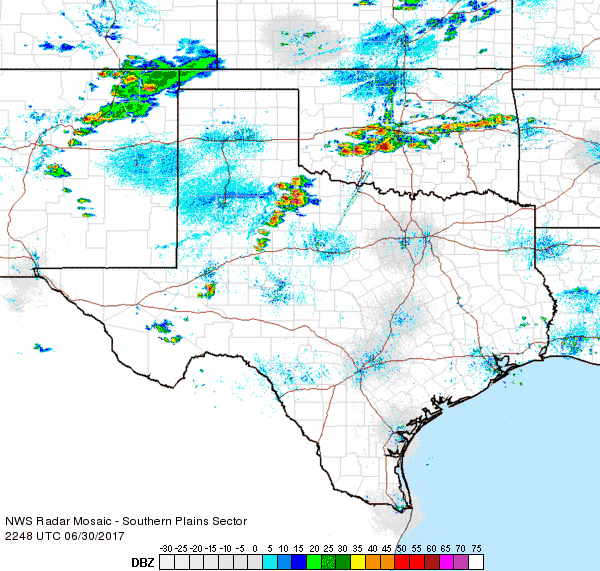
| Regional radar animation valid from 5:48 to 6:58 pm on 30 June 2017. | ||
| The triple digit heat contributed to strong instability that fueled several slow-moving severe storms that tracked over the same general area. In addition to producing large hail and damaging winds, torrential rains fell where the storms repeatedly tracked. One t-storm that moved through Childress dropped hail as large as 3 inch in diameter, or around baseball size. | ||
 |
||
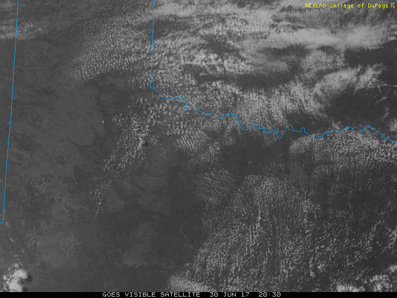
| Visible satellite animation valid from 3:30 pm to 6:45 pm on 30 June 2017. The GOES-16 data posted on this page are preliminary, non-operational data and are undergoing testing. Users bear all responsibility for inspecting the data prior to use and for the manner in which the data are utilized. | ||
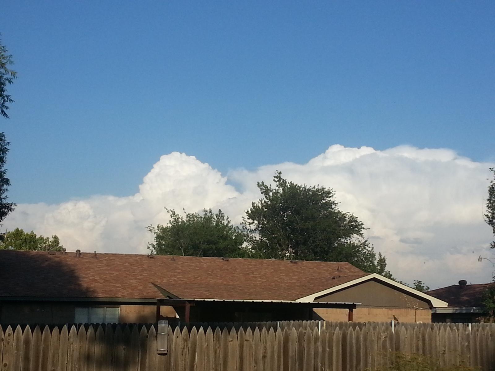
| The towering clouds were picturesque from a distance, though unfortunately they were also destructive in spots. | ||
 |
||
| Building storm clouds east of Lubbock Friday evening. | ||
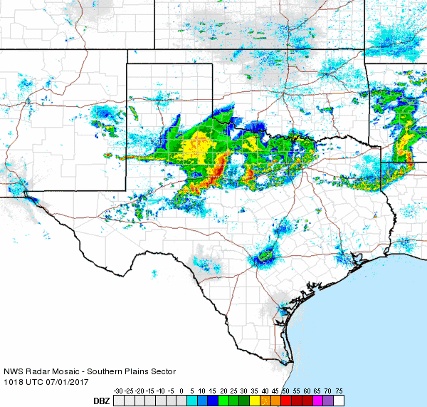
| The below radar animation shows how the thunderstorm activity was focused across the Rolling Plains through the late afternoon and early evening hours June 30th. Just as storms would slowly move off to the east and northeast new thunderstorms would quickly redevelop over the same location. This training led to locally very heavy rainfall, including a quick 5+ inches in Aspermont and Spur. | ||
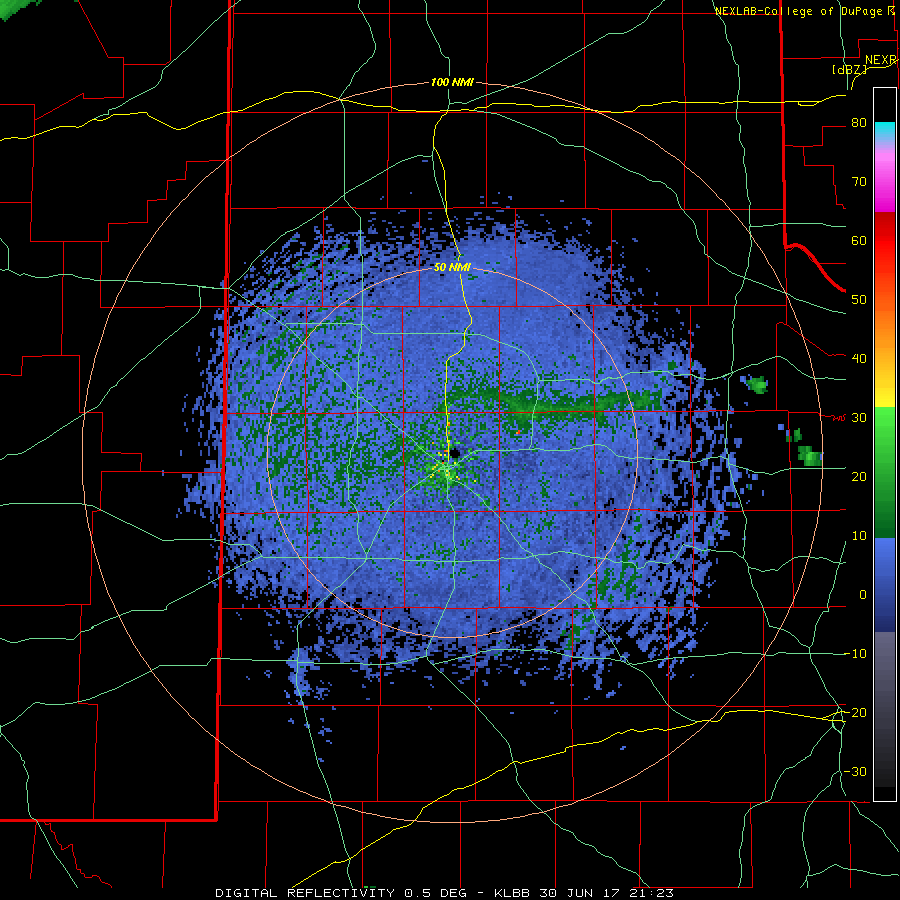 |
||
| Lubbock WSR-88D animation valid from 4:23 pm to 7:06 pm on 30 June 2017. | ||
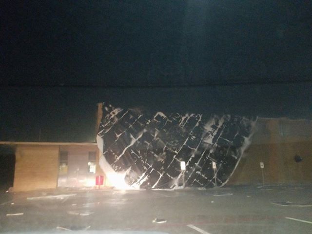
| One thunderstorm that dropped hail in excess of golf ball size in Aspermont also had strong downburst winds that damaged the roof of the school gym, as well as numerous trees around town. | ||
 |
 |
|
| (left) Roof damage done to the Aspermont Gym on Friday evening, 30 June 2017. The picture is courtesy of KTXS and Patricia Ramirez. (right) Large hail that fell in Aspermont Friday evening. The image is courtesy of KTXS and Rope Bradley. | ||
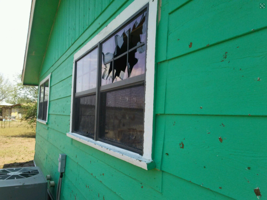
| Another severe storms around and shortly after midnight moved down Highway 84 from near Littlefield to Anton. This storm brought wind driven hail which damaged homes and vehicles. We received one report of baseball to softball size hail and wind gusts estimated to 70 mph about 8 miles southeast of Littlefield. | ||
 |
||
| Wind driven hail damaged homes and knocked out windows in Anton. This picture is courtesy of Weather Bar. | ||
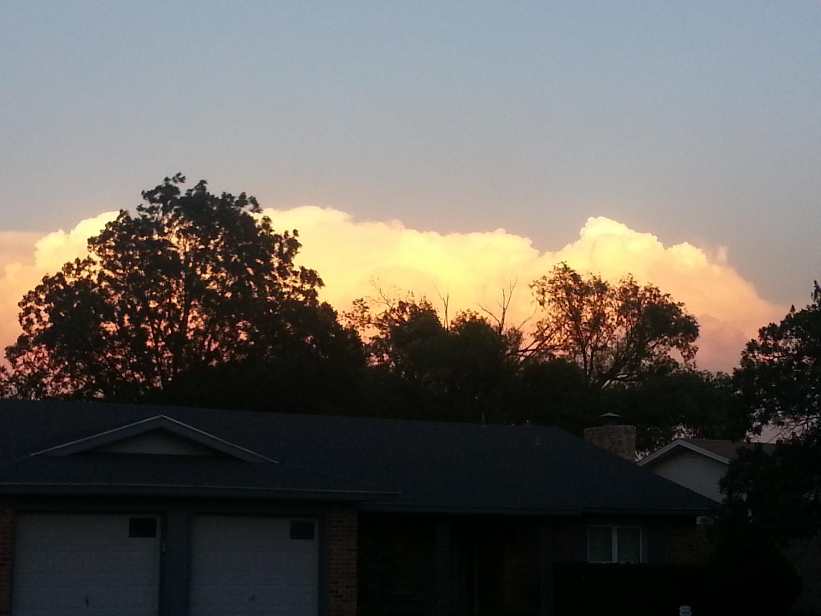
| Shortly after sunset, additional thunderstorms developed along outflows and another frontal surge further west over parts of the South Plains and southern Texas Panhandle. This activity also become strong to severe as it generally tracked eastward. | ||
 |
||
| Storm clouds east of Lubbock around sunset Friday evening. | ||
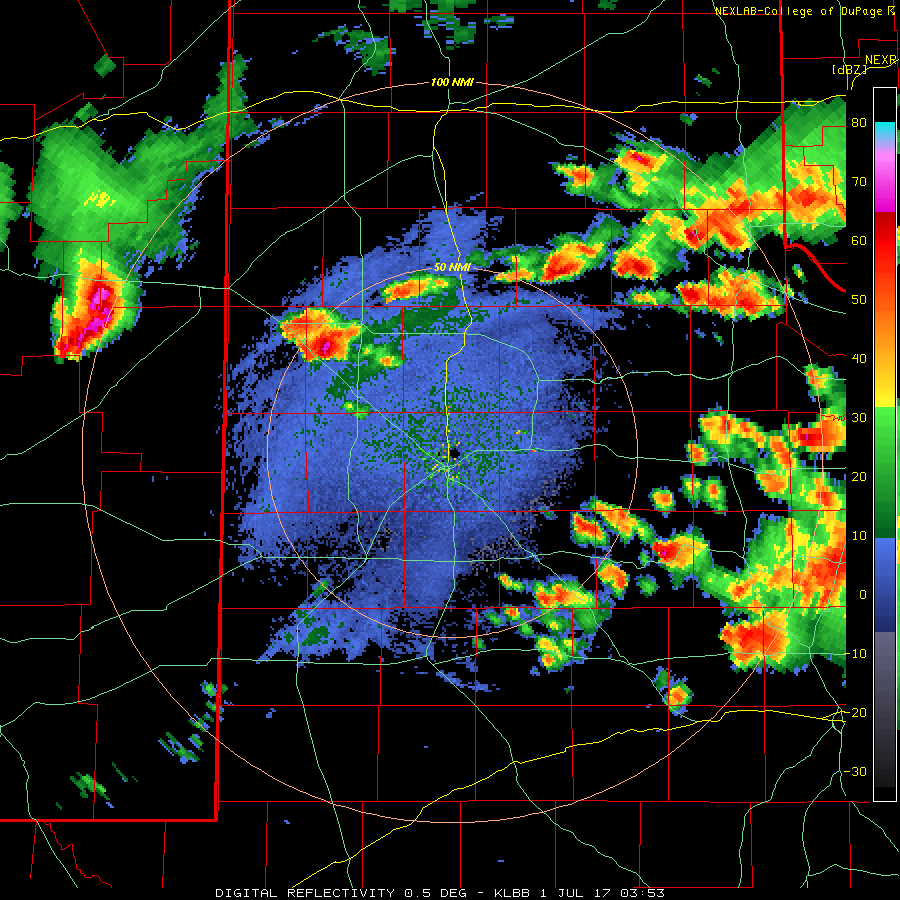
| Thunderstorms then took aim at the central South Plains late Friday night into early Saturday morning as new development occurred near and east of Lubbock and additional activity moved out of eastern New Mexico. There was enough energy in the atmosphere that some of these storms also produced large hail and damaging winds in addition to very heavy rain and frequent cloud to ground lightning. One storm dropped golf ball size hail in Anton shortly after midnight, with a storm following closely behind producing a wind gust to 80 mph at the West Texas Mesonet located 4 miles south of Levelland. | ||
 |
||
| Lubbock WSR-88D animation valid from 10:53 pm 30 June to 12:32 am on 1 July 2017. An additional regional radar animation valid from 5:18 am to 6:28 am on 1 July can be FOUND HERE. | ||
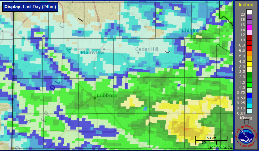
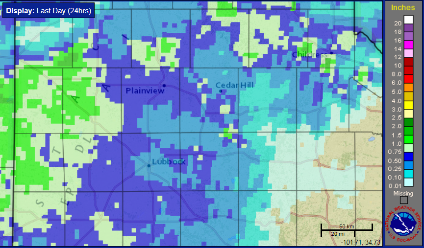
| Although the storms did produce large hail and damaging winds, they also brought rain to a large chunk of the area. Many spots in the central and southern Rolling Plains, where they have missed out on much of the rain this spring, recorded 1 to 3+ inches, with some locations in excess of 5 inches. Further west, 1 to 2+ inches of rain fell over parts of the central and southern South Plains. Officially the Lubbock Airport recorded an even inch of rain, while at the Science Spectrum, on the south side of town, saw 2.31 inches. | ||
 |
||
| Radar-estimated and bias-correct 24-hour rain totals ending at 9 am on 1 July 2017. A regional view of the same data can be VIEWED HERE. | ||
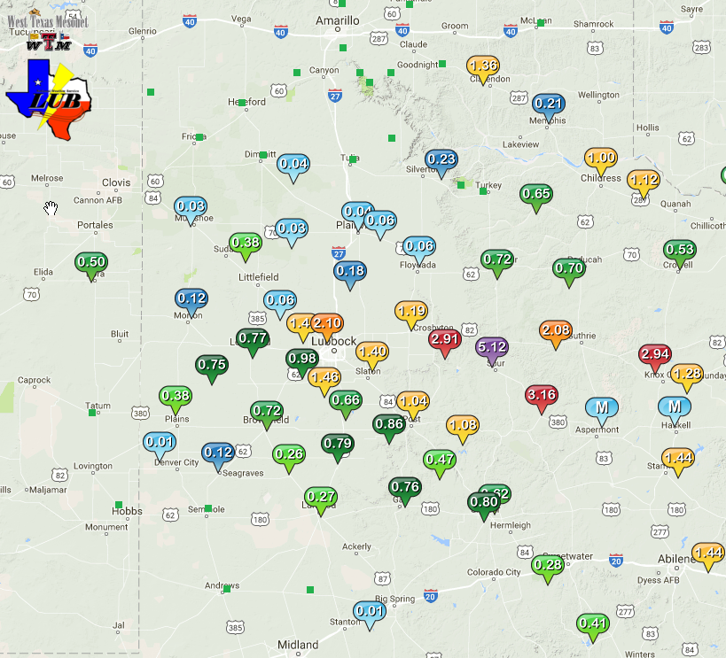
| The below plot shows measured rain totals from around the region. | ||
 |
||
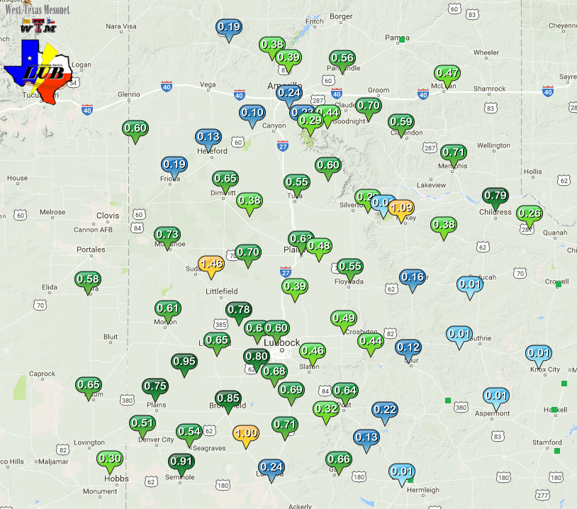
| West Texas Mesonet 24-hour rain totals ending at 9:30 am on 1 July 2017. | ||
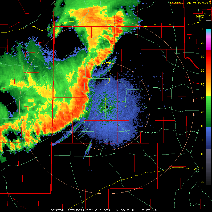
| After a quiet and relatively cool (by July standards) day to start the new month, another complex of thunderstorms moved out of eastern New Mexico and across much of the South Plains and Texas Panhandle late Saturday night into early Sunday morning (1-2 July). The round of activity brought widespread rainfall along with localized severe wind gusts. | ||
 |
||
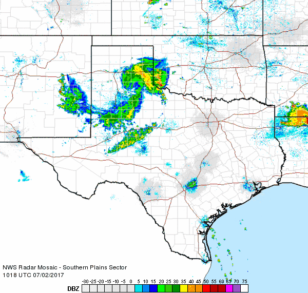
| Lubbock WSR-88D animation valid from 12:40 am to 1:21 am on 2 July 2017. An additional regional radar animation valid from 5:18 am to 6:28 am on 2 July can be FOUND HERE. | ||
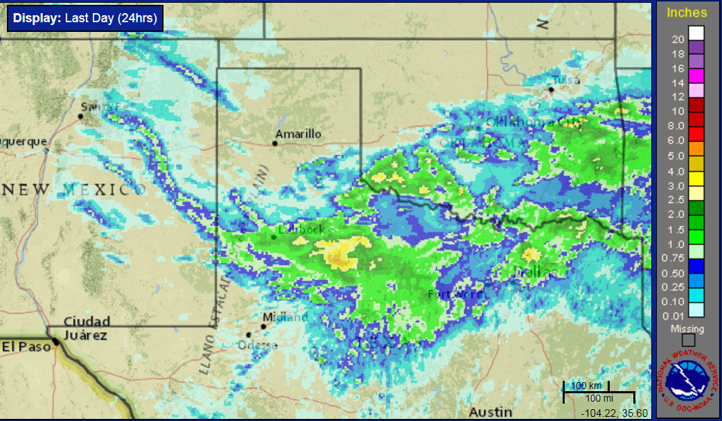
| Additional rainfall totals of a half inch to an inch half of rain were common over the South Plains and southern Texas Panhandle late Saturday night into early Sunday. Officially the Lubbock Airport recorded 0.71 inches, boosting the yearly total to 8.83 inches, which is only 1/2 inch shy of average to this point in the year. | ||
 |
||
| Radar-estimated and bias-correct 24-hour rain totals ending at 8 am on 2 July 2017. A summary of the West Texas Mesonet 24-hour rain totals for this same period can be VIEWED HERE. | ||
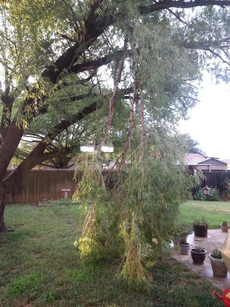
| The rain came with strong winds too, mostly peaking from 45 to 55 mph, though a few spots did gust to 55 to 65 mph. The strongest wind gust of 65 mph was recorded at the West Texas Mesonet station 5 miles east-northeast of Abernathy. The strong winds did cause generally minor tree damage in spots. | ||
 |
||
| The strong winds did cause minor damage to trees, including this branch downed in south Lubbock. | ||
| The preliminary storm reports of the evening and overnight thunderstorm events can be found below. | ||
PRELIMINARY LOCAL STORM REPORT...SUMMARY
NATIONAL WEATHER SERVICE LUBBOCK TX
540 AM CDT SAT JUL 01 2017

..TIME...   ...EVENT...      ...CITY LOCATION...     ...LAT.LON...
..DATE...   ....MAG....      ..COUNTY LOCATION..ST.. ...SOURCE....
            ..REMARKS..

0723 PM     HAIL             CHILDRESS               34.42N 100.25W
06/30/2017  E1.50 INCH       CHILDRESS          TX   LAW ENFORCEMENT

0727 PM     HAIL             JAYTON                  33.25N 100.57W
06/30/2017  E1.00 INCH       KENT               TX   LAW ENFORCEMENT

            FROM THE KENT COUNTY S.O.

0735 PM     HAIL             CHILDRESS               34.42N 100.25W
06/30/2017  E2.50 INCH       CHILDRESS          TX   TRAINED SPOTTER

            REPORTED IN SOUTHEAST CHILDRESS. PHOTO HAD SEVERAL HAIL
            STONES ALONG WITH A BASEBALL FOR COMPARISON.

0737 PM     HAIL             CHILDRESS               34.42N 100.25W
06/30/2017  M3.00 INCH       CHILDRESS          TX   PUBLIC

            SEVERAL PHOTOS IN SOCIAL MEDIA OF LARGE HAIL THAT HIT
            THE SOUTH AND SOUTHEAST PARTS OF CHILRESS THIS EVENING.

0805 PM     TSTM WND DMG     ASPERMONT               33.14N 100.22W
06/30/2017                   STONEWALL          TX   LAW ENFORCEMENT

            REPORT OF ROOF DAMAGE ON THE HIGH SCHOOL GYM

0824 PM     TSTM WND GST     ASPERMONT               33.14N 100.22W
06/30/2017  E65 MPH          STONEWALL          TX   LAW ENFORCEMENT

            STONEWALL S.O. REPORTED ESTIMATED 60 TO 65 MPH WINDS
            CAUSING UNKOWN TREE DAMAGE AT THE CURRENT TIME. ALSO
            VERY INTENSE RAIN AND PEA SIZE HAIL.

1147 PM     HAIL             LITTLEFIELD             33.92N 102.33W
06/30/2017  E1.75 INCH       LAMB               TX   POLICE DEPT

1159 PM     HAIL             LITTLEFIELD             33.92N 102.33W
06/30/2017  E1.00 INCH       LAMB               TX   LAW ENFORCEMENT

            LAMB COUNTY S.O. REPORTED HAIL THE SIZE OF LARGE
            MARBLES. ESTIMATE NEAR 1 INCH DIAMATER.

1210 AM     HAIL             ANTON                   33.81N 102.16W
07/01/2017  E1.75 INCH       HOCKLEY            TX   BROADCAST MEDIA

            RELAY OF PUBLIC REPORT VIA KCBD

1215 AM     HAIL             8 SE LITTLEFIELD        33.84N 102.24W
07/01/2017  E2.75 INCH       LAMB               TX   TRAINED SPOTTER

            WEATHER OBSERVER ENCOUNTERED BASEBALL TO SOFTBALL SIZE
            HAIL AND WIND GUSTS ESTIMATED TO AT LEAST 70 MPH WHEN
            TRAVELING 8 MILES SOUTHEAST OF LITTLEFIELD. TORRENTIAL
            RAIN ALSO FLOODED ROADS IN LITTLEFIELD. THE WIND AND
            HAIL KNOCKED OUT WINDSHIELDS. THE WIND ALSO CAUSED ZERO
            VISIBILITY IN BLOWING DUST.

1215 AM     TSTM WND GST     8 SE LITTLEFIELD        33.84N 102.24W
07/01/2017  E70 MPH          LAMB               TX   TRAINED SPOTTER

            WEATHER OBSERVER ENCOUNTERED BASEBALL TO SOFTBALL SIZE
            HAIL AND WIND GUSTS ESTIMATED TO AT LEAST 70 MPH WHEN
            TRAVELING 8 MILES SOUTHEAST OF LITTLEFIELD. TORRENTIAL
            RAIN ALSO FLOODED ROADS IN LITTLEFIELD. THE WIND AND
            HAIL KNOCKED OUT WINDSHIELDS. THE WIND ALSO CAUSED ZERO
            VISIBILITY IN BLOWING DUST.

1235 AM     HAIL             PLAINS                  33.19N 102.83W
07/01/2017  E1.00 INCH       YOAKUM             TX   LAW ENFORCEMENT

0150 AM     TSTM WND GST     4 S LEVELLAND           33.53N 102.36W
07/01/2017  M80 MPH          HOCKLEY            TX   MESONET

            WEST TEXAS MESONET REPORT

0230 AM     TSTM WND GST     SSW NEW HOME            33.33N 101.91W
07/01/2017  M65 MPH          LYNN               TX   MESONET

            WEST

0244 AM     FLOOD            ANTON                   33.81N 102.16W
07/01/2017                   HOCKLEY            TX   LAW ENFORCEMENT

            SHERIFFS OFFICE REPORT ANTON IS CUT OFF DUE TO FLOOD
            WATERS. HOME INUNDATION HAS ALSO OCCURRED.

1250 AM     TSTM WND GST     6 SSW ANTON             33.73N 102.19W
07/02/2017  M59 MPH          HOCKLEY            TX   MESONET

            WEST TEXAS MESONET REPORT

0135 AM     TSTM WND GST     5 ENE ABERNATHY         33.88N 101.76W
07/02/2017  M65 MPH          HALE               TX   MESONET

            DOPPLER RADAR INDICATED HEAVY RAIN DUE TO
            THUNDERSTORMS. THIS WILL CAUSE MINOR FLOODING IN THE
            ADVISORY AREA.

