
Dangerous heat will expand from the Gulf Coast into the Southern Plains and Desert Southwest through week's end. Additional extreme heat impacting the Pacific Northwest will shift to the northern Plains by the weekend. Tropical Storm Bertha is expected to continue to impact portions of the northern Gulf Coast from the western Florida Panhandle to southeastern Louisiana through tonight. Read More >
| Severe Thunderstorms and Heavy Rain Visit West Texas 5 October 2018 |
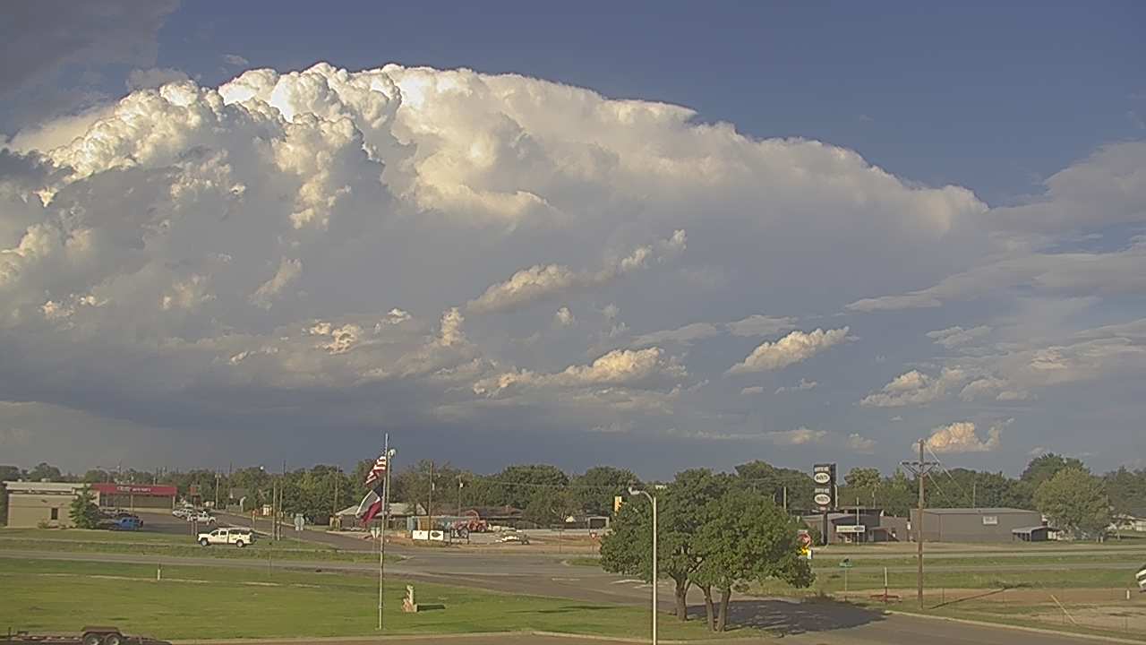 |
| Severe thunderstorm moving by to the north of Littlefield at 5:22 pm on Friday, 5 October 2018. The image is courtesy of KAMC. |
| A relatively warm, moist and unstable atmosphere, at least by Fall standards, provided a good environment for strong and severe thunderstorms Friday afternoon and evening (5 October). Isolated storms initially developed across the western South Plains then increased in coverage as they moved eastward through the evening. The initial thunderstorms became strong to severe, with one of the more intense storms tracking from near Springlake to south of Hart, then past Kress and Claytonville. This storm generated large hail, from quarter to golf ball size at times. In addition, it dumped very heavy rain and small corridor. |
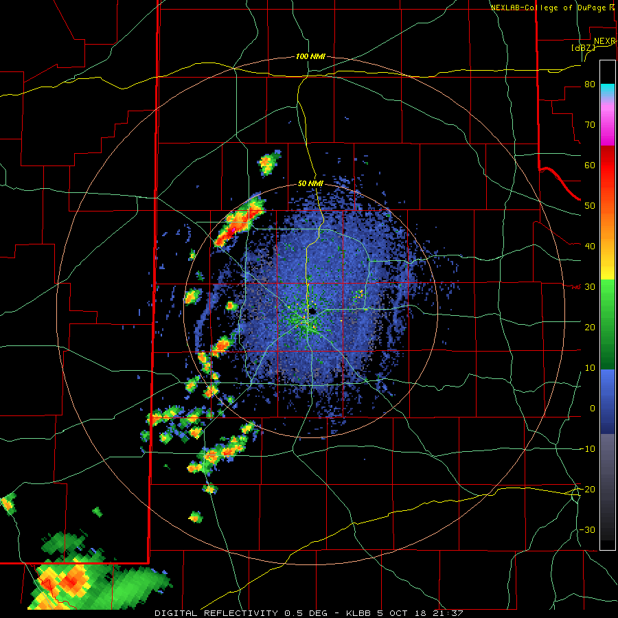 |
| Lubbock radar animation valid from 4:37 pm to 6:20 pm on Friday, 5 October 2018. |
| Additional thunderstorms then blossomed over the western and southwestern South Plains, becoming severe as they tracked northeastward through the central South Plains. Early on these storms likely produced pockets of large hail, but they quickly transitioned to gusty outflow winds and torrential rainfall, along with frequent lightning. |
 |
|
Large hail that fell in Claytonville Friday evening. The picture is courtesy of Matt Ernst and Barry Street. |
| The heaviest rain targeted Terry County and southeast Hockley County, where 2 to 3+ inches of rain fell in about an hour. The storm even produced a wall cloud as it approached Lubbock. The overall storm intensity weakened though, with only a few reports of small hail as it moved through the city. It did also drop a quick half inch to inch of rain which resulted in street flooding. |
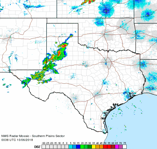 |
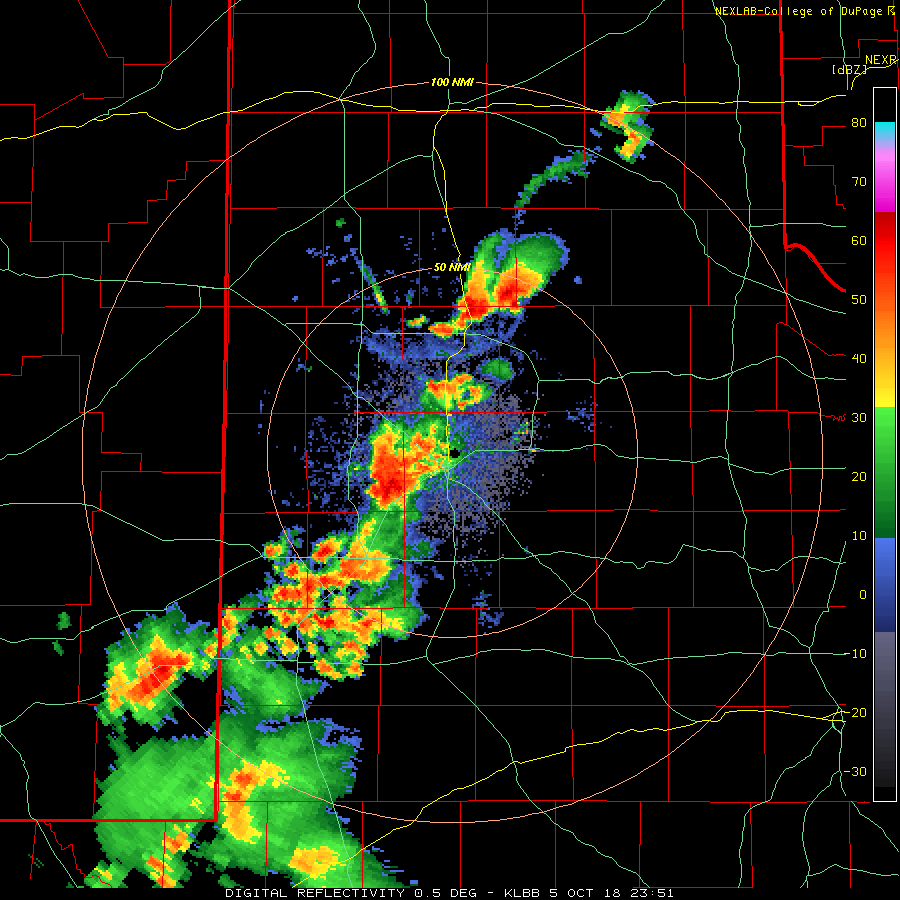
| Regional radar animation valid from 7:38 pm to 8:48 pm on Friday, 5 October 2018. For a closer view of the Lubbock radar, valid from 6:51 pm to 7:41 pm, CLICK HERE. |
| The showers and thunderstorms continued to produce heavy rain as they moved out into the Rolling Plains. One portion of the line of storms briefly became severe as it bowed out, with a 61 mph wind gust recorded at the White River Lake West Texas Mesonet site. |
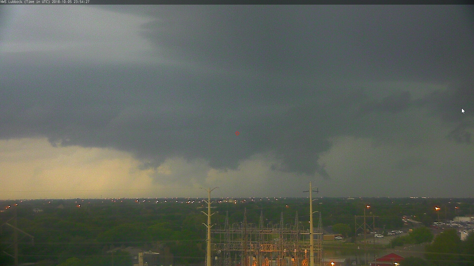 |
| View of a wall cloud just west of Lubbock captured at 6:54 pm on Friday, 5 October 2018. |
| Rain totals from this event were generous in many spots, ranging from a half inch to over two inches. Officially, the Lubbock Airport recorded 0.76 inches, raising the yearly total to 9.87 inches (still over 6 inches below average). |
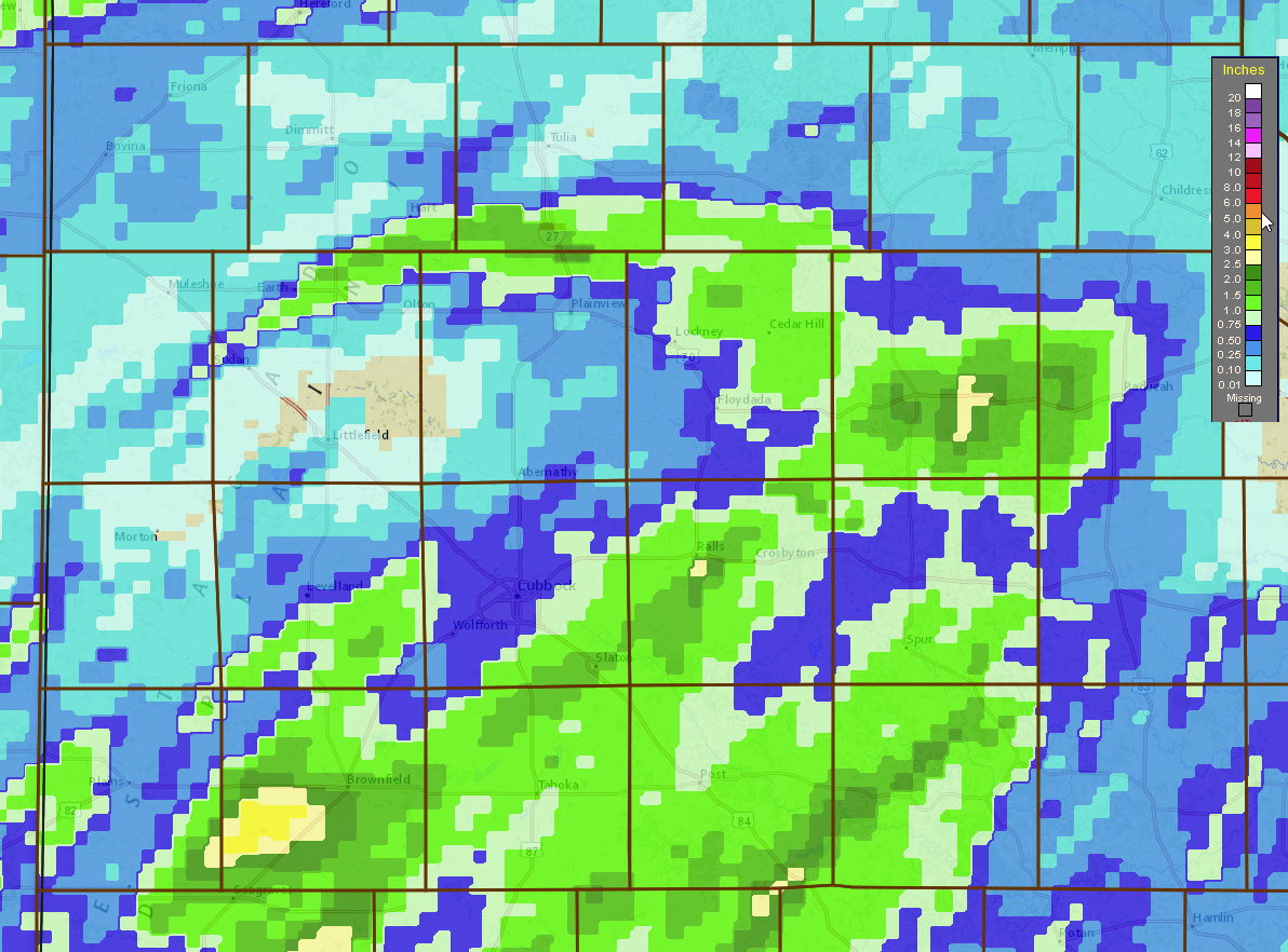 |
| Two-day radar-estimated and bias-corrected rain totals ending at 8 pm on Saturday, 6 October 2018. |
| To view the Preliminary Storm Reports (LSR) for October 5th, CLICK HERE. |

