
Numerous severe thunderstorms are expected across a broad region from the Ohio Valley to the Mid-Atlantic and Northeast States today into tonight. Swaths of damaging wind gusts are expected and some tornadoes are possible. Bertha is expected to bring tropical storm conditions to portions of the Gulf Coast from the Florida Panhandle westward to southeastern Louisiana later today and Wednesday. Read More >
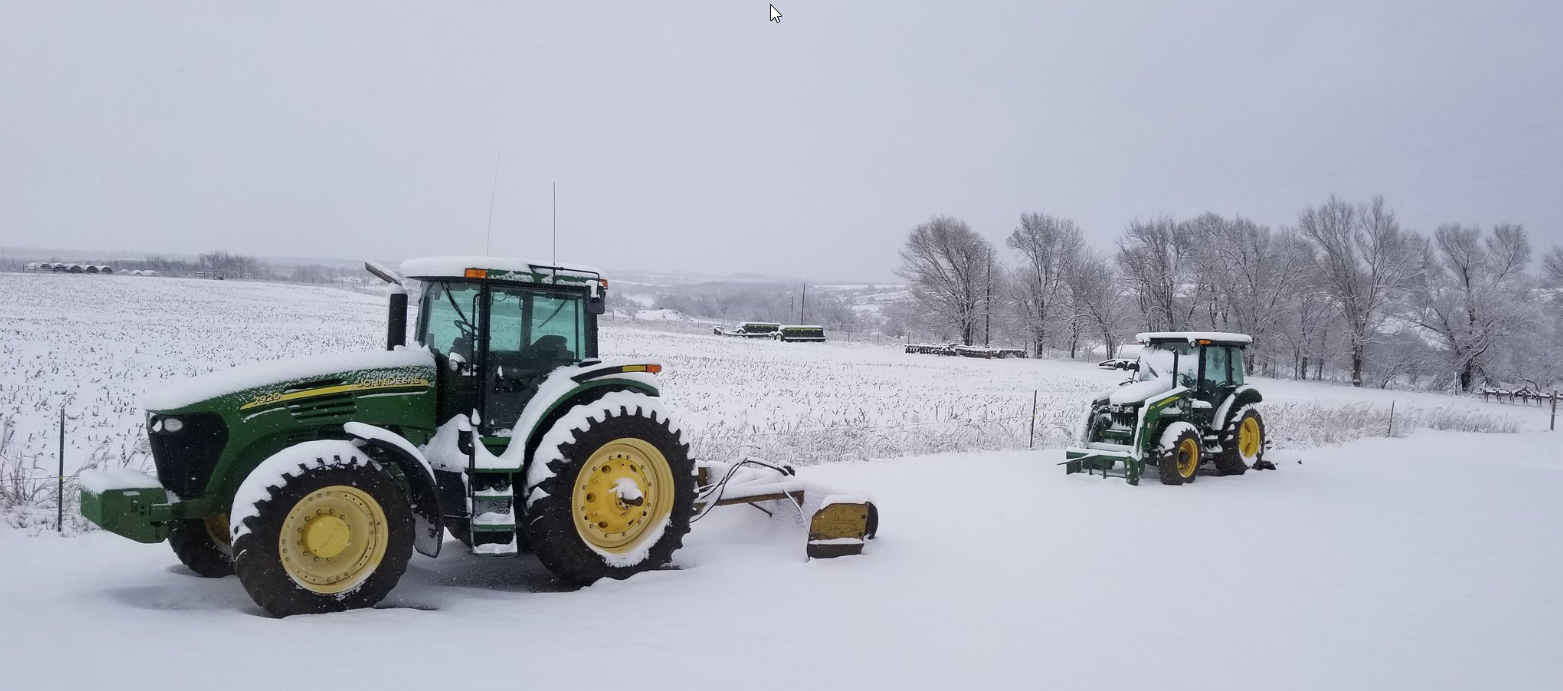
| Snow falls on the southeast Texas Panhandle 3 January 2019 |
|
 |
|
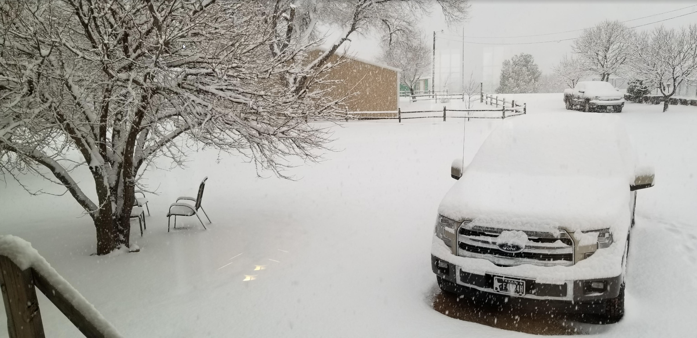
| The scene just south of Estelline around 9:30 am on 3 January 2019. The picture is courtesy of Farrah Holcomb. | |
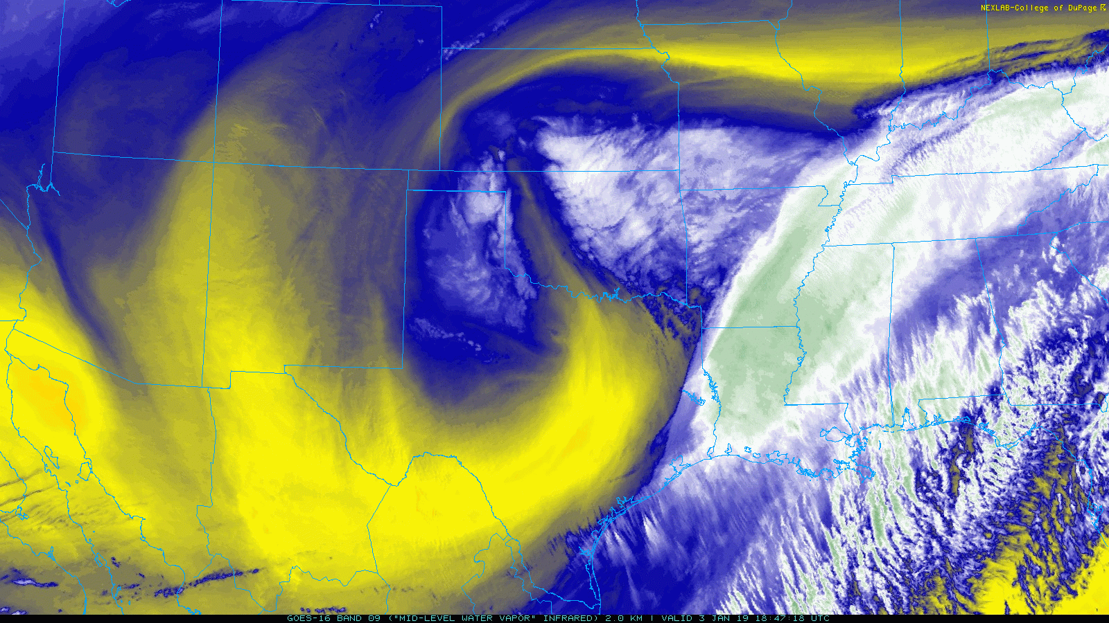
| After a cold start to 2019, a strengthening upper level storm system emerging from the Desert Southwest into the southern High Plains on January 3rd. This system proved strong enough to squeeze out a little wintry precipitation across northwest Texas late Wednesday into Thursday, 2-3 January 2019. | |
 |
|
| Water vapor imagery valid from 12:47 pm to 1:42 pm on 3 January 2019. | |
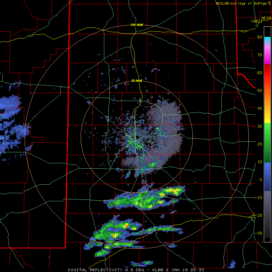
| The main limiting factor from more widespread precipitation across West Texas was the meager amounts of deep moisture. Even so, there was sufficient moisture and instability to produce showers of freezing rain and sleet across the Rolling Plains Wednesday evening (2 January). A few rumbles of thunder also mixed in. The wintry mix did create slick spots, though conditions were worse further east into Oklahoma and western North Texas where greater amounts of freezing rain fell. | |
 |
|
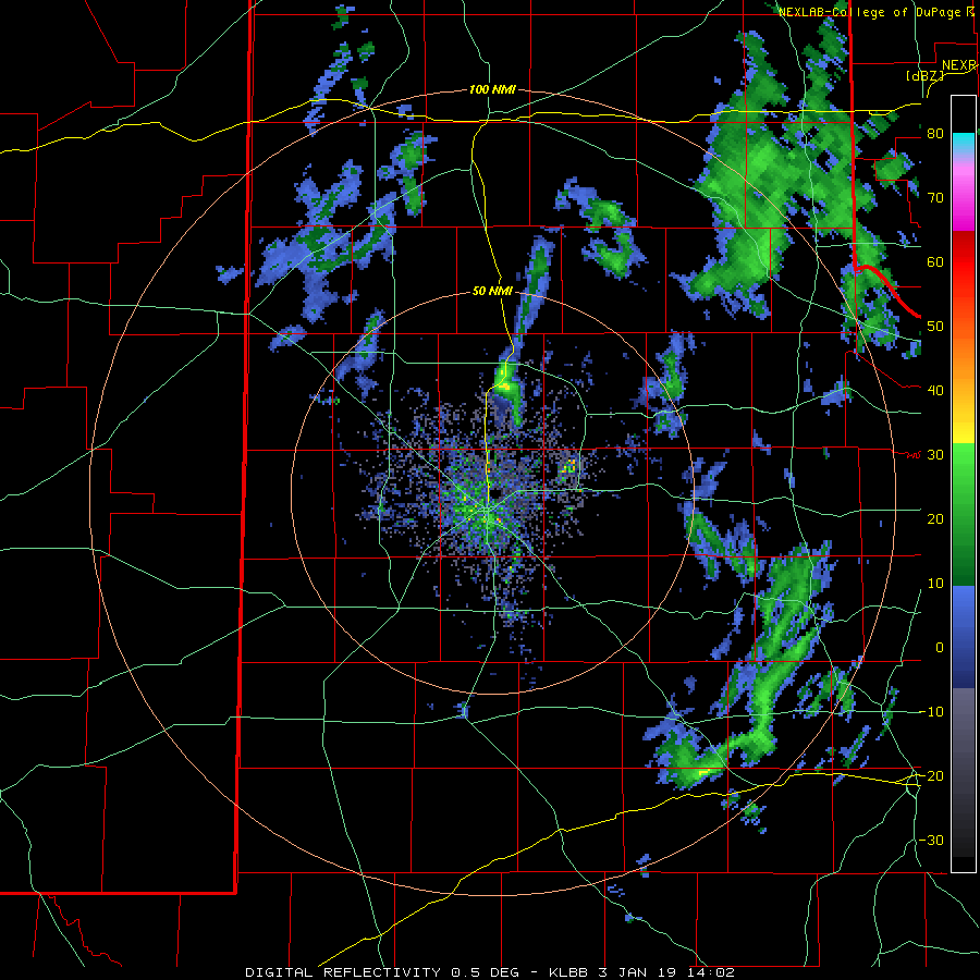
| Lubbock radar animation valid from 4:30 pm to 7:27 pm on 2 January 2019. | |
| After a lull in activity late Wednesday night, more precipitation developed early Thursday morning. Any wintry mix quickly change to snow, with light to moderate snow falling over the eastern Texas Panhandle into the Rolling Plains. | |
 |
|
| Snow blanketing the homestead just south of Estelline on 3 January 2019. The picture is courtesy of Farrah Holcomb. | |
| The heaviest areas of snow wrapped westward and eventually southward around the north and west side of the departing upper level low. The snow was heaviest over portions of the eastern Texas Panhandle into western Oklahoma. | |
 |
|
| Lubbock radar animation valid from 8:02 am to 1:35 pm on 3 January 2019. A regional radar animation valid from 11:58 am to 1:08 pm can be VIEWED HERE. | |
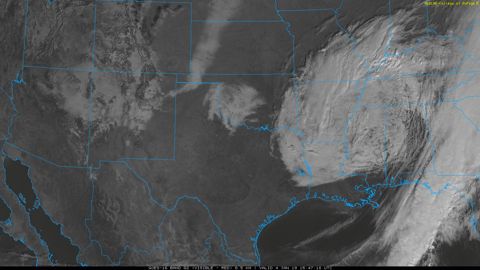
| The below satellite imagery shows the extent of the early January snow, stretching from the eastern Texas Panhandle into western and central Oklahoma. Snow totals of 2 to 4 inches were common, with localized pockets of 5 to 6 inches. Note that the swath of snow from the northwest Texas Panhandle through western Kansas and Nebraska was from a previous system that lifted through the region shortly after Christmas. | |
 |
|
| Visible satellite imagery captured around 10 am on 4 January 2019. | |
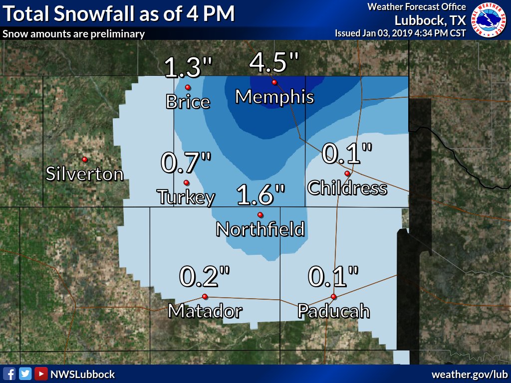
| The below map shows the approximate distribution of the snowfall over the southeast Texas Panhandle into the northern Rolling Plains. Memphis was the big winner locally, recording over 4 inches of snow. | |
 |
|
| Observed snowfall on 3 January 2019. | |
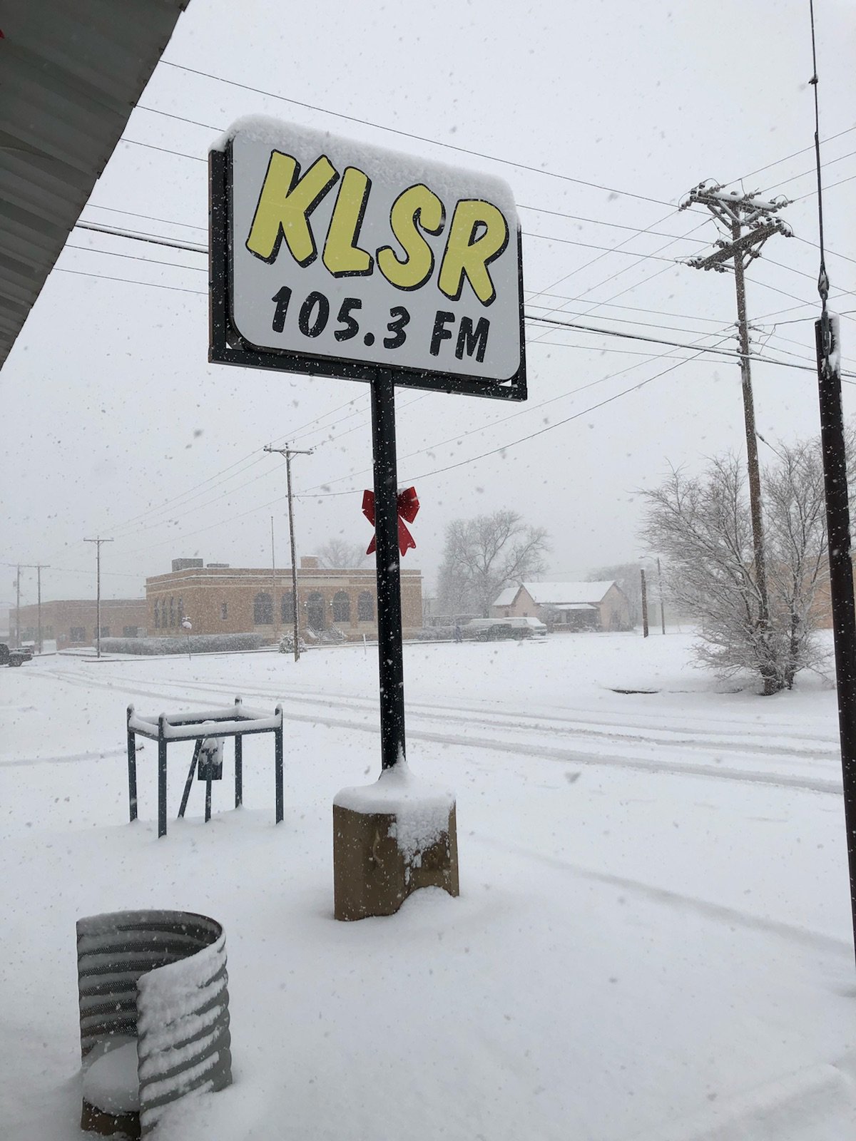
| Below are a couple of more views of the snow that fell over the southeast Texas Panhandle. Once melted down, liquid equivalents from the wintry mix and snow generally varied from a few hundredths to a quarter inch. However, locations that received the heaviest snow saw anywhere from quarter inch to in excess of a half inch. | |
 |
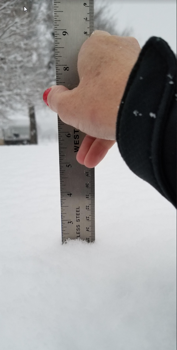 |
| Snow falling in Memphis (left) and being measured south of Estelline (right) on 3 January 2019. The pictures are courtesy of Joe Davis and Farrah Holcomb, respectively. | |

