
Scattered thunderstorms with severe gusts, hail and a tornado risk are possible near a cold front from the Ohio Valley to the Mid-Atlantic tonight. Tropical Storm Bertha is expected to bring tropical storm conditions to portions of the Gulf Coast from the panhandle of Florida into Louisiana through Wednesday. Read More >
Late May 2019 brought more rounds of severe thunderstorms to West Texas, including giant hail, damaging winds, tornadoes and torrential rain. An active dryline, rich moisture and strong instability and unsettled southwest flow aloft provided the ingredients for the rounds of severe weather. After a reprieve from the storms in mid-May, the active weather returned in full force on Monday, May 20th.
 |
|
|
Lubbock WSR-88D radar animation valid from 3:43 pm to 4:01 pm on 20 May 2019. Additional radar animations are available at: 4:56 pm to 5:13 pm; 6:29 pm to 6:48 pm; and 10:12 pm to 10:48 pm.
|
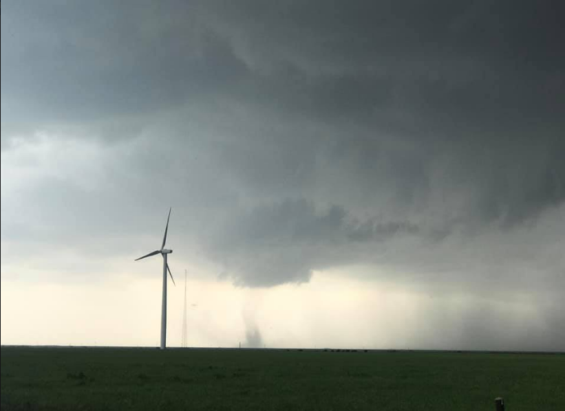
The impetus to kick off the severe weather on Monday, May 20th, was a strong upper low approaching via the Four Corners. Thunderstorm erupted early in the day, primarily from the Texas Panhandle northward, but soon followed over the South Plains and Rolling Plains shortly after midday. The activity continued to redevelop and affect portions of the region through the evening, lingering into the late-night hours across the Rolling Plains. At least a few brief tornadoes formed from these storms, including one near McAdoo, another west of Paducah and one east of Dickens. Thankfully, these tornadoes occurred over open land and did no known damage.
The intense storms also generated damaging winds, large hail and torrential rainfall. The wind and golf ball size hail did considerable tree damage in and around south and east Lubbock during the afternoon, while hail as large as tennis balls fell east of Memphis. A wind gust as high as 80 mph was measured at the West Texas Mesonet located on the west side of Spur.
 |
|
|
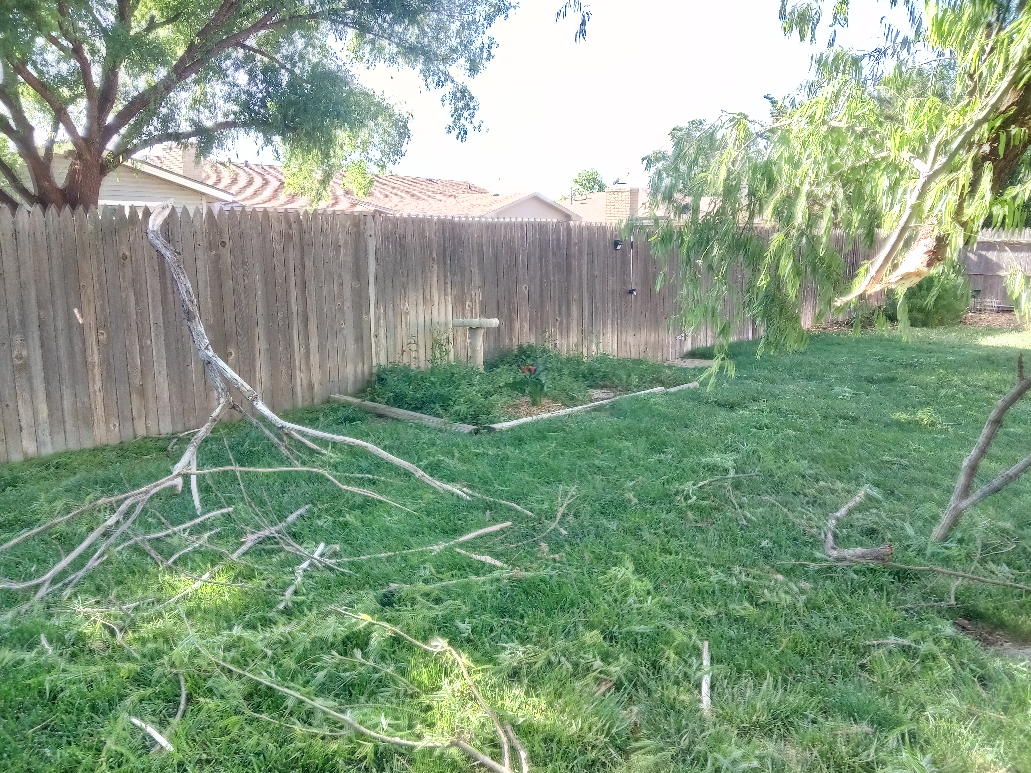
Minor tree damage in south Lubbock caused by the storms that moved through Monday afternoon (20 May).
|
Several rounds of strong to severe storms then trained over the southern Rolling Plains well into Monday night. In addition to severe weather, these storms dropped very heavy rain that resulted in minor flooding in and around Aspermont.

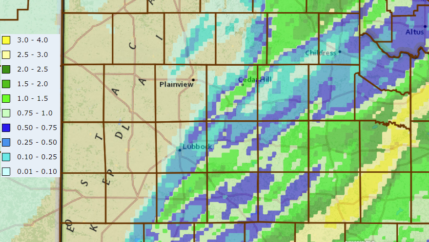
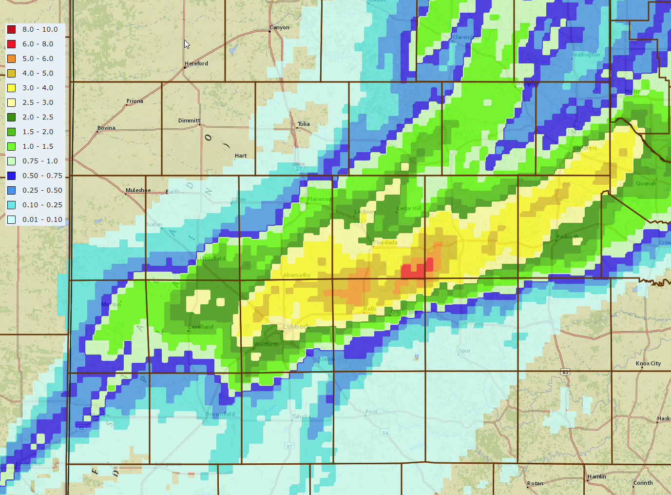
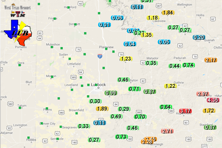
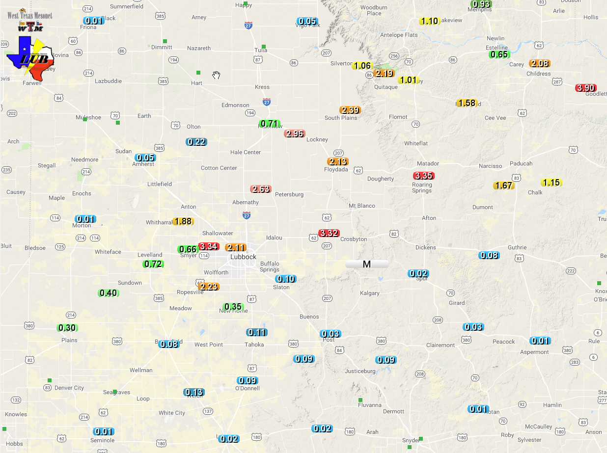
The below map shows that the rainfall fell roughly along and east of the I-27 and US-87 Corridor, with the heaviest rain falling in a swath across the southeast half of Stonewall County. The West Texas Mesonet site near Aspermont recorded 3.17 inches of rain.
 |
|
|
Radar-estimated, bias-corrected 24-hour rain totals ending at noon on 21 May 2019. The rain totals recorded by the West Texas Mesonet over this same period VIEWED HERE.
|
After a couple day reprieve, the active weather returned, with four straight days of severe weather in and around the South Plains over the Memorial Day Weekend.
 |
 |
|
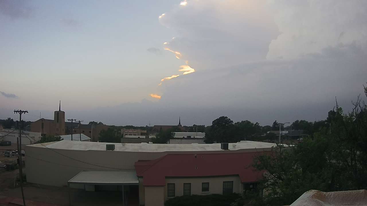
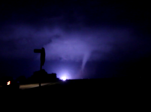
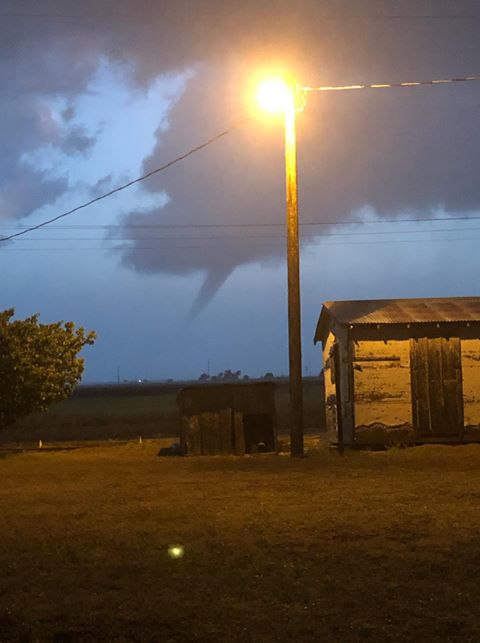
Pictures taken from Lubbock (left) and Slaton (right) on the evening of 23 May 2019. The left picture is courtesy of @austinjones and the right is courtesy of KAMC .
|
|
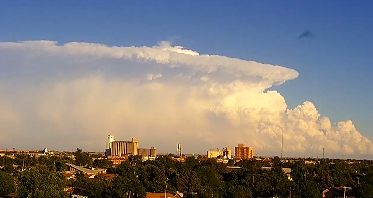
Thursday, May 23rd, kicked off this active stretch as deep Gulf moisture returned to West Texas, pushing well into eastern New Mexico early in the day. The dryline sharpened in the afternoon as it mixed into the western South Plains, and was the focus for scattered thunderstorm development. One storm spawned a brief anticyclonic tornado west of Brownfield, but the main impact from these storms were large hail and torrential rain.
 |
|
|
Lubbock WSR-88D radar animation valid from 7:44 pm to 8:22 pm on 23 May 2019. A visible satellite loop showing storm development between 4 pm and 5 pm on the 23rd can also be VIEWED HERE.
|
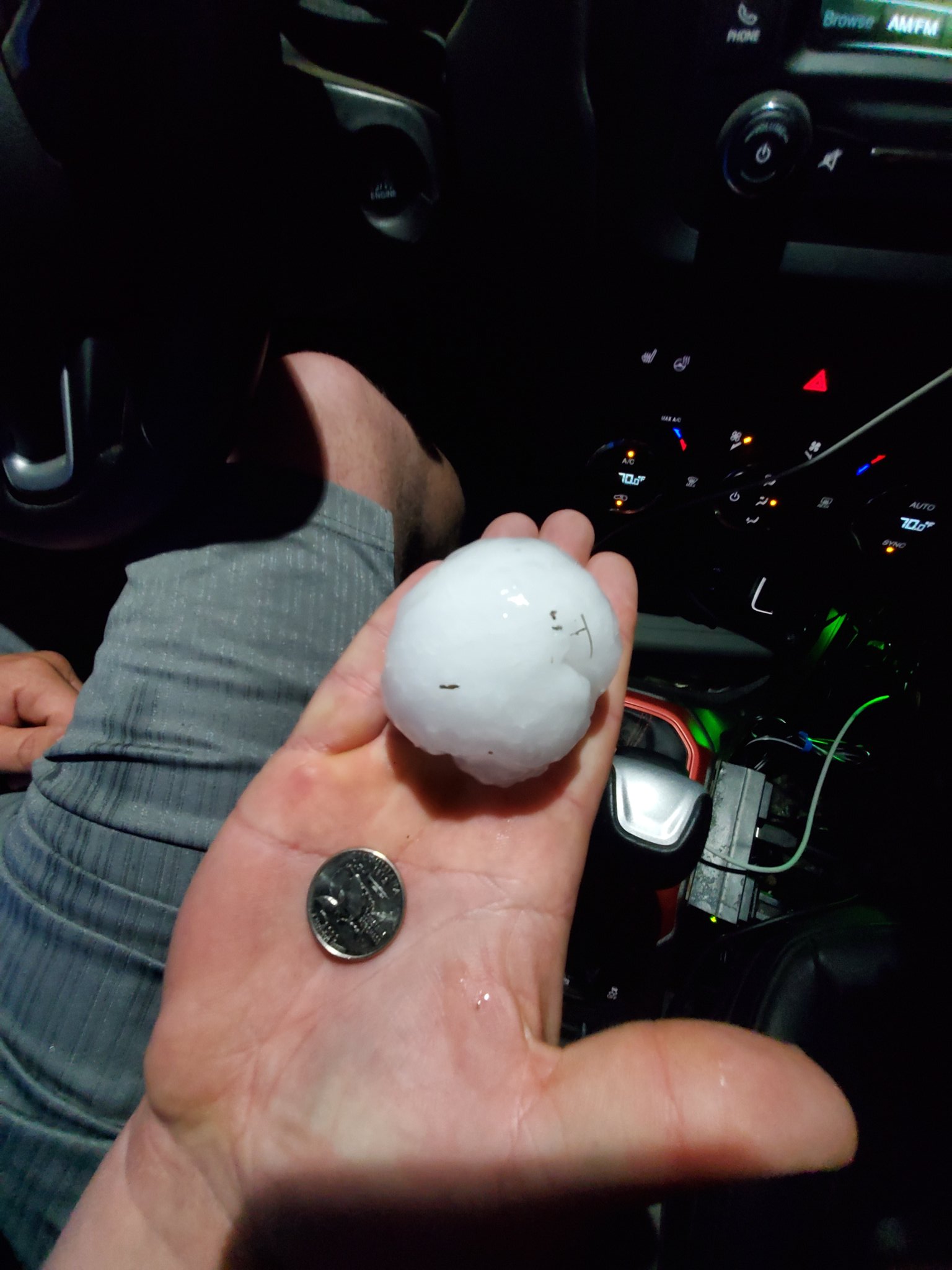
Numerous spots saw hail as big as golf balls, while baseball size hail was reported near Shallowater and tennis ball size hail fell west of Floydada.
 |
 |
|
(Left) Large hail that fell west of Floydada, courtesy of David Baxter III. (Right) Wall cloud near Brownfield, courtesy of Mike Olbinski. Both pictures were taken on 23 May 2019.
|
|
The slow-moving supercell thunderstorms repeatedly tracked across the central South Plains before spreading northeastward into the southeast Texas Panhandle. As they did so, the torrential rain, tallying to 1 to 3+ inches, caused flooding around the region.
The next day, Friday, May 24th, brought more of the same. This time the storms started early in the day, firing up just southwest of Lubbock before midday. This activity grew in coverage and intensity through the afternoon hours and persisted through much of the evening before finally diminishing late. To make matters worse, the thunderstorms trained over the same locations, dropping torrential rainfall as they did so.
 |
|
|
Flooding near Highway 84 and Loop 289 in Lubbock on Friday, 24 May 2019. The picture is courtesy of Marcus Diaz.
|
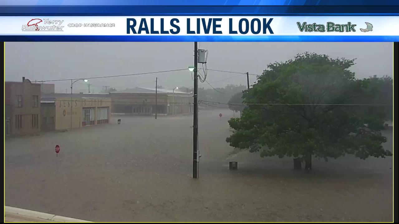
The excessive rainfall quickly flooded Lubbock before expanding its horizons to engulf locations to the east-northeast, including Ralls, Floydada and Matador. Unfortunately, all of this rain did cause extensive flooding, with the runoff inundating many locations across the central South Plains for the second day in a row.
 |
 |
|
Flooding in Ralls (left) and near Idalou (right) on 24 May 2019. The pictures are courtesy of KAMC.
|
|
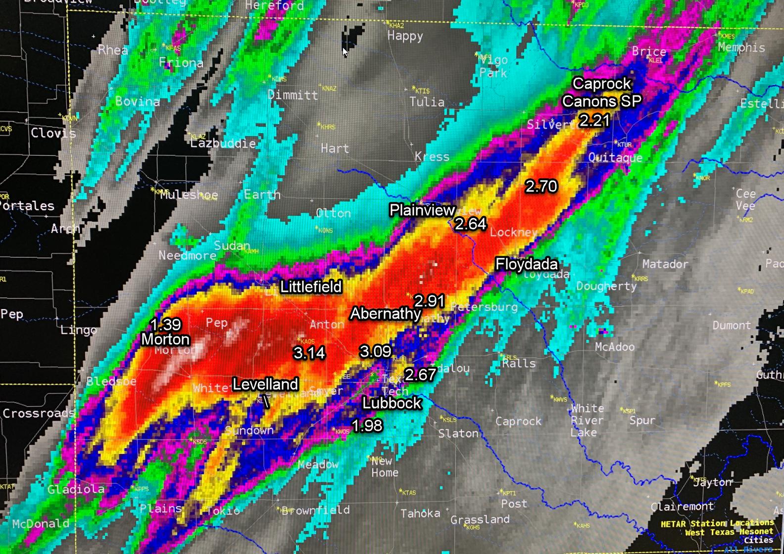
The focus for the nearly continuous thunderstorm development was a boundary left over from the previous day's activity that was reinforced by the outflows from the ongoing storms on the 24th. This boundary, visible in the below radar imagery, sat across the southern South Plains through the day, moving very little. Warm and very moist air south of the boundary advancing northward was continually lifted which resulted in the rapid thunderstorm redevelopment.
 |
 |
|
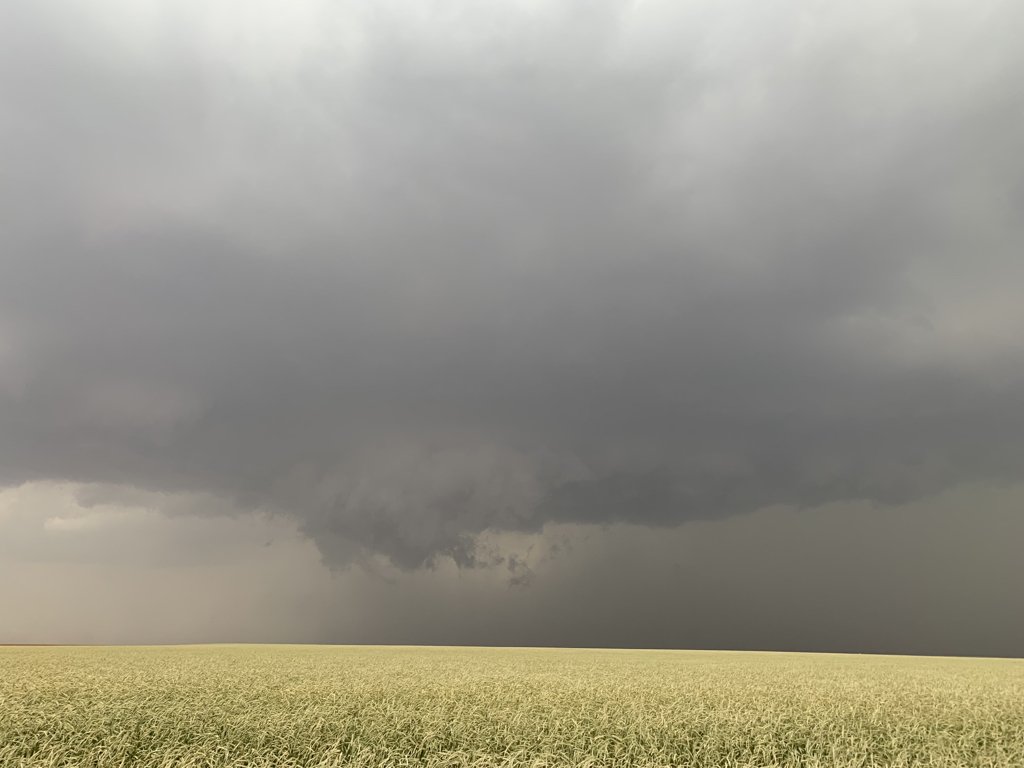
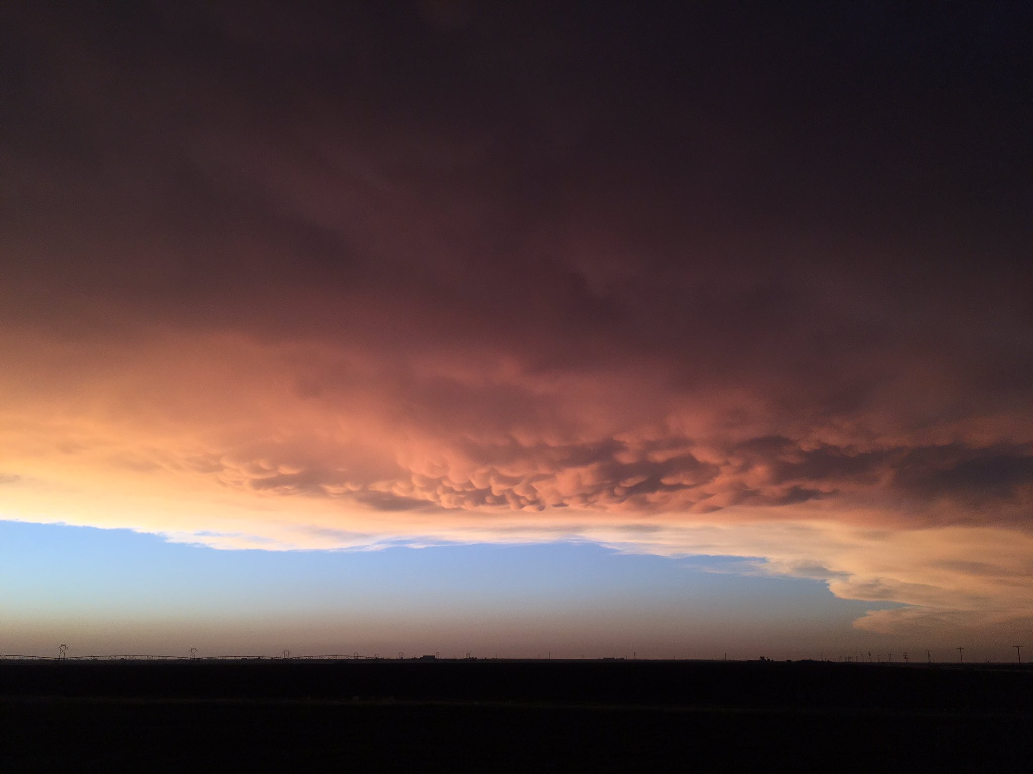
Views of the storms from Clovis (left) and Hale Center (right) on 24 May 2019. The left image is courtesy of Storm Search 7 and the right is courtesy of Roger Edwards.
|
|
Rain totals from this day were impressive in a swath from the central South Plains into the far southeast Texas Panhandle where 2 to 4+ inches were common. Officially, the Lubbock Airport recorded 2.40" on this day, setting a daily rainfall record (the previous record was 2.18", set in 1937) and instantly catapulting the yearly rainfall above average (to 6.83", which is 1.27" above the average year-to-date total of 5.56").
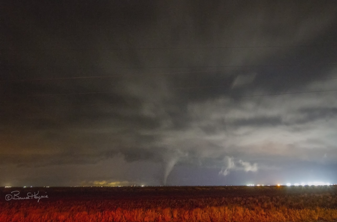
The weather was quieter much of the following day, Sunday, May 26th, but quickly turned active in the evening as storms moved out of eastern New Mexico. The bulk of the activity affected the Panhandles, but one lone supercell tracked out of east-central New Mexico and across the northwest South Plains into the south-central Texas Panhandle. This storm produced a large tornado in New Mexico mid-evening, then went on to produce a few (or more) tornadoes as the storm tracked from east of Muleshoe to just north of Hart and Sunnyside, to north of Tulia, after dark.
 |
 |
|
Tornado near Earth, Texas, (left) and funnel and possible tornado near Lariat (right) on Sunday evening (26 May 2019). The left image is courtesy of Bruce Haynie and the right is courtesy of Jessica Rivera and KAMC.
|
|
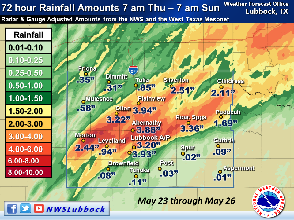
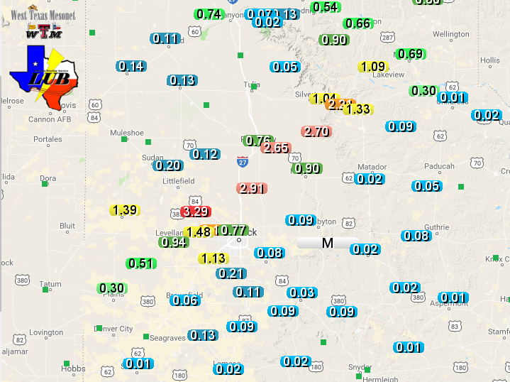
Rainfall over the course of the extremely active late May stretch was more than generous for a large chunk of the South Plains, southeast Texas Panhandle and northern Rolling Plains, as the above graphic illustrates. Many locations record 3+ inches of rainfall. The heavy rainfall did cause a lot of problems, but it also added water to a few of the reservoirs in the region.
A listing of the Preliminary Local Storm Reports (LSRs) for this active stretch of weather can be found below.
PRELIMINARY LOCAL STORM REPORT...SUMMARY
NATIONAL WEATHER SERVICE LUBBOCK TX
735 AM CDT TUE MAY 21 2019

..TIME...   ...EVENT...      ...CITY LOCATION...     ...LAT.LON...
..DATE...   ....MAG....      ..COUNTY LOCATION..ST.. ...SOURCE....
            ..REMARKS..

0213 PM     HAIL             8 WSW DUMONT            33.76N 100.65W
05/20/2019  E0.88 INCH       DICKENS            TX   STORM CHASER

0216 PM     HAIL             MCADOO                  33.73N 101.01W
05/20/2019  E1.25 INCH       DICKENS            TX   NWS EMPLOYEE

0300 PM     TORNADO          4 W PADUCAH             34.01N 100.37W
05/20/2019                   COTTLE             TX   EMERGENCY MNGR

0301 PM     TORNADO          4 W PADUCAH             34.01N 100.37W
05/20/2019                   COTTLE             TX   EMERGENCY MNGR

            TORNADO BRIEFLY ON THE GROUND.

0347 PM     NON-TSTM WND GST NEW HOME                33.33N 101.91W
05/20/2019  M75 MPH          LYNN               TX   MESONET

            GUSTED TO 63 AND 70 MPH AS WELL

0347 PM     TSTM WND DMG     NEW HOME                33.33N 101.91W
05/20/2019                   LYNN               TX   SOCIAL MEDIA

            FEW POWER LINES DOWNED

0352 PM     HAIL             9 E MEMPHIS             34.73N 100.38W
05/20/2019  M2.50 INCH       CHILDRESS          TX   STORM CHASER

0404 PM     TSTM WND GST     4 SSW LUBBOCK           33.53N 101.88W
05/20/2019  M60 MPH          LUBBOCK            TX   NWS OFFICE

0405 PM     TSTM WND GST     4 SSW LUBBOCK           33.52N 101.90W
05/20/2019  M58 MPH          LUBBOCK            TX   BROADCAST MEDIA

0407 PM     TSTM WND DMG     SLIDE                   33.41N 101.93W
05/20/2019                   LUBBOCK            TX   EMERGENCY MNGR

            SEMI-TRAILER BLOWN ONTO CAR 1/4 MILE WEST OF SLIDE ROAD
            ON FM41

0408 PM     HAIL             7 SSW LUBBOCK           33.49N 101.92W
05/20/2019  E1.75 INCH       LUBBOCK            TX   PUBLIC

            114TH AND QUAKER IN LUBBOCK

0408 PM     TSTM WND DMG     IDALOU                  33.66N 101.68W
05/20/2019                   LUBBOCK            TX   TRAINED SPOTTER

            POWERLINES BLOWN DOWN

0408 PM     TSTM WND DMG     6 SSW LUBBOCK           33.50N 101.92W
05/20/2019                   LUBBOCK            TX   SOCIAL MEDIA

            TRAMPOLINE BLOWN OVER FENCES INTO ALLEY AT UNIVERSITY
            AND 114TH

0409 PM     TSTM WND DMG     12 SSE LUBBOCK          33.42N 101.80W
05/20/2019                   LUBBOCK            TX   BROADCAST MEDIA

            POWERLINES BLOWN OVER ON HWY 87 JUST SOUTH OF FM41

0410 PM     TSTM WND DMG     1 SE LUBBOCK            33.58N 101.88W
05/20/2019                   LUBBOCK            TX   UTILITY COMPANY

            TREE DOWN IN MIDDLE OF STREET AT 23RD/24TH ON AVE L

0410 PM     TSTM WND DMG     4 S LUBBOCK             33.52N 101.88W
05/20/2019                   LUBBOCK            TX   SOCIAL MEDIA

            TREE SNAPPED AT CORNER OF AVE W AND 77TH STREET

0412 PM     TSTM WND DMG     3 NW WOODROW            33.48N 101.88W
05/20/2019                   LUBBOCK            TX   BROADCAST MEDIA

            HOUSE UNDER CONSTRUCTION COLLAPSED

0413 PM     TSTM WND GST     6 NNE LUBBOCK           33.67N 101.82W
05/20/2019  M54 MPH          LUBBOCK            TX   ASOS

0418 PM     HAIL             TURKEY                  34.39N 100.90W
05/20/2019  E1.00 INCH       HALL               TX   CO-OP OBSERVER

0420 PM     HAIL             5 W O`DONNELL           32.97N 101.92W
05/20/2019  E1.75 INCH       LYNN               TX   BROADCAST MEDIA

0430 PM     TSTM WND GST     5 ENE ABERNATHY         33.88N 101.76W
05/20/2019  M58 MPH          HALE               TX   MESONET

0431 PM     HAIL             FLOYDADA                33.98N 101.34W
05/20/2019  E1.00 INCH       FLOYD              TX   CO-OP OBSERVER

0435 PM     TSTM WND GST     2 NNE FLOYDADA          34.00N 101.33W
05/20/2019  M74 MPH          FLOYD              TX   MESONET

0439 PM     HAIL             6 S RALLS               33.59N 101.38W
05/20/2019  E1.00 INCH       CROSBY             TX   EMERGENCY MNGR

0528 PM     HAIL             3 SSE LORENZO           33.63N 101.51W
05/20/2019  E0.75 INCH       CROSBY             TX   EMERGENCY MNGR

0625 PM     TSTM WND GST     1 W SPUR                33.48N 100.88W
05/20/2019  M61 MPH          DICKENS            TX   MESONET

0630 PM     TSTM WND GST     1 W SPUR                33.48N 100.88W
05/20/2019  M80 MPH          DICKENS            TX   MESONET

0630 PM     TSTM WND DMG     3 NW SPUR               33.51N 100.89W
05/20/2019                   DICKENS            TX   FIRE DEPT/RESCUE

            APPROX. 20 HIGH LINES DOWN ALONG FM 1868

0635 PM     TSTM WND DMG     6 NNW SPUR              33.55N 100.89W
05/20/2019                   DICKENS            TX   FIRE DEPT/RESCUE

            ROOF BLOWN OFF HOME AT HWY70 AND CR466; POWER POLES
            DOWN

0647 PM     TORNADO          13 E DICKENS            33.62N 100.61W
05/20/2019                   DICKENS            TX   STORM CHASER

            LARGE RAIN-WRAPPED TORNADO

0654 PM     TORNADO          16 E DICKENS            33.62N 100.57W
05/20/2019                   DICKENS            TX   STORM CHASER

            TREES BLOWN DOWN AT CR371 AND HW82

0732 PM     TSTM WND DMG     4 SSW LUBBOCK           33.52N 101.90W
05/20/2019                   LUBBOCK            TX   SOCIAL MEDIA

            TREE BROKEN ONTO HOUSE AT 82ND AND UNIVERSITY

0738 PM     HAIL             2 S GUTHRIE             33.60N 100.32W
05/20/2019  E1.75 INCH       KING               TX   STORM CHASER

            HAIL WAS WIND DRIVEN

1141 PM     HAIL             JAYTON                  33.25N 100.57W
05/20/2019  E1.00 INCH       KENT               TX   LAW ENFORCEMENT

            QUARTER SIZE HAIL NEAR JAYTON CEMETARY.

1251 AM     FLOOD            N ASPERMONT             33.14N 100.22W
05/21/2019                   STONEWALL          TX   LAW ENFORCEMENT

            8 INCHES OF WATER FLOWING OVER HIGHWAY 83 ON THE NORTH
            SIDE OF ASPERMONT.

