|
Widespread mid-December rain falls on West Texas |
|
 |
|
|
Lubbock WSR-88D radar animation valid from 5:17 am to 10:12 am on Wednesday (13 December 2023). An additional radar animation, valid from 3:55 pm on Tuesday (12 December) to 10:12 am on Wednesday (13 December), can be VIEWED HERE.. |
|
|
Plentiful low-level moisture, in tandem with a slow-moving storm system approaching through the Four Corners region, brought a prolonged period of thick cloud cover, drizzle, areas of fog, periods of rain, and even a few thunderstorms to the South Plains region in mid-December. Initially, as the storm system dropped through the Great Basin, abundant Gulf moisture streamed northward over the southern High Plains. This resulted the development of a blanket of clouds that started generating sprinkles and a few light showers by late Tuesday afternoon (12 December). |
|
 |
|
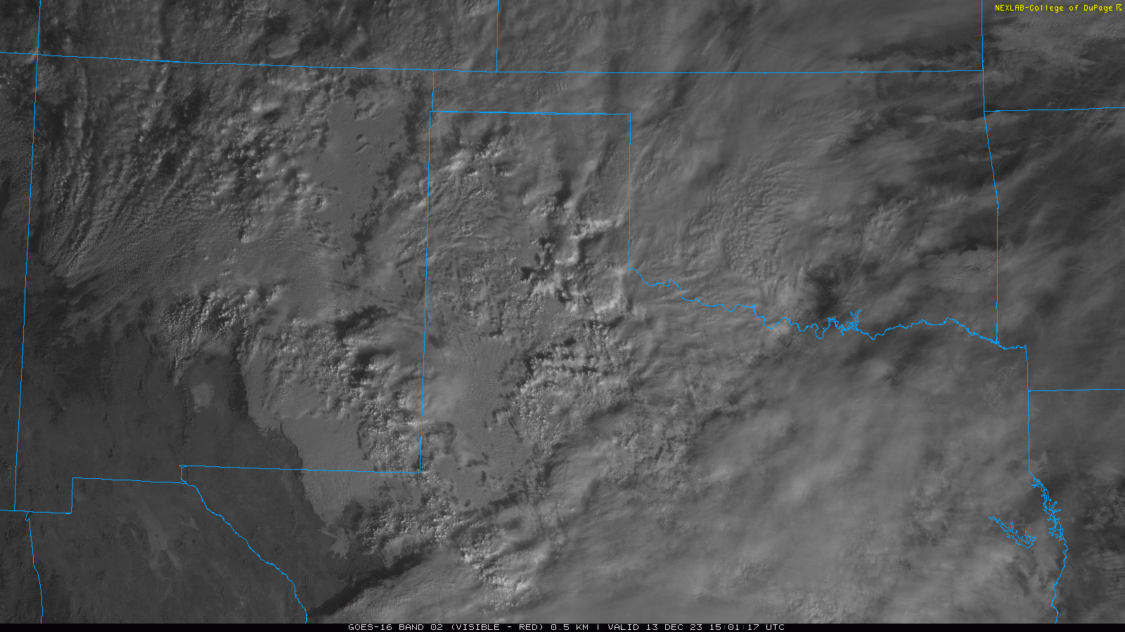
| Visible satellite animation valid from 9:01 am to 10:11 am on Wednesday (13 December 2023). Thick cloud cover can be seen blanketing much of Texas and northern and eastern New Mexico, with scattered taller clouds visible where heavier showers and even a few thunderstorms are occurring. | |
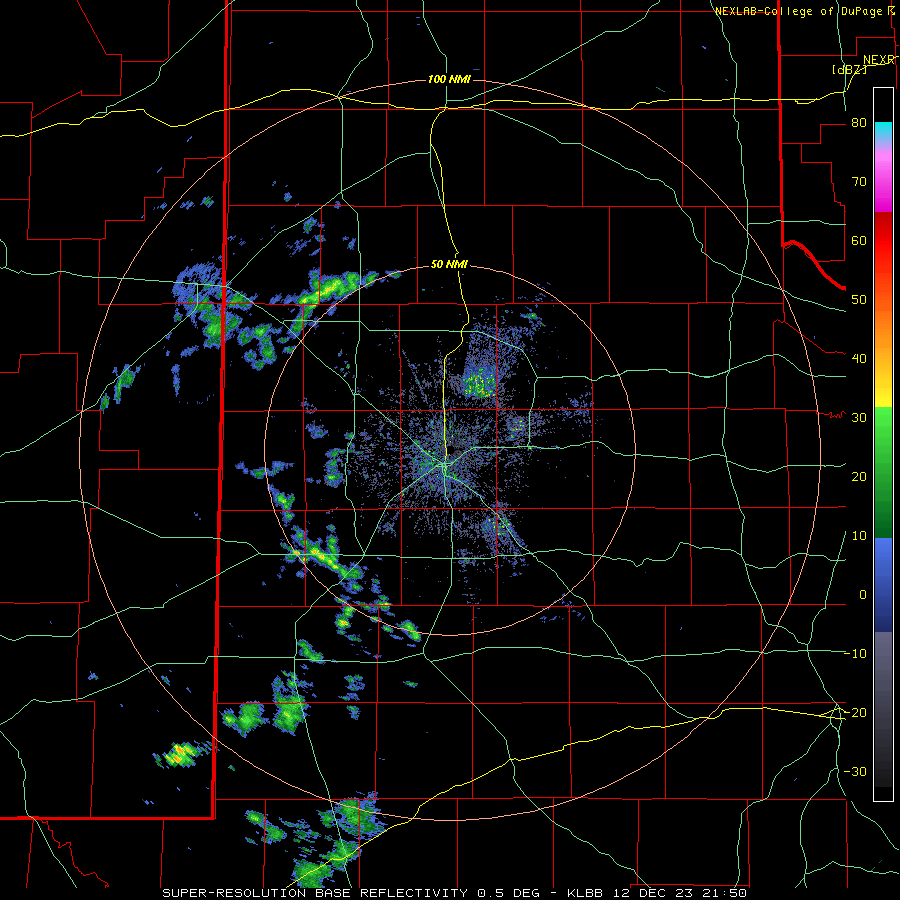
| The showers grew in coverage and intensity late Tuesday evening into Wednesday morning, with the thrust of the moderate to heavy precipitation targeting locations off the Caprock by early Wednesday. | |
 |
|
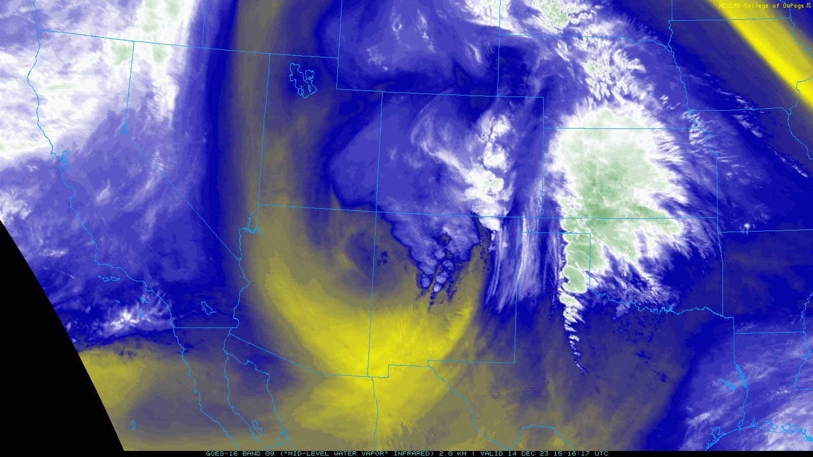
| Regional water vapor satellite animation valid from 9:16 am to 10:46 am on Thursday (14 December 2023). A well-defined counter-clockwise circulation (mid-upper level storm system) is seen advancing from northeast Arizona into northwestern New Mexico. | |
|
The cool, moist and gloomy conditions held firm through Wednesday and Thursday, with the bulk of the steady rainfall focused from the southeast Texas Panhandle into the Rolling Plains. Even outside the steady rain, heavy mist/drizzle persisted across the Caprock through much of this stretch as temperatures gradually decreased through the 40s on Wednesday, and eventually reached the 30s and lower 40s by late Thursday. |
|
 |
|
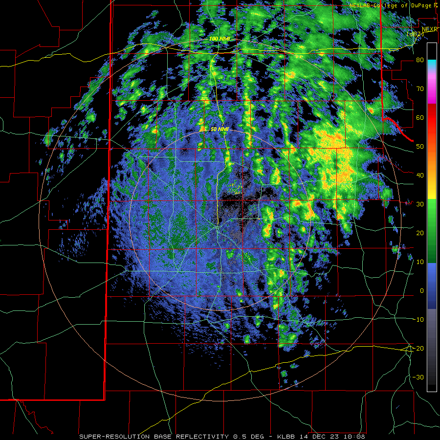
| Lubbock WSR-88D radar animation valid from 4:03 am to 10:49 am on Thursday (14 December 2023). | |
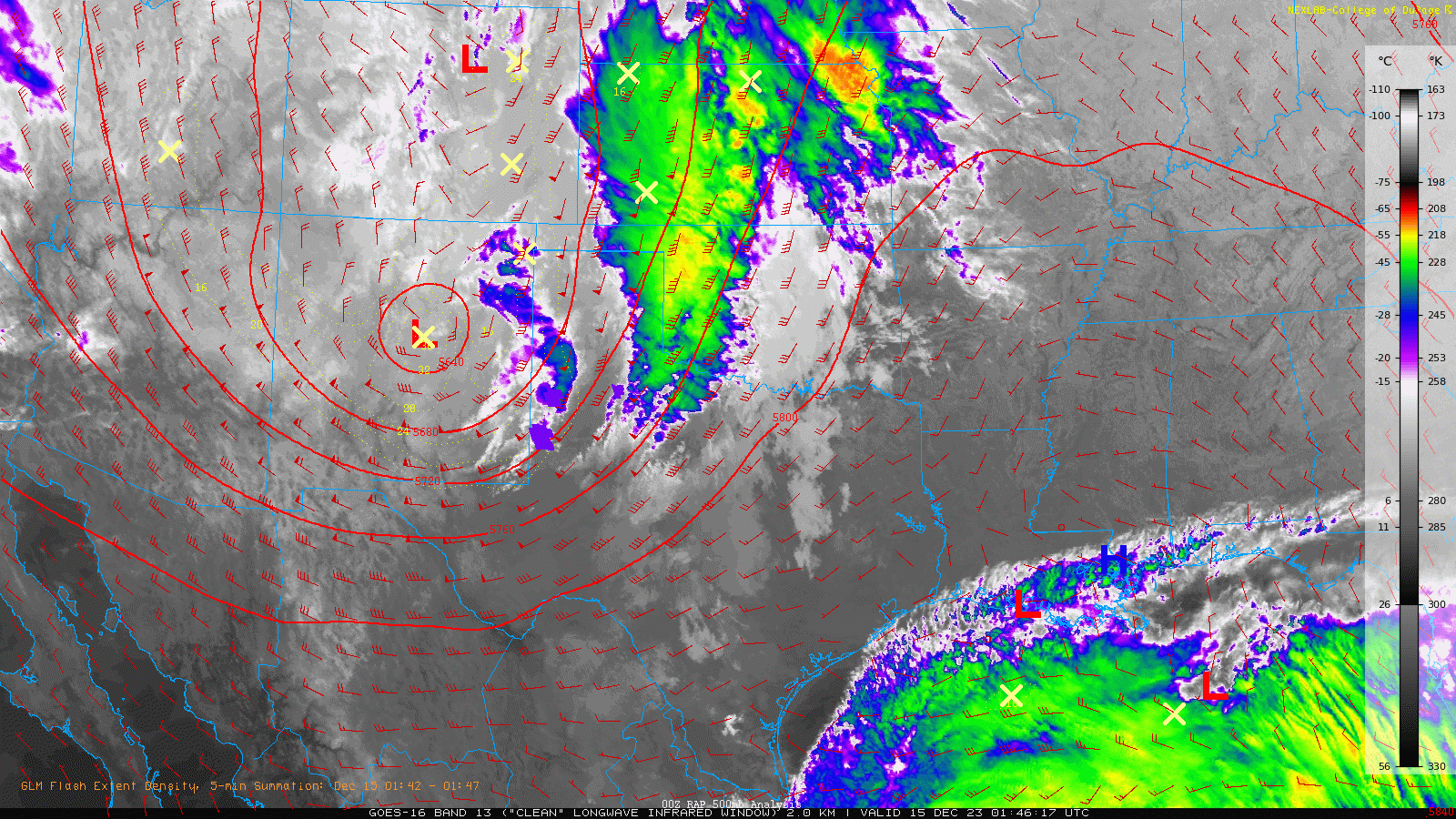
| Eventually, the storm system decided to head eastward Thursday evening, then accelerated northeast Thursday night into Friday morning, departing the region via the central Great Plains on Friday. Before leaving the region, one final slug of lift generated a broken band of showers and thunderstorms that swept from west-to-east across West Texas Thursday evening/night. | |
 |
|
| Infrared satellite animation valid Thursday evening (14 December 2023). Also plotted are the 500 mb heights and wind barbs. | |
|
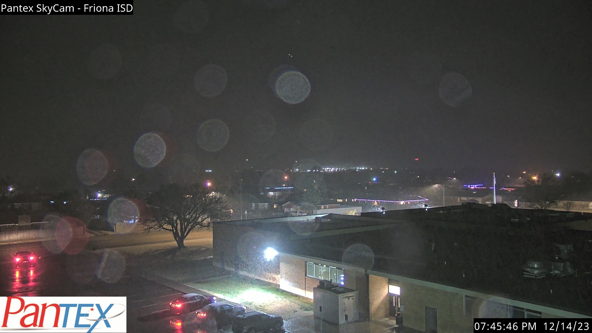
Just enough cold air moved in around Friona Thursday evening to cause the rain to briefly mix with snow before the precipitation ended altogether. The relatively mild conditions kept the snow limited in coverage and duration with no accumulating snowfall or travel impacts reported across the southern Texas Panhandle, South Plains or Rolling Plains. |
|
 |
|
| Rain/snow mix falling in Friona at 7:46 pm on Thursday (14 December 2023). The image is courtesy of Pantex. | |
| Outside of the few snowflakes noted over parts of the southwest Texas Panhandle Thursday evening, one final shot of rain and thunderstorms was the theme for the remained of the South Plains region Thursday evening/night. Any residual rain quickly came to an end across the southeast Texas Panhandle and Rolling Plains early Friday morning. | |
 |
|
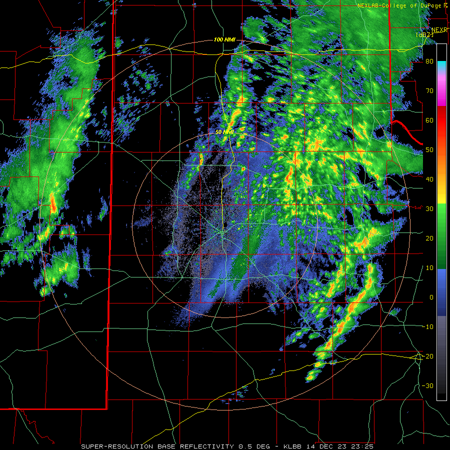
| Lubbock WSR-88D radar animation valid from 5:25 pm to 9:47 pm on Thursday (14 December 2023). | |
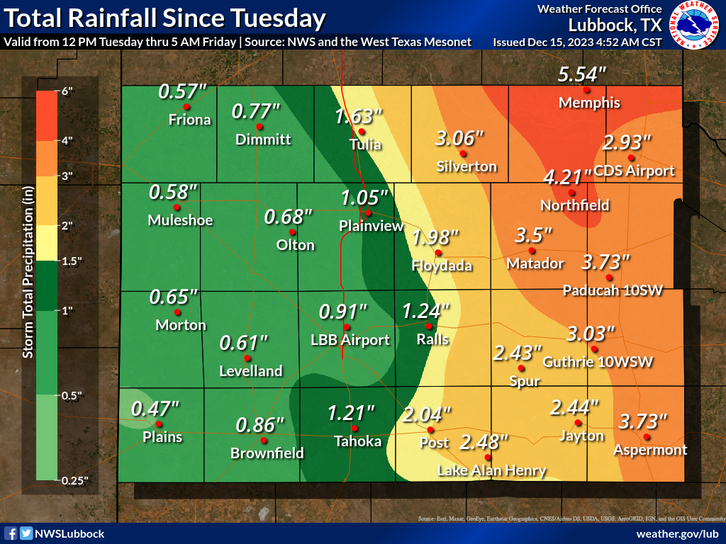
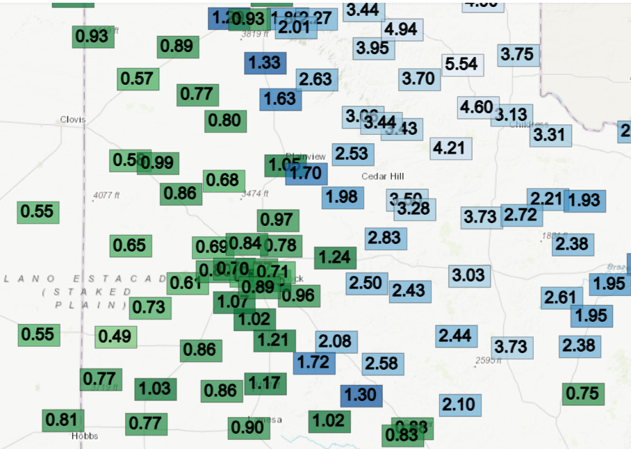
| Over the course of this cool and wet stretch the entire region recorded significant measurable rainfall, especially by December standards. The heaviest rain, 3 to 5+ inches, affected the southeast Texas Panhandle into the central and eastern Rolling Plains. Particularly hard hit was the southeast Texas Panhandle around Memphis, where over 5 inches fell. The West Texas Mesonet, located just northeast of Memphis, measured an astounding 5.54 inches over the 3-day stretch. | |
 |
|
| Total rainfall measured between Tuesday and Thursday, December 12th-14th. The data are courtesy of the West Texas Mesonet and the NWS. The 3-day rainfall measured by the West Texas Mesonet (WTM) during this wet mid-December stretch can be FOUND HERE. | |
|
Rain totals were lower further west, though still respectable, with 0.5 to 1.5 inches of rain common on the Caprock. Officially, the Lubbock Airport recorded 0.86 inches over the three days. The rain raised the yearly tally to 17.19 inches, which is less than an inch below average (average precipitation at Lubbock through December 15th is 17.93 inches). Childress fared even better, measuring 3.09 inches, which boosted their annual total to 27.43 inches (4.16 inches above average through December 15th). |
|

