|
Storms bring damaging winds and localized heavy rain |
|
 |
|
|
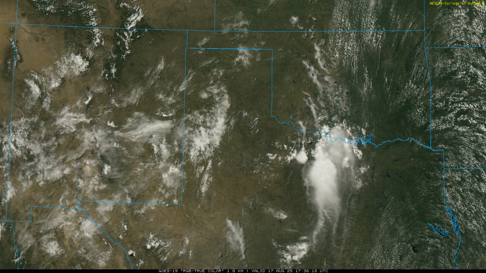
"RGB True-Color" satellite loop valid from 12:36 pm to 2:16 pm on Sunday (17 August 2025). |
|
|
The combination of lingering low-level boundaries, mid-level monsoon moisture and strong daytime heating (highs in the 90s, with even a few triple digits off the Caprock) conspired to bring scattered thunderstorms across West Texas and the greater southern High Plains region on Sunday, August 17th. |
|
 |
|
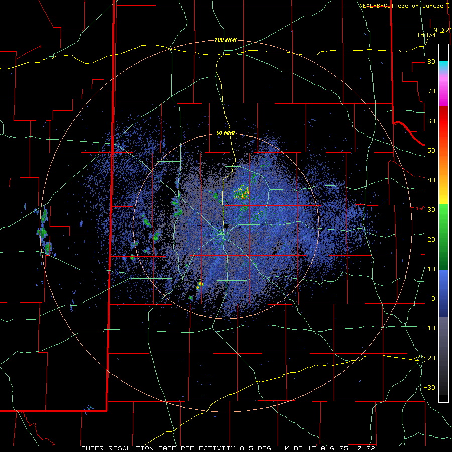
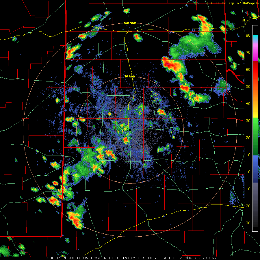
| LBB WSR-88D radar animation valid from 12:02 pm to 5:14 pm on Sunday (17 August 2025). An additional radar animation, valid from 4:38 pm to 6:25 pm on Sunday, can be VIEWED HERE | |
| The initial thunderstorm development occurred where temperatures peaked near 100 degrees off the Caprock, with scattered storms erupting from the southeast Texas Panhandle into the Rolling Plains by early to mid-afternoon. Shortly thereafter, additional thunderstorms formed over the southwestern South Plains, with more isolated activity becoming smattered over much of the rest of the South Plains and southern Texas Panhandle. | |
 |
|
| Plot of the preliminary storm reports collected on Sunday (17 August 2025). | |
| Overall coverage of Sunday's storms wasn't that impressive, but where they impacted, they packed a punch, producing strong downburst winds and brief torrential rainfall. A couple of locations that were targeted included the west side of Lubbock as well as in and around Turkey, Texas. Wind gusts as high 77 mph were measured by the West Texas Mesonet (WTM) site located 5 mile east-southeast of Reese Center, where visibility was also reduced to zero in wind driven torrential rainfall along West Loop 289 in Lubbock. The severe winds downed a power pole and caused significant roof damage to an apartment on the southwest side of Lubbock. Much farther northeast, the Turkey WTM site measured a 61 mph wind gust with a different storm, which also knocked down trees and fences in town. | |
 |
|
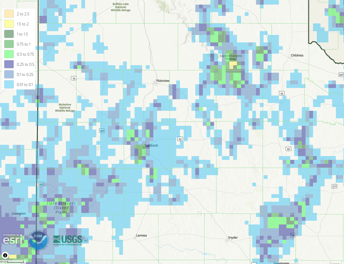
| 24-hour radar-estimated and biased-corrected precipitation ending at 7 am on Monday (18 August 2025). | |
|
In addition to the damaging winds, the small storms produced a few pockets of heavy rain that resulted in localized flooding, including over the west side of Lubbock. Although rain totals weren't crazy, when the rain fell it came fast, with 1 to 2 inches falling in small pockets over the west side of Lubbock as well as in and around Turkey. A list of the preliminary storm reports collected on August 17th can be found below. |
|
Preliminary Local Storm Report...Summary
National Weather Service Lubbock TX
1148 PM CDT Sun Aug 17 2025

..TIME...   ...EVENT...      ...CITY LOCATION...     ...LAT.LON...
..DATE...   ....MAG....      ..COUNTY LOCATION..ST.. ...SOURCE....
            ..REMARKS..

0430 PM     Tstm Wnd Gst     5 NNW Woodrow           33.50N 101.88W
08/17/2025  M62 MPH          Lubbock            TX   Mesonet

            West Texas Mesonet.

0445 PM     Tstm Wnd Dmg     4 SW Lubbock            33.55N 101.89W
08/17/2025                   Lubbock            TX   Public

            Report of a downed power pole blocking
            traffic.

0457 PM     Tstm Wnd Gst     3 WNW Lubbock           33.60N 101.90W
08/17/2025  M63 MPH          Lubbock            TX   Public

            West Texas Mesonet.

0523 PM     Tstm Wnd Dmg     5 SW Lubbock            33.53N 101.91W
08/17/2025                   Lubbock            TX   Broadcast Media

            Slack report and image of significant roof
            damage to an apartment complex, with roofs
            torn off the buildings. Late report. Time
            estimated by RADAR.

0523 PM     Tstm Wnd Gst     2 WSW Turkey            34.38N 100.93W
08/17/2025  M61 MPH          Hall               TX   Mesonet

            West Texas Mesonet. There was also a report
            of trees and fences blown down in Turkey.

0523 PM     Tstm Wnd Gst     5 ESE Reese Center      33.57N 101.94W
08/17/2025  M77 MPH          Lubbock            TX   Mesonet

            West Texas Mesonet. There was also a report
            of zero mile visibility from wind-driven,
            torrential rainfall on the West Loop.

0539 PM     Tstm Wnd Dmg     Turkey                  34.39N 100.89W
08/17/2025                   Hall               TX   Emergency Mngr

            Slack report of trees and fences blown down
            in Turkey. West Texas Mesonet measured a 61
            mph gust prior to the time of the received
            report.

0546 PM     Flash Flood      4 NW Woodrow            33.49N 101.87W
08/17/2025                   Lubbock            TX   Public

            Report from mPING.

0600 PM     Flash Flood      2 SW Lubbock            33.57N 101.87W
08/17/2025                   Lubbock            TX   Law Enforcement

            Numerous streets flooded.

0610 PM     Flash Flood      5 E Reese Center        33.61N 101.94W
08/17/2025                   Lubbock            TX   Public

            One foot of water at Frankford Avenue and
            Erskine Street.

