|
Mid-June brings unsettled weather across the South Plains |
|||
 |
|||
|
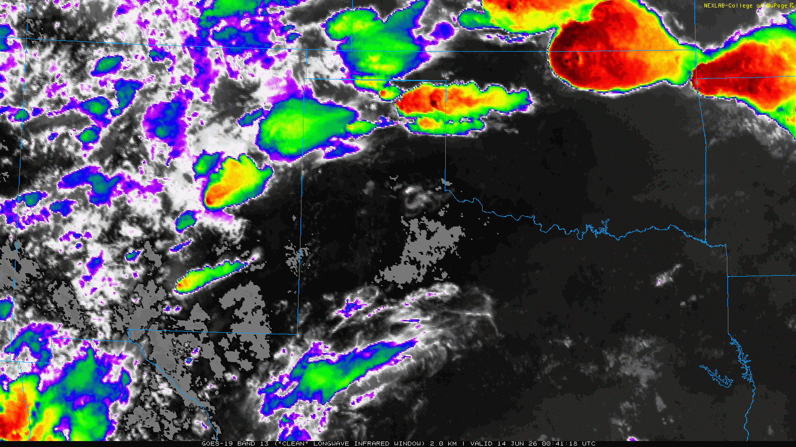
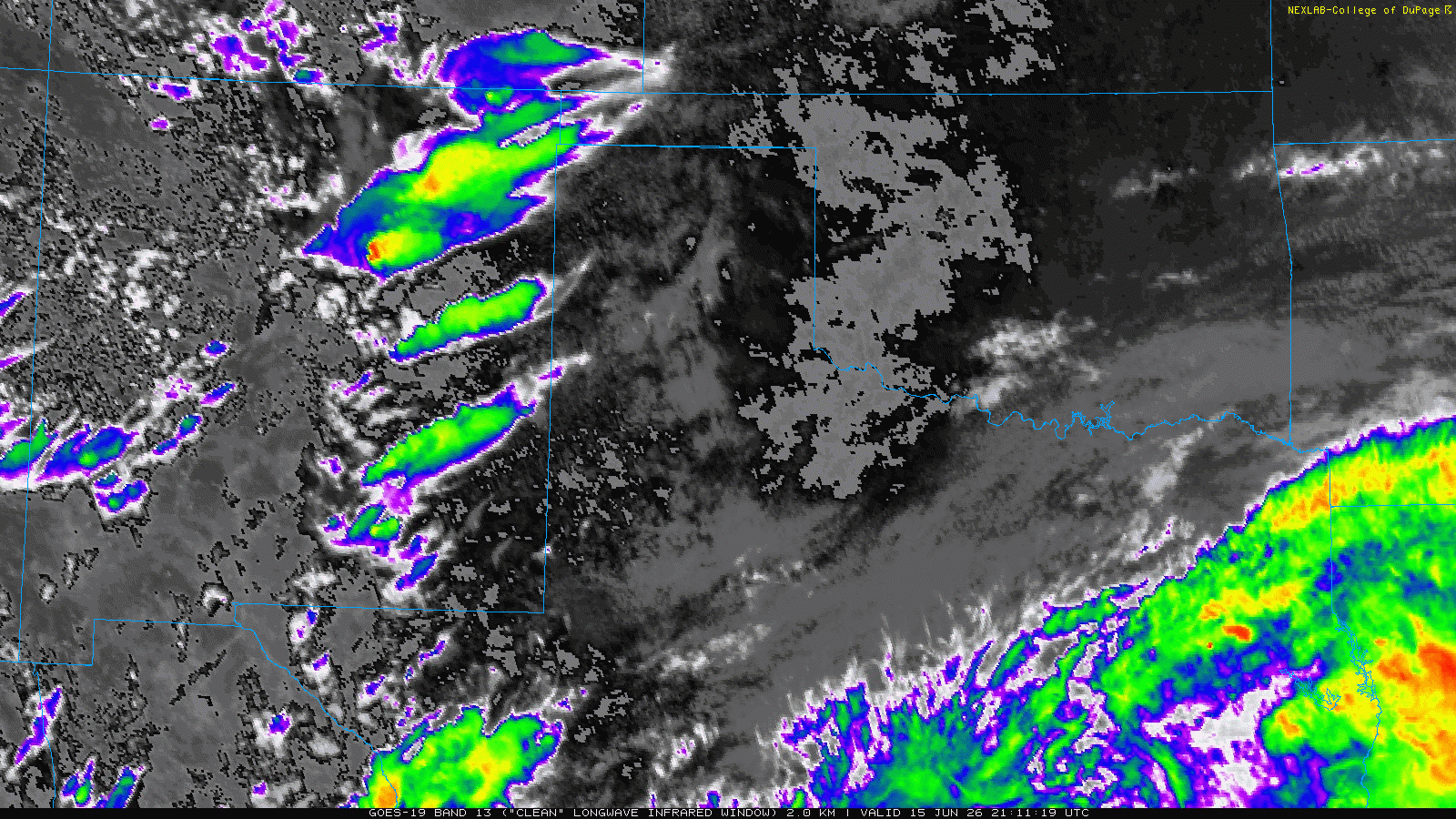
Infrared satellite loop valid from 7:51 pm on Saturday to 1:11 am on Sunday (13-14 June 2026). |
|||
|
The middle of June continued to supply active weather for West Texas and much of the region. More specifically, a hot Saturday (June 13th), with temperatures peaking well into the 90s at most spots, set the stage for an active late evening and overnight. The heat, coupled with decent moisture, supplied the fuel for the late-day and overnight thunderstorms. A cold front, approaching from the north, helped concentrate the activity through the overnight hours. |
|||
 |
|||
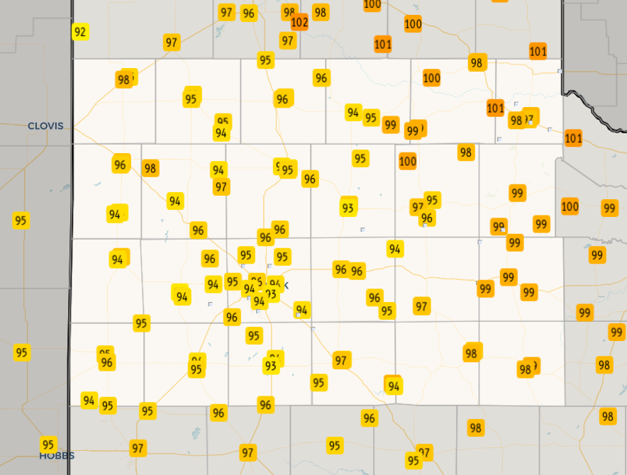
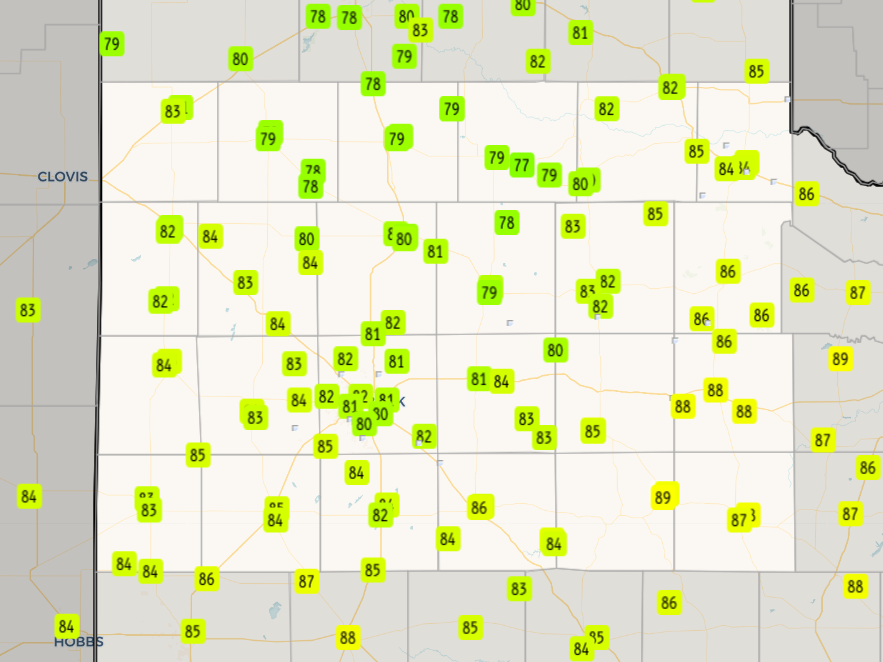
| High temperatures observed around the South Plains region on Saturday (13 June 2026). The data are courtesy of the West Texas Mesonet (WTM) and the National Weather Service (NWS) COOP observers. | |||
| Initial thunderstorm development occurred over the higher terrain of New Mexico into the northern and central Texas Panhandle, northwest Oklahoma and southern Kansas Saturday afternoon. Over time, outflows from the storms congealed and advanced south and eastward forcing new development to follow suite, expanding into the southern Texas Panhandle and northern and western South Plains late Saturday evening. | |||
 |
|||
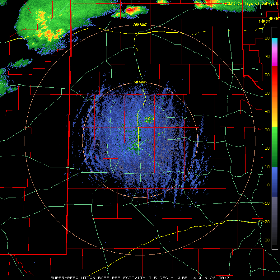
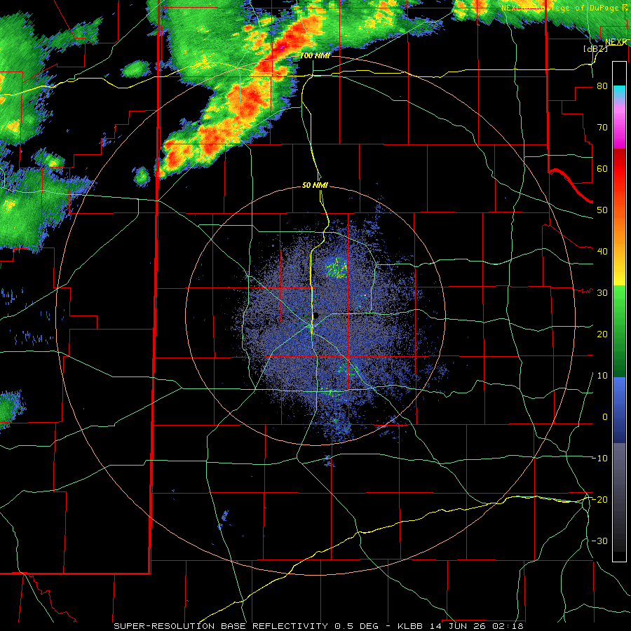
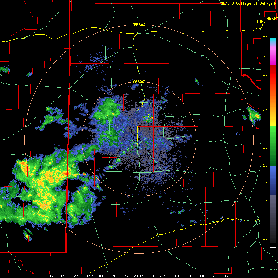
| Lubbock WSR-88D animation valid from 7:31 pm on Saturday to 1:14 am on Sunday (13-14 June 2026). Additional radar animations can be viewed at: 9:18 pm on Saturday to 10:43 am on Sunday (13-14 June); and 10:57 am to 3:39 pm on Sunday (14 June). | |||
| The most intense thunderstorms generated gusty winds and pockets of hail, along with brief bursts of heavy rain. Wind gusts of 40 to 50+ mph were common within the thunderstorm outflows as they overspread the southern Texas Panhandle and northern and western South Plains late Saturday evening into the early hours of Sunday. The activity persisted through much of the night, primarily tracking over the southern Texas Panhandle and northern South Plains. | |||
 |
 |
||
|
|||
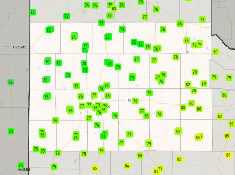
| As the overnight thunderstorms weakened and shifted east toward daybreak on Sunday, additional showers moved out of eastern New Mexico to the western South Plains. These showers persisted much of Sunday, moving from west-to-east across the South Plains, before fading over the Rolling Plains late Sunday afternoon. Plentiful cloud cover, until late in the day, coupled with a cold front sweeping through the region early in the day, brought a welcome cool down for the second half of the weekend. Most locations only warmed into the 70s Sunday afternoon, though it was humid. | |||
 |
|||
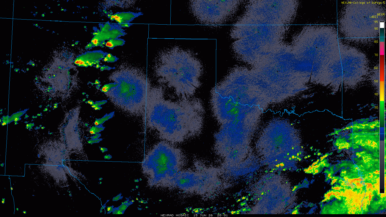
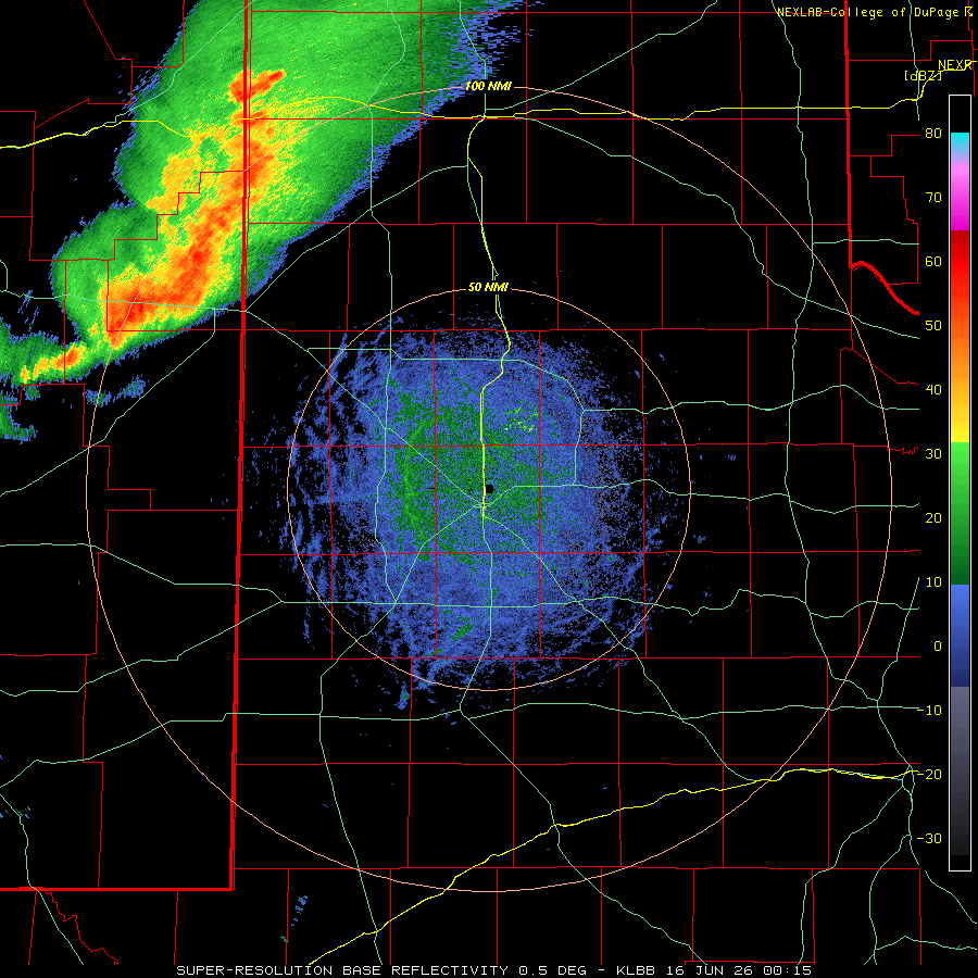
| Regional radar animation valid from 3:01 pm to 10:31 pm on Monday (15 June 2026). A Lubbock WSR-88D radar loop, valid from 7:15 pm to 10:50 pm on Monday, can be VIEWED HERE. Additionally, an infrared satellite loop, valid from 4:21 pm to 10:31 pm on Monday, can be FOUND HERE. | |||
| Monday (June 15th) provided more sunshine, which allowed temperatures to warm into the 80s at most spots. This warmth, coupled with lingering low-level moisture, supplied enough instability to maintain a small cluster of thunderstorms out of eastern New Mexico and into the western and central South Plains Monday evening. Downburst winds from the storms downed a few power poles north of Bovina and removed shingles from a roof in Abernathy. Aside from the two damage reports, generally sub-severe wind, occasional lightning, and widespread rainfall accompanied this activity as it traversed the South Plains. | |||
 |
|||
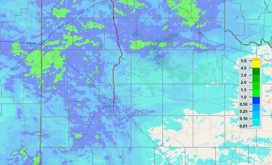
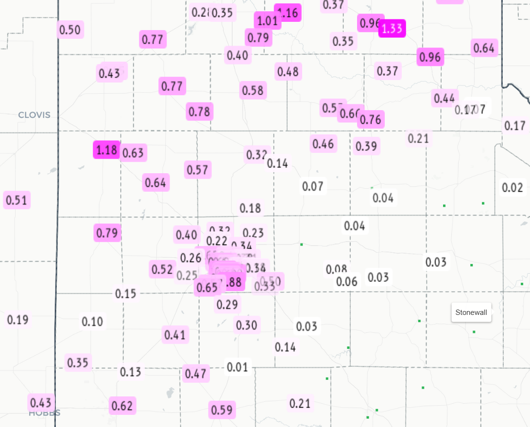
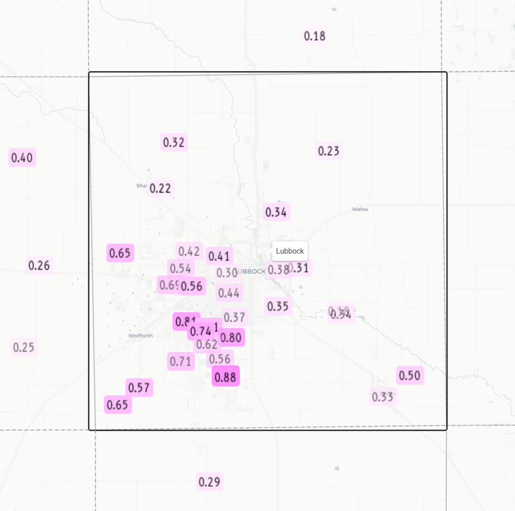
| 3-day radar-estimated and bias-corrected rainfall (inches) ending at 8 am on Tuesday (16 June 2026). Measured rainfall totals from the National Weather Service (NWS) and West Texas Mesonet (WTM) over this stretch can be VIEWED HERE. A zoomed in view of the measured rainfall around Lubbock can be FOUND HERE. | |||
|
Over the course of this unsettled stretch, all but the southern Rolling Plains received a little rain, though the bulk of the rainfall, from 0.50 to 1+ inches, was confined to portions of the southern Texas Panhandle and central and western South Plains. Muleshoe was the big winner, recording 1.18 inches over this period. Officially, the Lubbock Airport received 0.37 inches, boosting the year-to-date total to 6.10 inches. Though still nearly 2 inches below average through mid-June, the recent rains did help green up the countryside on much of the Caprock. A list of the preliminary storm reports collected on June 15th can be found below. |
|||
Preliminary Local Storm Report
National Weather Service Lubbock TX
1026 PM CDT Mon Jun 15 2026

..TIME...   ...EVENT...      ...CITY LOCATION...     ...LAT.LON...
..DATE...   ....MAG....      ..COUNTY LOCATION..ST.. ...SOURCE....
            ..REMARKS..

0748 PM     Tstm Wnd Dmg     3 N Bovina              34.55N 102.89W
06/15/2026                   Parmer             TX   Trained Spotter

            Three power poles snapped along FM 1731.
            Time estimated.

0957 PM     Tstm Wnd Dmg     Abernathy               33.84N 101.85W
06/15/2026                   Hale               TX   Public

            mPing report of shingles blown off roof.

