National Weather Service United States Department of Commerce

Francine Moving Northeastward Toward the Louisiana Coast; Critical Fire Weather Conditions in the Great Basin

Life-threatening storm surge, hurricane force winds, considerable flash flooding and tornadoes are forecast across much of southern Louisiana and the Mississippi coast through Thursday morning as a result of Hurricane Francine. Francine will continue to track across western Mississippi into the Mid-South Thursday and Friday. Heavy rainfall is likely and may lead to areas of flooding. Read More >

Hurricane Hunters Tour

at Reagan National  Airport (DCA)

Tuesday, May 9, 2017


Tour Pic 1 Tour Pic 2 Tour Pic 3 DCA Pic


Links:


Overview

Aircraft

Partner Exhibits

Location & Parking

Tours and Timelines

Event Layout

Other Tour Stops

For the Media

Available Speakers


Participating Aircraft


The DCA stop on the Hurricane Awareness Tour features 4 aircraft used in hurricane operations.  

C130    

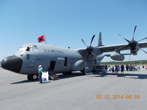
The WC-130J is one of ten such aircraft used by the U.S. Air Force Reservists from the 53rd Weather Reconnaissance Squadron, 403rd Wing, located at Keesler AFB in Biloxi, MS. Air crews fly directly into the core of tropical cyclones to gather data critical for forecasting tropical cyclone intensity and landfall.


P-3 Aircraft


NOAA's Lockheed WP-3D Orion "Hurricane Hunter" plays a key role in collecting data vital to tropical cyclone research and forecasting. To obtain the best possible data within the storm environment, crewmembers deploy expendable probes called GPS dropwindsondes through a launch tube in the aircraft to measure these powerful storms directly. The P-3's radar is used to gather a "MRI-like" look at the storm, and the P-3 uses microwaves to sense wind speeds at the sea surface.


The NOAA G-IV is part of the agency's fleet of highly specialized research and operational aircraft operated, managed, and maintained by the NOAA Office of Marine and Aviation Operations and based at MacDill AFB in Tampa, FL.  It flies at high altitude around and ahead of the tropical cyclone, gathering critical data to go into the hurricane forecast models.


King Air


Equipped with the latest aircraft technology, NOAA's King Air Special Mission aircraft’s main feature is the two large, downward-facing sensor ports that can support a wide variety of remote sensing systems, including digital cameras, multispectral and hyperspectral sensors, and topographic and bathymetric LIDAR systems.