Baltimore/Washington
Weather Forecast Office
These plots are no longer maintained. Please follow this link to the new ones.
 |
 |
 |
 |
 |
 |
 |
 |
 |
 |
 |
 |
 |
 |
 |
 |
 |
 |
 |
 |
 |
 |
 |
 |
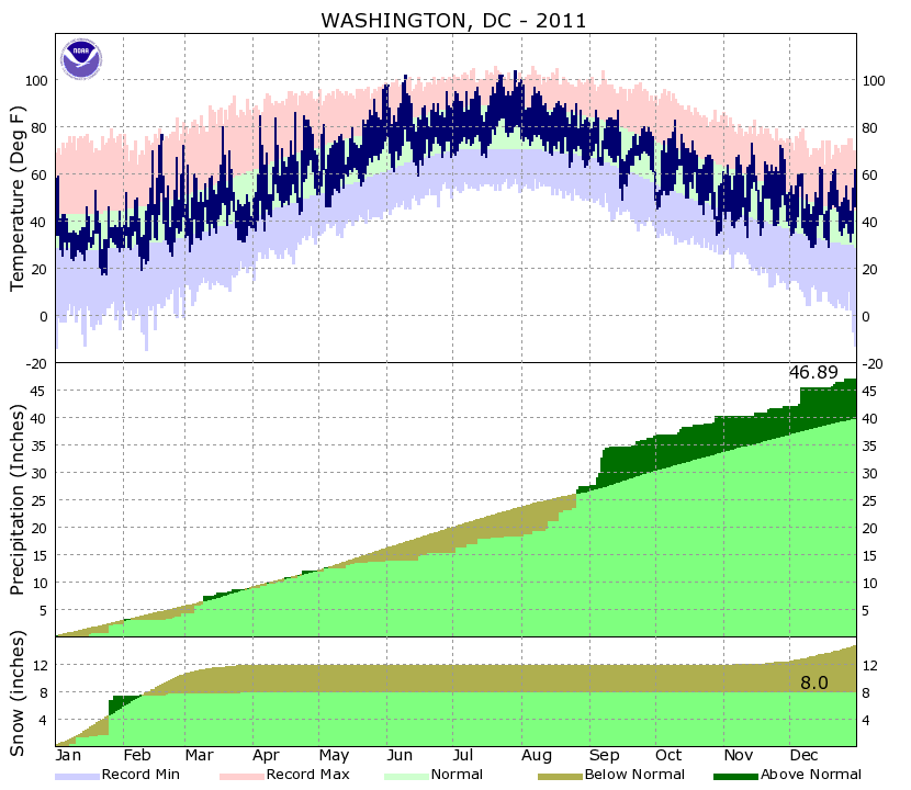
Climate data on this page is PRELIMINARY (unofficial). CERTIFIED (official) climate data are available from the National Centers for Environmental Information (NCEI).
US Dept of Commerce
National Oceanic and Atmospheric Administration
National Weather Service
Baltimore/Washington
Weather Forecast Office Baltimore/Washington
43858 Weather Service Rd.
Sterling, VA 20166
(571) 888-3500
Comments? Questions? Please Contact Us.


 Coastal Flood
 FAQ
FAQ