
Dangerous heat will expand from the Gulf Coast into the Southern Plains and Desert Southwest through week's end. Additional extreme heat impacting the Pacific Northwest will shift to the northern Plains by the weekend. Tropical Storm Bertha is expected to continue to impact portions of the northern Gulf Coast from the western Florida Panhandle to southeastern Louisiana through tonight. Read More >
...Squall Line RIps Area from Eastern WV to the Bay...
Summary
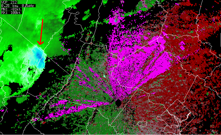
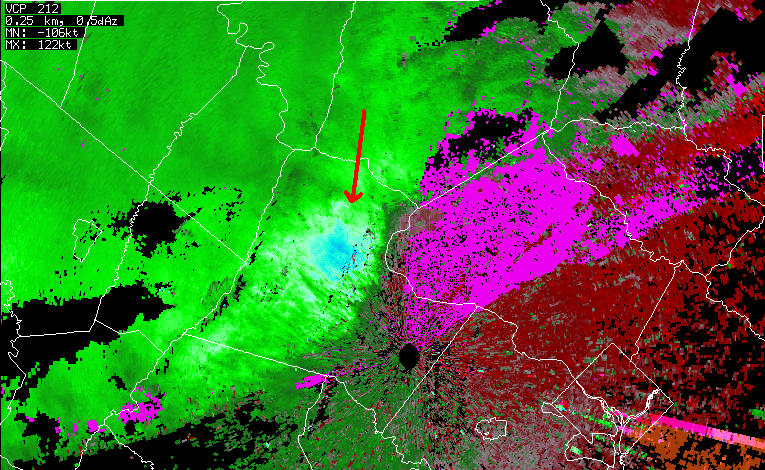
Early in the afternoon of Sunday July 25th, 2010, a squall line of thunderstorms formed over eastern West Virginia. With the heat of a near 100 degree afternoon to fuel it, and winds that strengthened to 70 mph higher up in the atmosphere where these clouds were billowing, that line intensified as it moved rapidly east.
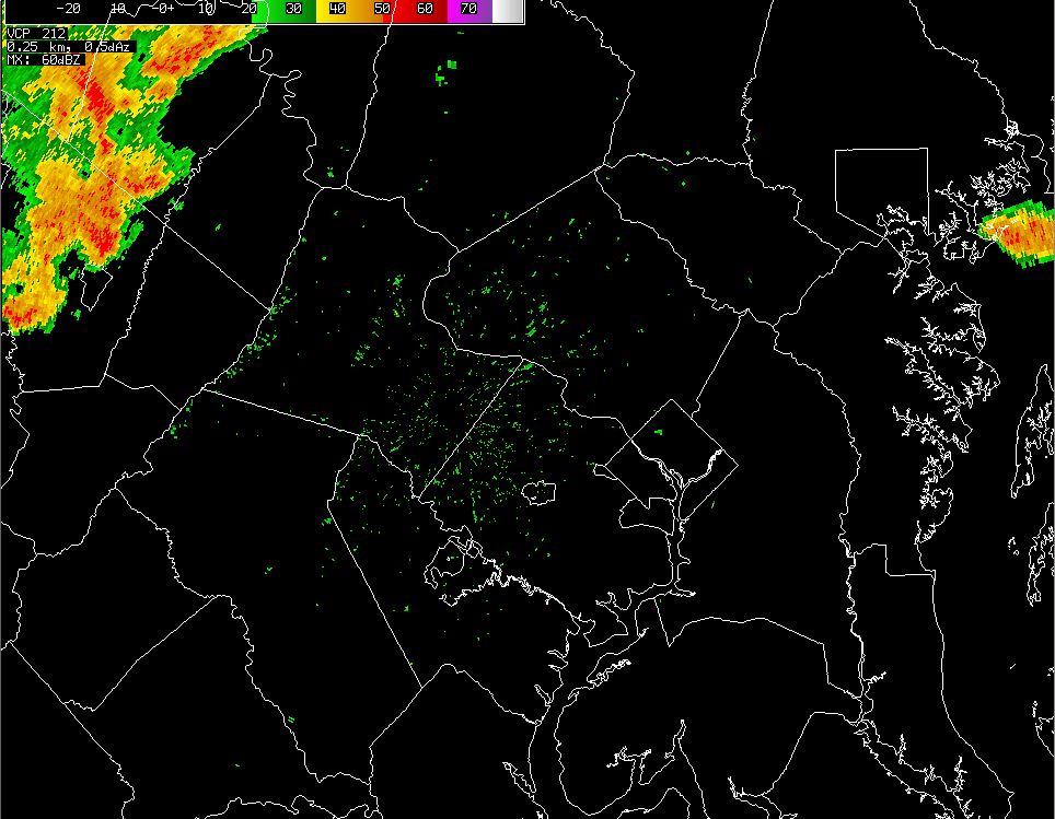
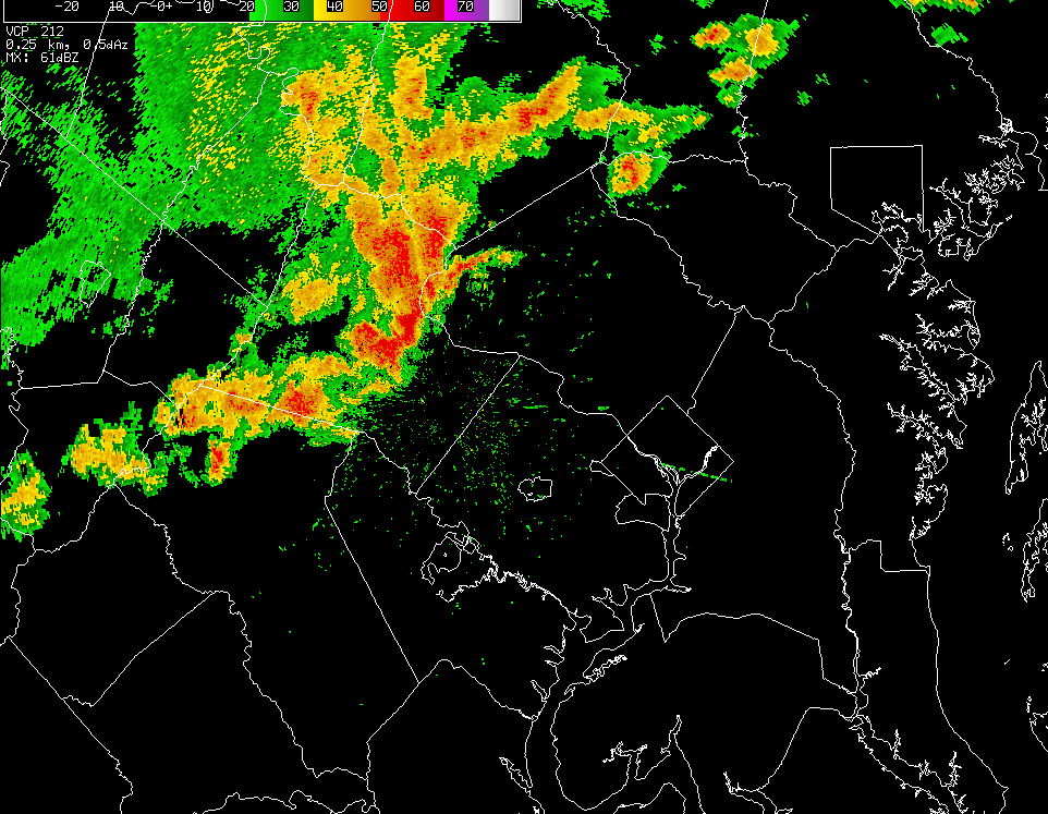
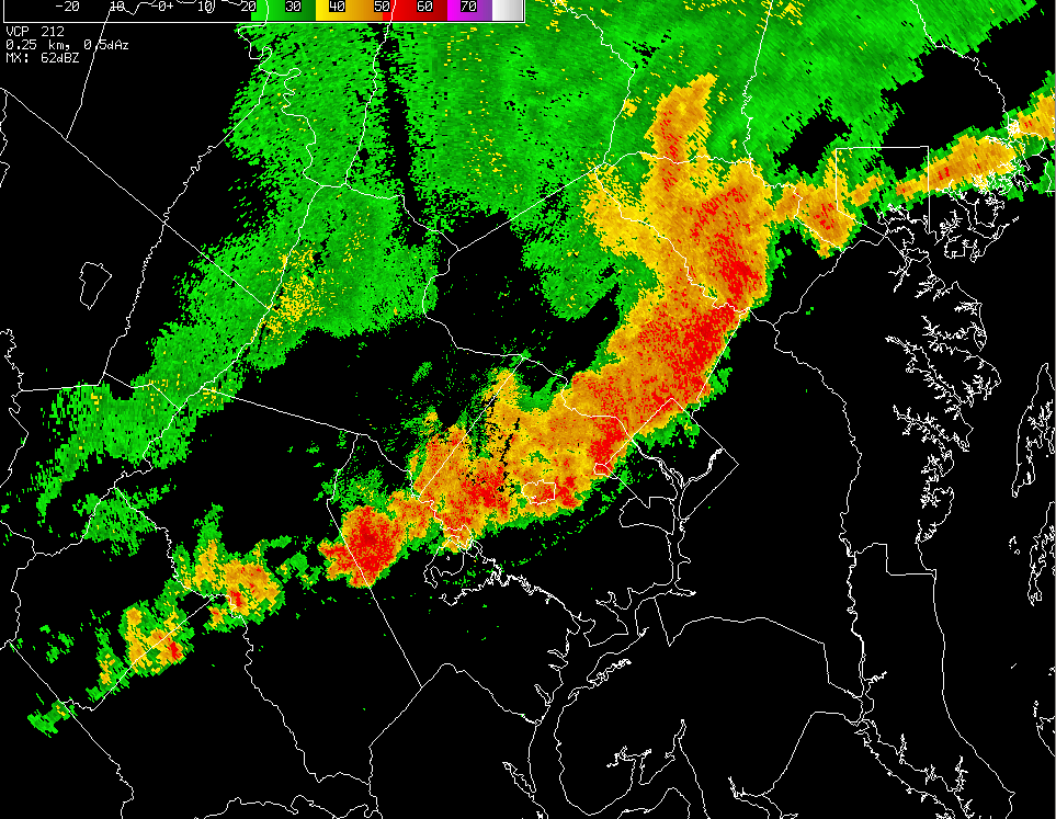
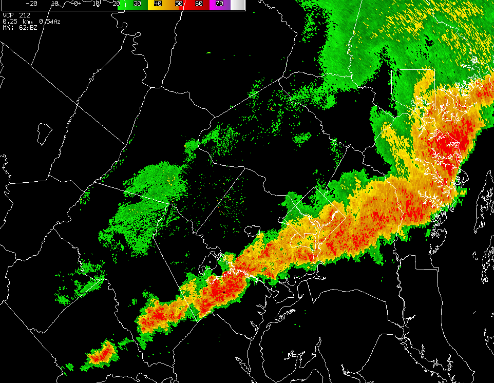
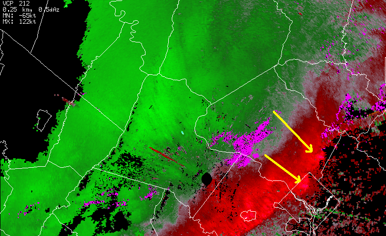
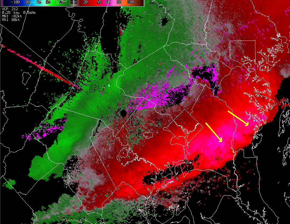
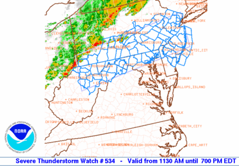
While the standard radar pictures above showing the heavy rain does not look too far out of the ordinary for a summertime line
Reported Damage and Impacts
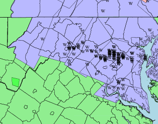
From those damaging winds, trees were downed along the squall line's path. Here is a map of damage reported to the National Weather Service. On this map, every 'W' is a report of wind damage. The blue areas are areas that were issued Severe Thunderstorm Warnings by the National Weather Service.
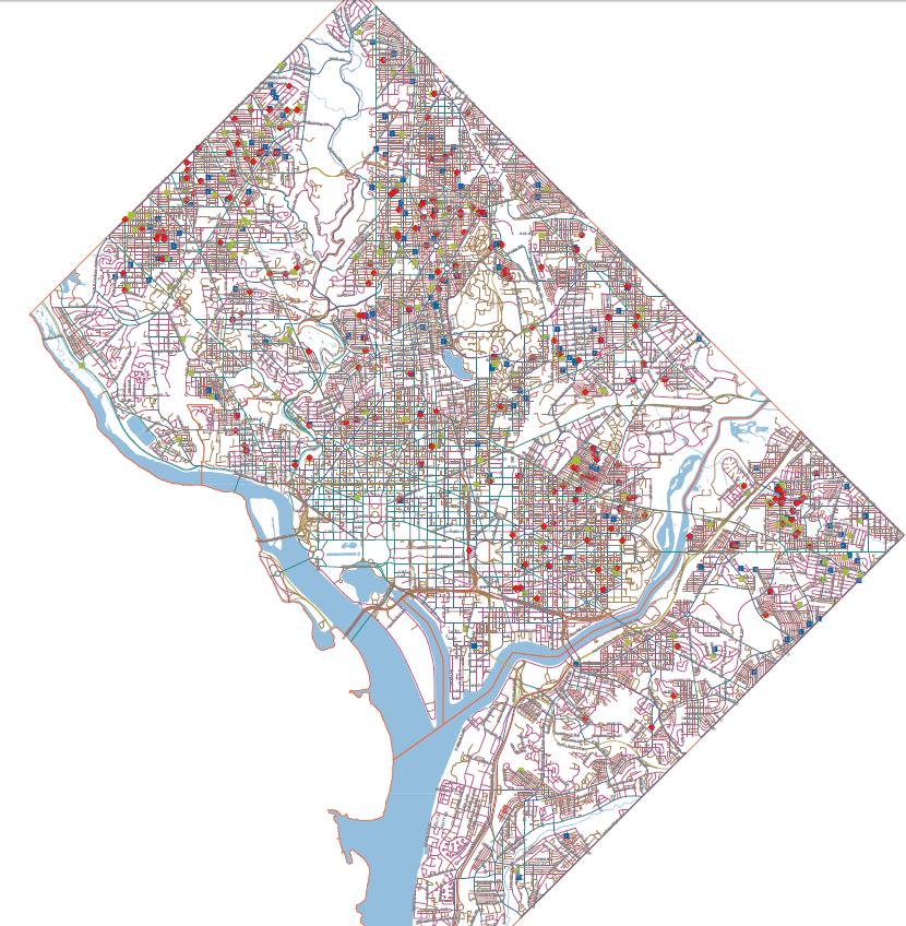
This is a map of trees damage just in the District of Columbia alone (dots):
In the main damage area shown in red here...
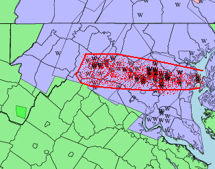
...winds gusted 40 to 50 mph on a widespread basis. That was enough to tear leaves and small branches off trees over that entire area, and even knock down some weaker trees. Within that area however, there were spots that received winds of 50-70 mph which was enough to bring down trees and large branches.
Some of those spots that had a wind instrument to measure the wind speed:
63 mph; Stephens City, VA
58 mph; Front Royal, VA
58 mph; North Potomac, MD
64 mph; Laytonsville, MD
58 mph; Sterling Park, VA
62 mph; Gaithersburg, MD
75 mph; Reston, VA
68 mph; Chevy Chase, MD
66 mph; White Oak, MD
60 mph; Glenn Dale, MD
62 mph; Annapolis, MD
60 mph; Eastport, MD
Danger Brewing (Outlook -> Watch -> Warning)
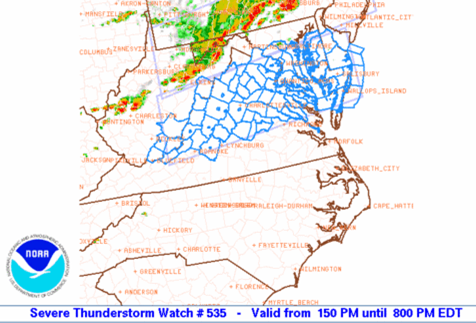
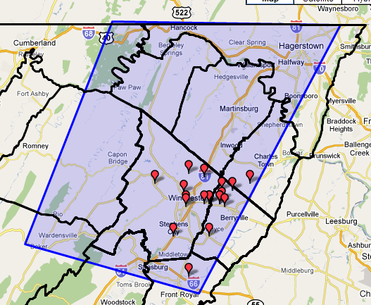
NWS meteorologists were monitoring the developing dangerous weather conditions during the late week, and by Friday morning began to include that threat in the Hazardous Weather Outlook with thunderstorms that "may produce strong gusty winds." That threat continued in the outlook through the weekend. As NWS meteorologists became even more confident on during the morning and midday hours on Sunday, a Severe Thunderstorm Watch was first issued for an areas including northern MD, northwestern VA, and northeast WV. That was followed by another Severe Thunderstorm Watch for an area just south of the initial one, including Washington D.C.
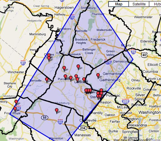
That was followed by a warning for the outer northwest D.C. suburbs at 2:36pm.
And then one for Washington and central MD at 3:07pm.
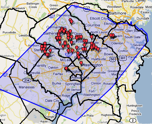
(in the above maps, red 'pins' are reported damage locations)
Other warnings were issued as well. All in all that Sunday, eight Severe Thunderstorm Warnings were issued, 7 Special Marine Warnings for the Chesapeake Bay and its major estuaries, and one Tornado Warning for Howard and Montgomery Counties. As of the following Wednesday morning, NWS Storm Survey teams dispatched for that warning area could find no conclusive evidence of a tornado, only strong damaging winds associated with the squall line.
Always remember the NWS uses the watch/warning program to alert you to ANY weather threat! The watch/warning system is much like a traffic light. Green is OK. If there is a possible threat, the NWS will issue a watch saying there is the potential for that threat to happen, so KEEP A WATCH OUT (a yellow light, caution)! If we move up to a WARNING (a red light), that means we expect something to occur, so take action!
In this case, a Severe Thunderstorm Watch means we have the potential for severe thunderstorms, so be ready and KEEP A WATCH OUT! A Severe Thunderstorm Warning means we expect a severe, damaging thunderstorm to occur in a targeted area, within a short period of time (generally 30-60 minutes)...so TAKE ACTION AND SEEK SHELTER!
For future events, if you would like to better receive warnings from the National Weather Service, you can do any or all of the following:
* Purchase an inexpensive NOAA Weather Radio. https://www.weather.gov/nwr
* If available, sign up for county text alerts from your county. Just internet search out your county's webpage, or your county's emergency management webpage for information.
* Many private weather companies offer public text/PDA alerting as well.
* Check the Hazardous Weather Outlook each day. That will alert you to any potential weather threats being tracked for the next 7 days.
* As always, keep tabs on your weather forecast at weather.gov/washington. Click anywhere on that map for a forecast specific for the point you click.
Photos and Video
A few selected damage photos from the squall line:
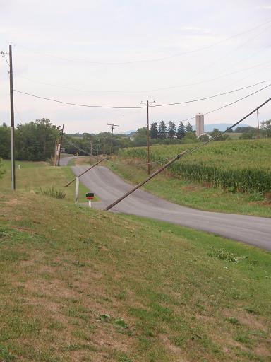
Above: Jefferson County WV power poles pushed over by wind. (Photo courtesy of Jefferson County Emergency Management)
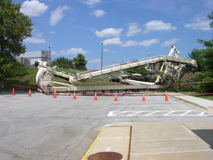
Above: Crane destroyed after being pushed over by wind at Montgomery County MD waste transfer station. (Photo courtesy of Montgomery County Emergency Management)
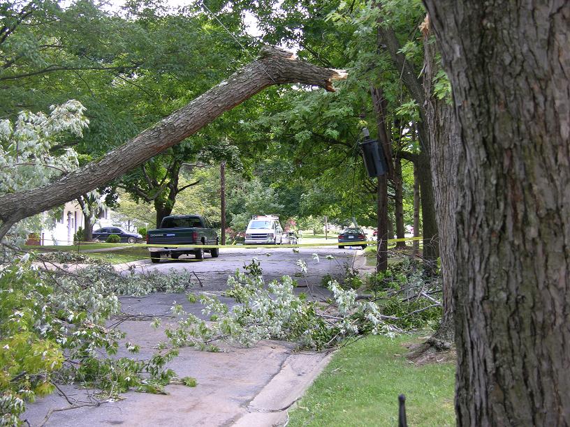
Above: The reason for many power outages across the area. (Photo courtesy of Montgomery County Emergency Management)
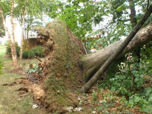
Large tree uprooted in Loudoun County VA (photo provided by NWS).
Also, here is a YouTube post of the storm from Maryland (the first few seconds show the worst for that spot)... https://www.youtube.com/watch?v=alSpvdZucB8


 Coastal Flood
 FAQ
FAQ