| Snow Amount Potential
Experimental - Leave feedback
|
|
| Expected Snowfall - Official NWS Forecast
What's this? |
High End Amount 1 in 10 Chance (10%) of Higher Snowfall What's this? |
| Low End Amount 9 in 10 Chance (90%) of Higher Snowfall What's this? |
|
| Percent Chance That Snow Amounts Will Be Greater Than...
Experimental - Leave feedback
What's this?
|
||||||||||||||||
|
||||||||||||||||
| Snowfall Totals by Location
Experimental - Leave feedback
What's this?
|
|
|
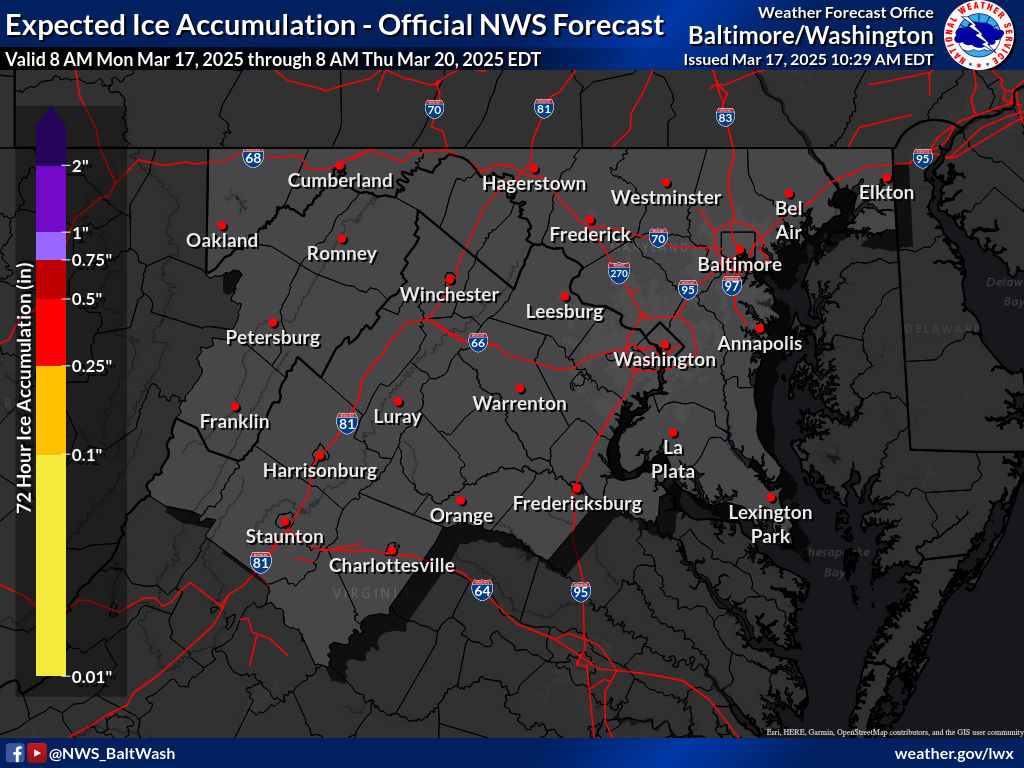
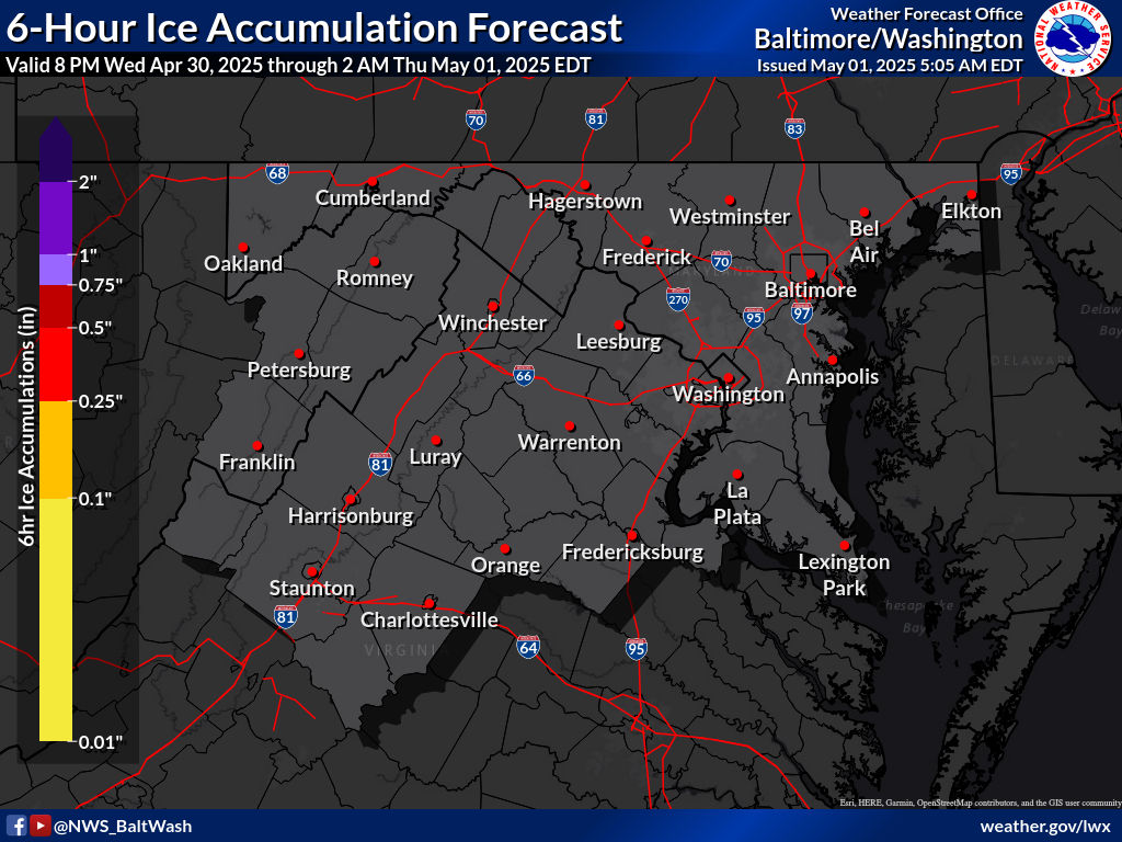
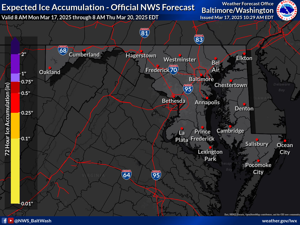
| Ice Accumulation Potential |
| Expected Ice Accumulation - Official NWS Forecast |
|---|
 What's this? |
 |
 |
 |
 |
| Snow Amount Potential
Experimental - Leave feedback
|
|
| Expected Snowfall - Official NWS Forecast
What's this? |
High End Amount 1 in 10 Chance (10%) of Higher Snowfall What's this? |
| Low End Amount 9 in 10 Chance (90%) of Higher Snowfall What's this? |
|
| Percent Chance That Snow Amounts Will Be Greater Than...
Experimental - Leave feedback
What's this?
|
||||||||||||||||
|
||||||||||||||||
| Other Snow/Ice Information | ||
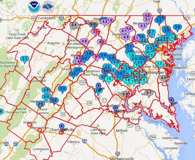
| Observed Snow/Ice Amounts | Winter Storm Severity Index | |
|---|---|---|
 |
 |
|
| What's this? | What's this? | |
| Useful Winter Weather Information | ||
| Historic Mid-Atlantic Winter Storms |
Winter/Snowfall Statistics |
El Niño and DC/Baltimore Winters |
| Watches, Warnings, & Advisories |
How to Measure Snow |
La Niña and DC/Baltimore Winters |
|
|
||
| At Home | On the Road | Outside in the Cold |
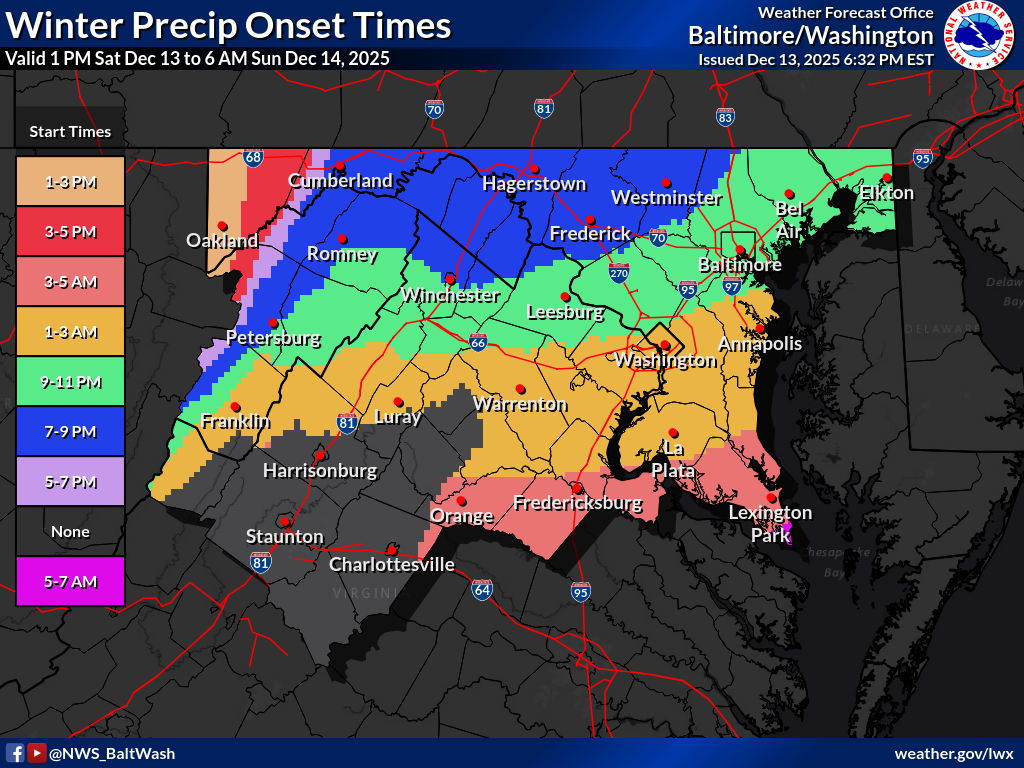
| Onset/End of Wintry Precipitation | ||
| Onset of Wintry Precipitation (For areas under Warning or Advisory) |
End of Wintry Precipitation (For areas under Warning or Advisory) |
|
|---|---|---|
 |
 |
|
| What's this? | What's this? | |
Precipitation OnsetMost likely time of winter precipitation onset (snow, sleet, freezing rain). Rain is not included here. This information is provided when we issue a Warning or Advisory for expected snow or ice accumulation; typically six to 24 hours in advance. Times are only given for places that are under a Warning or Advisory. They will be blank in areas outside Warnings or Advisories. Precipitation End TimeMost likely time that the accumulating winter precipitation ends (snow, sleet, freezing rain). Rain is not included here. This information is provided when we issue a Warning or Advisory for expected snow or ice accumulation; typically six to 24 hours in advance of the onset. Times are only given for places that are under a Warning or Advisory. They will be blank in areas outside Warnings or Advisories. |
||
| Long-Range Forecast | |
|
Days 4-7 |
|
| Day 4 Winter Weather Outlook | Day 5 Winter Weather Outlook |
 |
 |
| Day 6 Winter Weather Outlook | Day 7 Winter Weather Outlook |
 |
 |
| Days 4-5 Forecast Precipitation | Days 6-7 Forecast Precipitation |
 |
 |
|
Days 6-10 |
|
| Temperature | Precipitation |
 |
 |
|
Days 8-14 |
|
| TEMPERATURE | PRECIPITATION |
 |
 |
|
Week 3-4 |
|
|
TEMPERATURE |
PRECIPITATION |
 |
 |
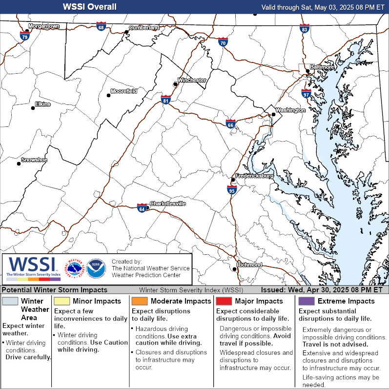
| Winter Storm Severity Index (WSSI) | Winter Storm Outlook (WSO) |
|---|---|
|
|
 |
| Maryland Ice Accumulation Forecast | ||
 |
||


 Coastal Flood
 FAQ
FAQ