 |
| High Water Situations |
| To help the local community in times of high water, the National Weather Service is spreading the word about Turn Around Don't DrownTM. |
|
|
 |
Turn Around Don't DrownTM (Hardy, Arkansas) |
 |
| |
 |
North central Arkansas, specifically along the upper Spring River, has a history of flood related problems. September 2006 was a tragic reminder of that statistic when two flood related deaths occurred. |
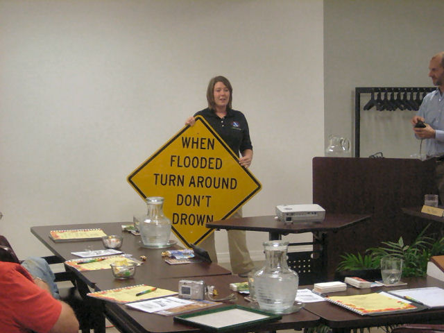
| In the picture: National Weather Service Little Rock Senior Service Hydrologist Tabitha Clarke dedicates high water signs at a Hardy (Sharp County) council meeting on 10/19/2010. Click to enlarge. |
 |
| In the pictures: Twenty four hour rainfall as of 7 am CDT on 09/23/2006. |
|
| |
|
A series of thunderstorms developed over northeastern Arkansas and brought nearly 15 inches of rainfall in portions of Sharp, Randolph, Clay, and Fulton counties. Water-levels on the Spring River climbed 13 feet in less than 12 hours, with nearly an 8 foot rise occurring in less than two-and-a-half hours.
|
| Rain at Hardy (Sharp County) |
| Date/Time |
Amount |
| 345 pm - 5 pm (09/22) |
0.7" |
| 5 pm - 9 pm (09/22) |
0.7" (Total 1.4") |
| 9 pm - 10 pm (09/22) |
1.3" (Total 2.7") |
| 10 pm (09/22) - 130 am (09/23) |
1.0" (Total 3.7") |
| 130 am - 3 am (09/23) |
1.1" (Total 4.8") |
| 3 am - 4 am (09/23) |
0.8" (Total 5.6") |
| 4 am - 5 am (09/23) |
1.8" (Total 7.4") |
|
Mayor Thornton of Hardy, Arkansas has been very proactive since the start of her position back in 2006. She helped institute a Flood Alert System, adding river gages along the Spring River and its tributaries. The USGS, in collaboration with the National Weather Service (NWS), developed a network of stream and rainfall gages on the upper Spring River that would alert emergency response personnel and the NWS at certain pre-determined rainfall rates and/or stream level changes.
Along with the Flood Alert System, Mayor Thornton has adopted a set of signs for her city. She placed these signs along a low water crossing on a small creek between Lake Sherwood and the Spring River.
"I have seen motorists trying to navigate through the water and one individual rescued," stated Mayor Thornton. "I thought these signs would serve as a reminder of how dangerous this road could become during high water."
|
| Each year, more deaths occur due to flooding than from any other thunderstorm related event. Why? The main reason is people underestimate the force and power of moving water. More than half of all flood related deaths occur in automobiles that are swept downstream. |
 |
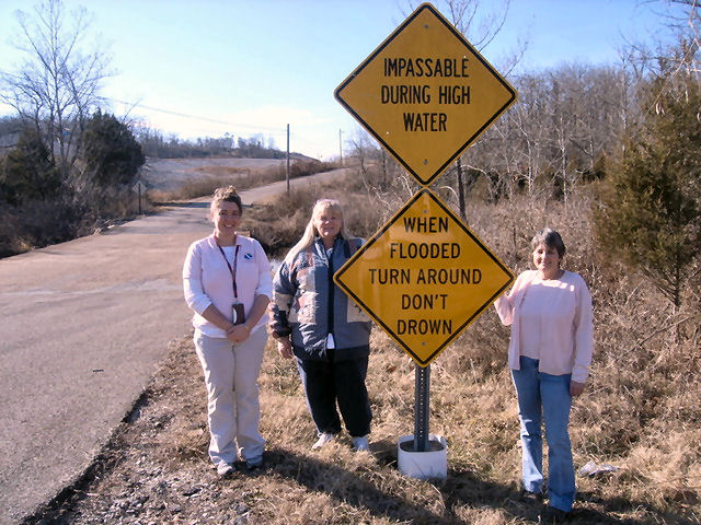
| In the picture (from left): Tabitha Clarke (Senior Service Hydrologist, National Weather Service Little Rock), Mayor Nina Thornton (Mayor of Hardy), Audrey Campbell (Water Clerk). Click to enlarge. |
 |
| In the picture: Map of Hardy (Sharp County), with high water sign placement in yellow. |
|
| |
|
Of these drownings, many are preventable, but too many people continue to drive around the barriers that warn the road is flooded or take precarious risks. A mere six inches of fast-moving flood water can knock over an adult. It takes only two feet of rushing water to carry away most vehicles. This includes pickups and SUVs.
|
 |
Whether you are driving or walking, if you come to a flooded road, TURN AROUND DON'T DROWN. You will not know the depth of the water nor will you know the condition of the road under the water. Mayor Thornton did the right thing by utilizing one of the NWS' newest campaigns, Turn Around Don't DrownTM (or TADD). |
| In the picture: Barriers are there for a reason. Don't ignore the barriers! |
|
TADD is a National Weather Service campaign to warn people of the hazards of walking or driving a vehicle through flood waters. Several counties are adopting TADD signs and posting them at locations where flash flooding often leads to water over the roads.
These TADD Warning Signs are compliant with the Federal Highway Administration's regulations and can be produced and deployed as an official road sign. If your community would like more information on purchasing these signs, contact the Senior Service Hydrologist at the NWS Little Rock office. Civic groups may consider donating or raising money to give to their local community officials for purchase of these TADD signs.
|
|
|