 |
| About This Page |
| Arkansas has had its share of historic events, many of which will be in our memories for years to come. |
|
|
 |
Historic Snow and Ice Storms in 2000 |
 |
| |
 |
The year 2000 began with a major winter storm bringing a lot of snow to Arkansas on January 27th and early on the 28th. The storm came after a prolonged period of warmer than normal weather and no measurable snow for almost three years in some areas including Little Rock (Pulaski County).
|
| In the picture: Snowfall on January 27-28, 2000. |
|
It was the heaviest snow in 12 years, with 4 to 8 inches or more common. Parts of southern Arkansas received over a foot of snow.
|
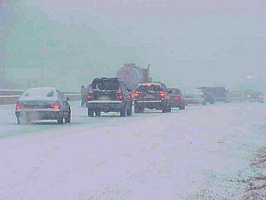 |
| In the picture: U.S. 67/167 near Jacksonville (Pulaski County) was snow and ice covered. Click to enlarge. |
 |
There were plenty of problems on area highways, with numerous accidents reported. In southern sections of the state, chicken houses collapsed under the weight of the snow.
|
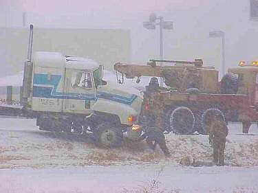
| In the picture: A truck was stalled just south of Jacksonville (Pulaski County). Click to enlarge. |
|
Several cold weather episodes affected the region in late December, 2000. Arctic cold fronts from the northwest brought much below normal temperatures, with two major snow and ice storms occurring. The first event occurred on the 12th and 13th, with the second event from the 25th through the 28th.
|
|
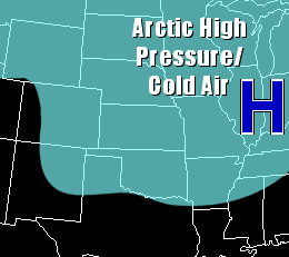
The setup for both events was similar. Arctic high pressure built into the state from the north, bringing at or below freezing temperatures near the ground.
|
|
| In the pictures: The surface map on 12/25/2000 featured Arctic high pressure ("H") in the Ohio Valley and surrounded by subfreezing conditions. A storm system ("L") to the southwest pulled warmth and moisture toward the region from the Gulf Coast. This warmer air flowed overhead, with frozen precipitation melting and becoming icy toward the ground. |
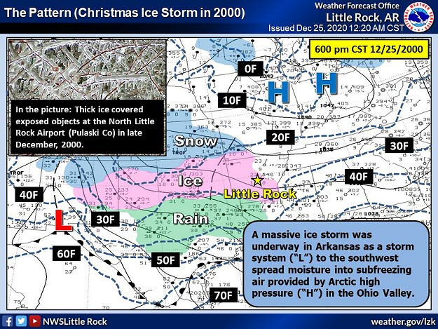 |
| In the picture: A massive ice storm was underway in Arkansas as moisture spread into subfreezing conditions by the early evening of 12/25/2000. The high temperature for the day was only 26 degrees F at Little Rock (Pulaski County). |
|
| |
|
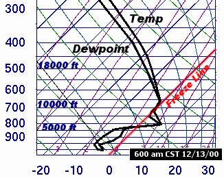
Meanwhile, a southwest wind developed ahead of storm systems approaching from the southwest, with warmer air trying to surge into Arkansas.
|
|
|
The end result was an overrunning situation, with warmer air flowing over the top of colder conditions near the ground. |
| In the picture: A sounding (temperature and dewpoint profile with height) at Little Rock (Pulaski County) showed a nose of above freezing air aloft, and subfreezing conditions near the ground at 600 am CST on 12/13/2000. The result was freezing rain and sleet. |
|
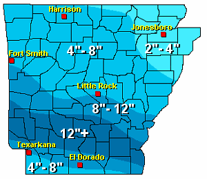
The storm on the 12th and 13th produced primarily snow in the extreme north, with sleet and some snow from west central into north central sections. For much of central and southern Arkansas, freezing rain and sleet were common with a major ice storm noted.
|
 |
| In the picture: Snow and ice accumulations on December 12-13, 2000. |
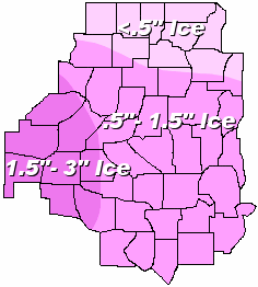 |
During the second event (the 25th through the 28th), mostly freezing rain and sleet were produced. Icing was most extreme in western sections of the state, with up to three inches of ice reported.
|
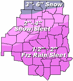
| In the picture: Ice accumulations on December 25-28, 2000. |
|
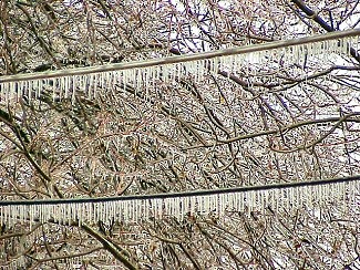
Ice collected on trees and power lines during both events. The buildup of ice stressed trees and tree limbs to the point where they fell on houses, causing some structural (mostly roof) damage. Also, power lines were downed by fallen trees, or snapped due to the weight of the ice...with numerous power outages noted. Over 500,000 customers lost power, with many customers without electricity for days (and weeks in some cases).
Looking back at the records, the events of December, 2000 were comparable to the ice of December, 1932. In the end, this was the worst icing in almost 70 years and the costliest natural disaster in state recorded history.
|
| Icy Pictures (December, 2000) |
 |
| In the picture: Trees and power lines were covered with ice in the Little Rock (Pulaski County) area. Click to enlarge. |
|
 |
| In the picture: Walking and driving became difficult to impossible. Click to enlarge. |
|
| |
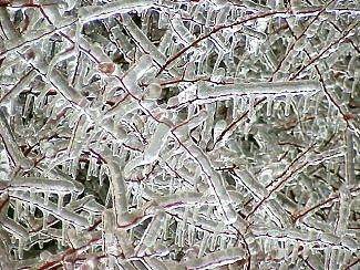 |
| In the picture: Trees were easier to recognize, but were stressed by the ice. Click to enlarge. |
|
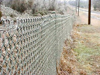 |
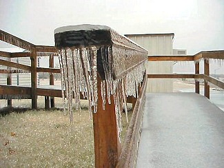
| In the picture: Other objects such as roads, cars and this fence were also coated. Click to enlarge. |
|
| |
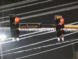 |
| In the picture: Many street lights stopped working, but not at this intersection. Click to enlarge. |
|
|
|