
Scattered thunderstorms with severe gusts, hail and a tornado risk are possible near a cold front from the Ohio Valley to the Mid-Atlantic tonight. Tropical Storm Bertha is expected to bring tropical storm conditions to portions of the Gulf Coast from the panhandle of Florida into Louisiana through Wednesday. Read More >
Early Friday morning, the National Weather Service in Midland conducted a damage survey in Mitchell County. Damage occurred Thursday afternoon at approximately 1:50 pm to a total of eight structures near Colorado City, as a complex of thunderstorms moved across the area. No injuries or fatalities occurred. Four of the structures sustained significant damage. The following are conclusions from that damage survey.
Damage was noted along a narrow path from near Farm to Market Road 1983, one half mile south of Interstate Business 20 just west of Colorado City, to the KVCM-KAUM radio station, and westward for another 1/4 mile along Business 20. This tornado developed and moved northwestward, then westward along this path.
The tornado’s damage path was approximately 30 yards wide. Eyewitness accounts also indicated a small and intense circulation, consistent with observed damage. The damage was intermittent, and stretched for a total distance of approximately one mile. Only a very small area along this track sustained F1 damage, with weaker F0 damage along the remainder of the path. The F1 damage classifies this tornado as a weak tornado on the Fujita Tornado Intensity Scale. Wind speeds were estimated to range from 90 to 100 mph based on observed damage.
The F1 damage occurred to one well-constructed residential structure. Winds associated with the tornado appeared to have initially impacted the home’s garage, allowing high winds to enter the northeast portion of the structure. This resulted in a large portion of the roof being lifted off of the home. Large pieces of roof debris caused additional damage downwind. Eyewitnesses reported large amounts of airborne debris at this time. The debris field along the tornado’s path also indicated the presence of a circulation.
The survey indicated that while a tornado-like vortex existed, this vortex was dissimilar from a supercellular tornado in that it did not move with the parent storm. Yesterday’s thunderstorms moved from west to east over Mitchell County, while the tornado moved in an opposite direction. Eyewitness reports of torrential rainfall immediately following the tornado suggest that the tornado’s development may have initially been associated with the thunderstorm’s outflow. The vortex, however, was likely enhanced as it moved under a nearby updraft or perhaps by a nearby frontal boundary.
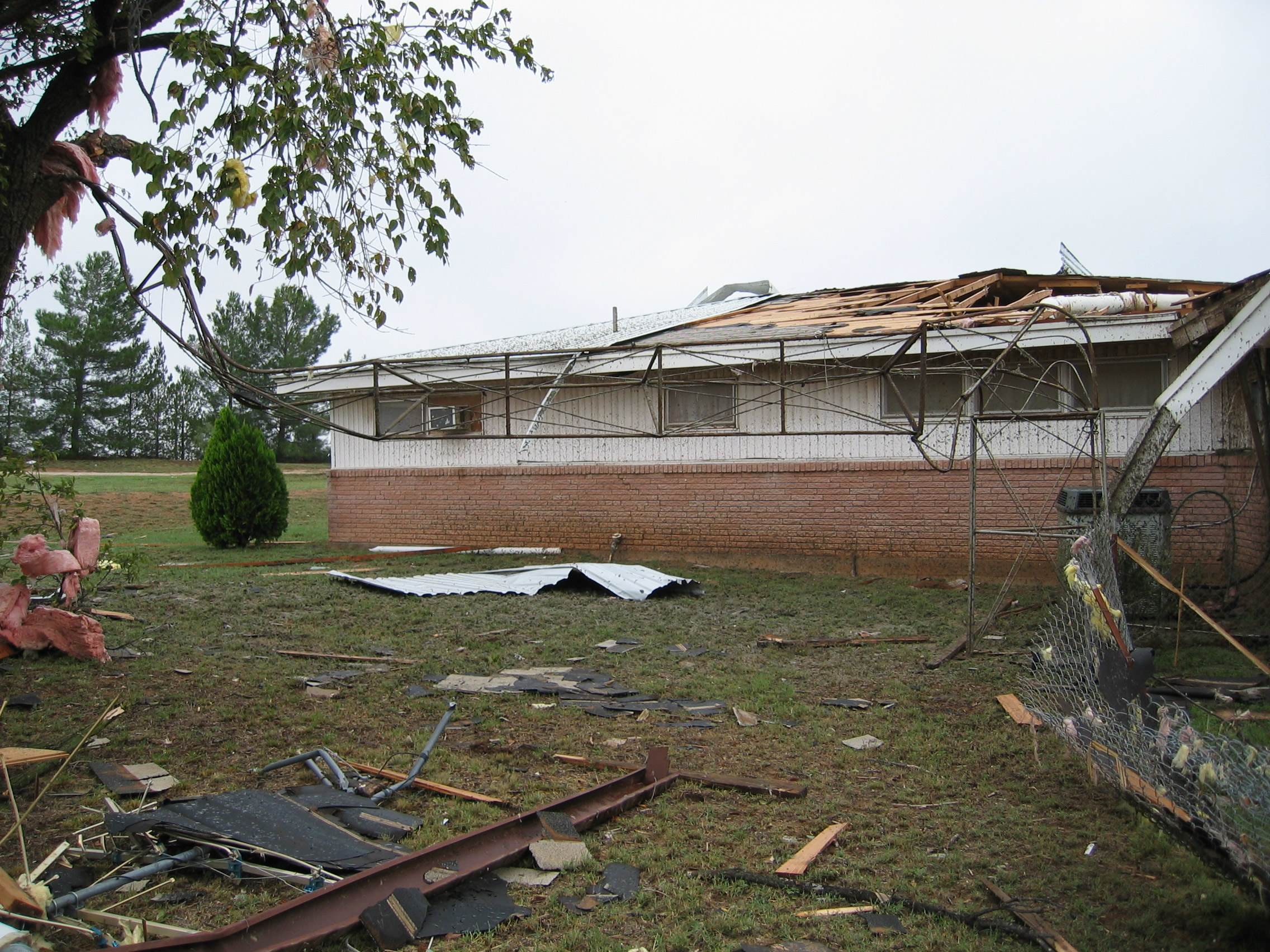
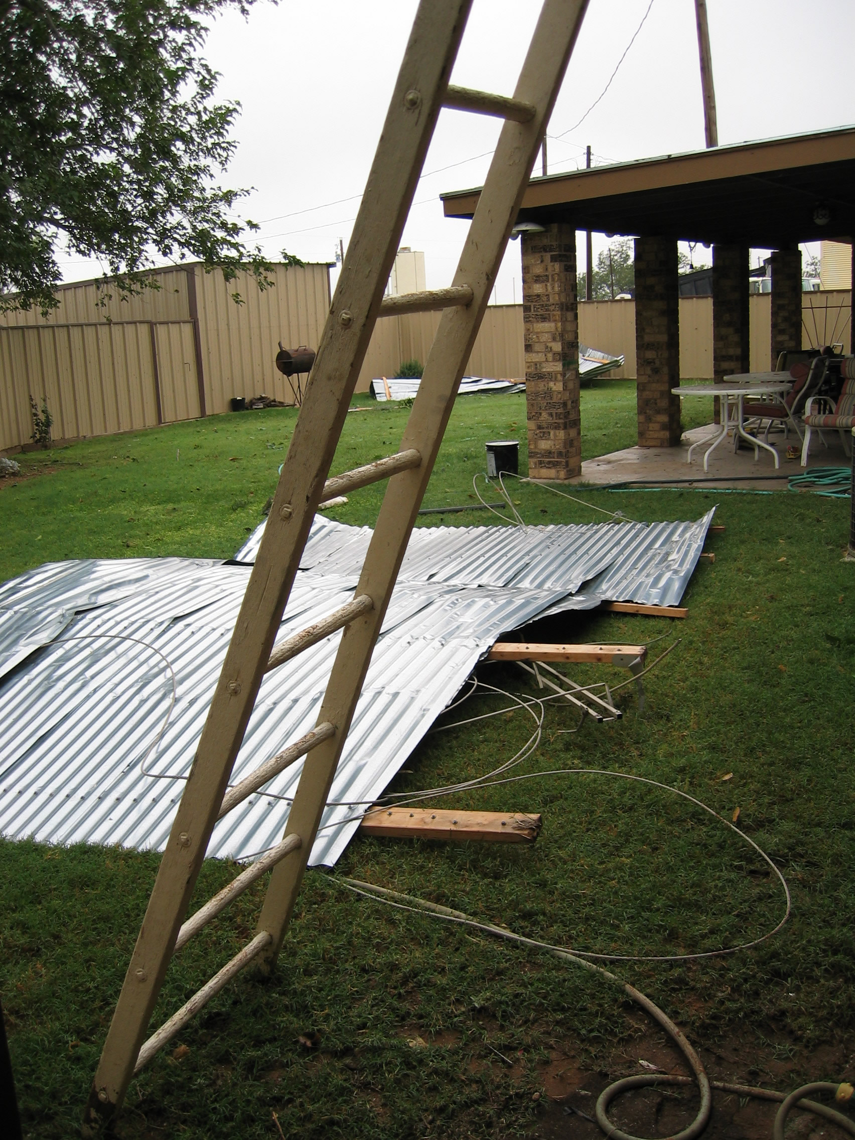
This is the backside of a house west of Colorado City on Business Loop 20 that suffered F1 tornado damage. This view is from the south side of the house. The garage failed allowing high winds to rush into house, pushing off a section of the roof. Note the television antenna that was pushed over, probably by blowing debris.
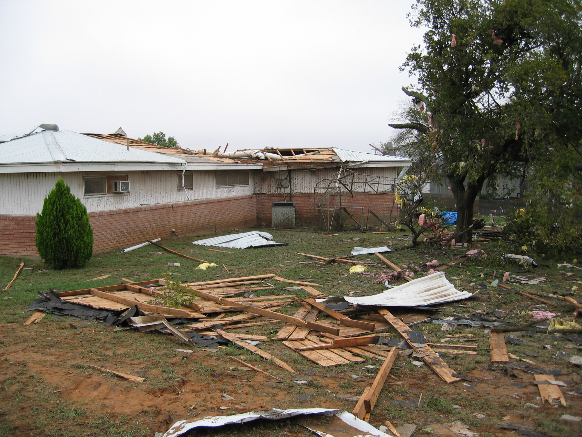 This photo, taken from the southwest of the same house at a greater distance, reveals a section of roof that was blown from the house.
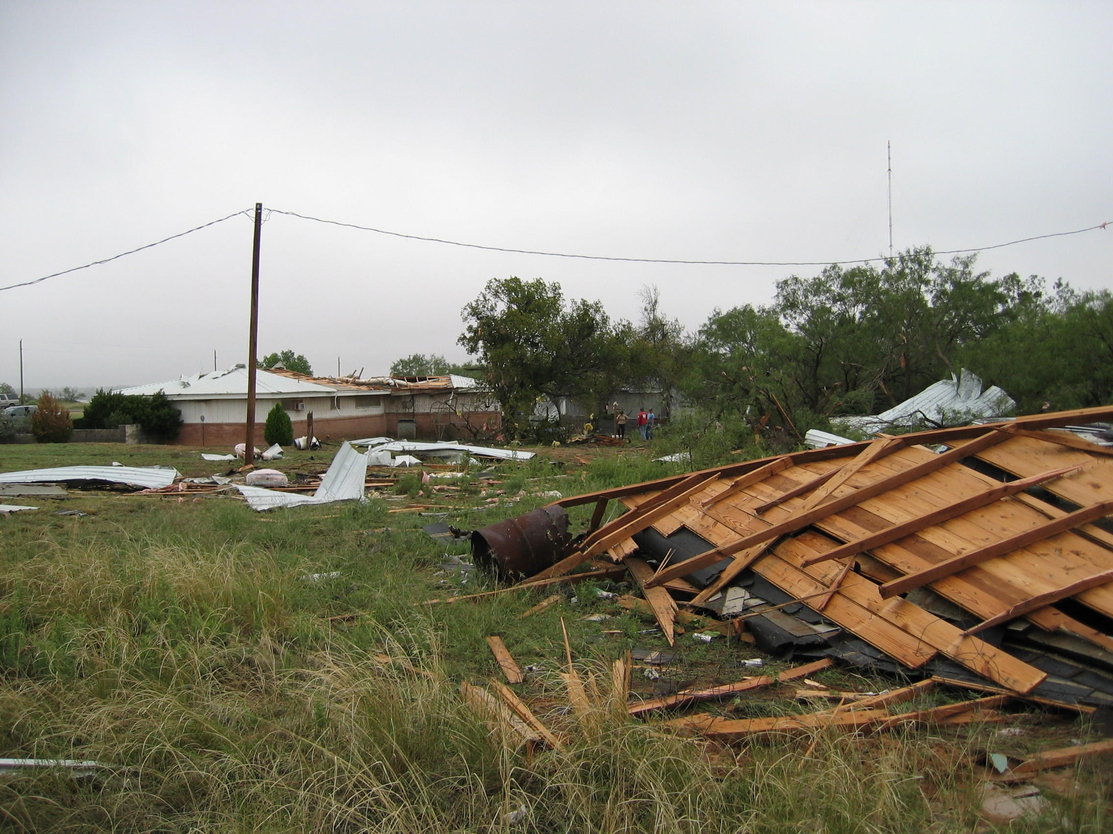
Again looking from the southwest at an even greater distance, a section of roof blown from the the house rests at a distance of better than 200 feet.
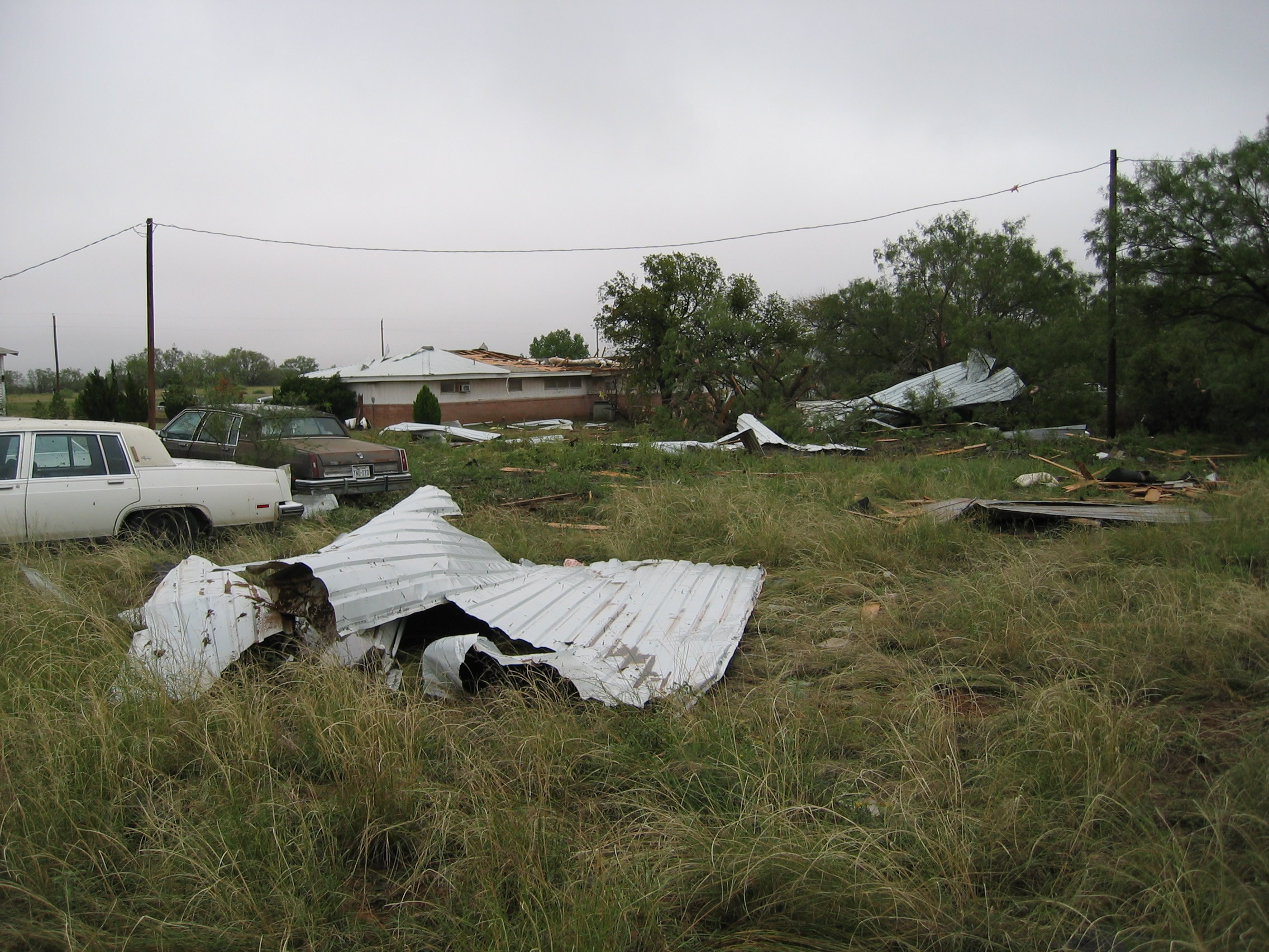
Looking from a greater distance yet, more roofing material appears to the right. Note the cars on the left side of the photo. The white car was parked parallel to the other car. It is believed that the combination of high winds and debris from the tornado rotated the white car 90 degrees to the left.
This house, located 2 houses west of the one suffering the greatest damage, was virtually untouched by the tornado. The debris shown here originated with the house that received F1 damage. This houses owner saw the tornado and the associated debris field. As he approached his home in his vehicle, he had to back up to avoid the rather large pieces of flying debris.
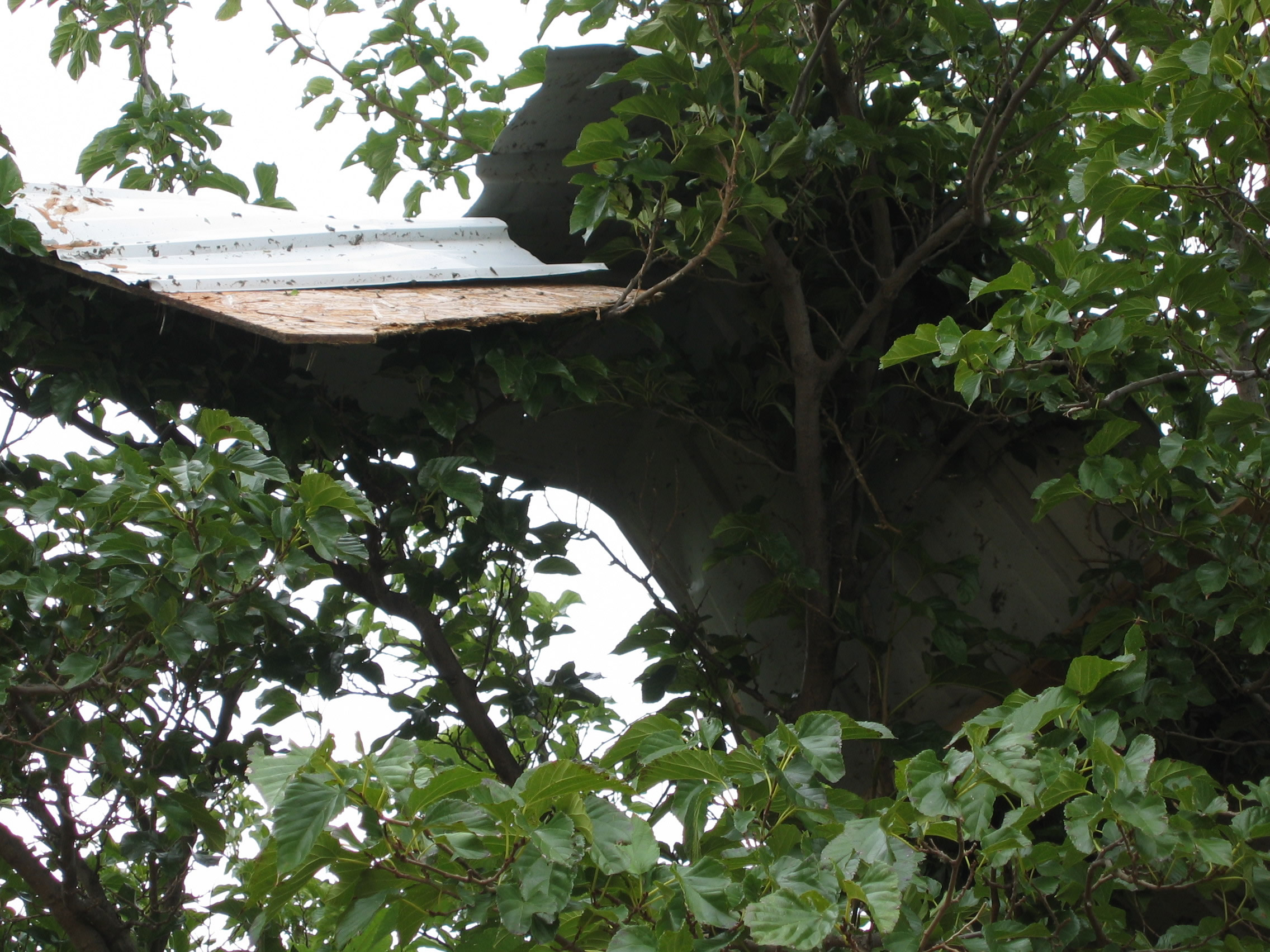
This is a photo taken by the same house. Notice the roofing material that was blown from the first house and into the tree by the tornado.

