
Numerous severe thunderstorms are expected across a broad region from the Ohio Valley to the Mid-Atlantic and Northeast States today into tonight. Swaths of damaging wind gusts are expected and some tornadoes are possible. Bertha is expected to bring tropical storm conditions to portions of the Gulf Coast from the Florida Panhandle westward to southeastern Louisiana later today and Wednesday. Read More >
Midland/Odessa
Weather Forecast Office
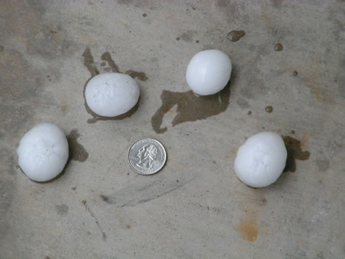
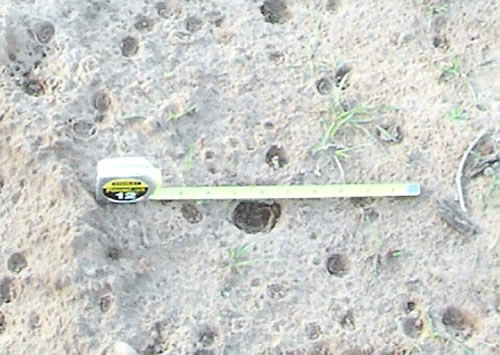
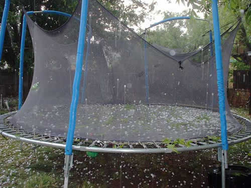
A severe thunderstorm rolled over Carlsbad, New Mexico during the evening hours on May 6, 2005. This storm developed over Whites City around 5:20 pm mdt, then quickly strengthened as it moved northeast towards Carlsbad. A severe thunderstorm warning was issued at 5:48 pm MDT, with penny sized hail first reported on the south side of Carlsbad at 6:09 pm. This thunderstorm continued to intensify and storm spotters reported golf ball size hail at 6:13 pm in the downtown area. Hailstones continued to pound the city with tennis ball size hail being reported at 622 pm. This thunderstorm began to move east of the city around 6:30, but remained severe as it moved over the community of Otis. As this storm continued to move east along Highway 128, storm spotters reported a possible tornado approximately 15 miles southeast of Carlsbad at 7:19 pm MDT. A tornado warning was issued for east central Eddy county at 7:22 pm , with a brief tornado sighted 22 miles southeast of Carlsbad along Highway 128 at approximately 7:26 pm.
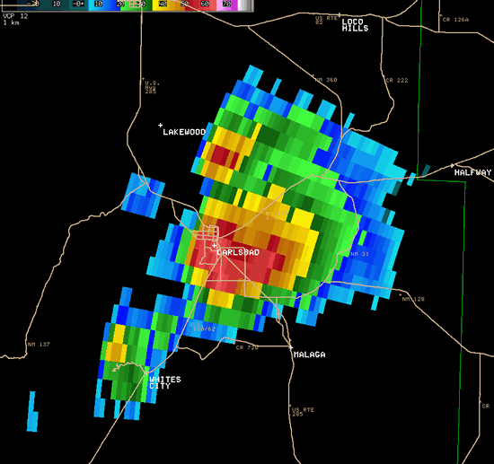
The radar image shows a severe thunderstorm over Carlsbad, New Mexico at 6:22 pm mdt on May 6, 2005. Tennis ball size hail was reported around this time.
Thanks to our weather spotters for your reports and pictures.
The severe thunderstorm warning issued by the National Weather Service in Midland provided a 21 minute lead time for the residents on the south side of Carlsbad and a 25 minute lead time for those in the downtown area.
Because of the teamwork between the National Weather Service and Eddy County emergency manager, Joel Arnwine, more than 500 people at the Carlsbad Relay for Life Event were able to take shelter well in advance of this severe thunderstorm, thus preventing injury.
Hazards
Spotter Briefing
Outlook
Current Hazards
Storm Report
Severe Weather
Drought
Storm Prediction Center
Weather Prediction Center
National Hurricane Center
Active Alerts
Winter Weather
Past Weather
Cooperative Observations
Local Climate Data
National Climate
Current Weather
Observations
Satellite
Upper Air
West Texas Mesonet
Radar
Forecasts
Activity Planner
Aviation
Climate Prediction Center
Fire
Forecast Discussion
Graphical
Local
Space Weather Center
Information Center
Weather Trivia
Forecast Models
GIS
International Weather
Glossary
Road Conditions
Water
Hydrology
Precipitation Estimates
Quantitative Precipitation Forecasts
US Dept of Commerce
National Oceanic and Atmospheric Administration
National Weather Service
Midland/Odessa
2500 Challenger Dr.
Midland, TX 79706-2606
(432) 563-5006
Comments? Questions? Please Contact Us.

