Dangerous and extreme heat will remain across portions of the southern U.S. this week. Heavy rainfall may bring significant flash flooding across portions of the Mid-Atlantic and Northeast through the night, and additional flash flooding concerns across New England on Wednesday. Monsoonal thunderstorms will bring a flash flood risk to the Four Corners region, especially in burn scar areas Read More >
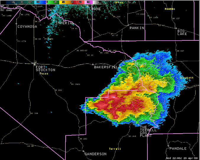
During the late afternoon on April 29, thunderstorms developed over portions of eastern Pecos County. Eventually, storms intensified and began to exhibit strong rotation. The first tornado warning was issued for a storm northwest of Bakersfield in east central Pecos County at 2:43 pm CDT.
Supercell thundertorms continued to develop across the area - each storm developing farther to south than the first. A tornado warning was issued at 3:49 pm CDT for eastern Pecos County and extreme northern portions of Terrell County for a storm located 13 miles south of Bakersfield. Then, at 4:21 pm CDT and again at 4:52 pm CDT, the National Weather Service in Midland issued tornado warnings for portions of northern Terrell County. It was within these two warning areas, that the National Weather Service received reports of significant damage due to a tornado. The following is the 0.5 degree reflectivity image from 5:00 pm CDT. The "Home" location marks the tornado damage.
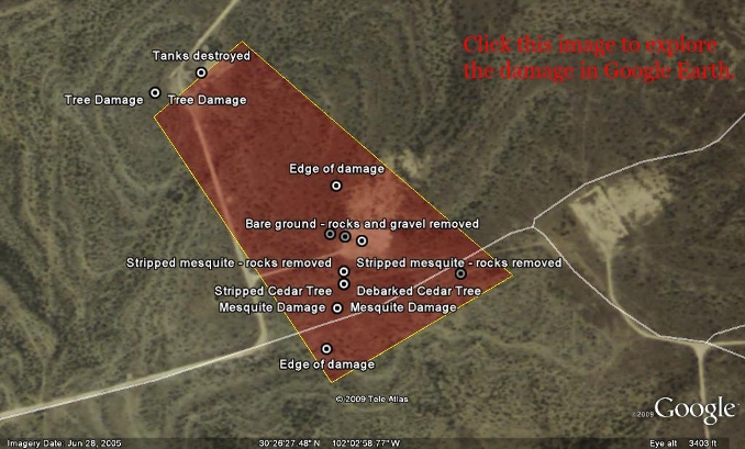
On May 1, the National Weather Service conducted a damage survey of this location, 13 miles northwest of the Terrell Gas Plant, between Farm to Market Road 2400 and State Highway 349. The following are the findings from that event.
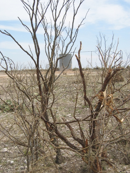
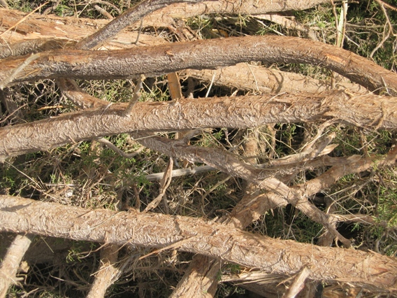
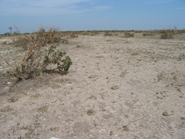
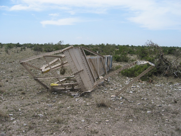
The damage found by the storm survey team indicated one of the most intense tornadoes of the last decade across the WFO Midland County Warning Area. Extensive damage was done to mesquite and cedar trees in the area. While the mesquite remained in the ground, in many cases it was stripped of leaves and debarked. The cedar trees were uprooted in many cases. The following images are example of that.
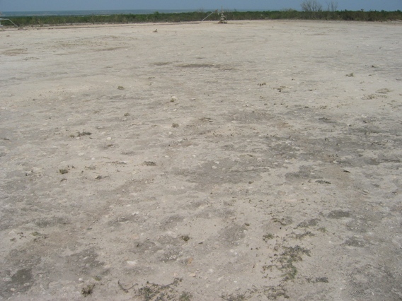
Along the damage path, gravel and larger rocks were scoured from the ground, leaving bare ground. The following images show examples of this.
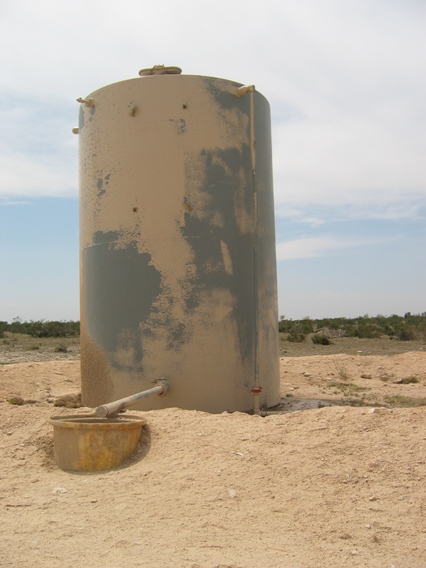
The following is an image of a recently painted 300 barrel oil storage tank. In this case, the paint was removed from the tank. The tank remained in place because it contained just under 6600 gallons of oil. Estmated weight of the oil and tank were calculated at approximately 41,000 pounds. The stairs attached to the tank were ripped from the tank as well.
Overall, the width of the tornado was estimated at 300-400 yards. Due to the remote nature of the location, the lack of a road network, and the topography, a good estimate of the damage path length was not possible. However, evidence supports the tornado being on the ground for just under half a mile. Radar imagery supports the existence of the tornado for a much longer time period than that.
Based on all evidence, the tornado will be rated as a high end EF2 tornado. Based on damage indicators, the wind speeds were estimated at around 130 mph with this tornado. Click the following image to display a Google Earth map showing the location of the tornado path and other damage images.