On October 8, 2009, an intense supercell thunderstorm approached Saint Lawrence, TX from the south southwest around 6:35 PM CDT. Saint Lawrence is located about 12 miles south southwest of Garden City, TX.
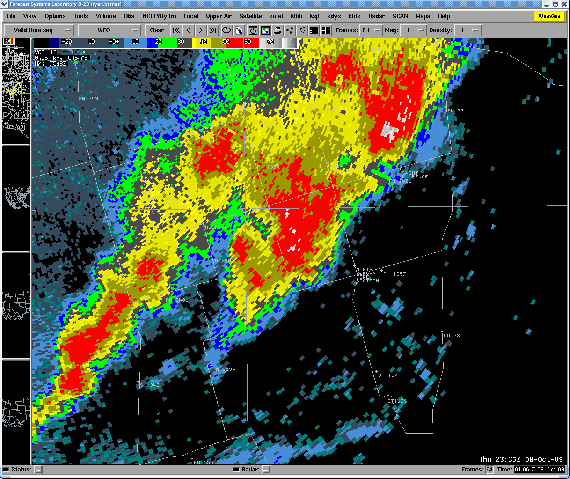
Straight line winds estimated to be near 70 to 80 mph, produced by a downburst, resulted in significant damage across extreme northwestern Reagan County and extreme southwestern Glasscock County. This storm first moved across State Highway 137 over extreme northwestern Reagan County, causing damage to multiple power poles along the roadway.
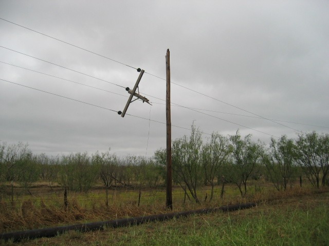
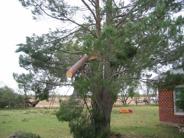
Some of the poles were snapped near their bases, and others were damaged near their tops. As the storm progressed north northeastward, a residence along State Highway 137 (just south of the county line) also experienced damage to its property. Numerous tree branches, some 8 to 12 inches in diameter, were snapped.
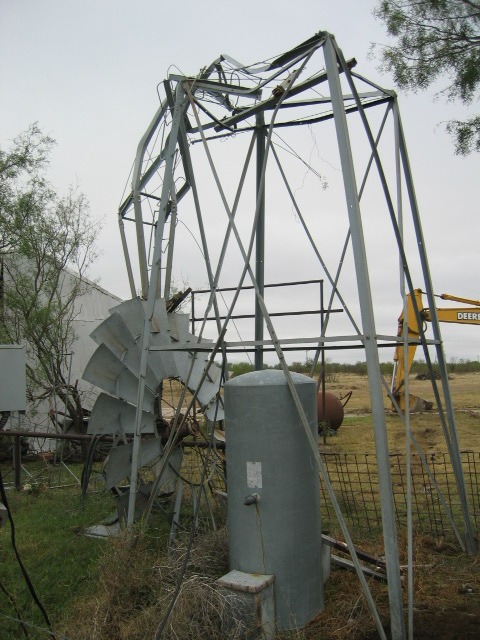
Two windows on the southwest corner of the home were also broken by the strong winds. A windmill near the back of the home was bent in half by the winds, and a 4’X4’ metal dumpster was assumed to be tossed several yards to the northeast (it was not found). In addition, some shingles were torn off the southwest portion of the home’s roof.
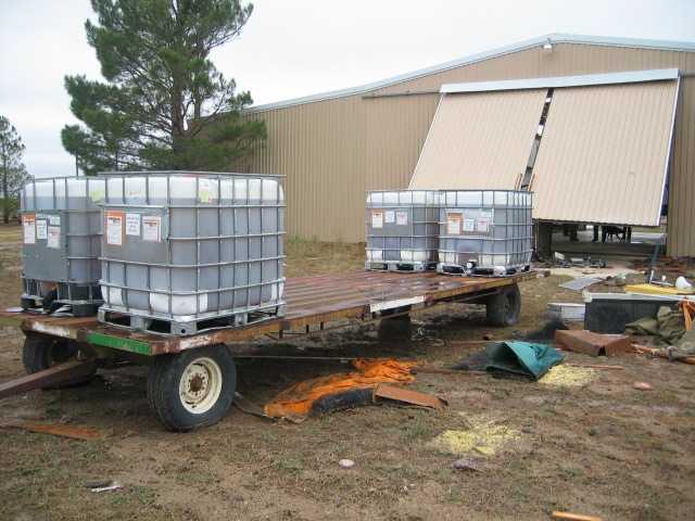
Large hail also accompanied the storm, and over 200 acres of cotton were destroyed. Most of the hail that fell was quarter size, but there were also isolated reports of tennis ball size hail. The most significant damage caused by the storm was at a residence along Farm Road 2401 about 1 mile east of the State Highway 137/Farm Road 2401 intersection. Here, large pine tree branches about one foot in diameter were snapped near the top of the tree. A couple of windows were also broken on the south side of the home. A large A-Frame metal barn was heavily damaged, with both doors bent from a south to north direction. The winds funneled through this structure and pushed a 4 ton trailer about 60 feet outside of the building. Heavy metal cabinets were also thrown from the barn. The barn’s steel roof support beams were bent and a piece of the tin roofing was thrown nearly 200 yards to the north northeast.
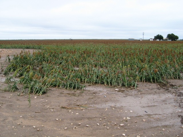
Just north of the aforementioned residence (across Farm Road 2401), sorghum crops were bent towards the north northeast near their bases.
The National Weather Service’s storm damage survey completed the following morning suggested strong straight line winds caused all of the damage, and not a tornado.

