
Widespread life-threatening flash and urban flooding will continue to pose a significant threat to life and property in south-central Texas. Catastrophic fiver flooding, with rapid rises on small streams, arroyos, and typically dry washes, is expected. Monsoonal showers persist across the Great Basin and Southwest with greatest flash flooding in southern Arizona. Read More >
On Friday, September 10, the National Weather Service in Midland conducted a damage survey of locations southeast of Lamesa in Dawson County for severe storms that occurred the previous evening. The survey found a significant amount of damage around Highway 87. The following is a clickable Google map:
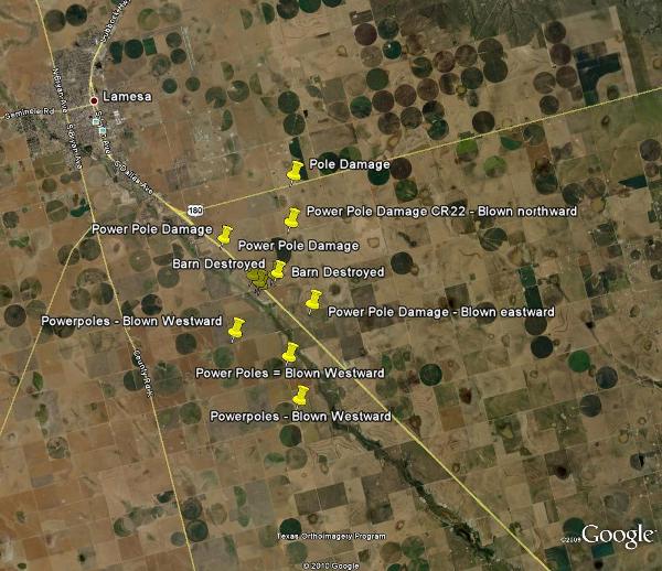
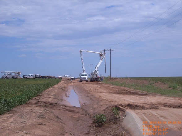
A total of 35 power poles were damaged/knocked over by the thunderstorm's strong winds. Two poles were knocked down two to three miles east of the Highway 180/87 junction. Just south of that location, 13 poles were damaged along County Road (CR) 22. In these cases, strong south winds cause the pole damage. Further south, 10 poles were damaged along County Road P. In these locations, severe westerly winds blew the poles eastward. West of Highway 87, 10 more poles were blown to the west (an east wind) along County Roads N, M, 24, 25, and 26.
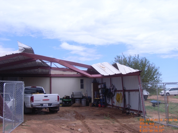
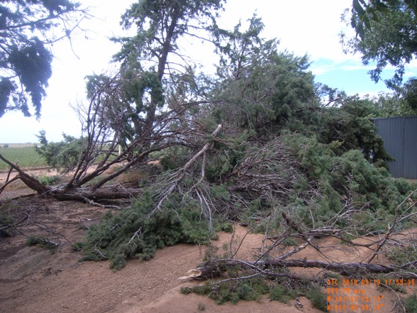
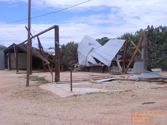
A carport, barn, irrigation equipment, and a motor home were among the many items that sustained significant damage in this area of Dawson County. Significant tree damage also occurred in some areas.
The image below shows the severe thunderstorm at 7:03 pm CDT.
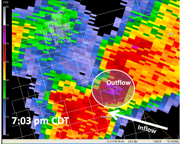
Based on the orientation of damaged power poles west of Highway 87 along County Roads N, M, 24, 25, and 26, and images of a lowering from the storm provided by KCBD Channel 11 in Lubbock, the damage survey team concluded that the most likely cause of damage at these locations was severe inflow winds in advance of the storm - between 6:55 pm and 7:00 pm CDT. However, the team cannot rule out the possibility that these poles fell due to microburst winds.
The NWS survey team concluded that the much of the remaining damage was mostly likely caused by a wet microburst. Some residents noted that as much as 5 inches of rain fell in one hour – indicative of a wet microburst event. The orientation of the pole damage and the location of the storm also support this observation. However, in some locations, such as where the barn was destroyed east of Highway 87 along CR 23, it is uncertain whether inflow winds leading up to the storm or outflow microburst winds exiting the storm caused the extensive damage.
Based on the widespread nature of the damage, the orientation of this damage, and radar information, it is highly unlikely that a tornado formed. However, images provided by KCBD suggest the presence of a possible wall cloud and strong storm updraft to the south of the microburst area. Quarter size hail also suggests that a significant updraft was present in the storm. It is believed that as drier air wrapped into the storm from the west, tornado formation was inhibited.
In summary, based on damage, it is believed that wind speeds were in the 75-100 mph range for this event. There are strong indications that the event was a combination of both severe inflow and microburst type winds. While the potential for a tornado was present, one did not occur and other contributing factors resulted in the Dawson County wind damage.

