
A significant heat wave is underway for the Intermountain West, Northern Plains, and Upper Great Lakes, peaking in intensity through midweek and lingering across parts of the Northern Plains and Midwest until this weekend. In southwest Texas, excessive rainfall may bring a risk for potentially life-threatening flash and arroyo flooding through Thursday. Read More >
Lake Michigan 2021 Beach Forecasts and Services
Will you be safe from dangerous swimming conditions on Lake Michigan this year?
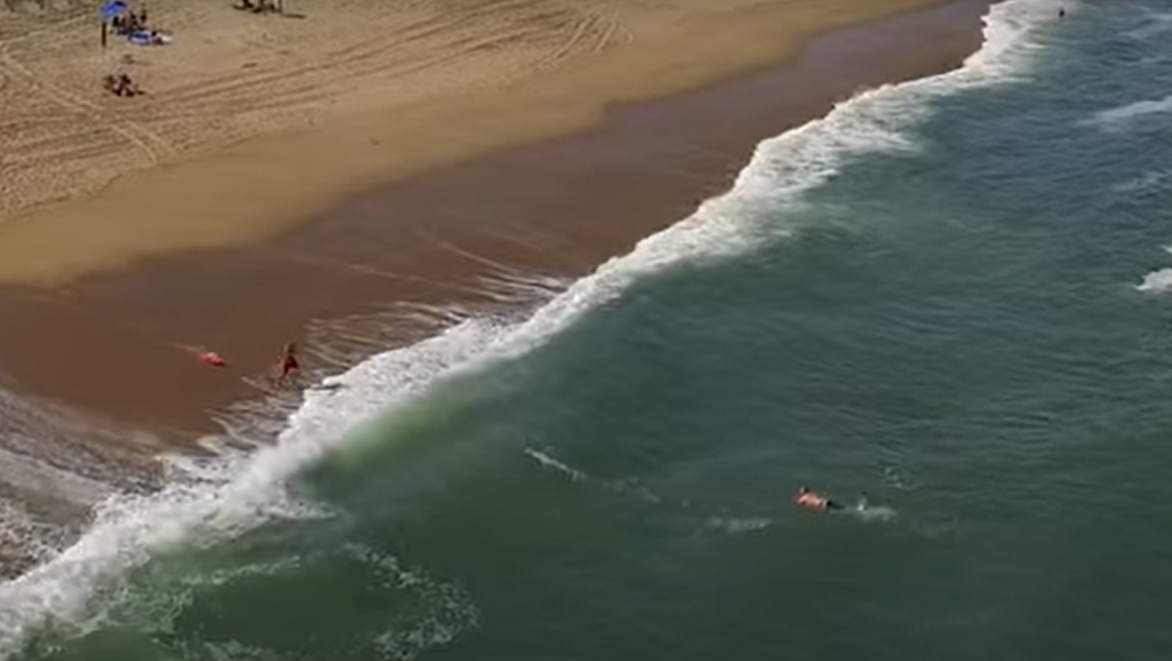
According to the Great Lakes Surf Rescue Project, there were 109 drowning deaths on the Great Lakes in 2020, an increase of 12 from 2019. Since records began, the highest number of drowning deaths was 117 in 2018. Since 2010, there have been 962 drowning deaths on the Great Lakes, with nearly 50% of the deaths occurring on Lake Michigan. That is why Lake Michigan is known as the "Deadliest" Great Lake. Already in 2021, through May 7th, there have been 6 drowning deaths on Lake Michigan. For a year by year summary of current-related incidents, check out the the Great Lakes Current Incident Database Seasonal Summaries webpage.
Each year there are an average of 12 drowning fatalities and 23 rescues due to dangerous currents on the Great Lakes (10 year average). Most of these incidents have occurred on Lake Michigan's eastern shore due to the prevailing wind direction resulting in favorable current development. This is also a popular tourist destination. Although not as common, fatalities do occur on the western shore of Lake Michigan due to dangerous currents. From 2002 through 2020, there were 13 current related deaths at Lake Michigan beaches from Sheboygan to Kenosha.
To help beach goers and swimmers remain safe at Lake Michigan beaches, the National Weather Service (NWS) in Milwaukee provides a daily beach forecast for beaches along Lake Michigan from Sheboygan south to the Kenosha area. This daily beach forecast includes a "swim risk" for the coming day. The "swim risk" will help you assess the risk of swimming in Lake Michigan, and can help you avoid an unnecessary trip to the beach due to expected dangerous swim conditions.
The NWS Beach Services program also provides decision support to beach managers, park patrols, and other officials for staffing, beach closures, and other beach-related concerns. For 2021, the NWS Beach Services forecast and program will begin on Wednesday, May 26th, with the first issuance of the Surf Zone Forecast (formerly Recreational Beach Forecast) for beaches along Lake Michigan from Sheboygan to Kenosha. The Beach Services season will continue through the end of September.
Why "Surf Zone"? The definition of the Surf Zone is the "area of water between the high tide level on the beach and the seaward side of the breaking waves". To maintain consistency between NWS offices in the Great Lakes and along the coastal areas, the Recreational Beach Forecast will now be called the Surf Zone Forecast, but it contains the exact same forecast information as previous years.
The Surf Zone Forecast will be issued around 4 am CDT and will provide a forecast of weather and water conditions expected at Lake Michigan beaches for the coming day and night. Forecast information for the beach will include expected weather, wave heights, water and air temperature, beach winds, the Ultraviolet Index and sunrise and sunset. Most importantly a "Swim Risk" will be provided for the coming day that is based on the expected wave heights and winds.
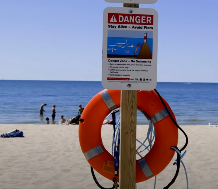
A Low Swim Risk implies that dangerous waves and currents are not expected at the beach. However, dangerous currents may exist at any time near piers, breakwalls, and river outlets. Always use caution and never swim alone.
A Moderate Swim Risk implies that breaking waves and currents are expected at the beach. Stay away from dangerous areas like piers, breakwalls, and river outlets at these times. Always have a flotation device with you in the water.
A High Swim Risk implies that life threatening waves and currents are expected. Stay out of the water, and away from dangerous areas like piers and breakwalls.
A second Surf Zone Forecast will be issued around 5 pm CDT, providing a detailed beach forecast for the coming night and next day.
Here is an example of an early morning issuance of the Recreational Beach Forecast for Lake Michigan beaches in Sheboygan county:
.PNG)
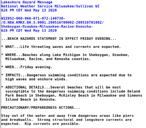
If winds and waves are expected to causing dangerous swimming conditions and a High Swim Risk for the coming day, overnight or possibly the next day, then the National Weather Service will issue a Beach Hazard Statement. The Beach Hazard Statement emphasizes the dangerous swimming conditions expected, the time of the dangerous conditions and which beaches would be most susceptible to these conditions.
Here is a sample Beach Hazard Statement for Lake Michigan beaches in Sheboygan, Ozaukee, Milwaukee, Racine and Kenosha counties:
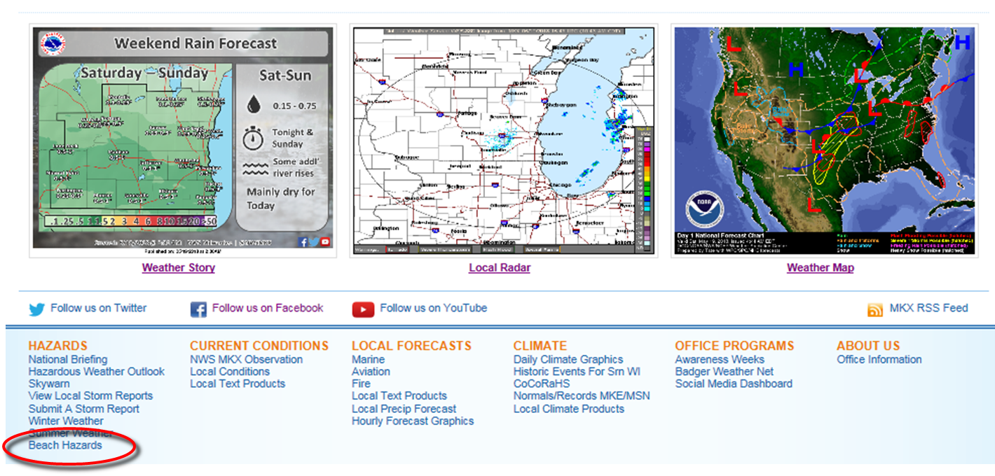
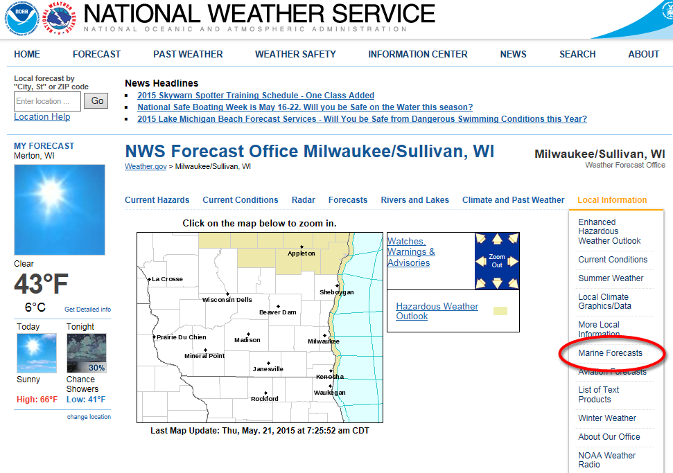
On the National Weather Service Milwaukee/Sullivan webpage, the Beach Hazard Services program can be accessed by scrolling down to the bottom of the page and clicking on the "Beach Hazards" link in the Hazards column, as illustrated below:
A second method of retrieving Beach Hazard and Marine information is by choosing the "Marine Forecasts" link under the "Local Information" menu as illustrated below:
Then choose the "Beach Hazard Information" link above the Lake Michigan graphic as shown below:
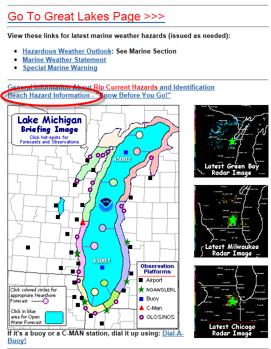
The above links will access the new Great Lakes Beach Hazards web-page. The direct link is https://www.weather.gov/greatlakes/beachhazards.
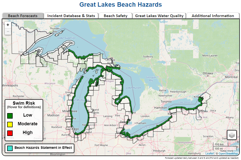
By adding "#mkx" to the end of the web address, you can quickly zoom into southeast Wisconsin when opening the page. The web address to use this capability is https://www.weather.gov/greatlakes/beachhazards#mkx. The below closeup of southeast and east central Wisconsin and adjoining Lake Michigan would then display:
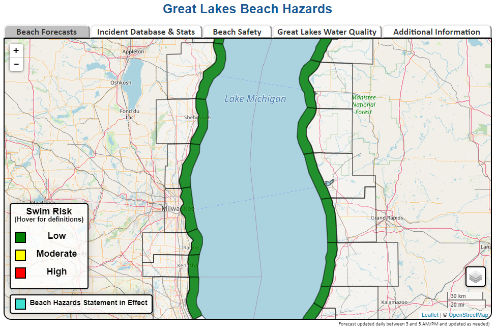
By hovering over the marine zone adjacent to the desired county, a forecast of waves, temperature, weather and winds will pop up for the county as well as the expected swim risk for the coming day. Click on the marine zone for the full text of the Recreational Beach Forecast as depicted below:
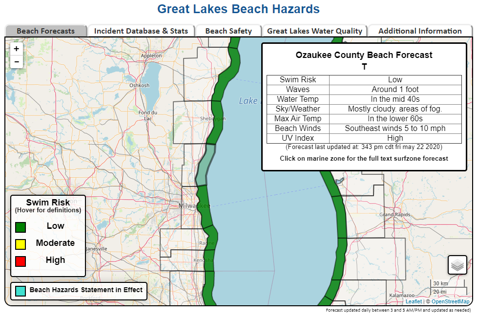
The marine zone will be highlighted in either green, yellow or red to indicate the expected swim risk for the coming day.
If the marine zone is highlighted in red, then the swim risk for the coming day is High, and a Beach Hazard Statement will be in effect. Hover over the adjacent county to get more details on the Beach Hazard Statement.
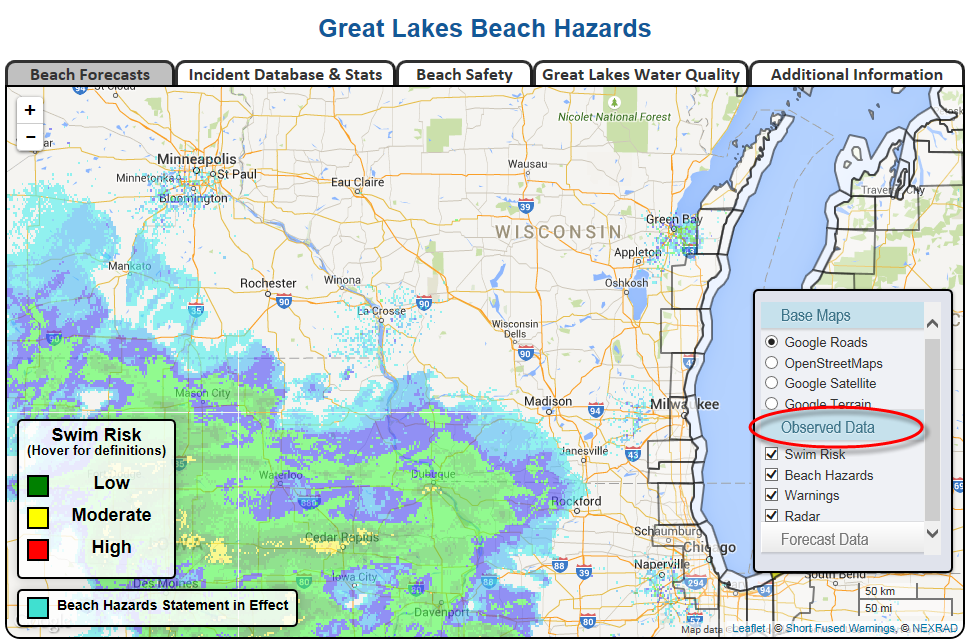
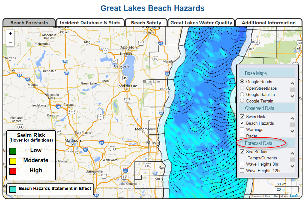
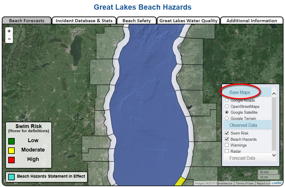
Other features and capabilities of the Great Lakes Beach Hazard webpage include having the ability to display radar data, visible satellite data, regional warnings, forecast wave height, current lake surface temperature and lake currents.
To access this data, click on the layer icon  located in the lower right of the display window. Then click on "Observed Data" or "Forecast Data" to access these features. You also have the capability to change the background display.
Here are examples of some of the features:
 |
 |
 |
Also available on the Great Lakes Hazard webpage is access to the Great Lakes Current Incident database. This is a database of current related incidents (rescues and drowning fatalities) on the Great Lakes since 2002. This database includes information collected from newspaper articles, online articles, and police reports.
The main display of the Great Lakes Current Incident webpage graphically illustrates the number of incidents that have occurred in each U.S. county bordering the Great Lakes since 2002.
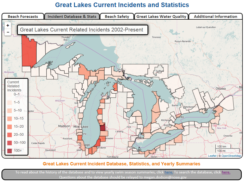
Access the Great Lakes Current Incident database here.
Have a safe and enjoyable 2021 Beach swimming season on Lake Michigan.
Please email our Marine Program Leader Marc Kavinsky with any questions or concerns.

