 |
 |
|||
Radars
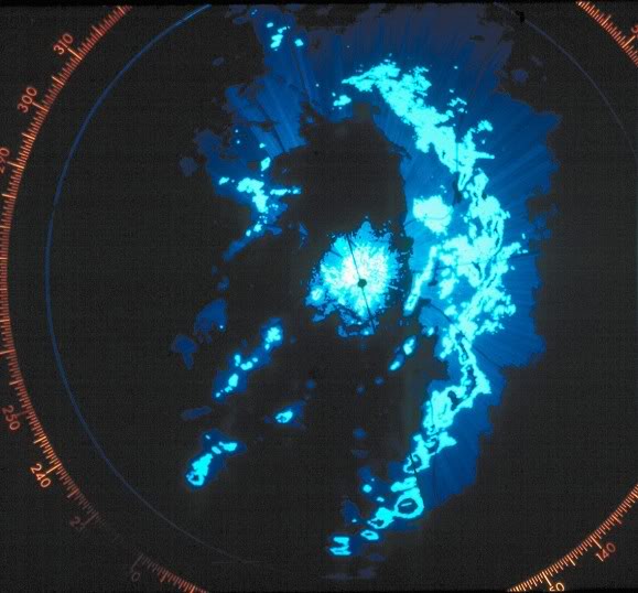
Besides weather satellites, atmospheric measurements, and computer models, meteorologists use weather radar to monitor and forecast the weather. Weather radar provides important information on where rain or snow is falling. Looking at several radar images over a period of time can give clues about where and how fast the rain or snow is moving. A loop of several images can also help show if the rain or snow is growing or shrinking in area or if it is becoming more intense. Radar through the years In 1975, weather radars used old vacuum tubes, similar to television sets of that era. Radar displays consisted of varying shades of gray to show different intensities of the rain or snow.
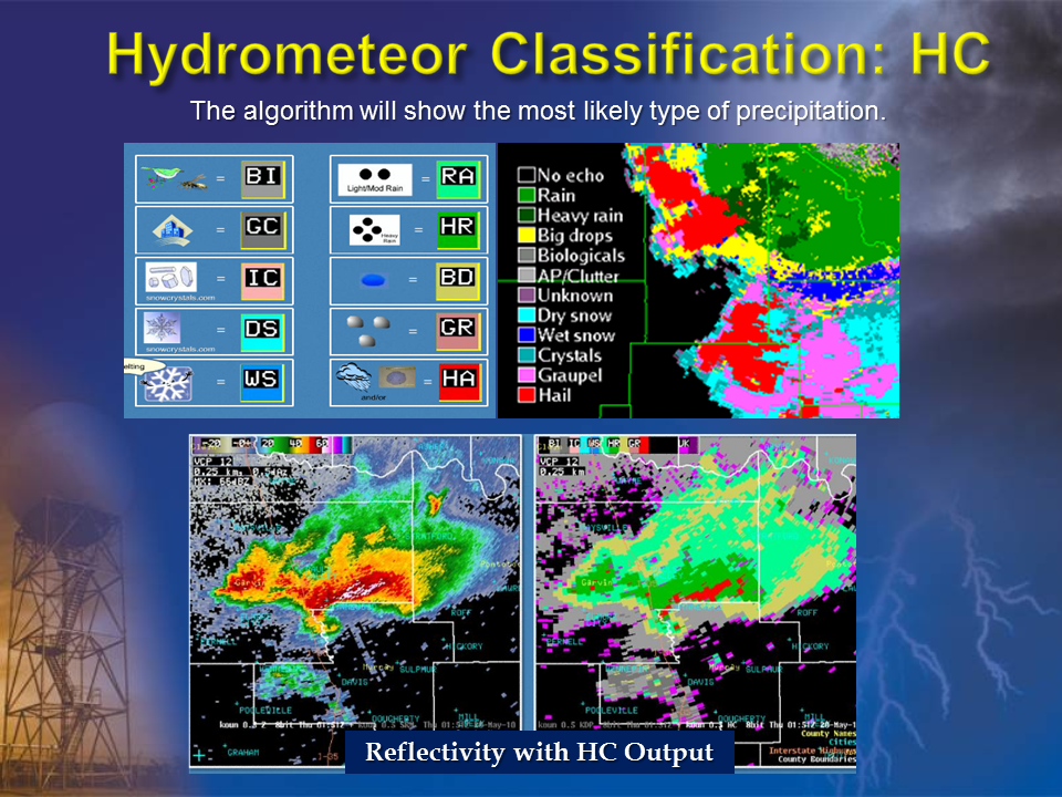
Coarse low resolution radar images similar to those that would be present during 1970s. Left: radar image of severe thunderstorm from 1960s and right: 74C radar image of squall line with trailing area of light rain. Source for both images is medialine.com Today's weather radars operated by the National Weather Service are highly sensitive and include Doppler capabilities. They provide fine resolution measurements of reflectivity and velocity and multiple categories of analysis products. Data and information from these radars allow forecasters to look inside storms and infer wind speed and direction. Recent radar advancements Additionally, an upgrade to dual polarization products in all National Weather Service radars in 2012-2015 allows forecasters to better determine atmospheric target type, size and diversity. These new dual polarization capabilities allow forecasters to better identify precipitation type, which ultimately helps with winter weather forecasting and hail detection, improves precipitation estimation, filters out non-meteorogical targets so forecasters can only focus on meteorological phenomena, and identifies airborne debris which can assist in locating tornadoes.
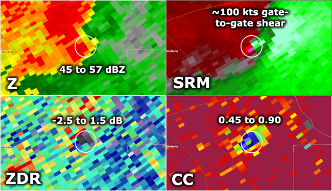
Dual Polarization improvements to the NWS radars occurred in 2012-2015. Image at left shows the algorithm that indicates the most likely precipitation type. Image at right shows different dual polarization elements for a tornadic thunderstorm. Source for both images is NWS Jackson, MS.
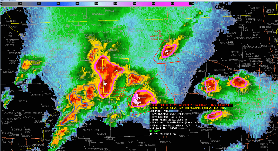
While radar displays in 1975 were different shades of gray, radar displays today are in digital format with advanced color curves to highlight specific features. In 1975, the radar meteorologist had to manually trace the outline of rain and snow areas on an overlay to see where it was. Today's radars use geographic information systems (GIS) to allow for quick identification of storms and rain or snow areas near various cities or towns, parks, rivers, and highways. Radar data today can also be merged with other data types such as satellite cloud top temperatures and lightning strikes to determine the trend of a storm and to estimate rainfall rates and hail size within the storm.
Recent development in radar technology includes use of additional datasets such as lightning and satellite cloud top temperature to determine the trend of storm strength. Image source is NOAA/CIMSS. |
||||
| Credits | Disclaimer | |
||||