 |
 |
|||||||||||||||||||||||||||||||||
Observation Network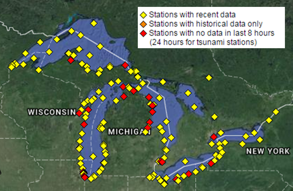 There were no buoy or C-MAN observations available in 1975. Currently, there are nearly 30 observation platforms across Lake Superior, including those from the National Weather Service, National Ocean Service, Michigan Tech University, Northern Michigan University and Environment Canada. There were no buoy or C-MAN observations available in 1975. Currently, there are nearly 30 observation platforms across Lake Superior, including those from the National Weather Service, National Ocean Service, Michigan Tech University, Northern Michigan University and Environment Canada.
(Image courtesy of the National Data Buoy Center)
History of Observations One of the most important improvements in marine technology since 1975 is the significant increase in the number of real-time observations. In 1975, there were no data buoys on the Great Lakes, nor any data from automated stations. The only real-time observations available to the mariner were shore and ship reports. The main method by whiche the commercial mariner obtained observations in 1975 was via VHF voice radio. Typically, a mate on a boat would tune in to the Coast Guard frequently to get up to date observations. The mates would then plot these observations on a map for the area of interest, essentially creating their own weather surface chart. Expansion of Observations The observation system on the Great Lakes began to dramatically improve in 1979 as eight data buoys measuring wind speed and direction, and wave height were dispersed in the water. This was a direct response to the Edmund Fitzgerald disaster. Additional weather equipment was also added to some of the Great Lakes lighthouses in 1983. This network of stations, which measure wind direction and speeds, air temperature, and surface pressure, is known as the Coastal Marine Automated Network (CMAN). From 2003-2015, numerous nearshore weather stations were added across the Great Lakes by the National Weather Service, National Ocean Service, Great Lakes Envionrmental Research Laboratory, and several universities. These new stations further enhance the understanding of the marine weather environment across the Great Lakes. Select Buoy and C-MAN stations across Lake Superior
|
||||||||||||||||||||||||||||||||||
| Credits | Disclaimer | |
||||||||||||||||||||||||||||||||||

