National Weather Service United States Department of Commerce

Cold Front Moving Through the Northeast U.S. Monday; Atmospheric River to Impact the Pacific Northwest Midweek

A cold front will cross the Great Lakes and Northeast U.S. through Monday with gusty winds and areas of rain showers. A strong atmospheric river is expected to move into the Pacific Northwest by midweek bringing a threat for moderate to heavy rainfall, gusty winds, and mountain snows for parts of Washington, Oregon, northern California, and the Sierra Nevada. Read More >

Back to Main Page Storm Warning: Advancements in Marine Forecasting since the Edmund Fitzgerald
  Background Information:
The Edmund Fitzgerald
The Fall Storm Season
Forecast and Warning Definitions
Resources, Links and Credits
 
Advances in:
Scientific Understanding
Numerical Weather Prediction
Communications
Radars and Satellites
Observations and Forecasts
 
Back to:
Main Page
NWS Marquette Home Page
 
  • Simulation of Winds and Waves
 

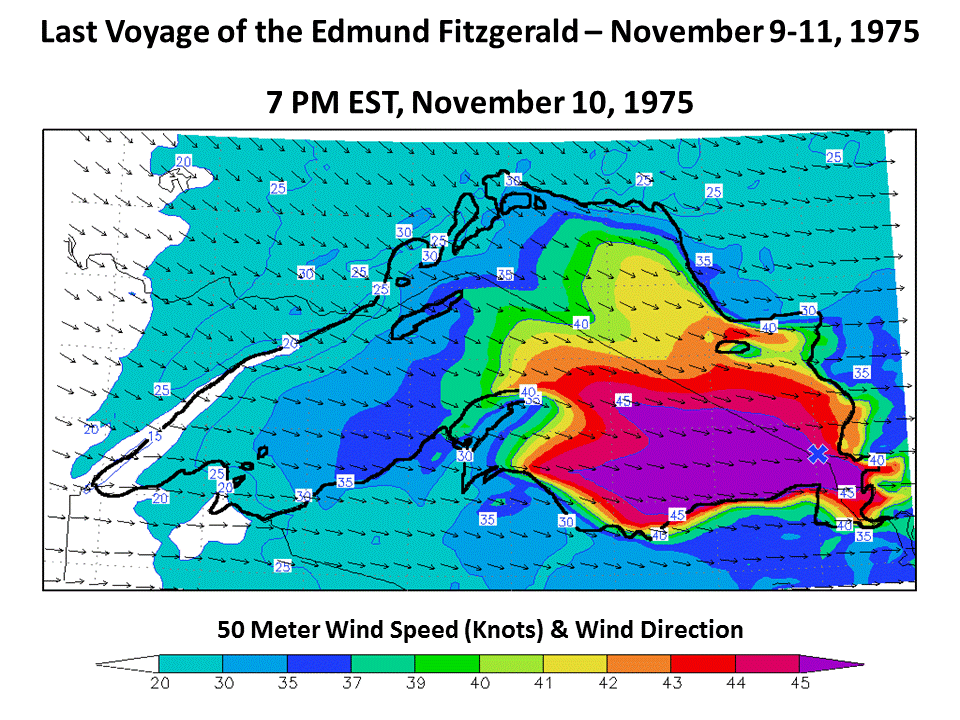
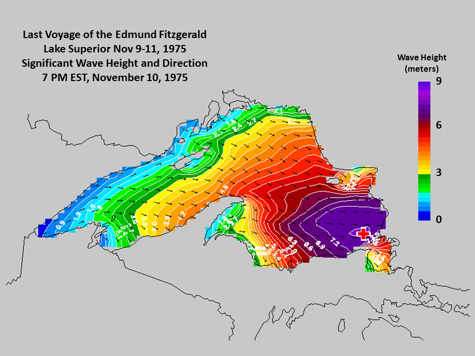
Reexamining the Weather During the Final Voyage of the Edmund Fitzgerald

In 2006, Hultquist, et al. re-examined the weather conditions during the final voyage of the Edmund Fitzgerald.  In particular, this paper showed that the worst conditions were coincident with the time and location at which the Fitzgerald was lost. Mesoscale modeling in this study showed sustained winds near storm force (48 kt) and significant waves of 25+ feet.

Modeled Winds at 7 pm EST November 10, 1975. Purple denotes winds near storm force (45+ kt).

Modeled Waves at 7 pm EST November 10, 1975. Maximum waves of 25+ ft are near where the Fitzgerald was lost.


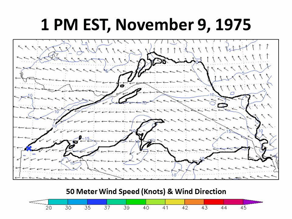
Animations of modeled winds and waves valid from 1 pm EST on November 9th, 1975 through 10 pm EST on November 10th, 1975.


Credits | Disclaimer | Privacy Notice | Site Map | Feedback