 |
 |
|||
Understanding the Marine Layer
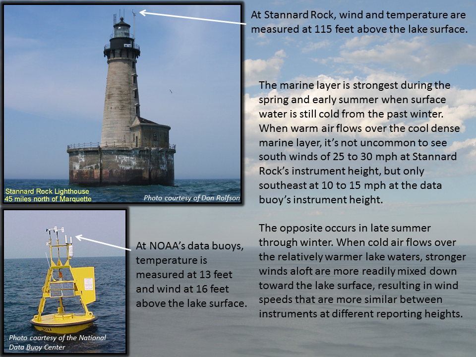
The often drastic difference in wind speed between the marine layer and the warm layer aloft can be confusing when looking at marine weather observations. The Great Lakes freighters measure and report winds about 100 feet above the lake surface. Wind measurements at Lake Superior land-based reporting stations vary from about 50 feet at Passage Island to 150 feet at Rock of Ages. Stannard Rock reports winds 115 feet above the lake surface. These wind reports are above the marine layer. Conversely, the data buoys report winds around 15 feet above the lake surface, which is often within the marine layer. The meteorologist and the small boat operator must take the wind reporting heights into account and realize that not all wind reports over Lake Superior will be representative of the winds at the water surface, particularly during the early summer. |
||||
| Credits | Disclaimer | |
||||