
Widespread, life-threatening considerable flash flooding is expected in south-central Texas through at least Friday. Catastrophic river flooding and rapid rises on small streams, arroyos, and typically dry washes are expected in the Texas Hill Country. Wildfire smoke is impacting air quality across much of the Great Lakes region into the Northeast U.S. with Air Quality Alerts in effect. Read More >
Damage Photos from the June 2003 Coleridge Tornado
|
|
|||||||||||||||||||||||||||||||||||||||||||||||||||||||||||||||||||||||||||||||||||||||||||||||||||
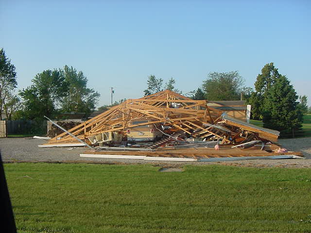
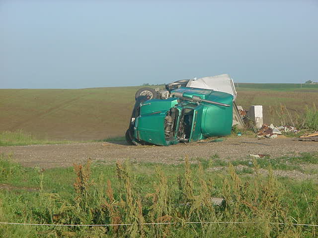
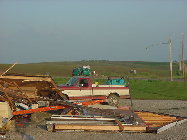
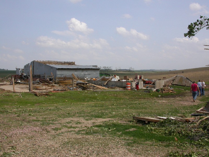
| Damaged home on a farm, 3 miles northeast of Coleridge. Photo courtesy of Cedar County Emergency Management | Damage to farm, 3 miles northeast of Coleridge. Photo courtesy of Cedar County Emergency Management | Damaged home on a farm, 3 miles northeast of Coleridge. Photo courtesy of Cedar County Emergency Management | Damaged pickup truck east of Coleridge. Photo courtesy of Cedar County Emergency Management | ||||||||||||||||||||||||||||||||||||||||||||||||||||||||||||||||||||||||||||||||||||||||||||||||
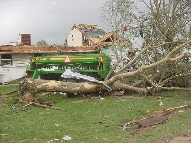 mvc-747s.jpg 37.60 Kb 640 * 480 |
 mvc-754s.jpg 36.95 Kb 640 * 480 |
 mvc-756s.jpg 37.25 Kb 640 * 480 |
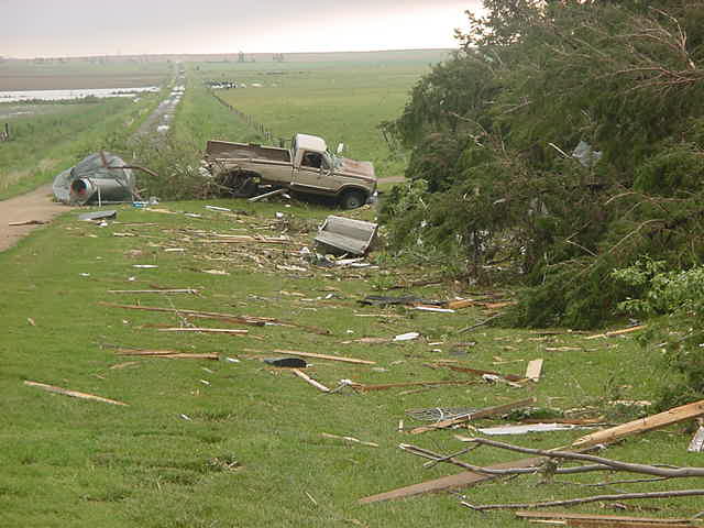 mvc-759s.jpg 38.18 Kb 640 * 480 |
||||||||||||||||||||||||||||||||||||||||||||||||||||||||||||||||||||||||||||||||||||||||||||||||
|
|
|||||||||||||||||||||||||||||||||||||||||||||||||||||||||||||||||||||||||||||||||||||||||||||||||||
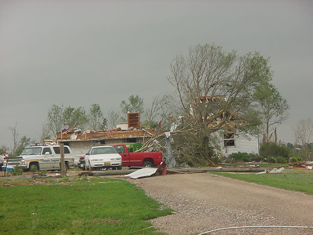
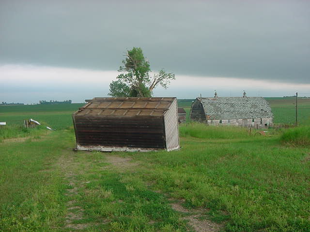
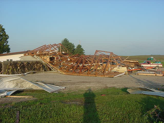
| Damage to a building contractor garage on the north side of Coleridge. Photo courtesy of Cedar County Emergency Management | A Semi-truck that flipped on it's side on the North Side of Coleridge. Photo courtesy of Cedar County Emergency Management | Overturned shed east of Coleridge. Photo courtesy of Cedar County Emergency Management | Damage to a home on a farmstead 3 miles northeast of Coleridge. Photo courtesy of Cedar County Emergency Management | ||||||||||||||||||||||||||||||||||||||||||||||||||||||||||||||||||||||||||||||||||||||||||||||||
 mvc-701s.jpg 38.94 Kb 640 * 480 |
 mvc-702s.jpg 37.06 Kb 640 * 480 |
 mvc-741s.jpg 37.74 Kb 640 * 480 |
 mvc-746s.jpg 36.36 Kb 640 * 480 |
||||||||||||||||||||||||||||||||||||||||||||||||||||||||||||||||||||||||||||||||||||||||||||||||
|
|
|||||||||||||||||||||||||||||||||||||||||||||||||||||||||||||||||||||||||||||||||||||||||||||||||||
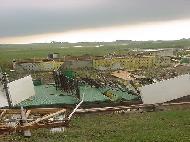
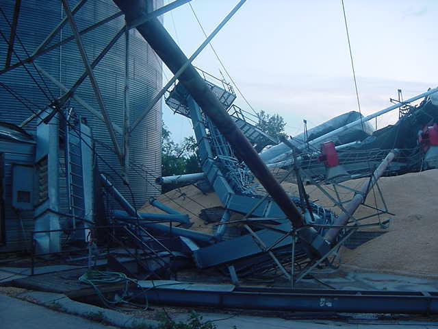
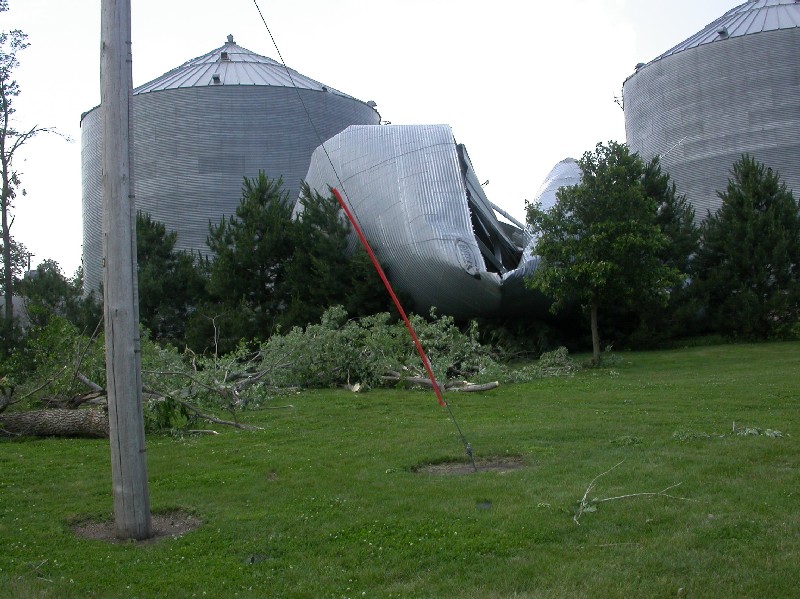
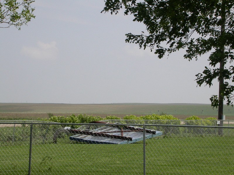
| Closeup to damage of a grain bin in Coleridge. Photo courtesy of Cedar County Emergency Management | Tree damage in the city park in Coleridge. Photo courtesy of Cedar County Emergency Management | Damage to a building contractor garage on the north side of Coleridge. Photo courtesy of Cedar County Emergency Management | Damage to a truck on the north side of Coleridge. Photo courtesy of Cedar County Emergency Management | ||||||||||||||||||||||||||||||||||||||||||||||||||||||||||||||||||||||||||||||||||||||||||||||||
 mvc-621s.jpg 39.84 Kb 640 * 480 |
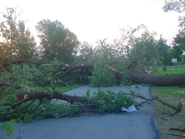 mvc-645s.jpg 37.41 Kb 640 * 480 |
 mvc-697s.jpg 37.35 Kb 640 * 480 |
 mvc-699s.jpg 35.61 Kb 640 * 480 |
||||||||||||||||||||||||||||||||||||||||||||||||||||||||||||||||||||||||||||||||||||||||||||||||
|
|
|||||||||||||||||||||||||||||||||||||||||||||||||||||||||||||||||||||||||||||||||||||||||||||||||||
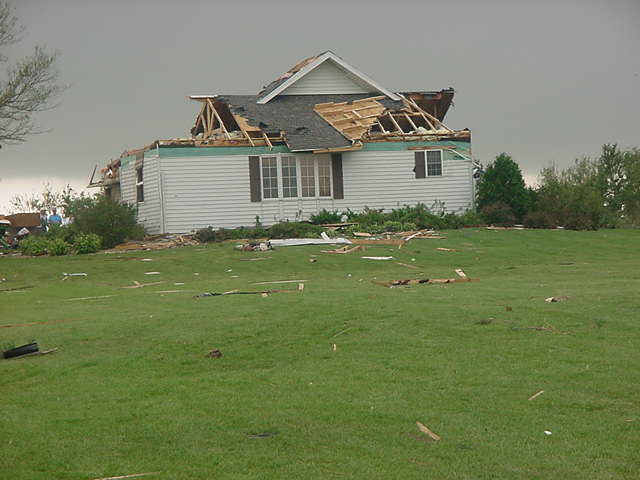
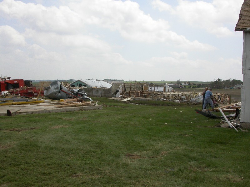
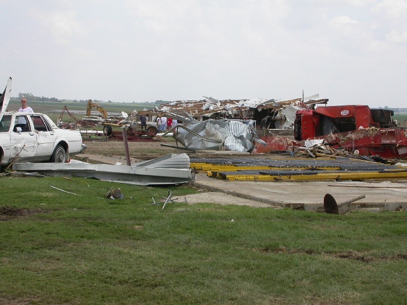
| Damage to a farmstead near Nebraska Highway 15 , 5 miles east of Coleridge. NWS Photo | House shifted off a foundation about 6 feet. The home was located about 5 miles east of Coleridge. NWS photo | One of two grain storage bins destroyed in Coleridge by the tornado. NWS Photo | Closeup of the damage to the grain storage bins in Coleridge. Photo courtesy of Cedar County Emergency Management | ||||||||||||||||||||||||||||||||||||||||||||||||||||||||||||||||||||||||||||||||||||||||||||||||
 coleridge37_03cz.jpg 153.19 Kb 800 * 599 |
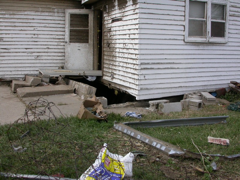 coleridge38_03cz.jpg 194.44 Kb 800 * 599 |
 coleridge8_03cz.jpg 146.11 Kb 800 * 599 |
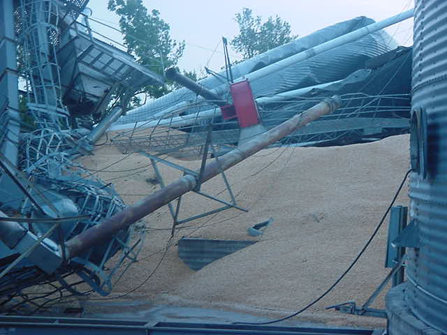 mvc-619s.jpg 38.84 Kb 640 * 480 |
||||||||||||||||||||||||||||||||||||||||||||||||||||||||||||||||||||||||||||||||||||||||||||||||
|
|
|||||||||||||||||||||||||||||||||||||||||||||||||||||||||||||||||||||||||||||||||||||||||||||||||||
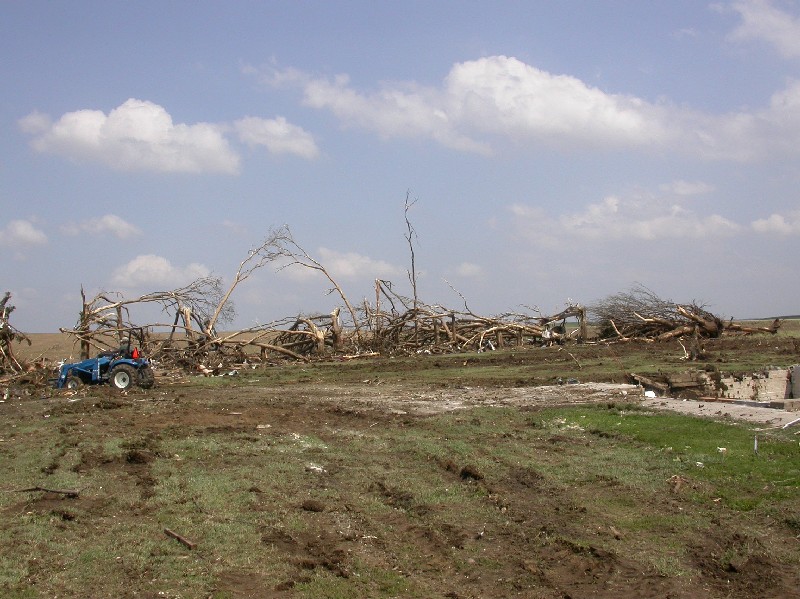
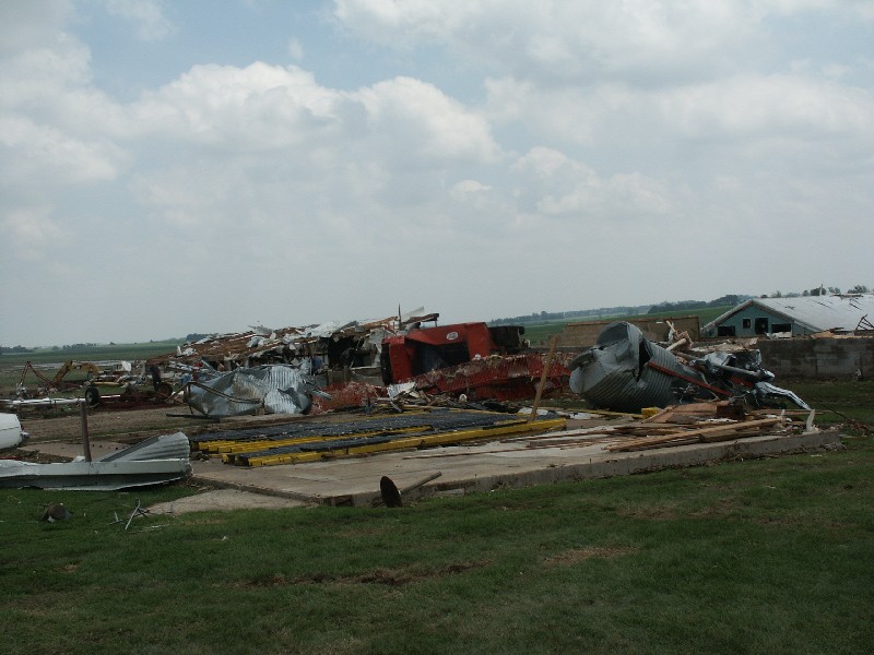
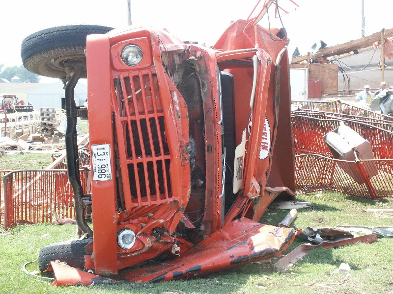
| Scoreboard sign knocked down by the tornado in Coleridge. NWS Photo | Damage to a hog farm, just over 2 miles northeast of Coleridge. NWS Photo | Damage to a hog farm, just over 2 miles northeast of Coleridge. NWS Photo | Destroyed farmstead, just over 4 miles northeast of Coleridge. All thirteen structures were literally wiped out on this farmstead. Every tree was gone and tree trunks were debarked. At this point, corn was totally gone, leaving behind bare ground. The tornado's width at this point as 3/4 of a mile. NWS Photo | ||||||||||||||||||||||||||||||||||||||||||||||||||||||||||||||||||||||||||||||||||||||||||||||||
 coleridge14_03cz.jpg 157.73 Kb 800 * 599 |
 coleridge25_03cz.jpg 113.01 Kb 800 * 599 |
 coleridge26_03cz.jpg 139.69 Kb 800 * 599 |
 coleridge35_03cz.jpg 142.73 Kb 800 * 599 |
||||||||||||||||||||||||||||||||||||||||||||||||||||||||||||||||||||||||||||||||||||||||||||||||
|
|
|||||||||||||||||||||||||||||||||||||||||||||||||||||||||||||||||||||||||||||||||||||||||||||||||||
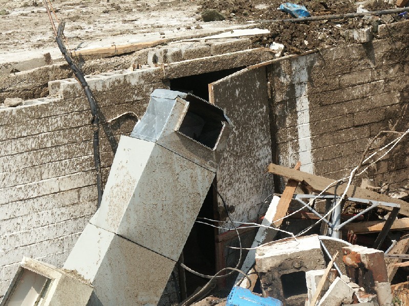
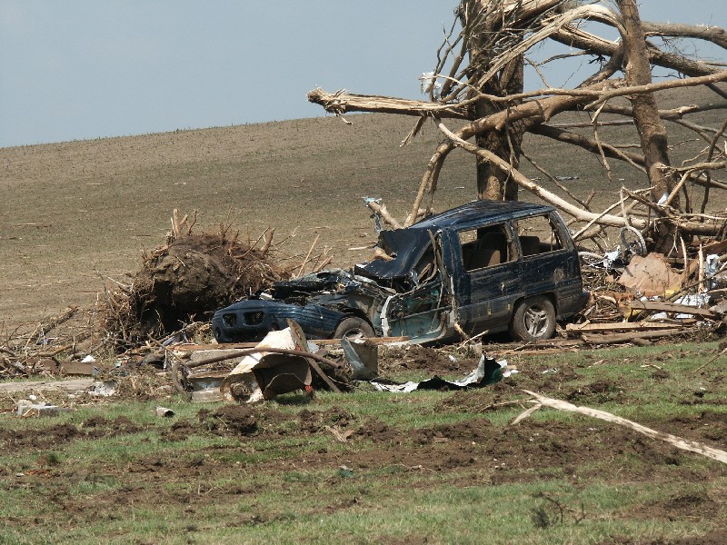
| Damage to a hog farm, just over 2 miles northeast of Coleridge. NWS Photo | Overturned truck on the hog farm. NWS Photo | Closeup of the farmstead, 4 miles northeast of Coleridge. The house was flattened, exposing the basement. The family survived the tornado by hiding in the root cellar (behind the door shown) that was attached to the basement. NWS Photo | Crushed van in the yard of the farmstead, 4 miles northeast of Coleridge. NWS Photo | ||||||||||||||||||||||||||||||||||||||||||||||||||||||||||||||||||||||||||||||||||||||||||||||||
 pict0167.jpg 107.19 Kb 800 * 600 |
 pict0171.jpg 191.47 Kb 800 * 600 |
 pict0181.jpg 241.30 Kb 799 * 599 |
 pict0182.jpg 215.12 Kb 800 * 600 |
||||||||||||||||||||||||||||||||||||||||||||||||||||||||||||||||||||||||||||||||||||||||||||||||
|
|
|||||||||||||||||||||||||||||||||||||||||||||||||||||||||||||||||||||||||||||||||||||||||||||||||||


 Back to the Archives Page