Dangerous heat will expand from the Gulf Coast into the Southern Plains and Desert Southwest through week's end. Additional extreme heat impacting the Pacific Northwest will shift to the northern Plains by the weekend. Tropical Storm Bertha is expected to continue to impact portions of the northern Gulf Coast from the western Florida Panhandle to southeastern Louisiana through tonight. Read More >
Overview
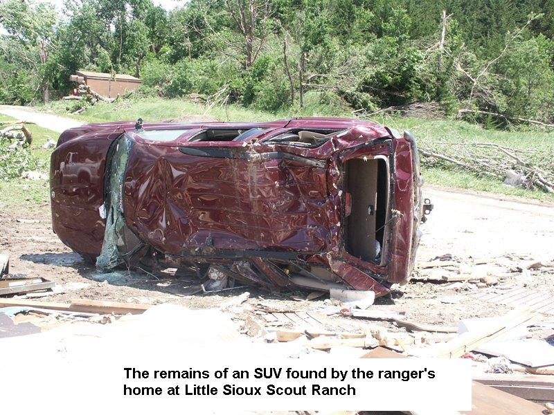
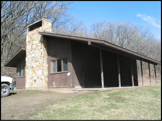
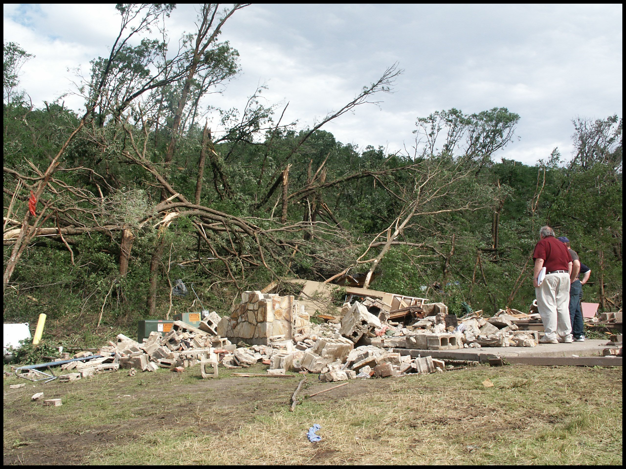
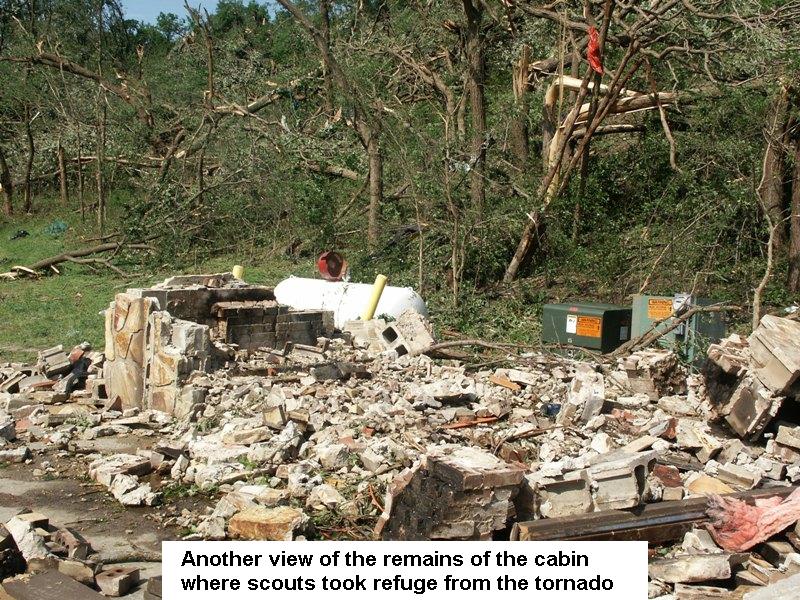
| The tornado started 4.5 miles west of Little Sioux, Iowa in Burt County, NE where center pivot irrigation systems were tipped over and numerous trees were damaged. The storm tracked northeast across the Missouri River and interstate 29 near mile marker 97, where a semi-truck flipped on its side. Heading northeast, the tornado snapped power poles and then entered the Little Sioux Scout Ranch. The tornado destroyed the ranger's home near the entrance of the park and was rated a solid EF-3. The storm then blew down trees and struck a bunk house where the four fatalities occurred. The storm continued northeast into Preparation Canyon State Park and continued to topple trees. Prior to entering the park, a farmstead sustained damage. The tornado then hit another farmstead approximately 2.5 miles southwest of Moorhead, IA. Trees were blown down and sheds were damaged on the farmstead. The tornado then began to weaken and lifted 2 miles southwest of Moorhead, IA. In addition to the fatalities, the tornado also resulted in 48 confirmed injuries. | 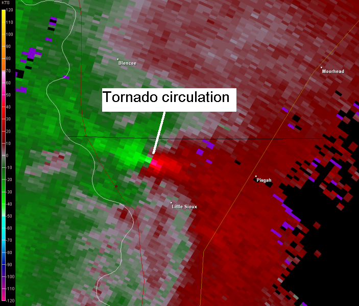 KOAX Velocity Radar Image |
Tornadoes:
|
Tornado #1 - Little Sioux, Iowa
Track Map 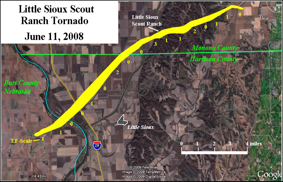
|
||||||||||||||||
|
||||||||||||||||
The Enhanced Fujita (EF) Scale classifies tornadoes into the following categories:
| EF0 Weak 65-85 mph |
EF1 Moderate 86-110 mph |
EF2 Significant 111-135 mph |
EF3 Severe 136-165 mph |
EF4 Extreme 166-200 mph |
EF5 Catastrophic 200+ mph |
 |
|||||
Photos:
 |
 |
 |
 |
|
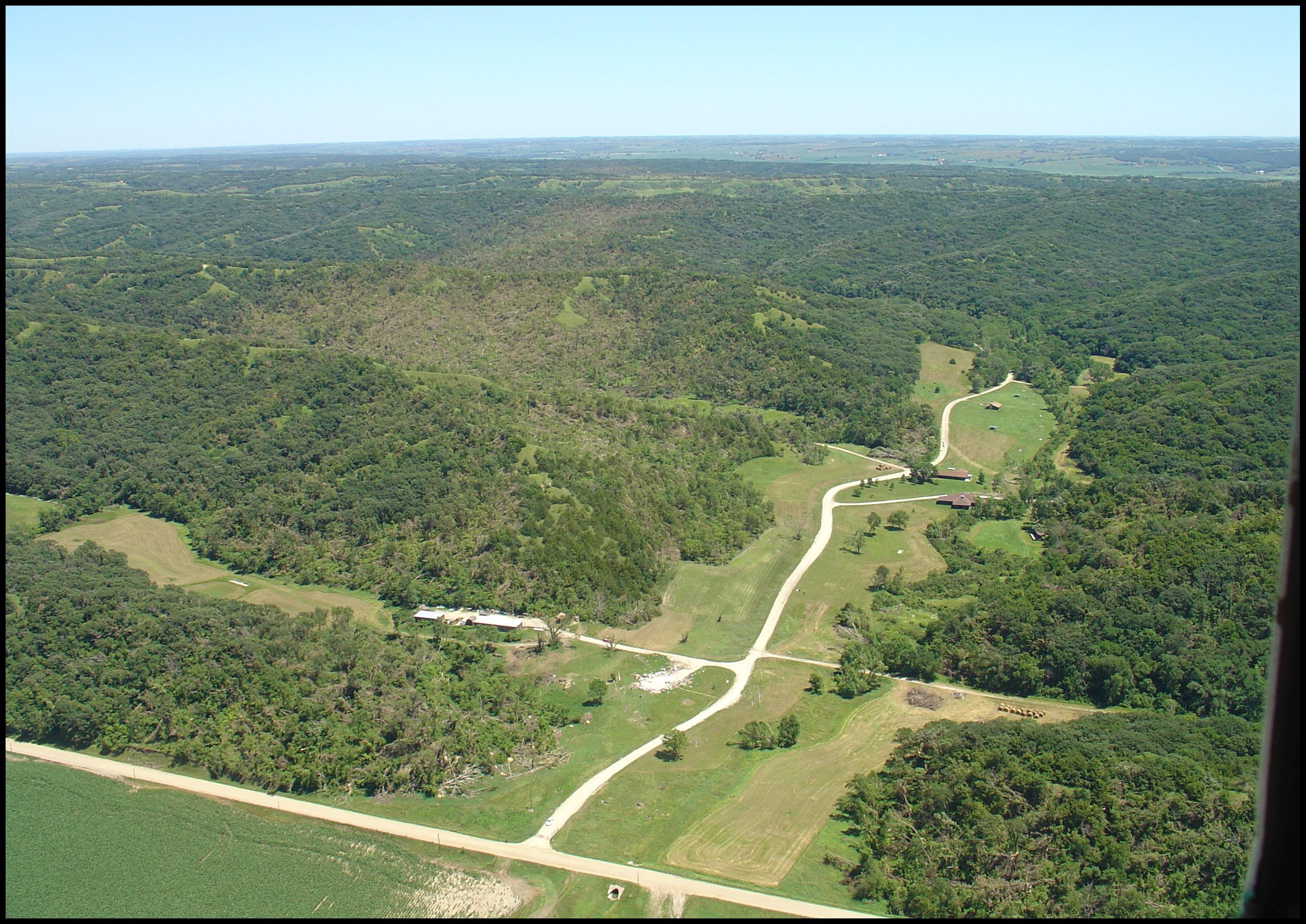
Aerial View Courtesy Dr. Crabb |
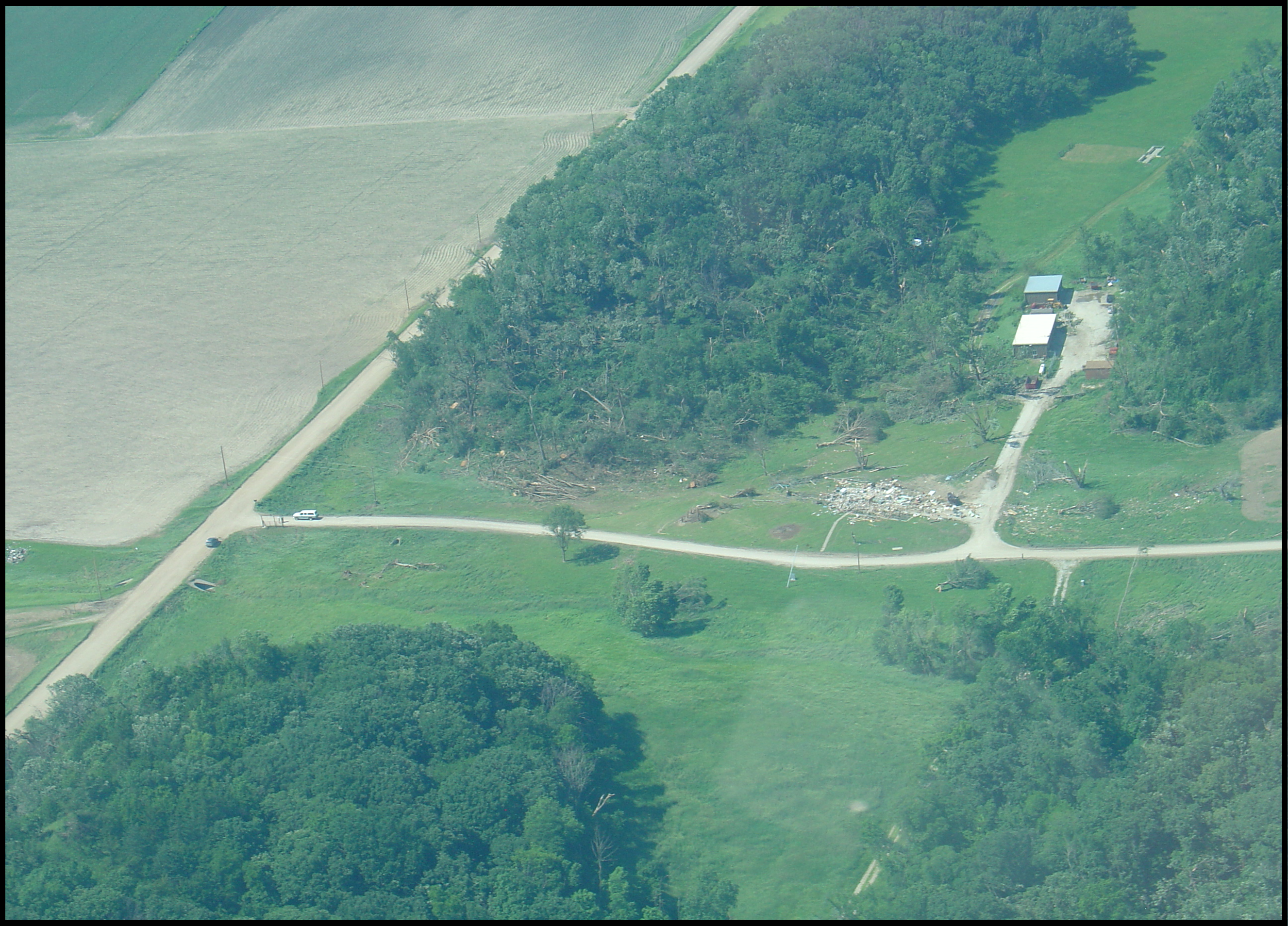
Aerial View #2 Courtesy Dr. Crabb |
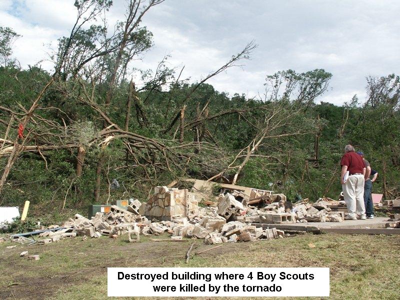
Bunk House #1 |
Bunk House #2 |
Radar:
 |
 |
| 0.5º Radar Reflectivity Animation | 0.5º Radar Storm Relative Velocity Animation |
|
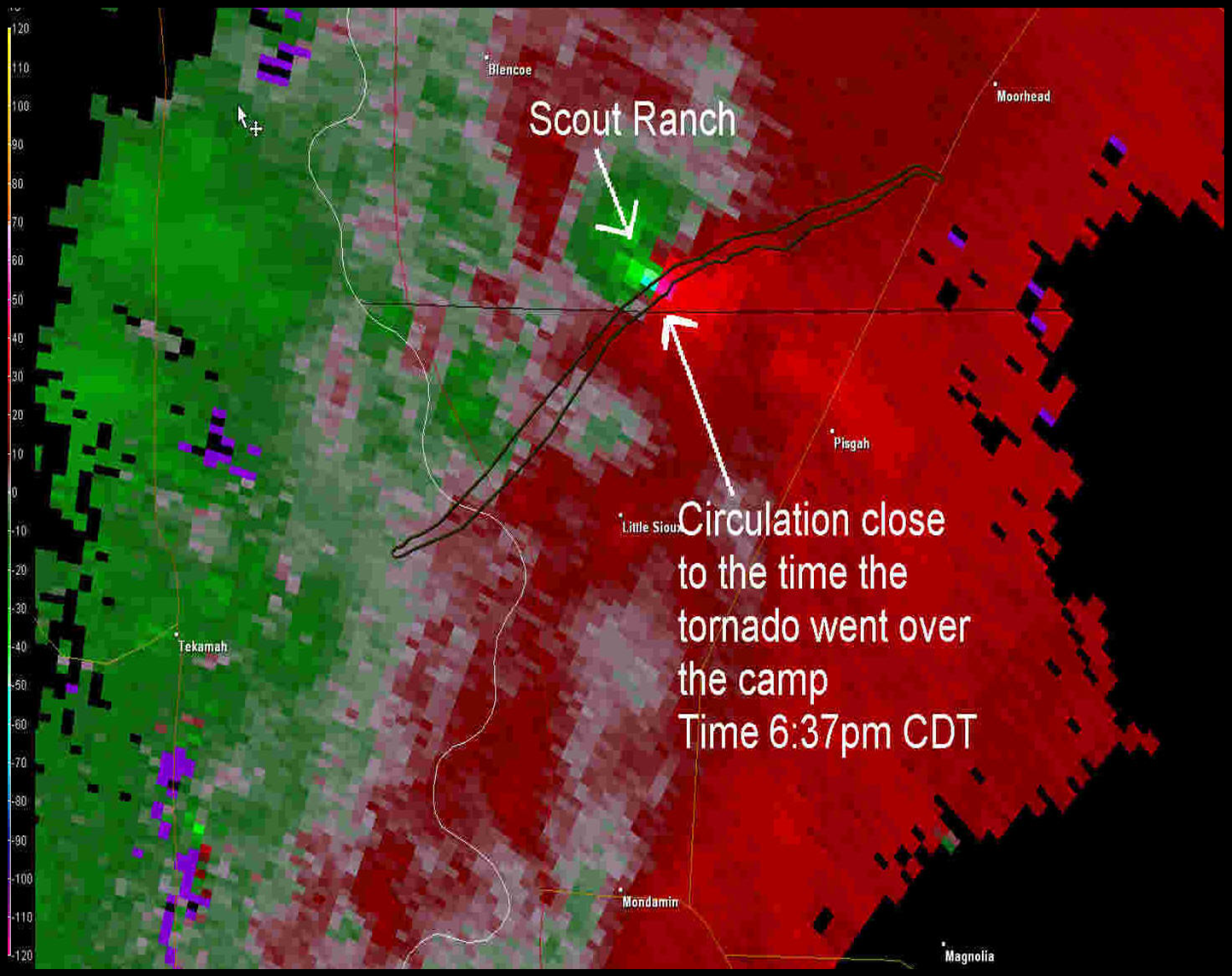 |
| 0.5º Storm Relative Velocity image | 0.5º Storm Relative Velocity image |
Tornado Reports
| Date | Time | County/City | Comments |
| 6/11/2008 | 23:08 | Saunders/1 S Wahoo | |
| 6/11/2008 | 23:35 | Monona/6 N Little Sioux | TORNADO HIT A BOYSCOUT RANCH JUST NORTH OF THE HARRISON COUNTY LINE. THIRTY TO FORTY INJURIES WITH 4 FATALITIES REPORTED BY HARRISON COUNTY DISPATCH. |
| 6/11/2008 | 23:35 | Monona/6 SE Blencoe | *** 4 FATAL, 48 INJ *** TORNADO HIT THE 1800 ACRE LITTLE SIOUX BOY SCOUT RANCH JUST NORTH OF THE HARRISON COUNTY LINE. 48 INJURIES AND 4 FATALITIES CONFIRMED. CAMP CABINS AND HOME DESTROYED. LOCATION WAS CORRECTED BASED ON AERIAL IMAGERY AND PRELIMINARY EF SCALE RATING. |
| 6/11/2008 | 23:42 | Monona/Moorhead | RAIN-WRAPPED TORNADO RELAYED BY WFO-DMX |
| 6/11/2008 | 23:48 | Douglas/2 W Elkhorn | |
| 6/11/2008 | 23:50 | Douglas/Elkhorn | TORNADO ON GROUND AT THE WEST EDGE OF TOWN. |
| 6/11/2008 | 23:59 | Douglas/6 N Elkhorn | |
| 6/12/2008 | 00:20 | Monona/6 NE Castana | |
| 6/12/2008 | 00:39 | Cass/Greenwood | |
| 6/12/2008 | 00:48 | Shelby/3 NW Defiance | |
| 6/12/2008 | 00:48 | Crawford/4 NW Defiance | |
| 6/12/2008 | 00:50 | Cass/3 SW Louisville | TORNADO ON THE GROUND JUST SOUTH OF HWY 66 NEAR PLATTE RIVER STATE PARK. RELAYED BY WFO LBF. |
| 6/12/2008 | 00:50 | Cass/Plattsmouth | TORNADO ON GROUND JUST SOUTH OF HWY 66 NEAR PLATTE RIVER STATE PARK. RELAYED BY WFO LBF |
| 6/12/2008 | 01:00 | Cass/2 SW Cedar Creek | BARN DESTROYED ALONG 114TH STREET. MOBILE HOME MOVED 8 INCHES OFF THE FOUNDATION AT 96TH STREET. 2 OAK TREES UPROOTED. GROVE OF TREES TOPPED. TIME ESTIMATED BASED ON RADAR IMAGERY. |
| 6/12/2008 | 01:05 | Shelby/4 S Defiance | 30-40 VERY LARGE TREES KNOCKED OVER. OUTBUILDING DAMAGED. |
| 6/12/2008 | 01:25 | Jefferson/Plymouth | |
| 6/12/2008 | 01:38 | Jefferson/2 N Jansen |
Wind Reports
| Date | Time | County/City | Comments |
| 6/11/2008 | 22:55 | Dodge/Winslow | LARGE HEALTHY TREE BRANCHES DOWN |
| 6/11/2008 | 23:05 | Burt/Tekamah | LARGE HEALTY TREE BRANCHES AND TREES DOWN |
| 6/11/2008 | 23:15 | Douglas/3 N Papillion | TREE DOWN AT GILES AND ELLSWORTH. |
| 6/11/2008 | 23:30 | Harrison/ 2 NW Little Sioux | BRANCHES AND DEAD TREE DOWN. POWER OUT. |
| 6/12/2008 | 00:00 | Douglas/1 NW Bennington | PATIO CHAIRS BLOWN INTO WINDOW. PONTOON BOAT PICKED UP AND BLOWN TWO HOUSES DOWN. IN THE NEWPORT SUBDIVISION. ESTIMATED WIND SPEED 60 MPH. |
| 6/12/2008 | 00:05 | Lancaster/1 NW Lincoln | LARGE TREE LIMB DOWN |
| 6/12/2008 | 01:00 | Harrison/5 NW Persia | TWO WINDOWS BLOWN OUT. SMALL BRANCHES BLOWN DOWN. 1.75 INCHES OF RAIN. TIME ESTIMATED BASED ON RADAR IMAGERY. |
| 6/12/2008 | 01:20 | Cass/Plattsmouth | TREE BLOWN ONTO MOBILE HOME. APPEARS TO HAVE POSSIBLY BEEN DUE TO RFD WINDS. TIME ESTIMATED BASED ON RADAR IMAGERY. |
Hail Reports
| Date | Time | County/City | Size (inches) | Comments |
| 6/12/2008 | 00:00 | Douglas/Omaha | 1.00 | LAW ENFORCEMENT REPORTED QUARTER SIZE HAIL AT THE CORNER OF 168TH AND BENNINGTON |
| 6/12/2008 | 00:12 | Lancaster/1 NW Lincoln | 1.00 | |
| 6/12/2008 | 00:37 | Saline/Dorchester | 1.00 | |
| 6/12/2008 | 00:48 | Cass/Greenwood | 1.75 | AT 310TH AND CHURCH RD |
| 6/12/2008 | 01:08 | Douglas/Omaha | 1.00 | AT 159 AND GILES |
| 6/12/2008 | 01:12 | Douglas/Omaha | 1.00 | 138TH AND INDUSTRIAL ROAD |
| 6/12/2008 | 01:15 | Douglas/Omaha | 1.00 | 108TH AND HARRISON |
| 6/12/2008 | 01:17 | Douglas/Omaha | 1.00 | AT 120 AND W ST |
| 6/12/2008 | 01:19 | Douglas/Omaha | 1.00 | |
| 6/12/2008 | 01:24 | Sarpy/Bellevue | 1.00 | WASHINGTON STREET |
| 6/12/2008 | 02:10 | Sarpy/Papillion | 1.00 |
 |
Media use of NWS Web News Stories is encouraged! Please acknowledge the NWS as the source of any news information accessed from this site. |
|