
Widespread life-threatening flash and urban flooding continues in south-central Texas, with considerable flooding impacts possible across central Texas. Wildfire smoke is impacting air quality across much of the Great Lakes region into southern New England and the Mid-Atlantic. Monsoonal thunderstorms may produce isolated to scattered flash flooding across the Southwest into the Great Basin. Read More >
Overview
|
As a warm and moist atmosphere returned to the central and northern Plains on June 16th thunderstorms developed during the early morning over central and eastern Nebraska, which later moved into western Iowa by early afternoon. These thunderstorms were severe with large hail, some up to tennis ball size. The morning thunderstorm left a boundary between rain-cooled air to the north and a hot and humid airmass to the south over eastern Nebraska. The combination of this boundary and strong vertical wind shear resulted in an volatile atmosphere by mid afternoon over the area on June 16, 2014 that was favorable for supercell thunderstorms capable of producing tornadoes. Shortly after 2 pm CDT, thunderstorms began developing in this atmosphere to the northwest of Columbus, NE. This area of scattered thunderstorms quickly became one very intense supercell over Stanton County that tracked to the northeast through the afternoon. The supercell thunderstorm produced a total of 5 tornadoes, 4 of which were rated as violent on the Enhanced Fujita Scale. The tornadoes resulted in 2 fatalities, several injuries, and millions of dollars in damage. |
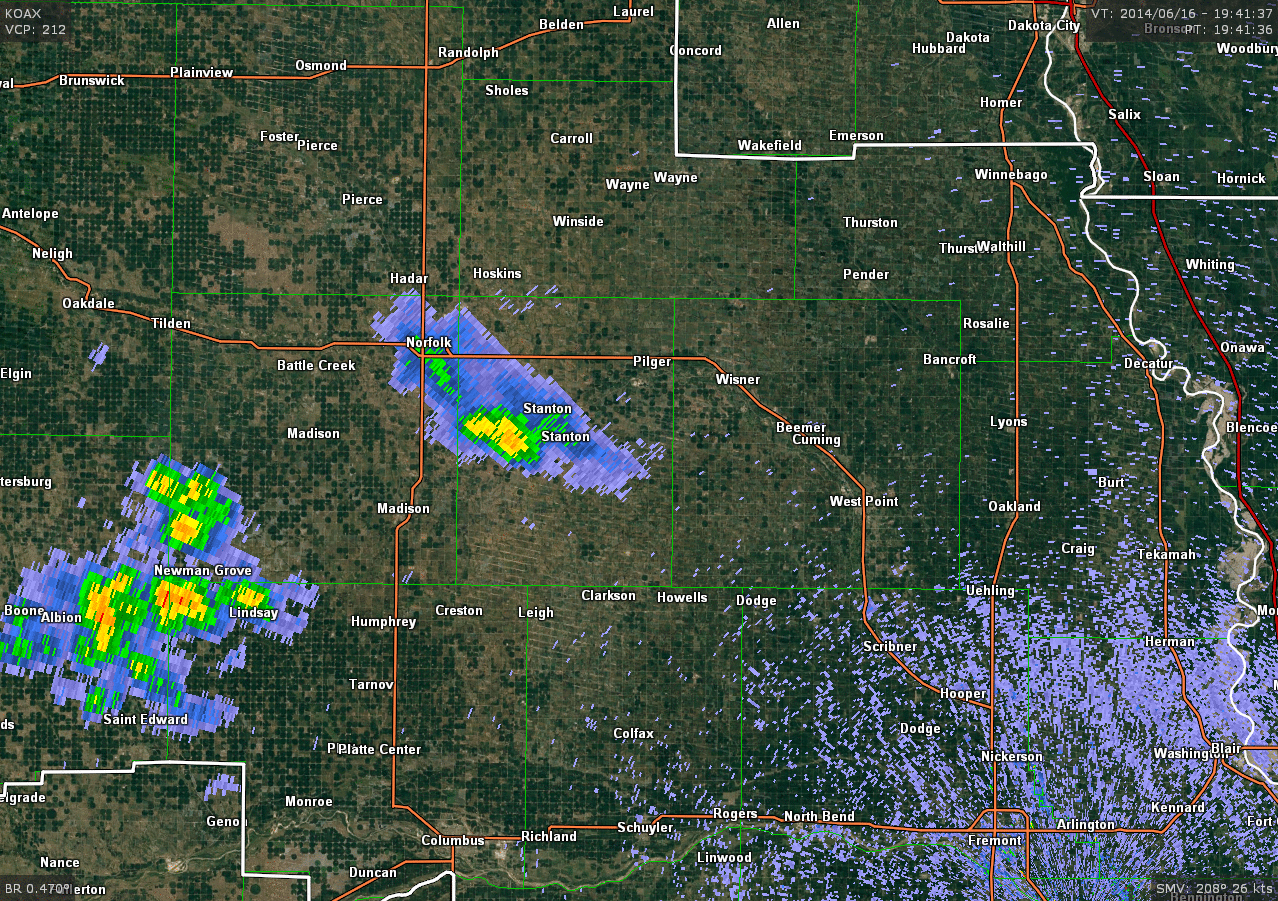
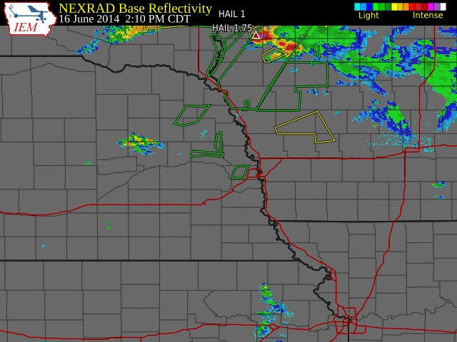 Regional Radar Mosaic June 16, 2014 |
Tornadoes:
|
Tornado #1 - Stanton, NE
Track Map 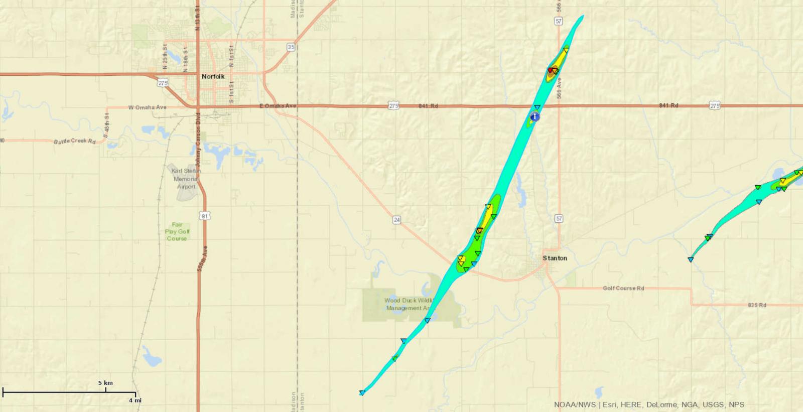 
|
||||||||||||||||
|
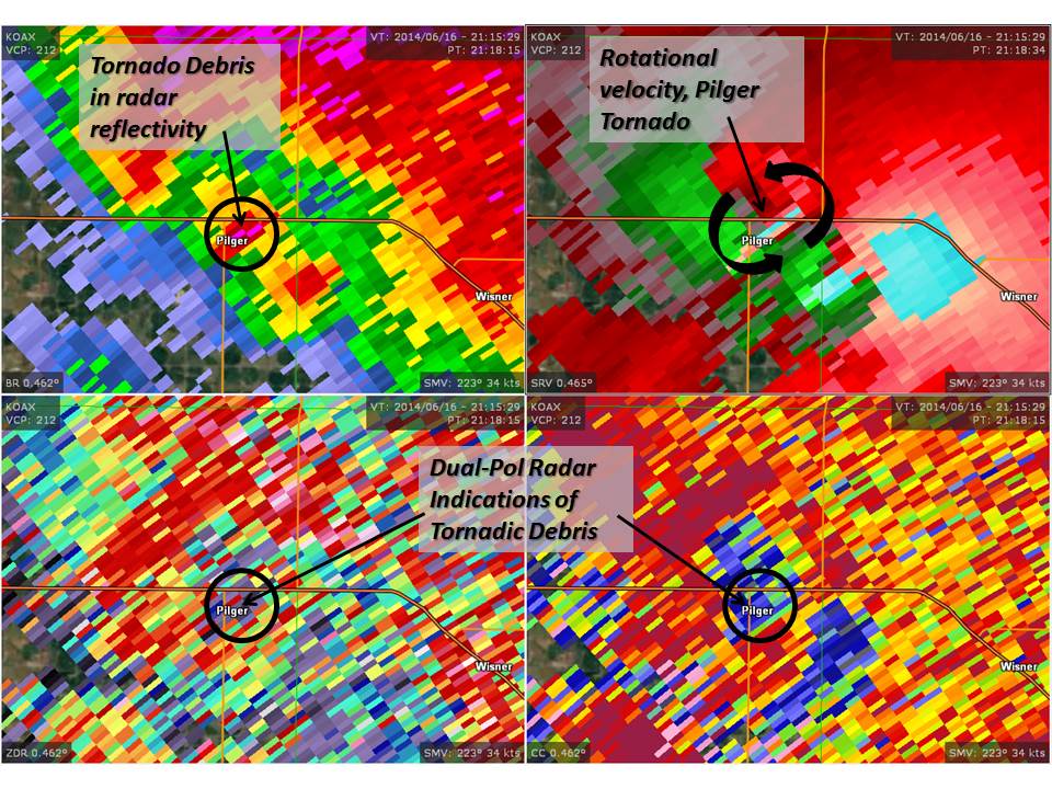
Tornado #2 - Pilger, NE
Track Map 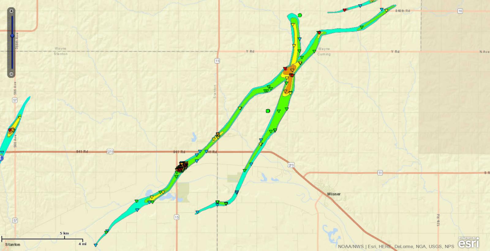
|
||||||||||||||||
|
Tornado #3 - Pilger East
Track Map 
|
||||||||||||||||
|
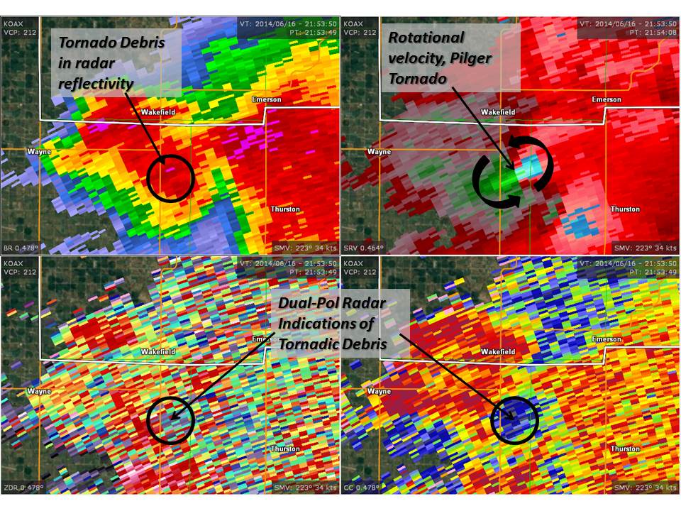
Tornado #4 - Wakefield
Track Map 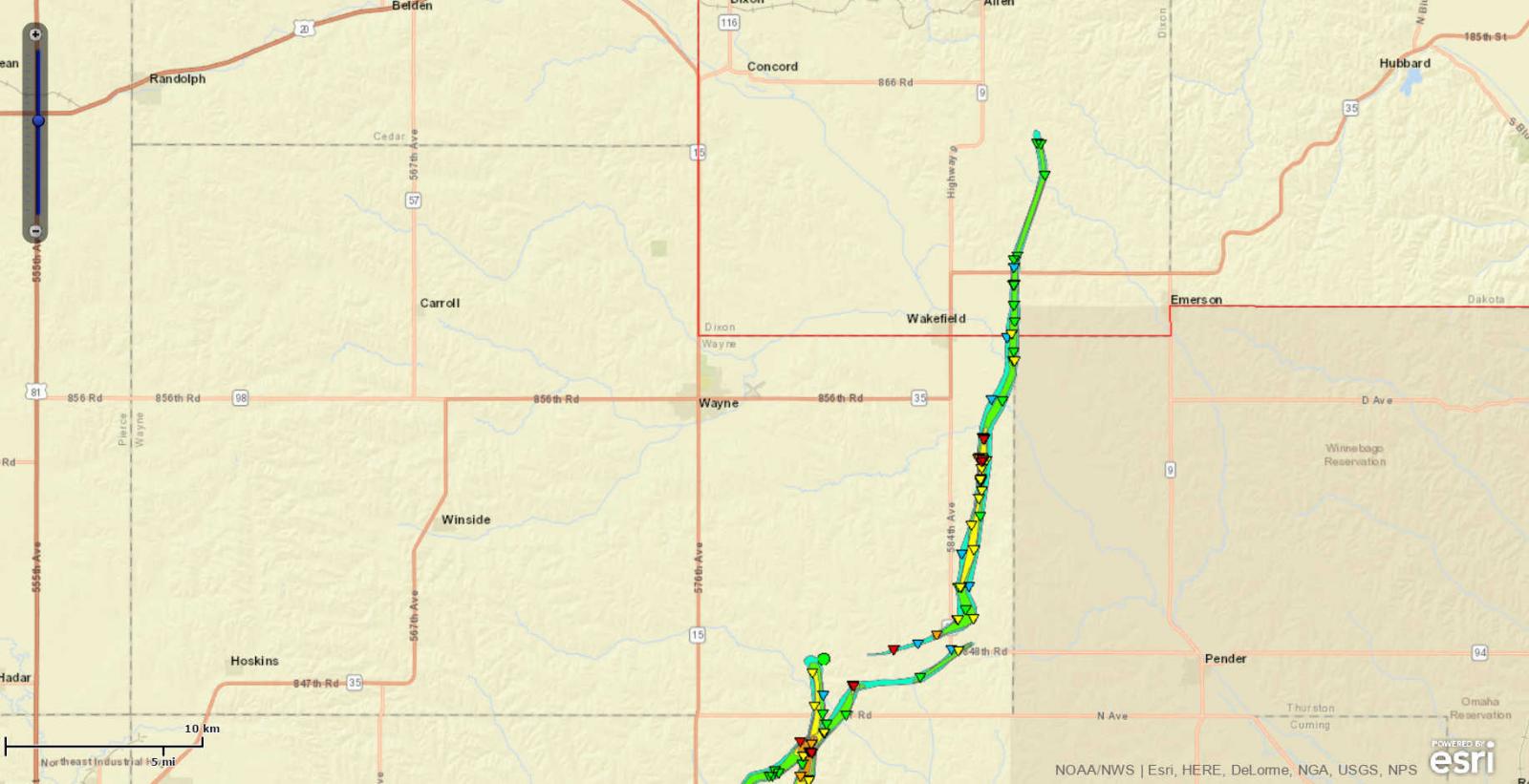
|
||||||||||||||||
The Enhanced Fujita (EF) Scale classifies tornadoes into the following categories:
| EF0 Weak 65-85 mph |
EF1 Moderate 86-110 mph |
EF2 Significant 111-135 mph |
EF3 Severe 136-165 mph |
EF4 Extreme 166-200 mph |
EF5 Catastrophic 200+ mph |
 |
|||||
Photos:
Tornado and Damage Imagery
 |
 |
 |
 |
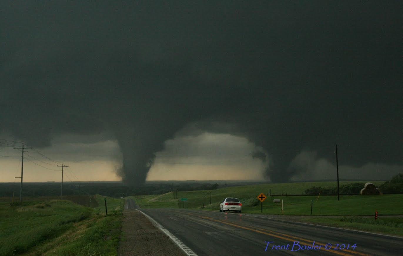
| Pilger and Pilger east Tornado (Trent Bosler) |
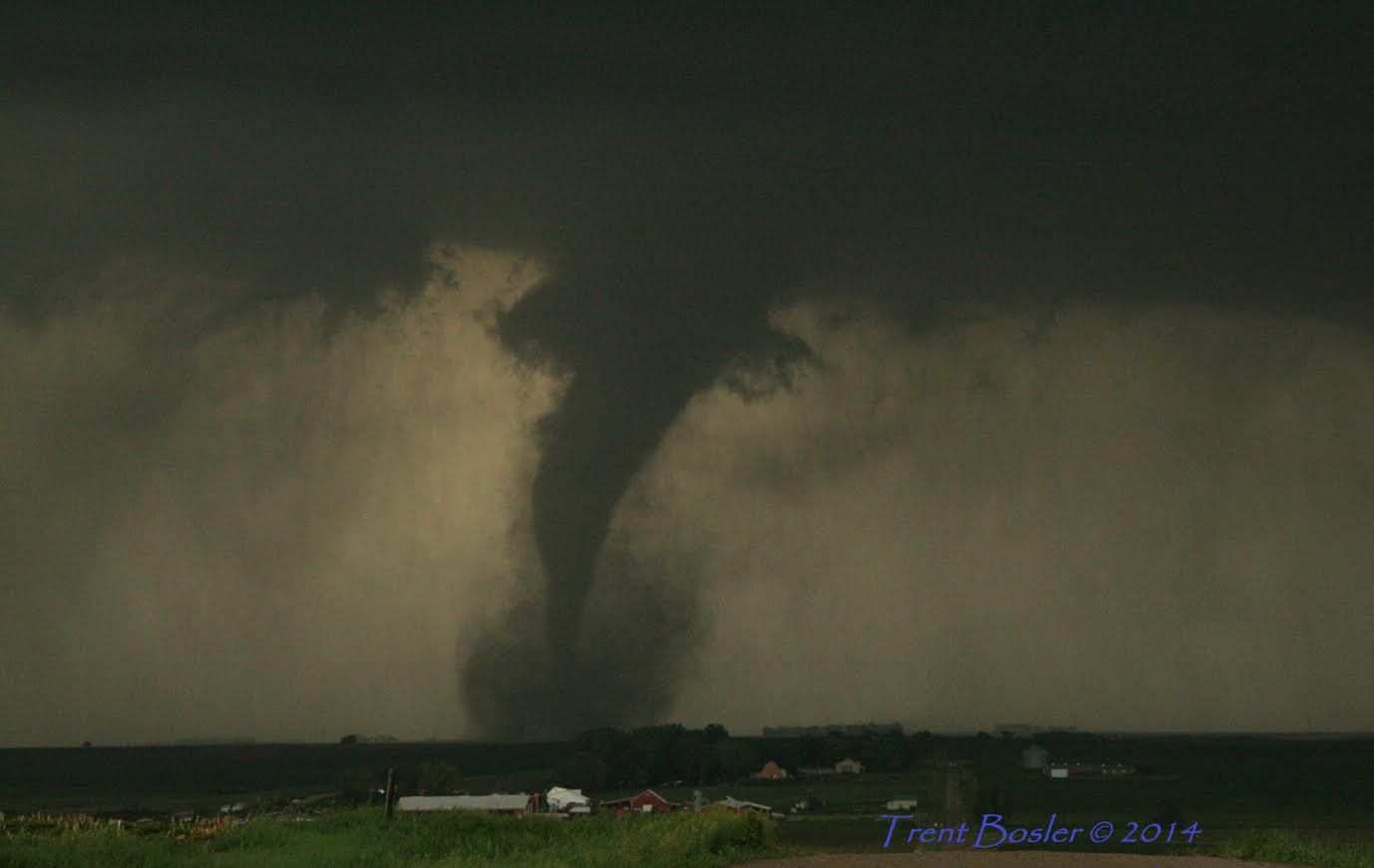
Pilger Tornado Weakening (Trent Bosler) |
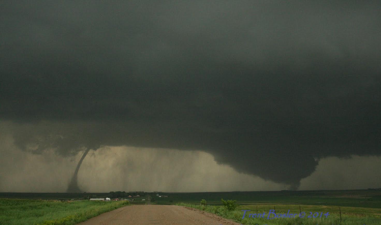
Pilger and New Wakefield Tornado (Trent Bosler) |
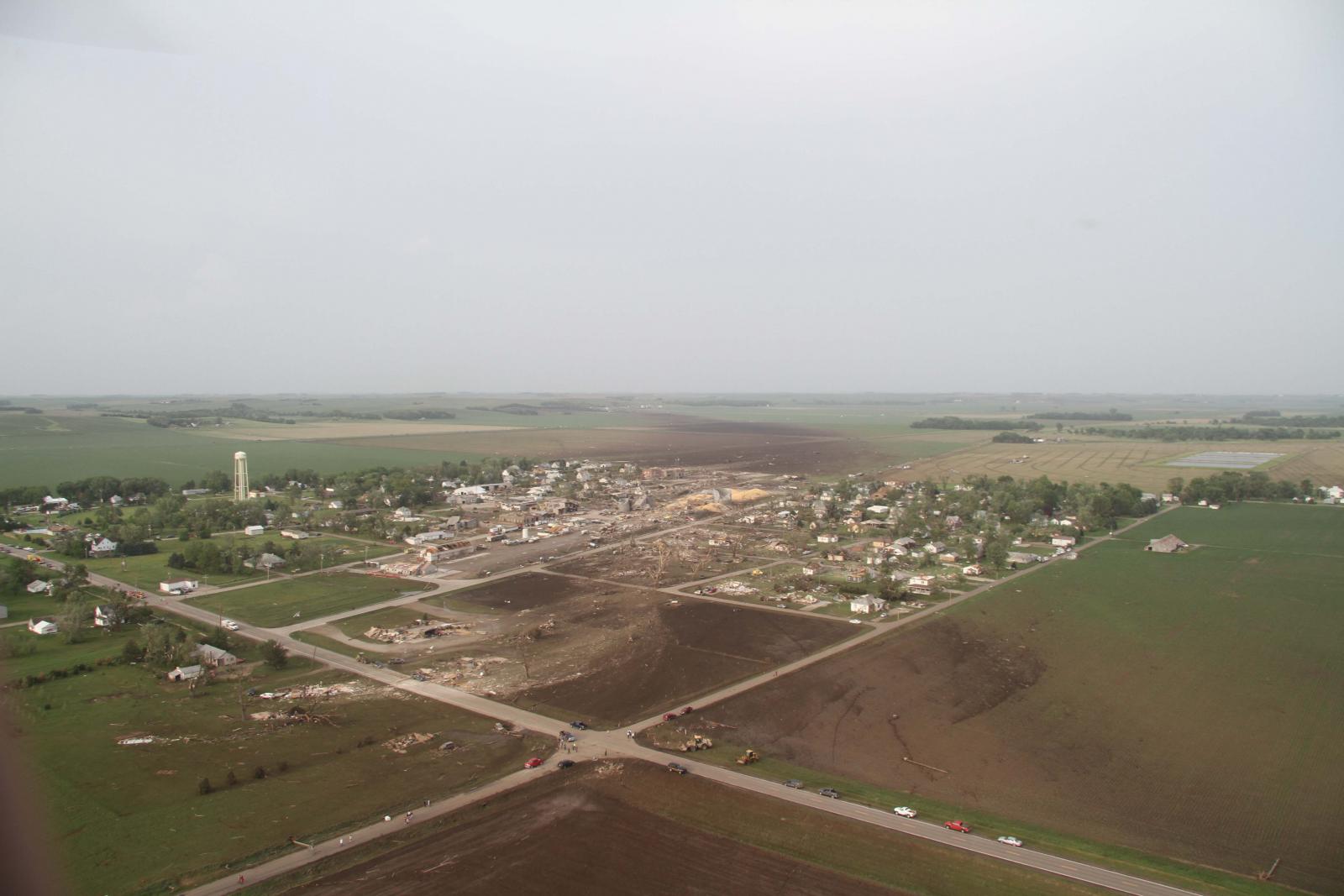
Aerial View of Pilger (NE State Patrol) |
 |
 |
 |
 |
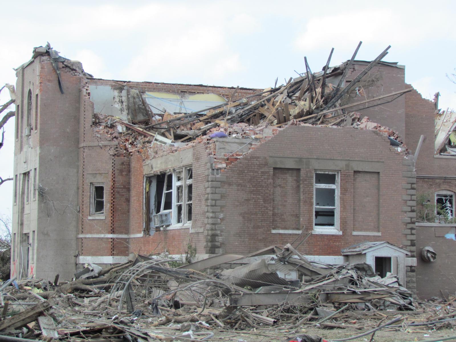
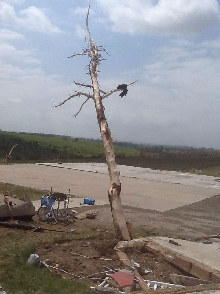
| Pilger School (NWS) |
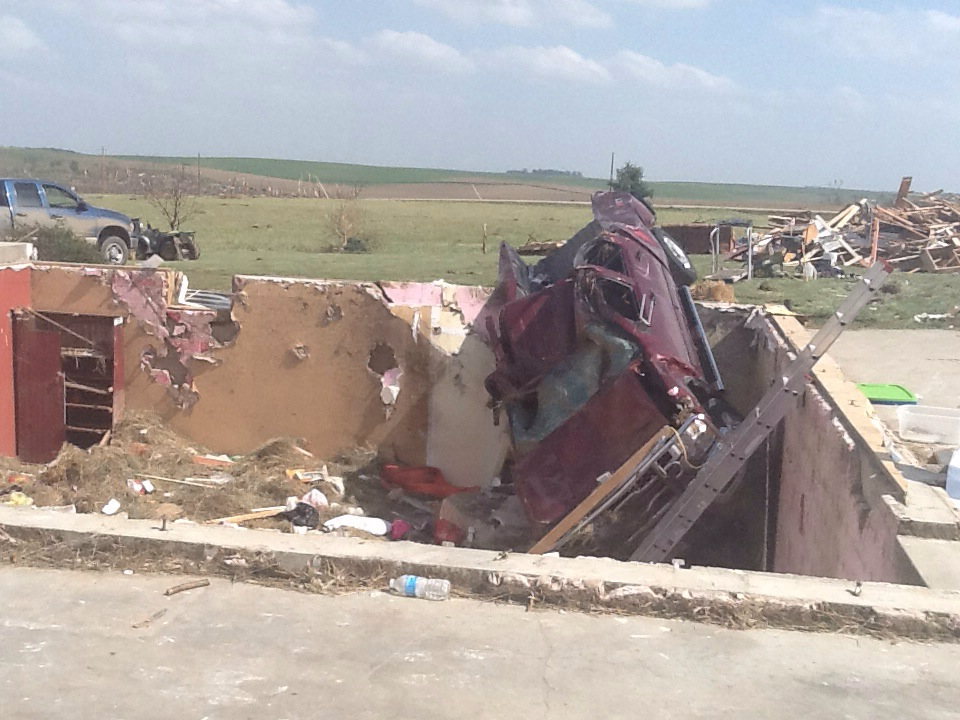
Destroyed Home in Pilger (NWS) |
Damage in Pilger (NWS) |
Damage in Pilger (NWS) |
 |
 |
 |
 |
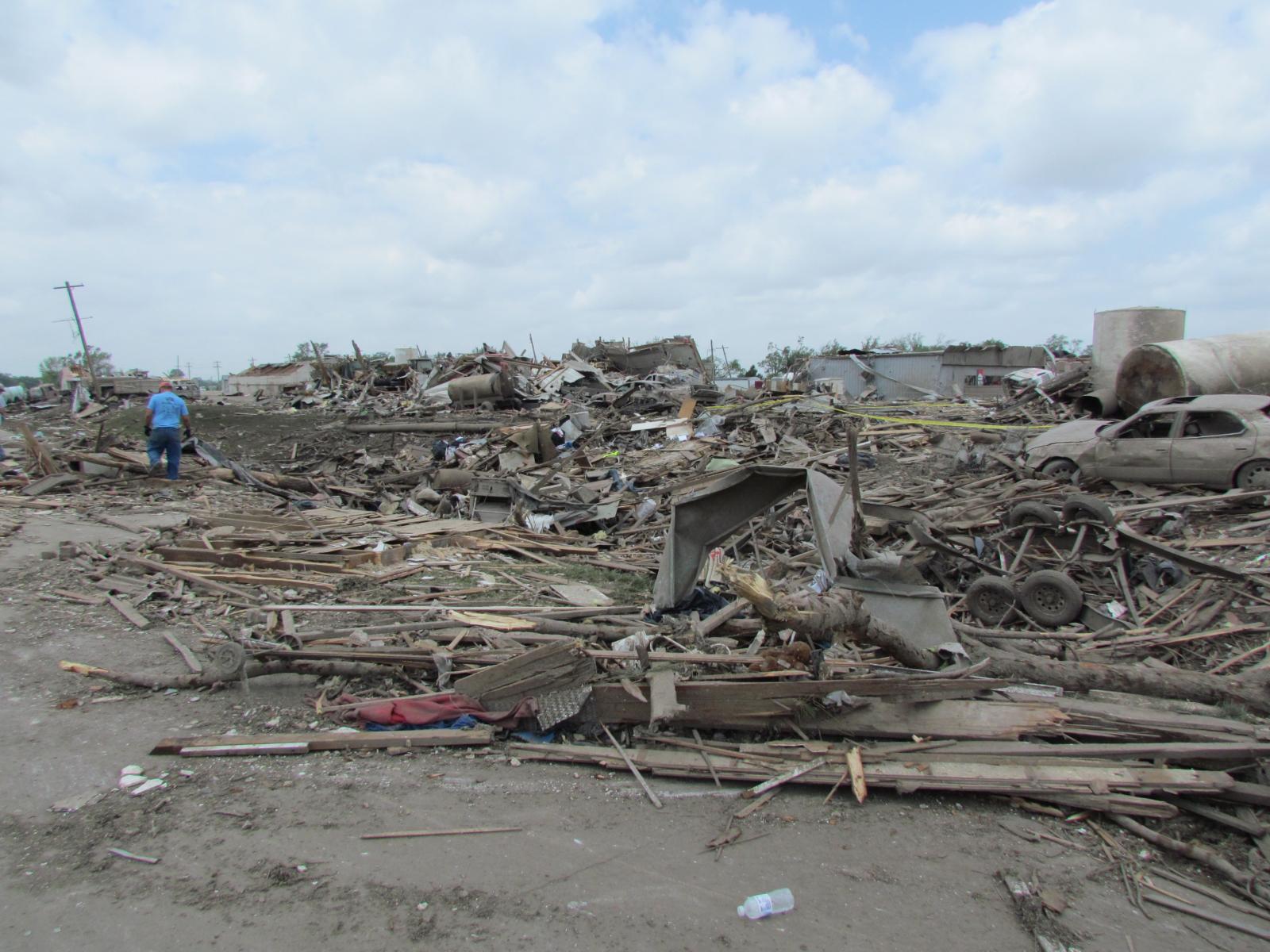
| Wakefield Tornado Damage (NWS) |
Wakefield Tornado Damage (NWS) |
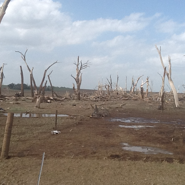
Pilger East Tornado Damage (NWS) |
Pilger East Tornado Damage (NWS) |
 |
 |
.png) |
|
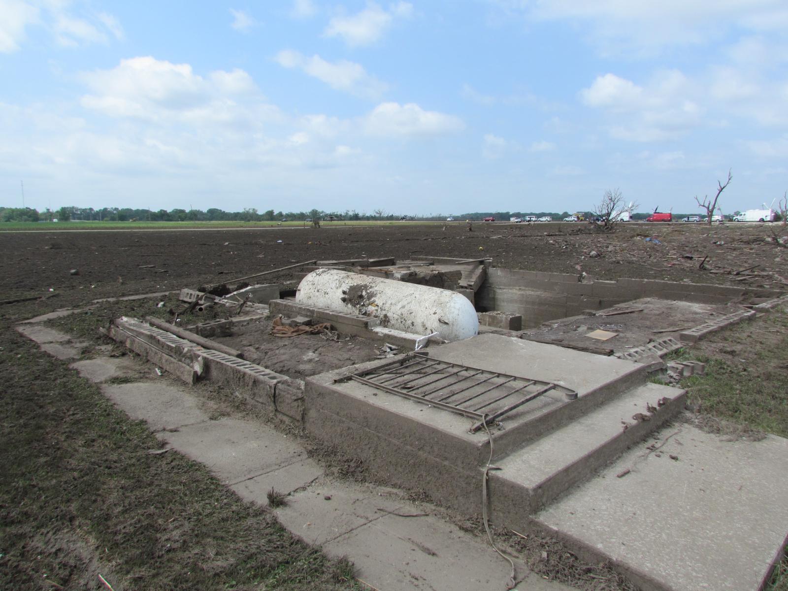
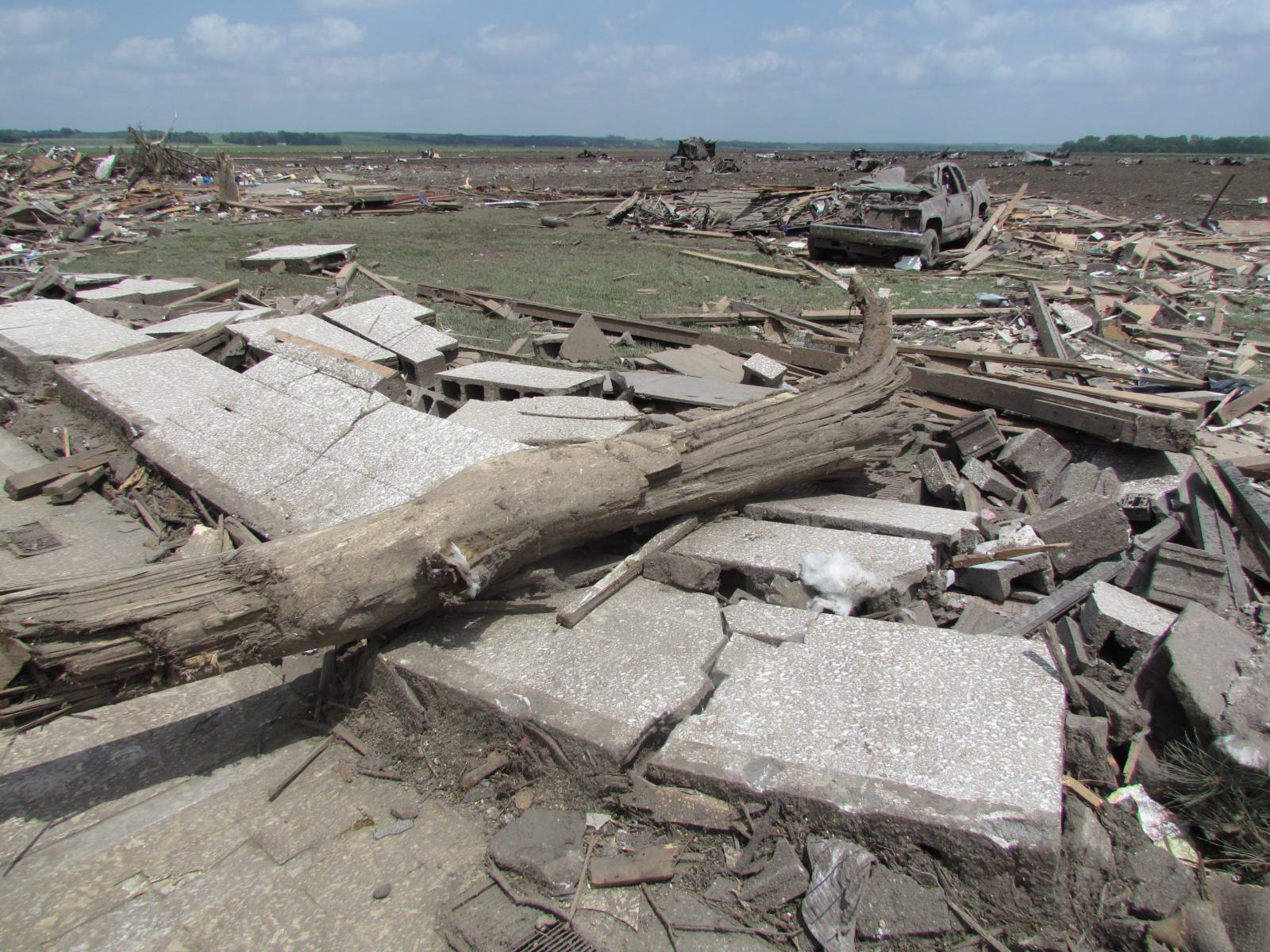
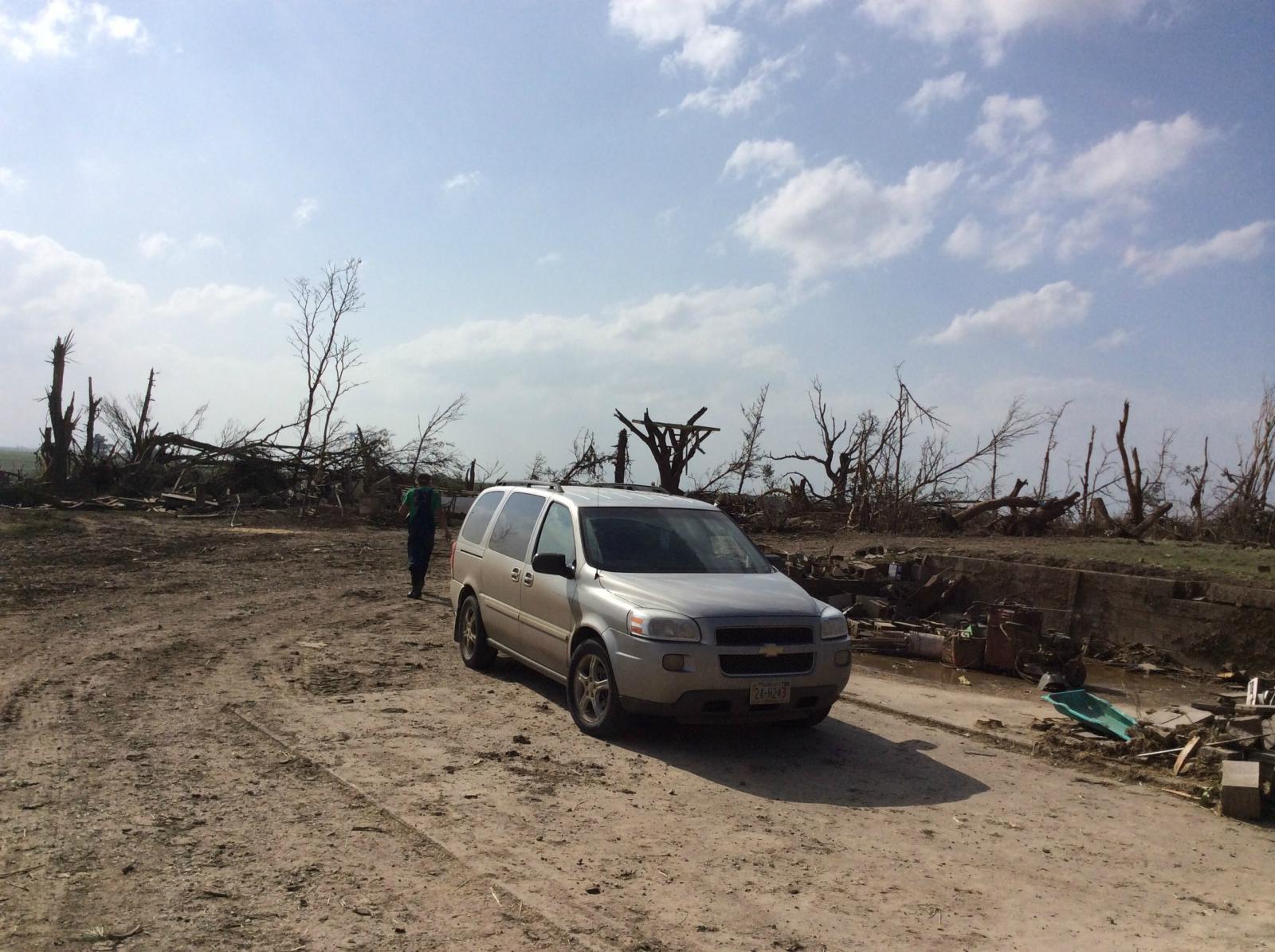
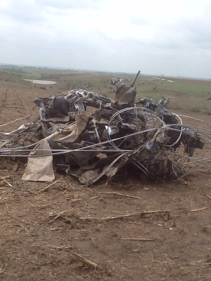
| Destroyed Truck from Stanton Tornado (NWS) |
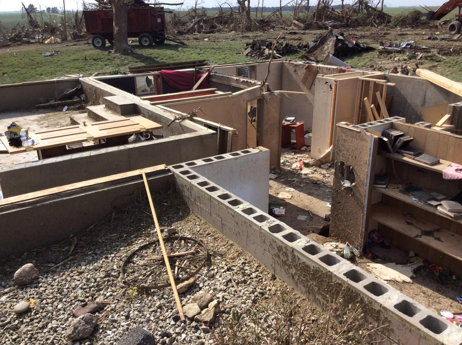
Destroyed Farmstead from Stanton Tornado (NWS) |
Destroyed Farmstead from Stanton Tornado (NWS) |
Radar:
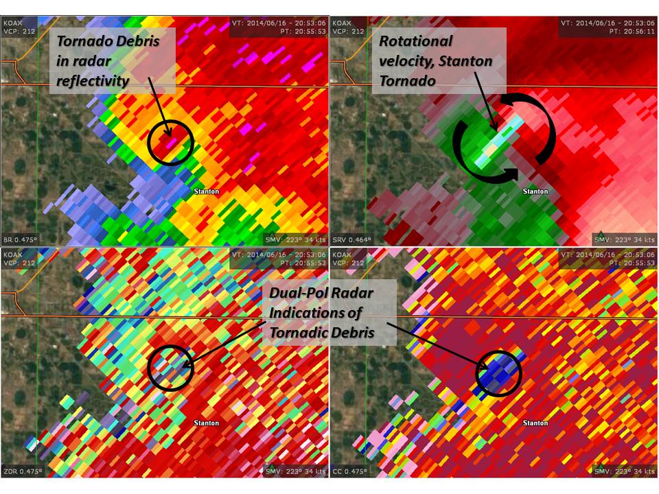
Images from each of the violent tornadoes associated with the intense supercell on June 16, 2014
 |
 |
 |
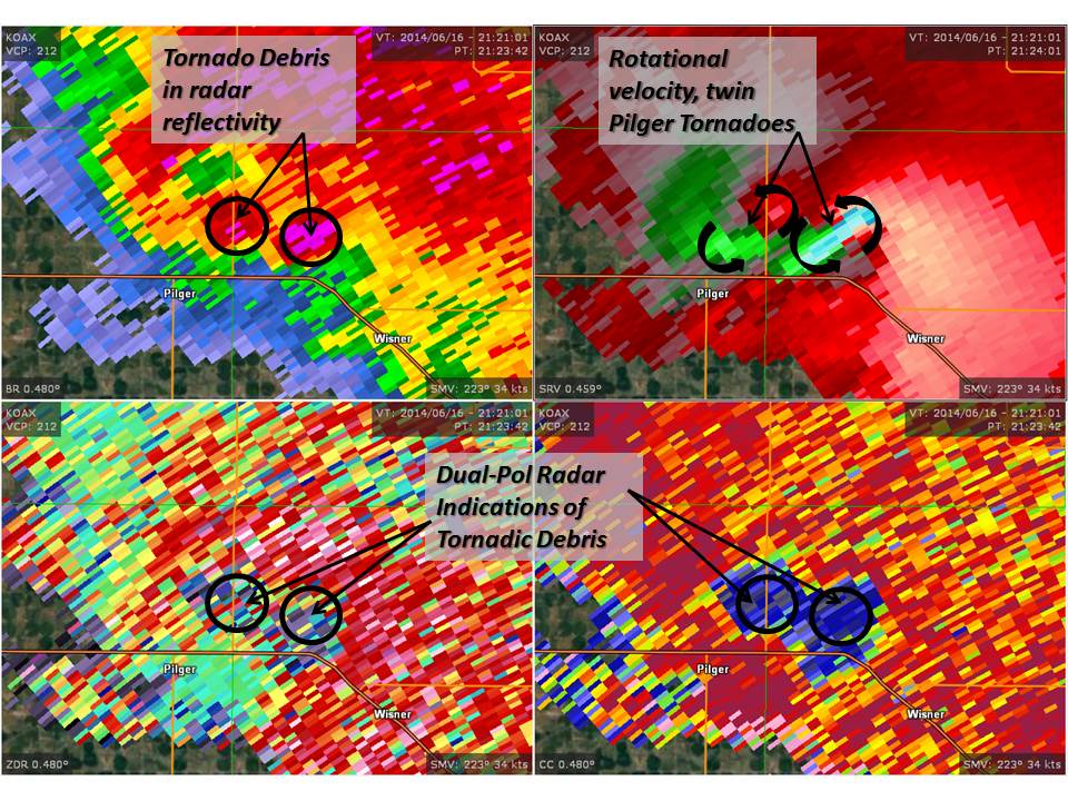 |
| Radar Loop 1941-2221 UTC | 2053 UTC 4-panel of reflectivity, storm-relative velocity, differential reflectivity, and correlation coefficient for the Stanton, NE tornado | 2115 UTC 4-panel of reflectivity, storm-relative velocity, differential reflectivity, and correlation coefficient for the Pilger, NE tornado | 2121 UTC 4-panel of reflectivity, storm-relative velocity, differential reflectivity, and correlation coefficient for the twin tornadoes |
 |
|||
| 2153 UTC 4-panel of reflectivity, storm-relative velocity, differential reflectivity, and correlation coefficient for the Wakefield, NE tornado |
Storm Reports
PRELIMINARY LOCAL STORM REPORT...SUMMARY
NATIONAL WEATHER SERVICE OMAHA/VALLEY NEBRASKA
1147 PM CDT MON JUN 16 2014

..TIME...   ...EVENT...      ...CITY LOCATION...     ...LAT.LON...
..DATE...   ....MAG....      ..COUNTY LOCATION..ST.. ...SOURCE....
            ..REMARKS..

0316 PM     HAIL             MADISON                 41.83N 97.46W
06/16/2014  E0.75 INCH       MADISON            NE   LAW ENFORCEMENT

0316 PM     HAIL             1 ESE MADISON           41.82N 97.44W
06/16/2014  M1.00 INCH       MADISON            NE   TRAINED SPOTTER

0340 PM     TORNADO          8 S NORFOLK             41.92N 97.42W
06/16/2014                   MADISON            NE   STORM CHASER

            TORNADO WAS ON THE GROUND 338 PM TO 340 PM NEAR THE
            JUNCTION OF HIGHWAY 81 AND 833 ROAD. THEN LIFTED.

0343 PM     TORNADO          2 SW STANTON            41.93N 97.25W
06/16/2014                   STANTON            NE   LAW ENFORCEMENT

0401 PM     TORNADO          STANTON                 41.95N 97.22W
06/16/2014                   STANTON            NE   TRAINED SPOTTER

            HOME DESTROYED

0406 PM     TORNADO          5 NNW STANTON           41.04N 97.21W
06/16/2014                   SEWARD             NE   STORM CHASER

            HOME DESTROYED APPROXIMATELY 5 TO 6 MILES NORTH NORTHWEST
            OF STANTON. STORM CHASER ALSO REPORTED TORNADO MOVING
            ACROSS HIGHWAY 275 EAST OF NORFOLK. LOCATION CORRECTED.

0416 PM     TORNADO          4 W WISNER              41.99N 96.99W
06/16/2014                   CUMING             NE   TRAINED SPOTTER

0444 PM     TORNADO          5 W PENDER              42.11N 96.81W
06/16/2014                   THURSTON           NE   TRAINED SPOTTER

0446 PM     TORNADO          5 E BEEMER              41.93N 96.71W
06/16/2014                   CUMING             NE   TRAINED SPOTTER

0530 PM     HAIL             WINNEBAGO               42.24N 96.47W
06/16/2014  E0.88 INCH       THURSTON           NE   TRAINED SPOTTER

            LATE REPORT.

0818 PM     HAIL             OSMOND                  42.36N 97.60W
06/16/2014  E1.00 INCH       PIERCE             NE   TRAINED SPOTTER

            PEA TO QUARTER SIZE HAIL LASTED A FEW MINUTES.

0830 PM     HAIL             HARTINGTON              42.62N 97.26W
06/16/2014  E1.00 INCH       CEDAR              NE   TRAINED SPOTTER

0910 PM     HAIL             LAUREL                  42.43N 97.09W
06/16/2014  E1.00 INCH       CEDAR              NE   TRAINED SPOTTER

0929 PM     HAIL             ELGIN                   41.98N 98.08W
06/16/2014  E0.88 INCH       ANTELOPE           NE   CO-OP OBSERVER

0934 PM     HAIL             4 NW PETERSBURG         41.90N 98.13W
06/16/2014  E1.75 INCH       BOONE              NE   PUBLIC

            HAIL COVERNING THE GROUND. RANGING FROM QUARTER TO GOLF
            BALL SIZE.


&&

$$
Environment
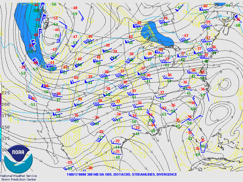
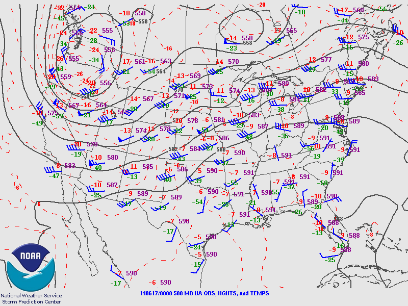
The event across northeast Nebraska on June 16, 2014 was synoptically typical for significant severe weather across the central and northern Plains. Aloft the wind profile was from the southwest that allows for the advection of warm and dry air from the higher terrain over the southwestern United States into the Plains states creating steep mid tropospheric lapse rates. This inversion aloft or capping is important to allow for the development of strong instability as warm moist air moves north on strong southerly winds from the Gulf of America. A number of weak weather disturbances were visible moving through the area within the southwest flow aloft that helped to break the capping inversion and trigger periods of thunderstorms on the 16th through the 17th of June.
 |
 |
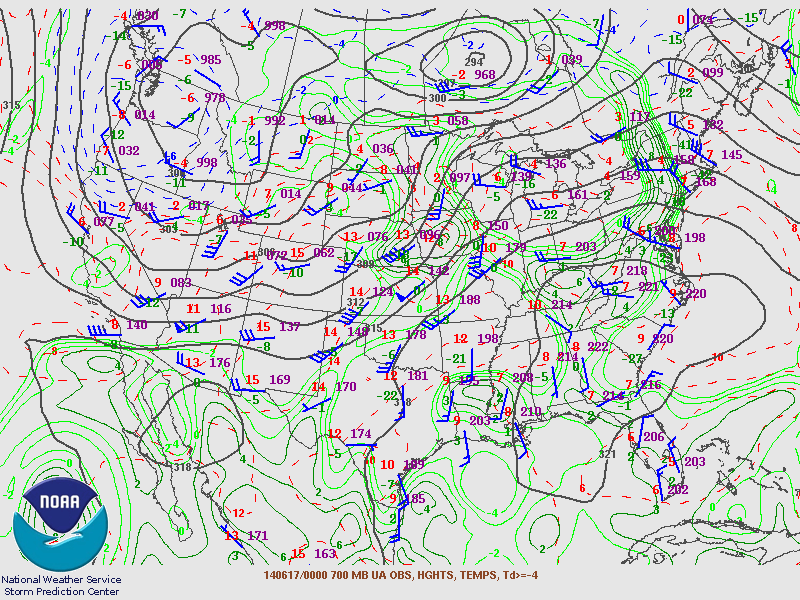 |
| Figure 1: 0000 UTC 17 June 300mb Anslysis (SPC) | Figure 2: 0000 UTC 17 June 500mb Analysis (SPC) | Figure 3: 0000 UTC 17 June 700mb Analysis (SPC) |
 |
||
| Figure 4: 0000 UTC 17 June 850mb Analysis (SPC) |
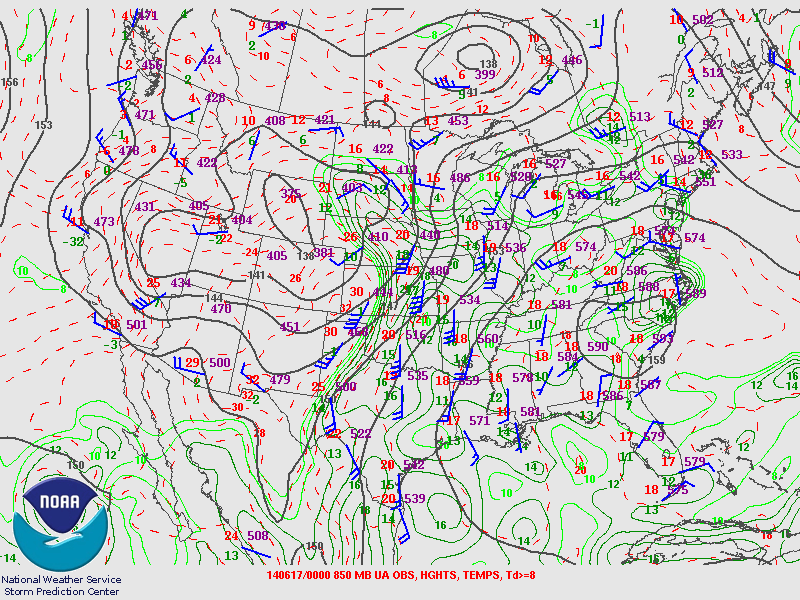
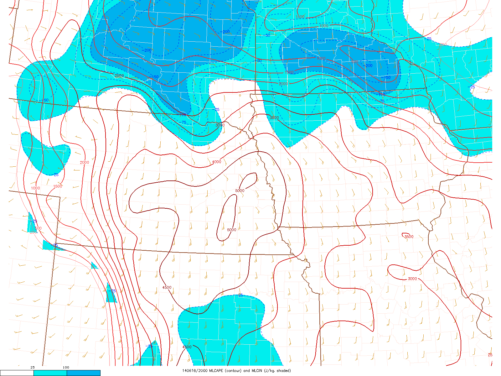
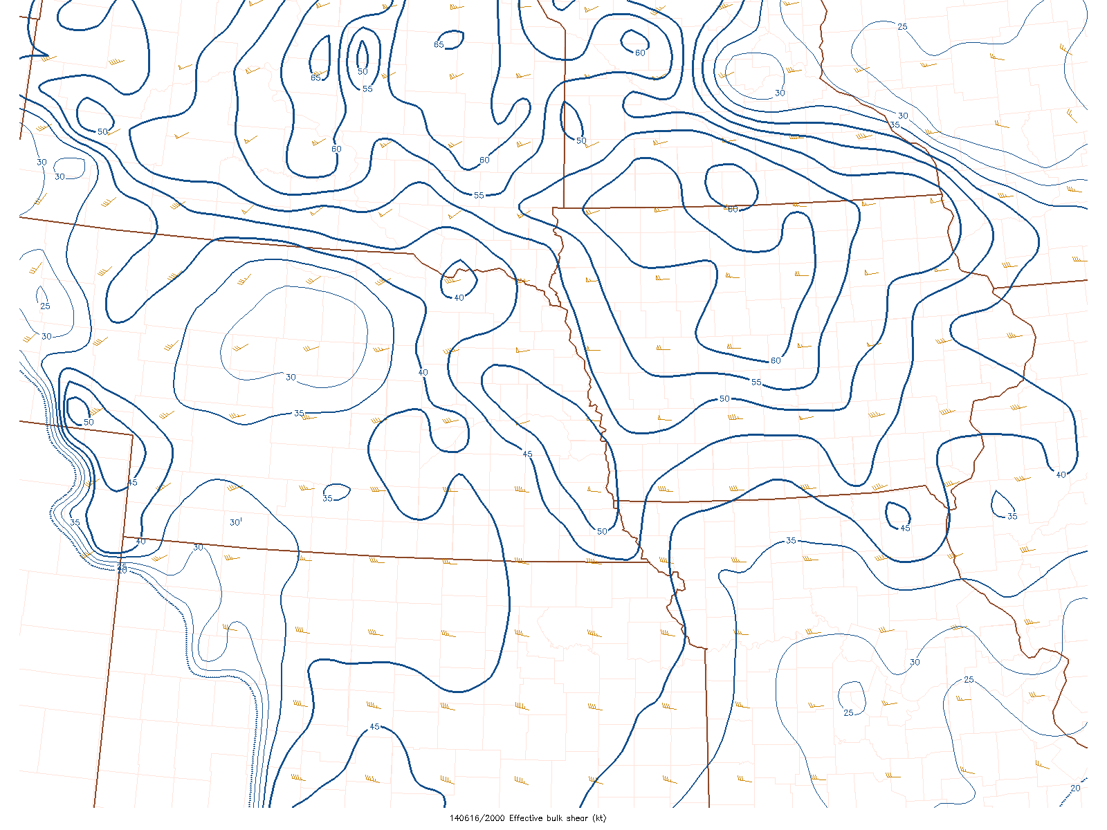
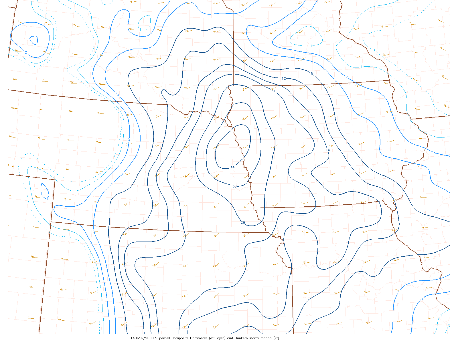
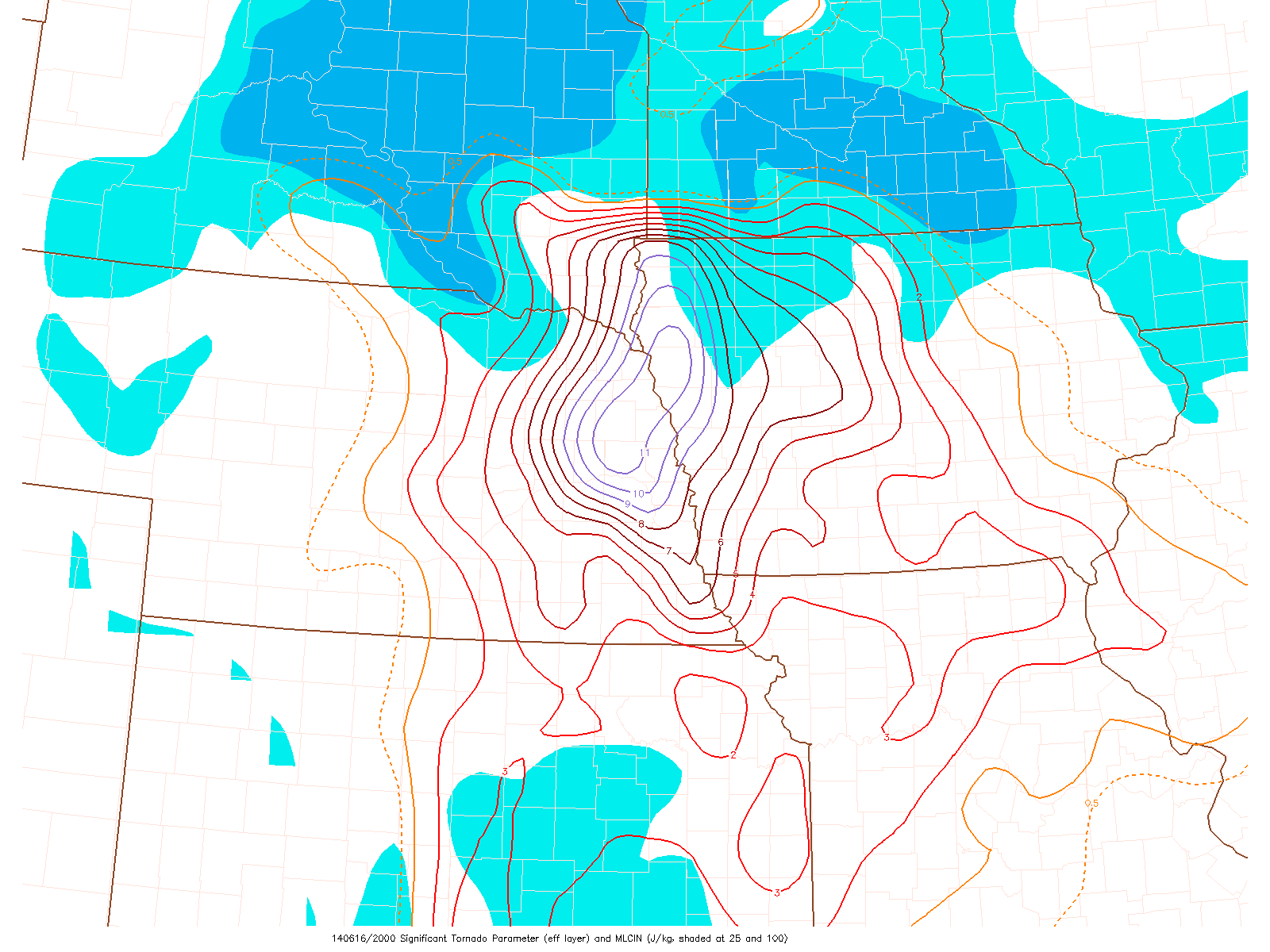
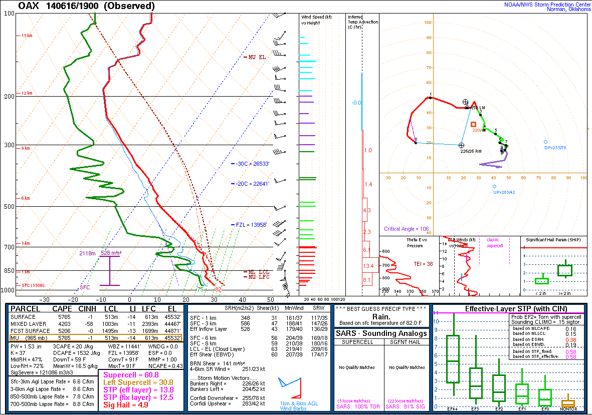
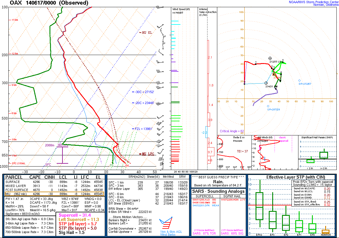
The storm-scale environment over the area exhibited extreme instability (Fig. 4) and strong vertical wind shear (Fig. 5). This creates an environment that is ideal for supercell thunderstorms. The low-level wind profile also exhibited strong directional turning with height as well as increasing wind speeds, which is favorable for the thunderstorms to rotate at the lower levels (Fig. 6). These parameters combined to create very high to extreme values of supercell composite (Fig. 7) and significant tornado parameter (Fig. 8) in the location of the supercell that would produce the northeast Nebraska area tornadoes on June 16. Atmospheric soundings from North Platte, NE and Omaha, NE are presented in figures 9 through 11. The 1200 UTC sounding from North Platte, NE indicated that there was the potential for extreme instability to develop later in the day. The 1900 UTC and 0000 UTC Omaha soundings indicated that the instability had developed, and this couple with the strong environmental wind shear was creating a volatile atmosphere.
 |
 |
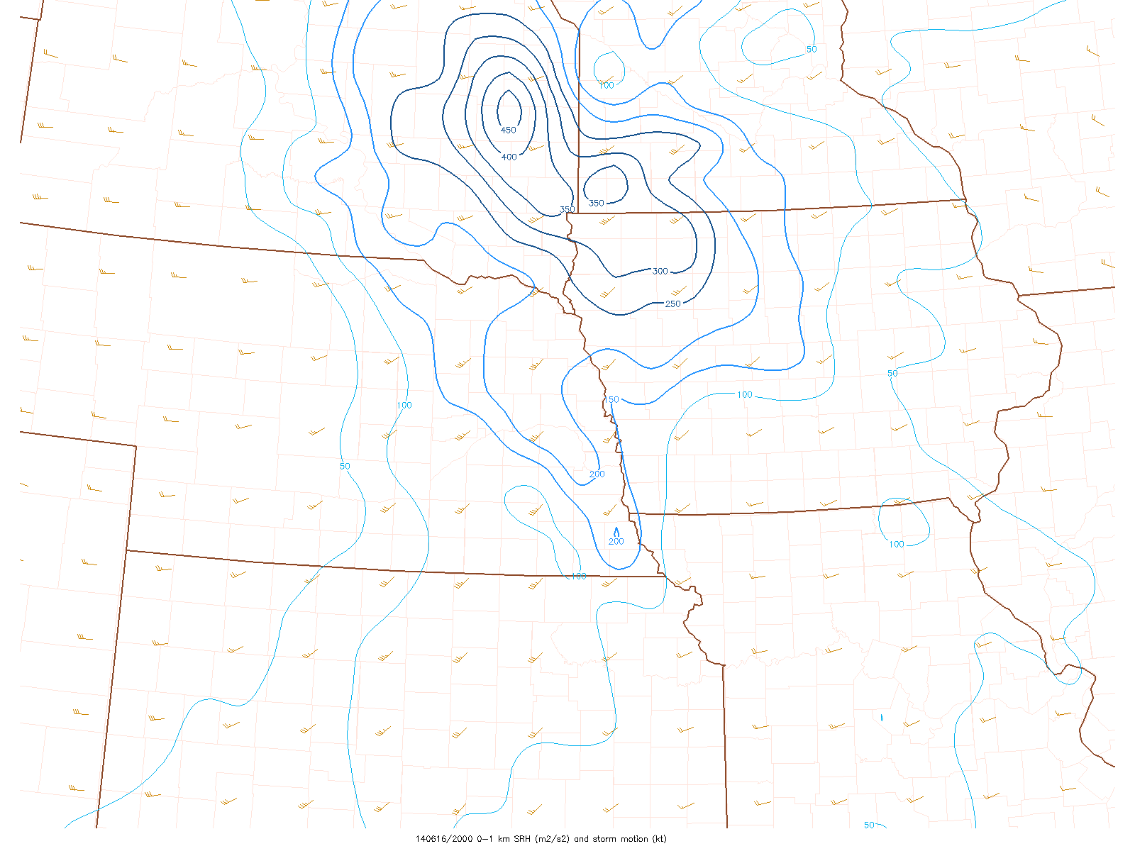 |
| Figure 4: 2100 UTC 16 June MLCAPE/CIN | Figure 5: 2100 UTC 16 June Effective Shear | Figure 6: 2100 UTC 16 June 0-1km SRH |
 |
 |
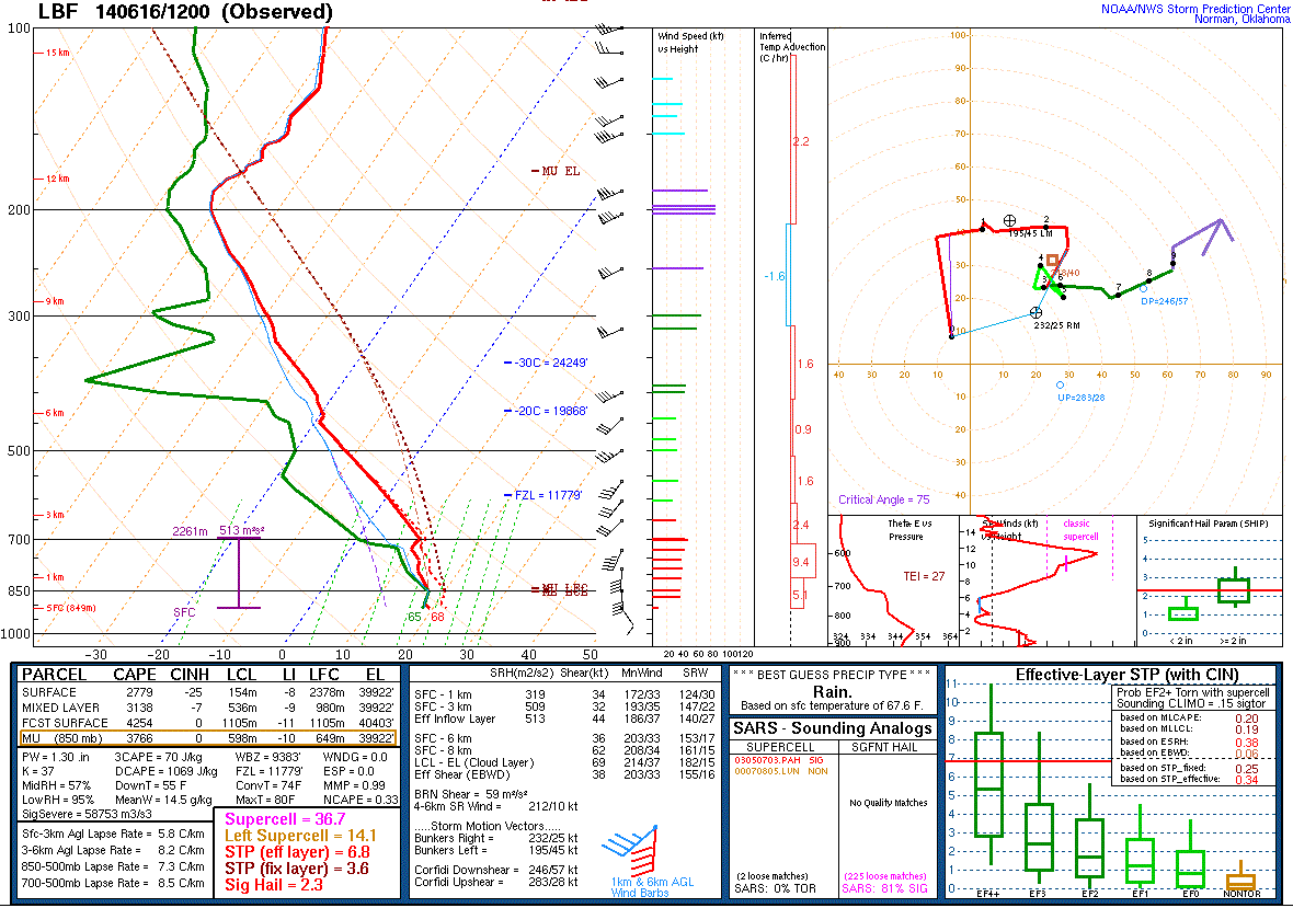 |
| Figure 7: 2100 UTC 16 June Supercell Composite | Figure 8 2100 UTC Sig Tornado Parameter | Figure 9 1200 UTC North Platte, NE Sounding |
 |
 |
|
| Figure 10 1900 UTC Omaha, NE Sounding | Figure 11 0000 UTC Omaha, NE Sounding |
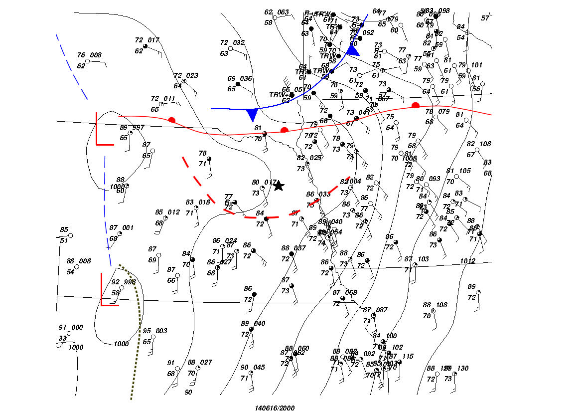
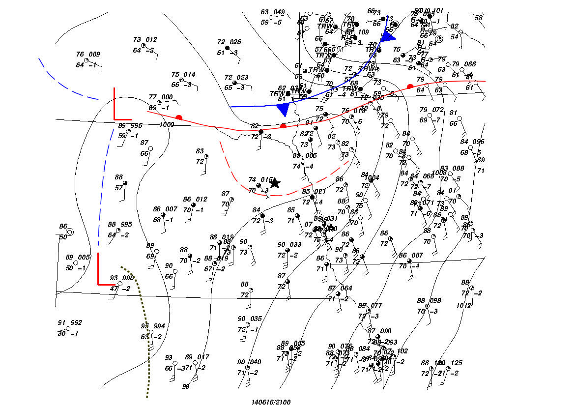
A subjective surface analysis is presented in figures 12 through 14. Although the synoptic warm front and cold front were located from southeast South Dakota into northern Iowa and southern Minnesota, an outflow boundary from thunderstorms earlier in the day resided over northeast Nebraska. The addition of this boundary both helped to initiate the supercell, but also create an enhanced low-level shear environment for the production of intense tornadoes. This boundary diminished through the late afternoon as the thunderstorms moved out of the area.
 |
 |
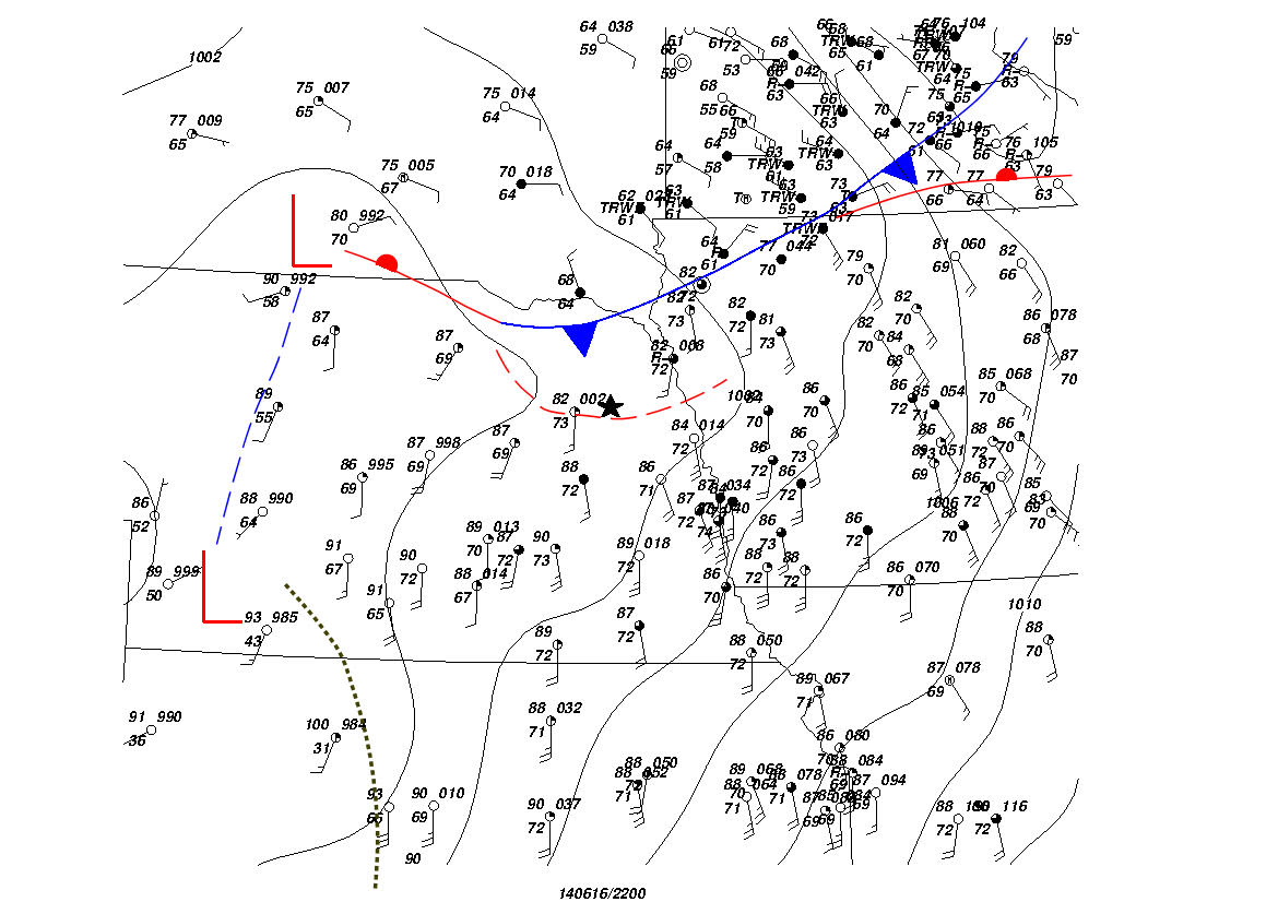 |
| Figure 12: 2000 UTC Subjective Surface Analysis | Figure 13: 2100 UTC Subjective Surface Analysis | Figure 14: 2200 UTC Subjective Surface Analysis |
 |
Media use of NWS Web News Stories is encouraged! Please acknowledge the NWS as the source of any news information accessed from this site. |
|

