
Extreme heat continues today from the central Plains to the lower Mississippi River Valley, over southeast Montana, and from southern California into the Southwest Deserts. Extreme Heat Warnings remain in effect. Severe thunderstorms capable of strong to severe wind gusts and large hail are possible across the Great Lakes into the Ohio Valley today into tonight. Read More >
Overview
|
On January 27, 2015 an ice jam developed below the Highway 92 bridge along the Platte River. During the early morning hours of the 27th water was reported crossing the road into Two Rivers State Recreation Area. The Waterloo Fire Department was dispatched to rescue three people stranded on top of a pickup on a road inside the park. A second vehicle was swept off the road and a couple was rescued from the park, also by Waterloo Fire. On January 29th, an explosives contractor was brought in to begin dynamite operations to break up the jam. By late that morning the ice jam released on its own, thus eliminating the need for the use of dynamite. The map to the right shows the approximate location of the ice jam. The jam started just north of where F street meets the Platte River and extends about 2.1 miles downstream. All photos below are courtesy of the Papio-Missouri River Natural Resource District. |
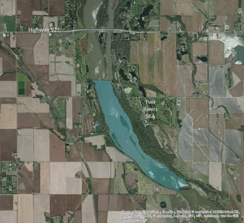
The Google Earth image above shows the approximate location of the ice jam. |
 |
 |
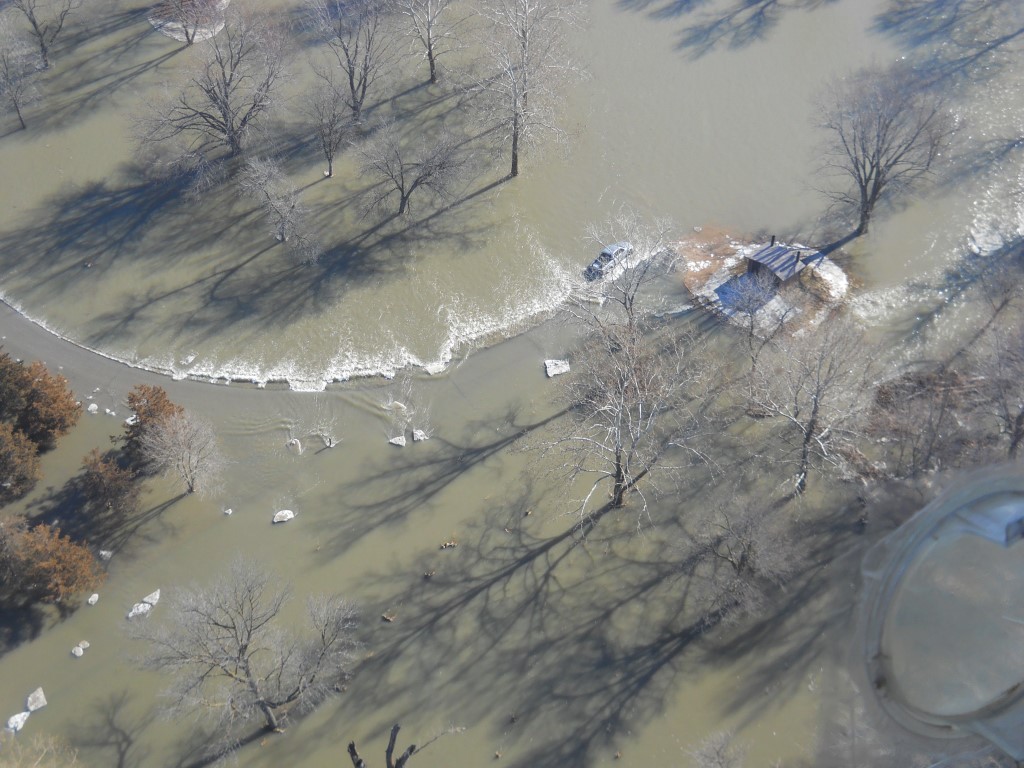 |
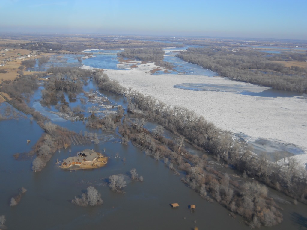
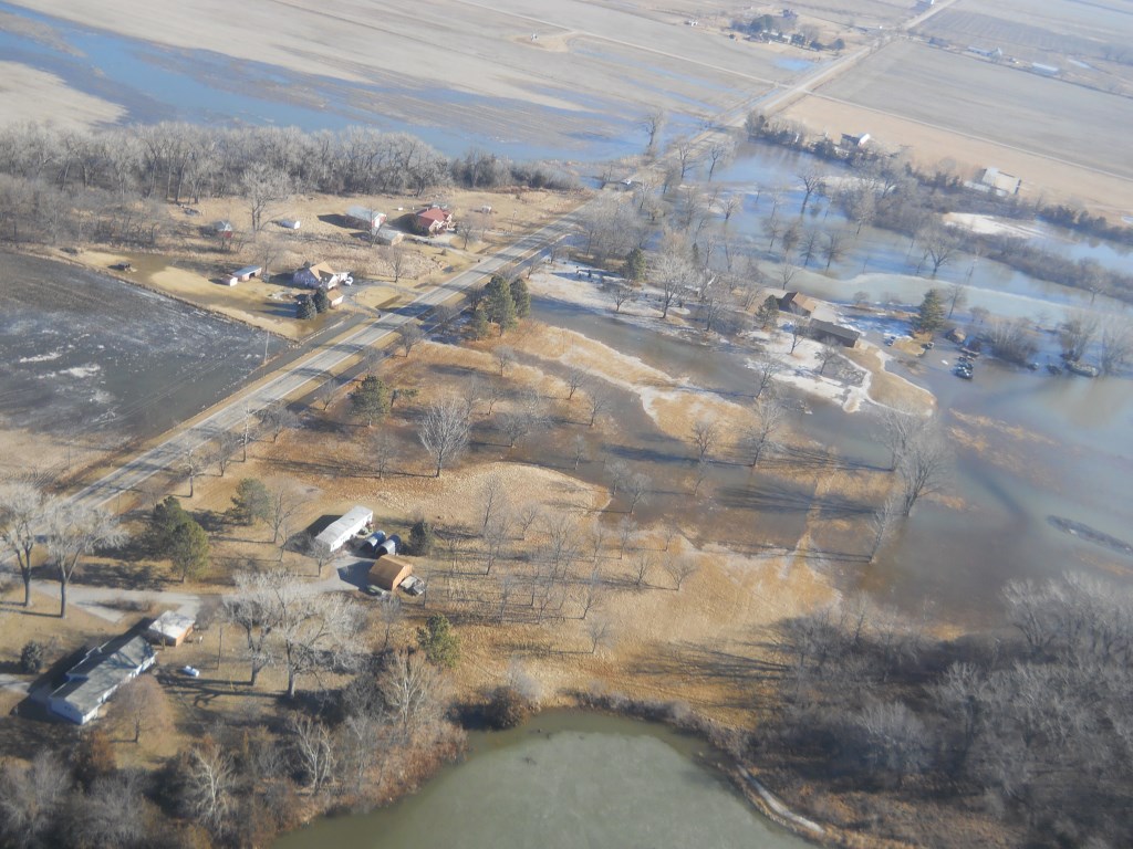
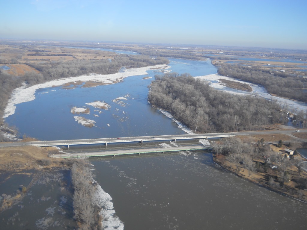
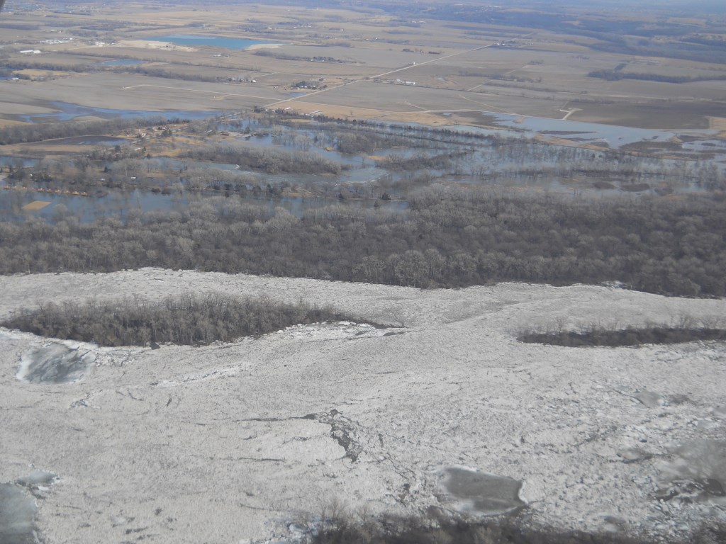
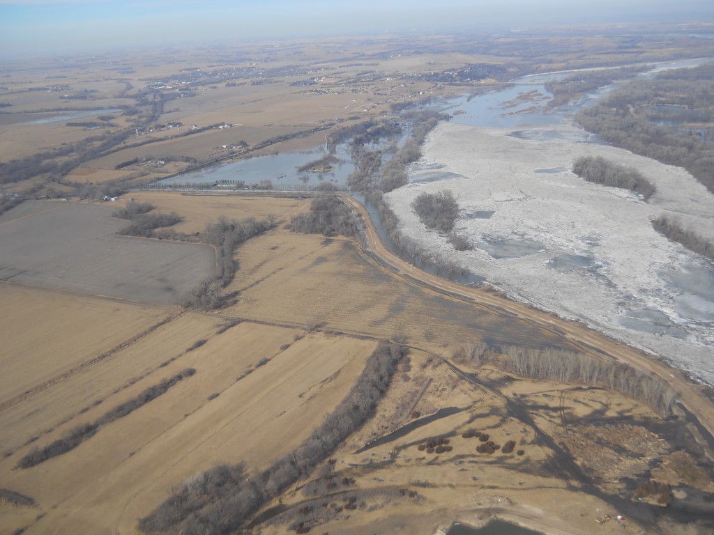
| Aerial view of the flooding with isolated home | Aerial view of the Two Rivers SRA | Flooded campground at the Two Rivers SRA |
Photos
 |
 |
 |
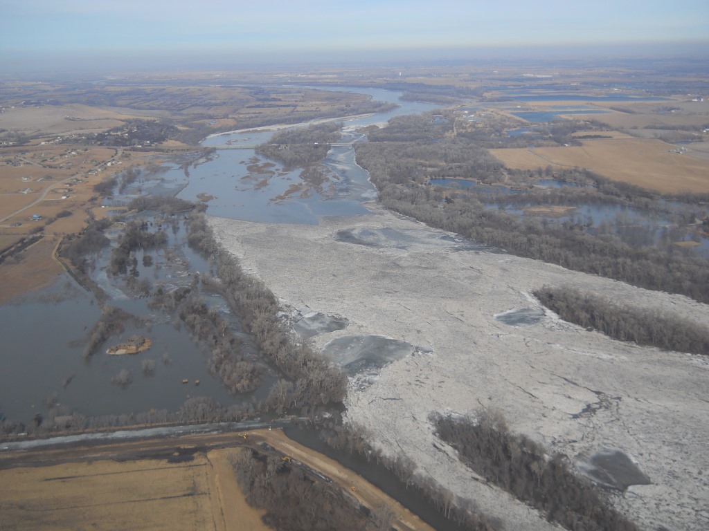 |
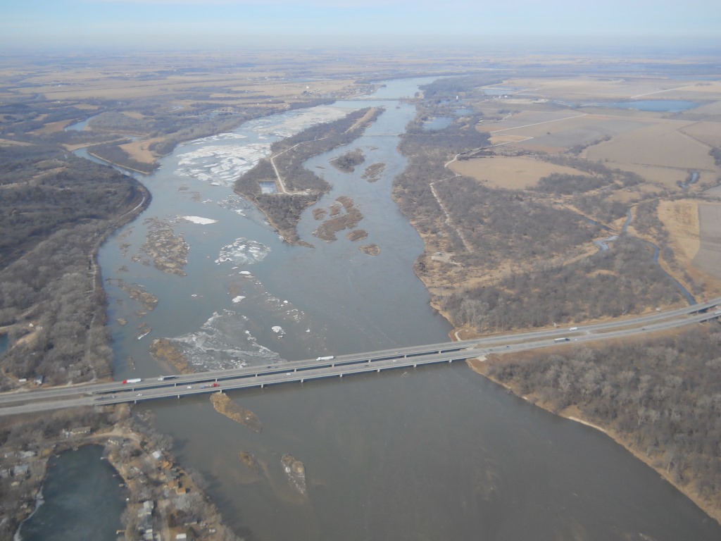
| Highway 92 (looking north) | Beginning of ice jam (looking east) | Highway 6 | Looking north |
 |
 |
 |
 |
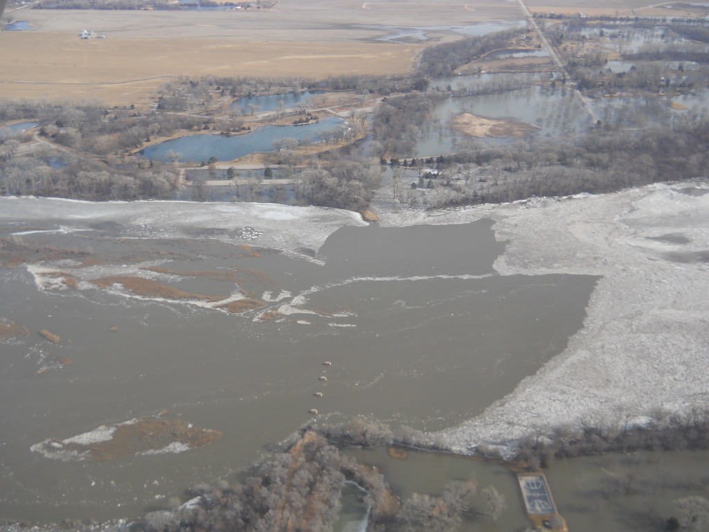
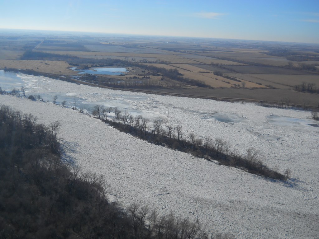
| Packed ice | Packed ice | Flooded area (looking north) | Interstate 80 (looking upstream) |
Weather and River Conditions
 |
 |
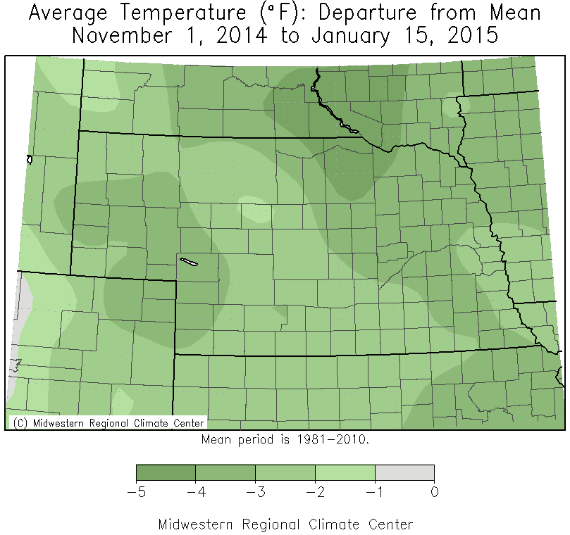 |
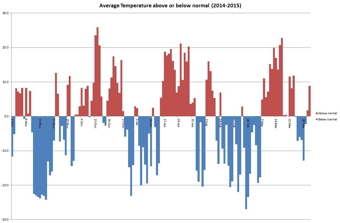
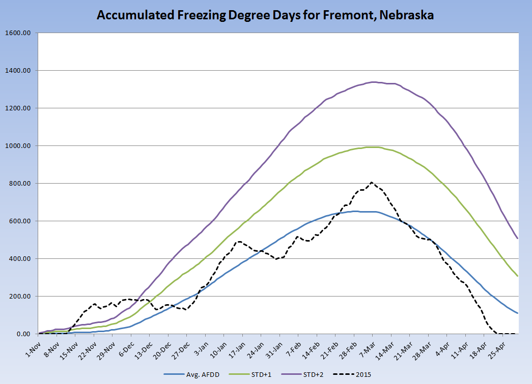
| The above graph is a depiction of temperatures in Fremont, Nebraska relative to normal. Note the big warm-up prior to breakup (Jan 26th) and the formation of the ice jam. | The graphic above is an attempt to show the temperatures from this winter and the amount of cold air available to make ice. The dotted line shows values were near average for much of the winter but started out very high, meaning a cold start to the winter which allowed for a lot of ice to form. | As the map above shows, the winter of 2014-2015 began with temperatures below normal. This allowed for thick ice to develop on area rivers. |
 |
 |
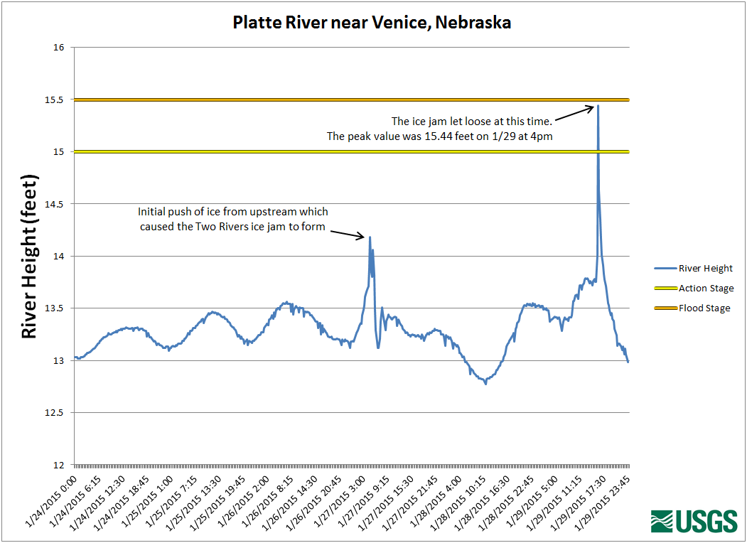 |
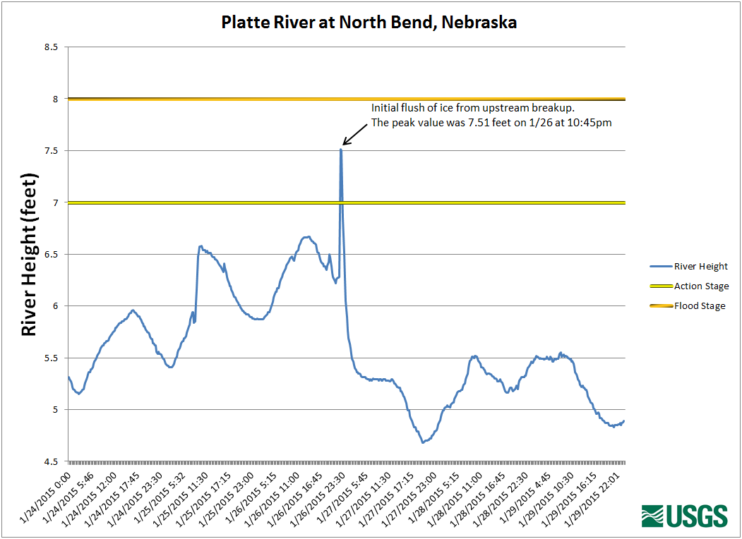
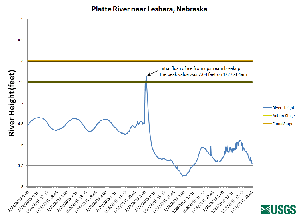
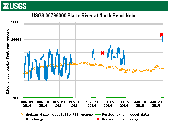
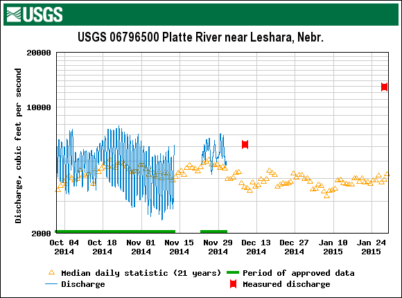
| The graph above is from the USGS river gage near North Bend, Nebraska. Note the times when ice moved through. | The graph above is from the USGS river gage near Leshara, Nebraska. Note the times when the ice moved through. | The graph above is from the USGS river gage near Venice, Nebraska. It shows when the upstream ice moved in, causing the jam and when the ice jam let loose. |
 |
 |
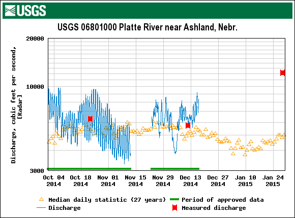 |
| The graphic above from the USGS shows river levels were elevated going into breakup, likely contributing to the overall threat for ice jams. | The graphic above from the USGS shows river levels were elevated going into breakup, likely contributing to the overall threat for ice jams. | The graphic above from the USGS shows river levels were elevated going into breakup, likely contributing to the overall threat for ice jams. |
 |
Media use of NWS Web News Stories is encouraged! Please acknowledge the NWS as the source of any news information accessed from this site. |
|

