
Heat expands across the Desert Southwest, Plains, Mississippi Valley and Midwest into Monday. Fire weather concerns continue for portions of the Intermountain West. Active monsoonal moisture fuels thunderstorms over the Southwest with possible flash flooding. Tropical cyclone Fausto in the Pacific, should weaken as it approaches Hawaii; Dangerous surf, swells and rip currents are expected. Read More >
Overview
|
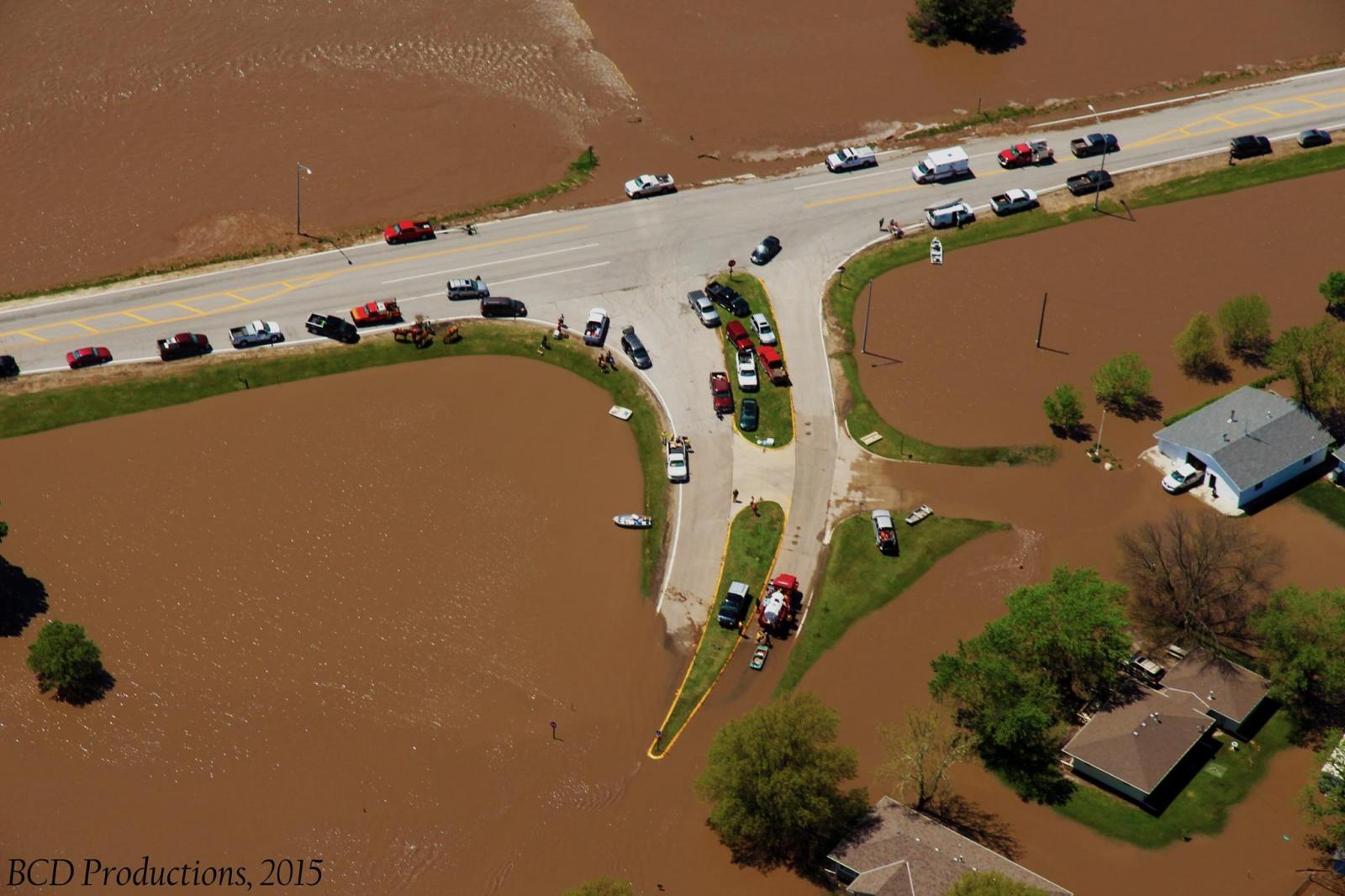
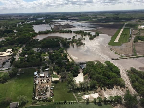
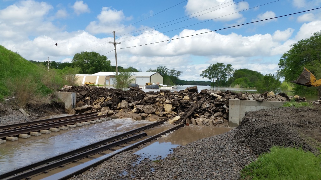
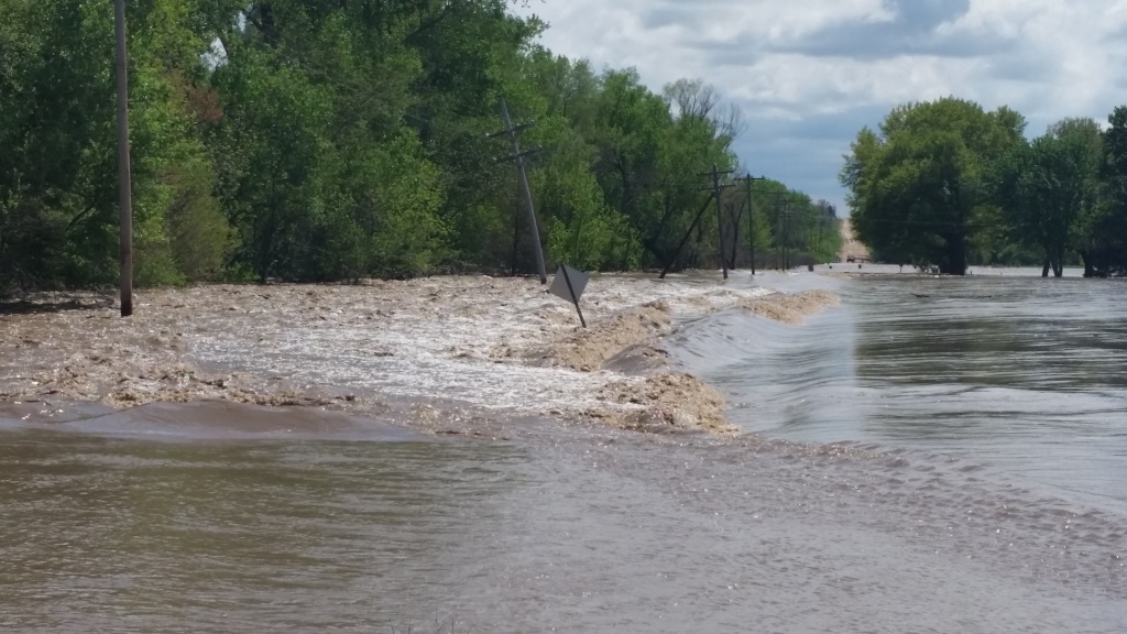
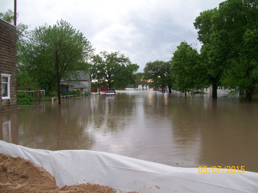
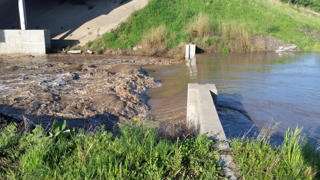
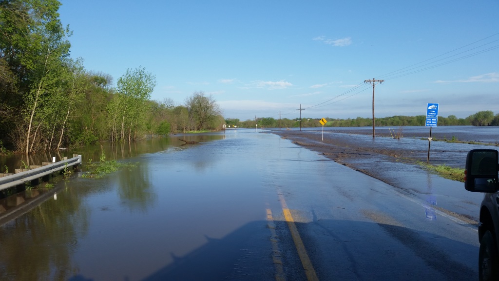
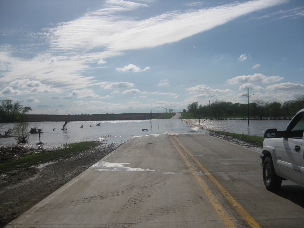
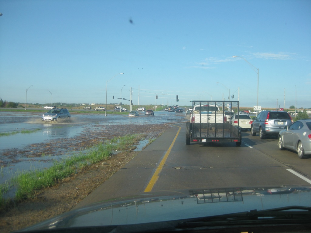
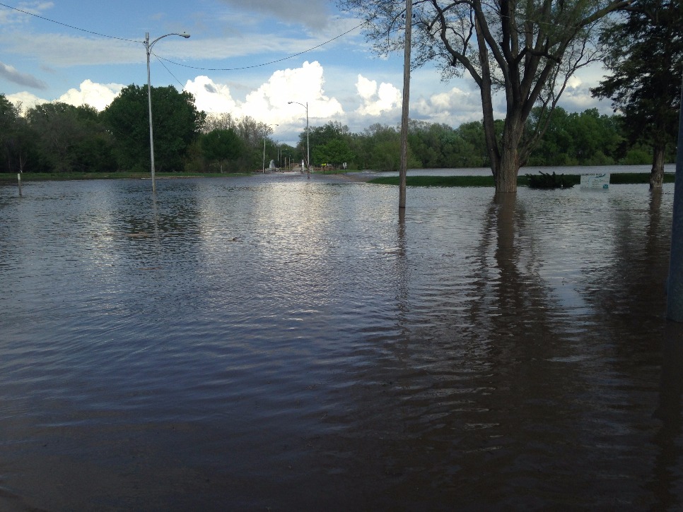
Historic rains fell across portions of southeast Nebraska during the evening hours of May 6th and into the early morning hours of May 7th. Rainfall amounts exceeding 6 to 7 inches were common. The highest official reports received by the NWS was 10.91 inches in Hebron. The rain wasn't just heavy, it rain fell over a large area. The resulting runoff led to record river levels along the Little Blue River, Salt Creek and Turkey Creek. The town of DeWitt (pictured right) was completely flooded from Turkey Creek and the Big Blue River. In Lincoln, Salt Creek saw its highest crest in over a 100 years. The levee system in Lincoln was pushed to the limit but held the water back. In Fairbury the Little Blue River overflowed the railroad tracks east of town. The water rose so fast, city officials didn't have time to put in a levee gate over the tracks and instead used rip rap (pictured below). Flood damages reached far and wide and totaled over $13 million when it was all said and done. |
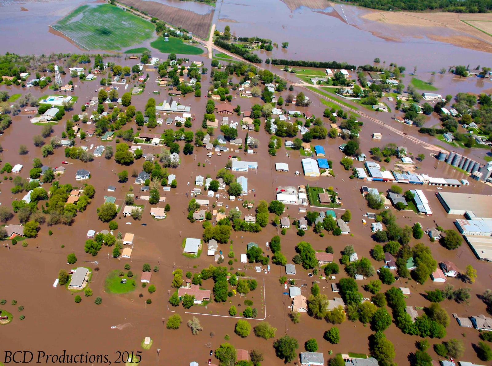 DeWitt, Nebraska underwater after heavy rains |
 |
 |
 |
| Intersection near DeWitt | Flooding near Hebron Source: Nebraska Governors Office |
Railroad track near Fairbury |
Watershed Overview
Note the orientation of where the heavy rain fell in this event. The storms moved in a similar orientation to Salt Creek (southwest to northeast), likely contributing the historic river levels observed after the rain ended.
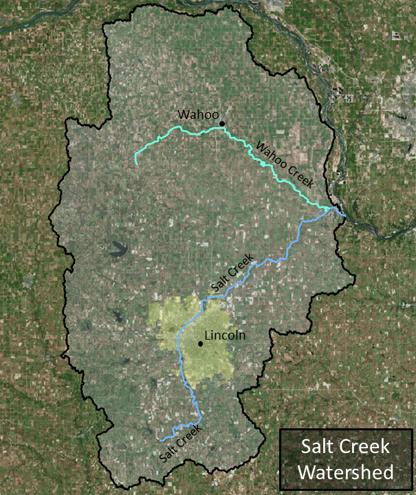 |
| Click the image above for an overview map of Salt Creek |
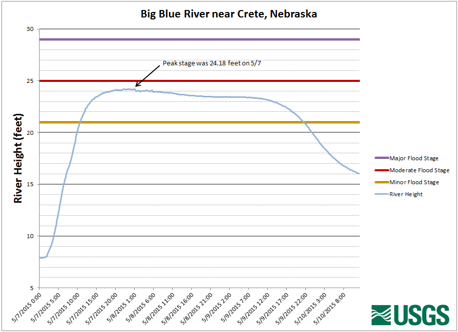
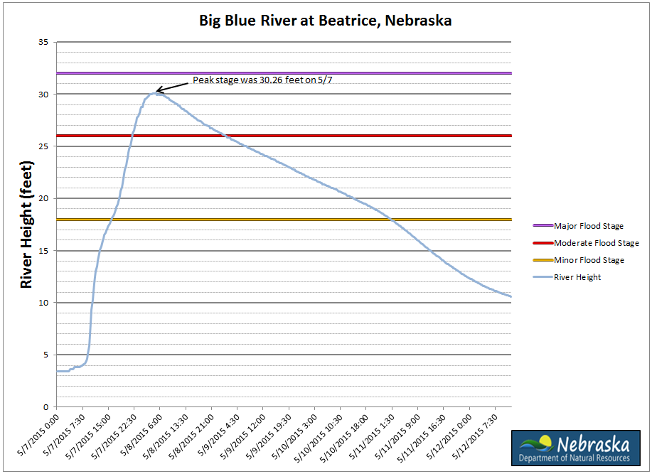
Big Blue River:
Moderate flooding occurred along the Big Blue River through northern and central Gage County. The flooding was extensive over the western and southern side of the city of Beatrice leading to many local streets to be closed, in addition to U.S. Highway 77 and U.S. 136. The Big Blue River created near Crete at 24.18 feet, or 3.18 feet above flood stage during the afternoon of the 7th. The Big Blue River at Beatrice crested at 30.26 feet, or 12.26 feet above flood stage late in the evening on the 7th. The Big Blue River near Barneston crested at 27.78 feet or 7.78 feet above flood stage during the morning on the 8th.
 |
 |
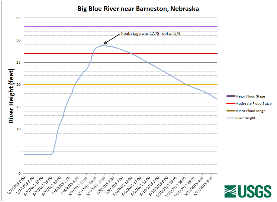 |
| near Crete, Nebraska | at Beatrice, Nebraska | near Barneston, Nebraska |
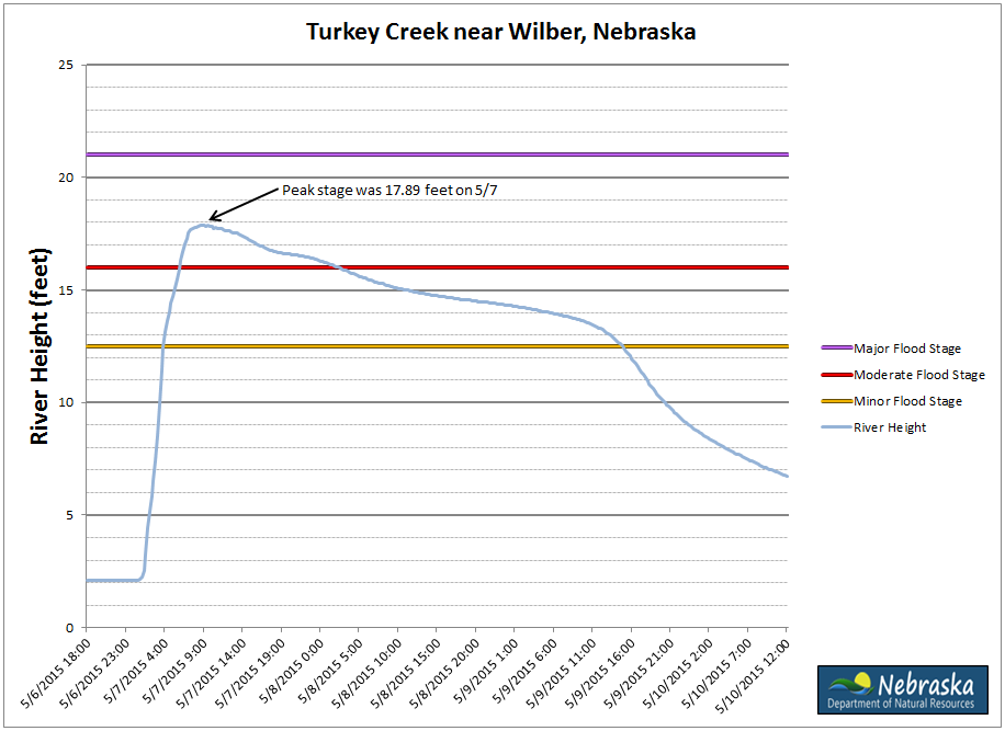
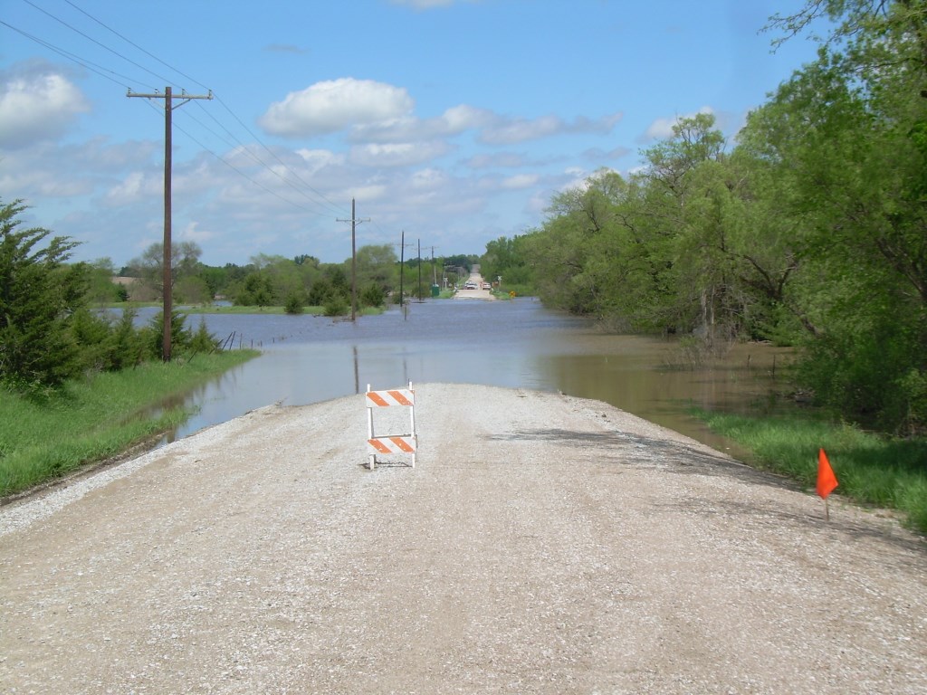
Turkey Creek
Extremely heavy rainfall of 5 to 10 inches fell along the Turkey Creek basin. This allowed for the creek to swell into moderate flood levels. Flooding along the Creek resulted in numerous rural road closures and significant low-land flooding. The combination of the Turkey Creek and Big Blue river led to nearly the entire town of De Witt to be flooded on the 7th of May resulting in a voluntary evacuation of the city. The creek at Wilber crested at 17.89 feet, or 5.39 feet above flood stage.
 |
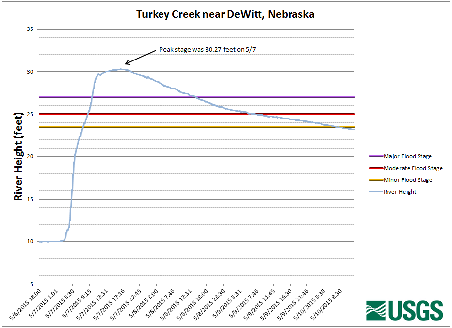 |
| near Wilber, Nebraska | near DeWitt, Nebraska |
Little Blue River
Extremely heavy rainfall of 6 to 10 inches fell across the northern basin of the Little Blue River. This cause the river to swell to record levels around the Fairbury area. The flooding resulted in the mandatory evacuations of areas of the western and southern parts of town, to the west of the Union Pacific Railroad tracks. The flooding of some residents along the river did result in one fatality of an elderly residence in her basement. The river crested at 25.48 feet or 6.98 feet above flood stage.
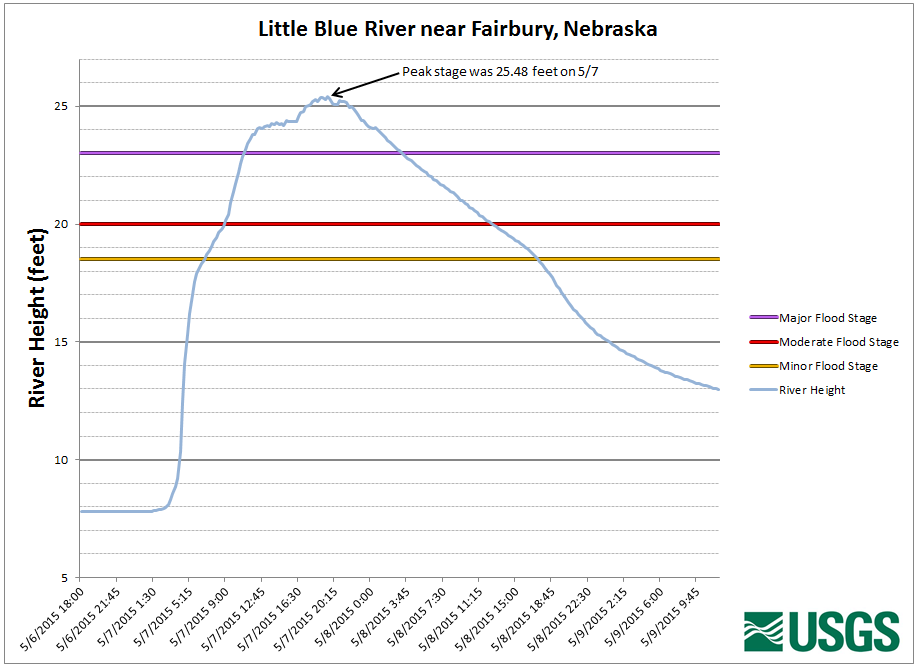 |
| near Fairbury, Nebraska |
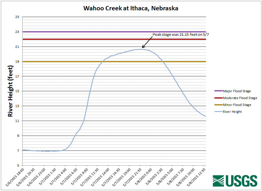
Wahoo Creek
Heavy rainfall of 2 to 5 inches fell across the Wahoo Creek basin from the evening of the 6th into the morning of the 7th. This resulted in widespread low-land flooding along the creek from near Ithaca to Ashland .
 |
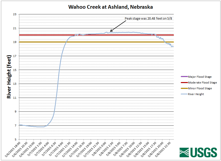 |
| at Ithaca, Nebraska | at Ashland, Nebraska |
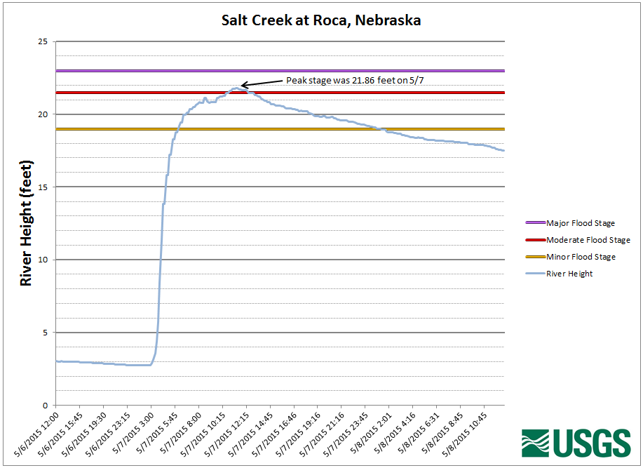
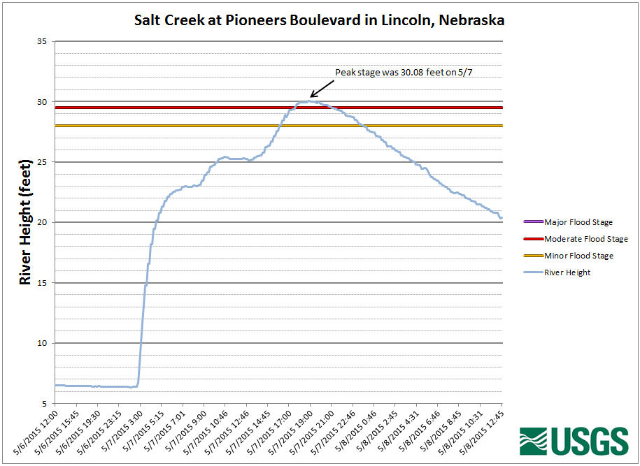
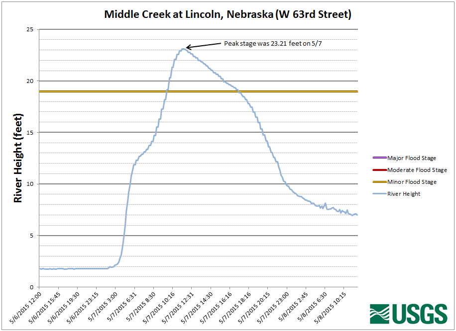
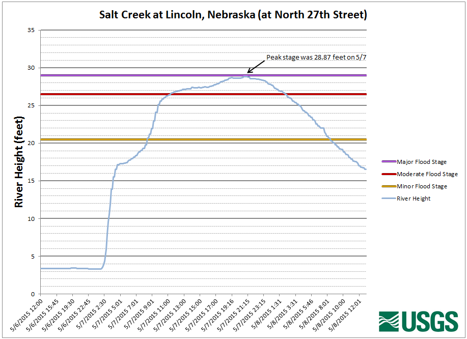
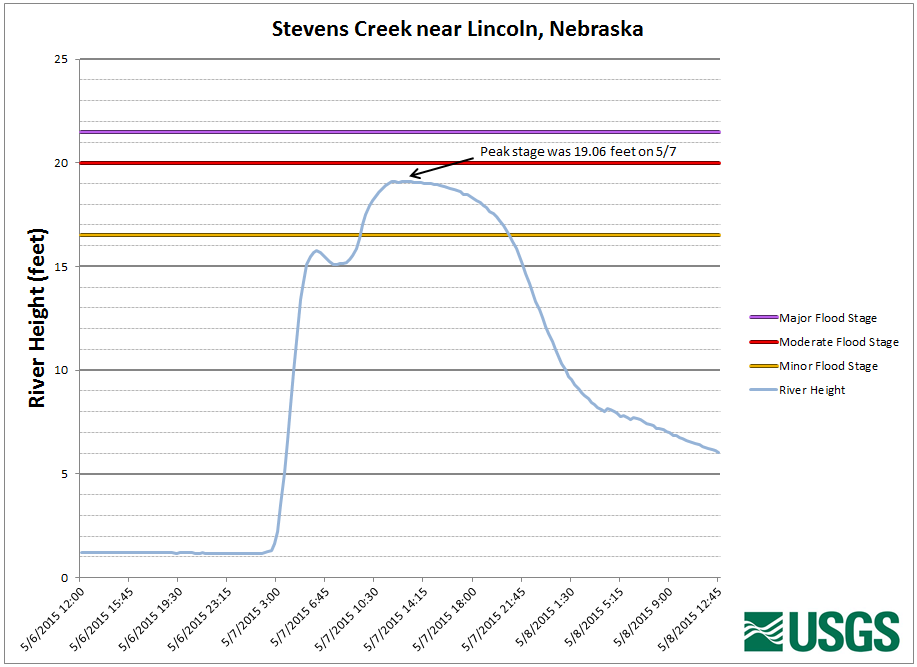
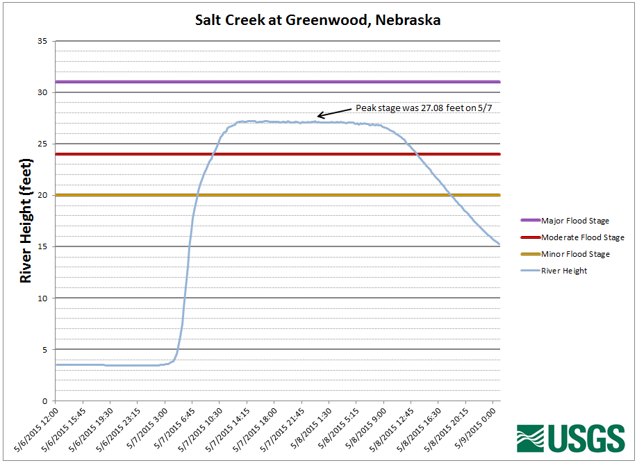
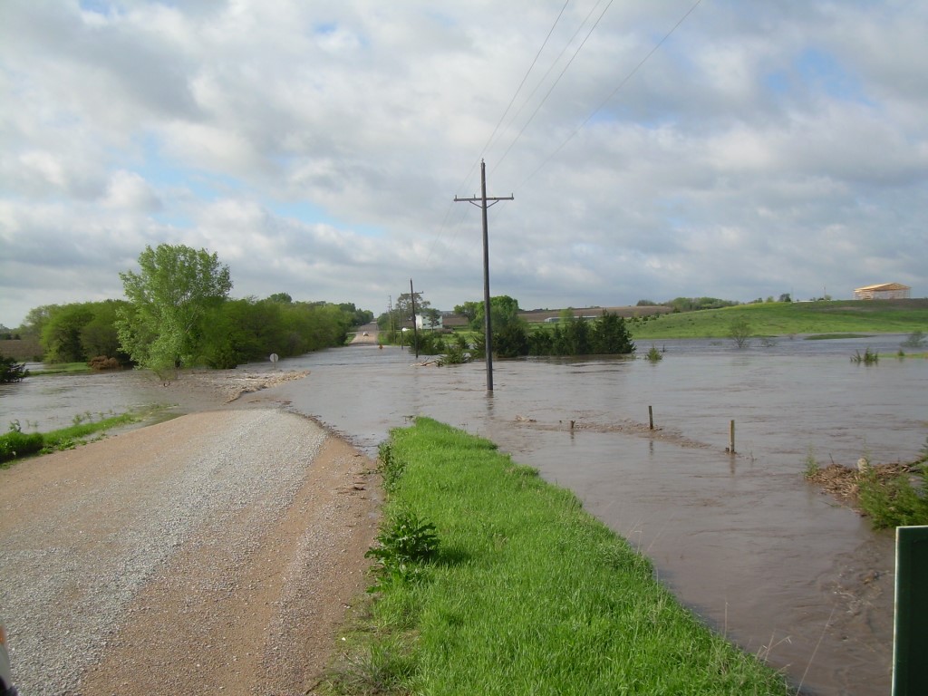
Salt Creek
Record rainfall of 5 to 10 inches fell across Lancaster County, and the Salt Creek basin on the evening of the 6th into the early morning of the 7th. This led to significant flooding along the creek, from near Roca north through the Lincoln metro area. The flooding resulted in numerous road closures, water rescues and some mandatory evacuations. The flooding was largely contained within the levee system within the city of Lincoln, but many parks and low-lined areas were flooded.
 |
 |
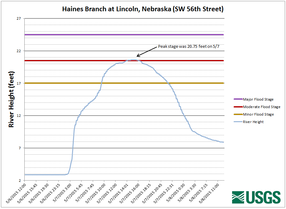 |
| near Roca, Nebraska | at Pioneers Blvd in Lincoln | Haines Branch at SW 58th Street |
 |
 |
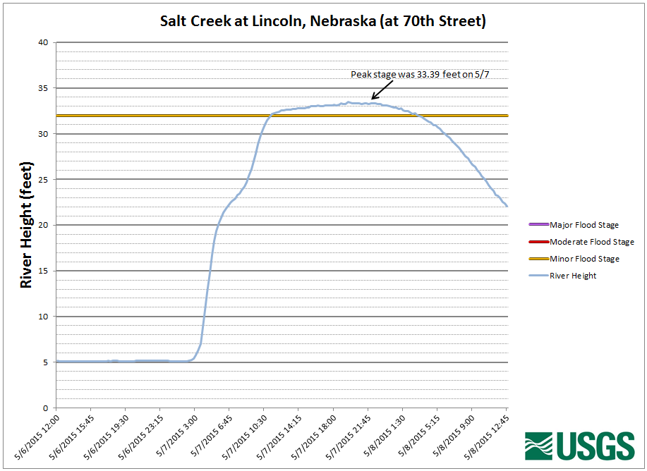 |
| Middle Creek at W 63rd Street | at North 27th Street | at 70th Street |
 |
 |
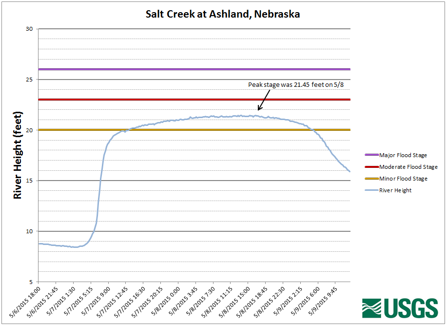 |
| Stevens Creek - northeast of Lincoln | at Greenwood, Nebraska | at Ashland, Nebraska |
Rainfall Summary
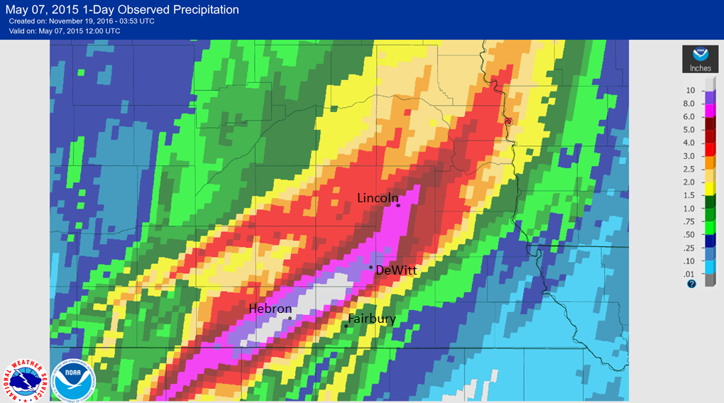
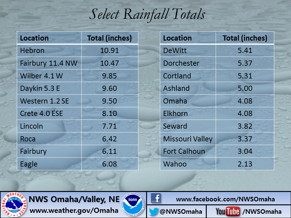
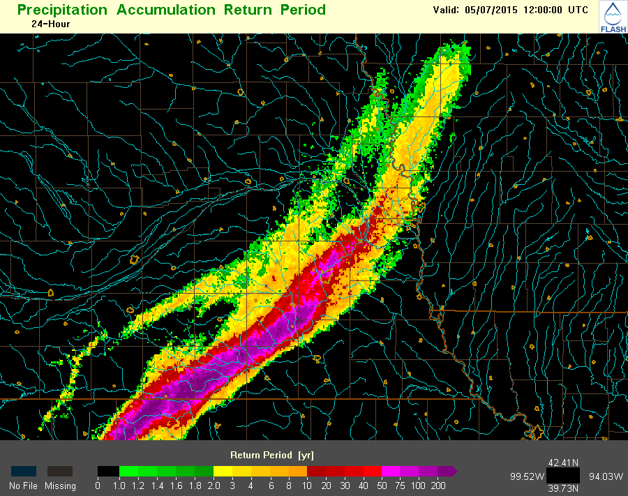
Rainfall reports across the area were substantial to say the least. While the highest official report was 10.91 inches, higher unofficial reports were received by the National Weather Service. Some of this rainfall amounts exceed 12 inches. The figures below show both the magnitude and areal coverage of the storms. Figure 3 is an attempt to show how rare the rainfall was. Note in this image that some of the rain falls into the 100-200 year category. This doesn't mean that rains this heavy only happen once every 100 to 200 years, rather they have a 1% or less of occurring any year!
 |
 |
 |
| Figure 1: NWS Quality-Controlled Rainfall Estimates Source: AHPS |
Figure 2: Select Rainfall Totals |
Figure 3: Rainfall Return Period Source: FLASH |
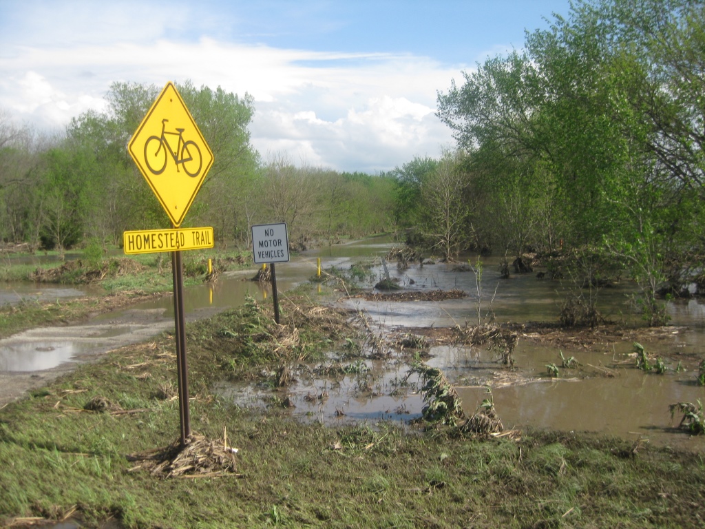
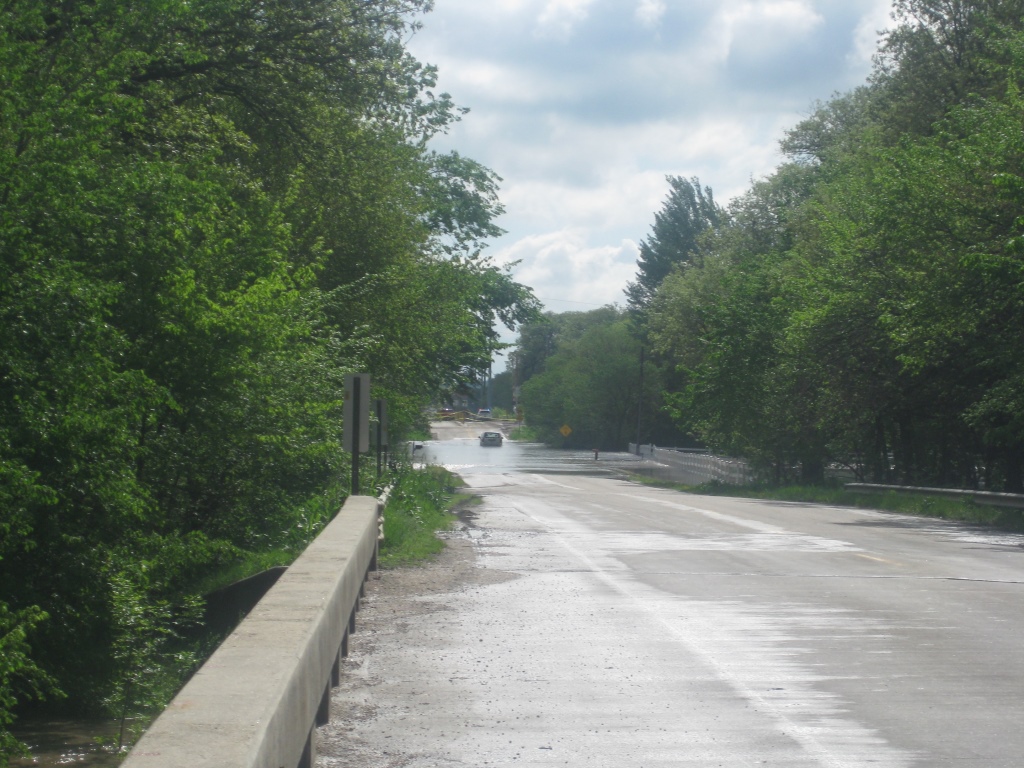
Photos
 |
 |
 |
| Fredrick Avenue in Fairbury (source: Jefferson Co. EM) |
Steele City (source: Jefferson Co. EM) |
Railroad cut near Fairbury (source: Jefferson Co. EM) |
 |
 |
 |
| Southwest 56th Street (source: USGS) |
Southwest 56th Street (source: USGS) |
Homestead Trailhead (source: USGS) |
 |
 |
 |
| Pioneers Blvd (source: USGS) |
Roca bridge (source: USGS) |
Roca Road (source: USGS) |
 |
 |
 |
| Flooding at Warlick Blvd (source: USGS) |
Flooding at Silver Street in Ashland (source: JEO) |
Saltillo Road (source: USGS) |
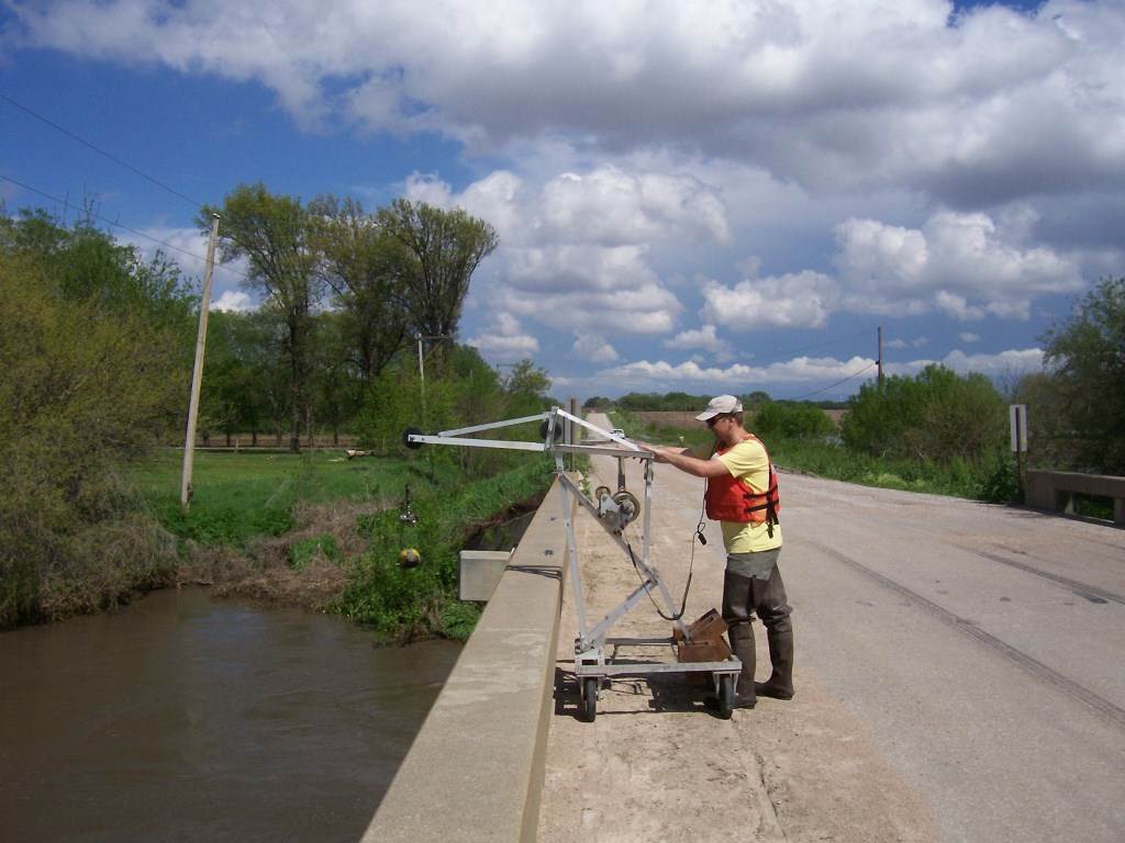 |
||
| USGS Crews at work during the flood | ||
 |
Media use of NWS Web News Stories is encouraged! Please acknowledge the NWS as the source of any news information accessed from this site. |
|

