A couple of frontal boundaries will move east and south from the Plains to the Gulf and Atlantic coastlines. These boundaries will focus showers and thunderstorms through the weekend, with scattered severe thunderstorms from the Southern Plains and across the Gulf Coast states. Locally heavy rainfall may also occur, which may be welcome news across drought areas. Meanwhile, heat spreads westward. Read More >
Omaha/Valley, NE
Weather Forecast Office
Report Rainfall from Your Backyard!
We want your rain! Seriously, if you measure the rain we would like you to send it to us. The best way is through CoCoRaHS. By joining CoCoRaHS you'll be one of many people providing the NWS, and other weather-related agencies, vital rain and snow reports. You can even report hail and drought conditions. If you are interested, click this link.
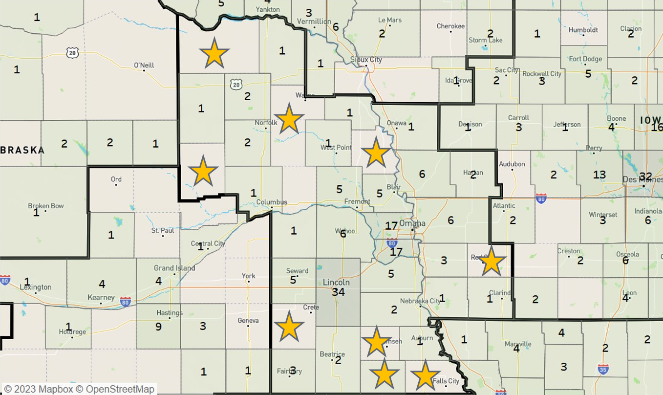
Some places we need more observers are labeled by a star on the map below. The numbers indicated how many active observers we already have in each county. We want these numbers to grow! Will you help us? For questions, contact David Pearson.

Warnings/Hazards
Forecast Discussion
Winter Weather
Severe Weather
Fire Weather
Drought
Storm Prediction Center
SubmitReport
Rivers And Lakes
River Forecasts
Missouri River Overview
Platte River Overview
Elkhorn River Overview
Ice Jam Risk
Local Information
Latest Briefing Packet
Weather Monitor
Winter Monitor
Preparedness
Storm Spotters
About Us
Other Useful Links
US Dept of Commerce
National Oceanic and Atmospheric Administration
National Weather Service
Omaha/Valley, NE
6707 North 288th Street
Valley, NE 68064-9443
402-359-5166
Comments? Questions? Please Contact Us.

