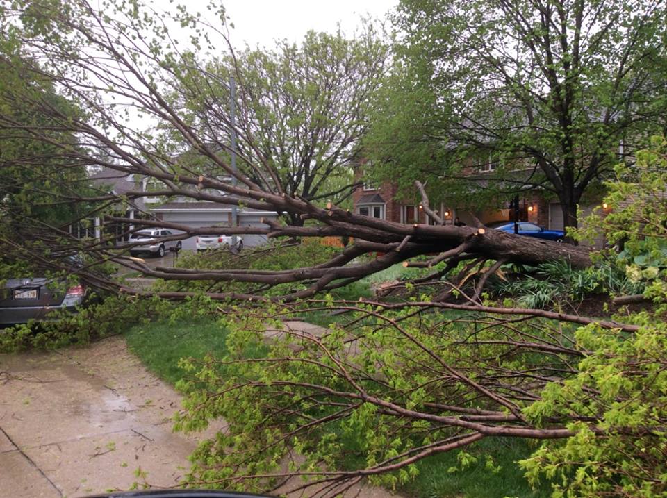
Summary of tornadoes that occured on Wednesday, April 27, 2016
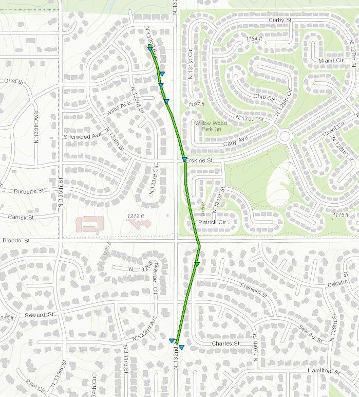
----- Omaha Tornado 1 -----
EF SCALE RATING: EF-1
ESTIMATED PEAK WIND: 86-110 MPH
PATH LENGTH /STATUTE/: 0.67 MILES
PATH WIDTH /MAXIMUM/: 50 YARDS
FATALITIES: 0
INJURIES: 0
START DATE: APRIL 27, 2016
START TIME: 3:43 PM CDT
START LOCATION: ALONG 132ND ST. AND CHARLES ST.
START LAT/LON: 41.2744 /-96.1196
END DATE: APRIL 27, 2016
END TIME: 3:47 PM CDT
END LOCATION: 132ND ST. JUST NORTH OF LAKE ST.
END LAT/LON: 41.2837 /-96.1206
----- Omaha Tornado 2 -----
EF SCALE RATING: EF-0
ESTIMATED PEAK WIND: 65 TO 85 MPH
PATH LENGTH /STATUTE/: 0 MILES
PATH WIDTH /MAXIMUM/: PENDING
FATALITIES: 0
INJURIES: 0
START DATE: APRIL 27, 2016
START TIME: 3:59 PM CDT
START LOCATION: POND IN WATERFORD SUBDIVISION NEAR 146TH AND IDA
START LAT/LON: 41.3223/-96.1468
END DATE: APRIL 27, 2016
END TIME: 3:59 PM CDT
END LOCATION: POND IN WATERFORD SUBDIVISION NEAR 146TH AND IDA
END_LAT/LON: 41.3223/-96.1468
----- Stanton, IA, Tornado -----
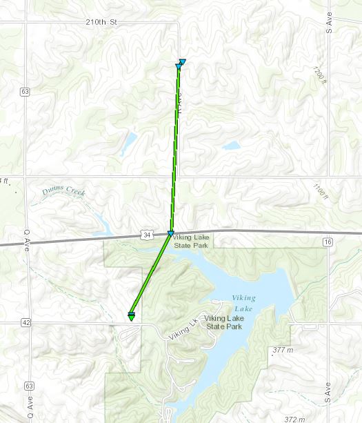
EF SCALE RATING: EF-1
ESTIMATED PEAK WIND: 85 TO 90 MPH
PATH LENGTH /STATUTE/: 1.74 MILES
PATH WIDTH /MAXIMUM/: 25 YARDS
FATALITIES: 0
INJURIES: 0
START DATE: APRIL 27, 2016
START TIME: 3:14 PM CDT
START LOCATION: 3 ESE STANTON IOWA
START LAT/LON: 40.9737 N / -95.048 W
END DATE: APRIL 27, 2016
END TIME: 3:19 PM CDT
END LOCATION: 3 ENE STANTON IOWA
END_LAT/LON: 40.9978 N / -95.0415 W
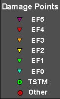
EF SCALE: THE ENHANCED FUJITA SCALE CLASSIFIES
TORNADOES INTO THE FOLLOWING CATEGORIES.
EF0...WEAK......65 TO 85 MPH
EF1...WEAK......86 TO 110 MPH
EF2...STRONG....111 TO 135 MPH
EF3...STRONG....136 TO 165 MPH
EF4...VIOLENT...166 TO 200 MPH
EF5...VIOLENT...>200 MPH*

