Summary | Forecast | Travel Center | Monitoring & Reporting | Safety
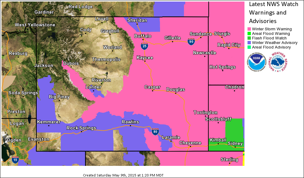
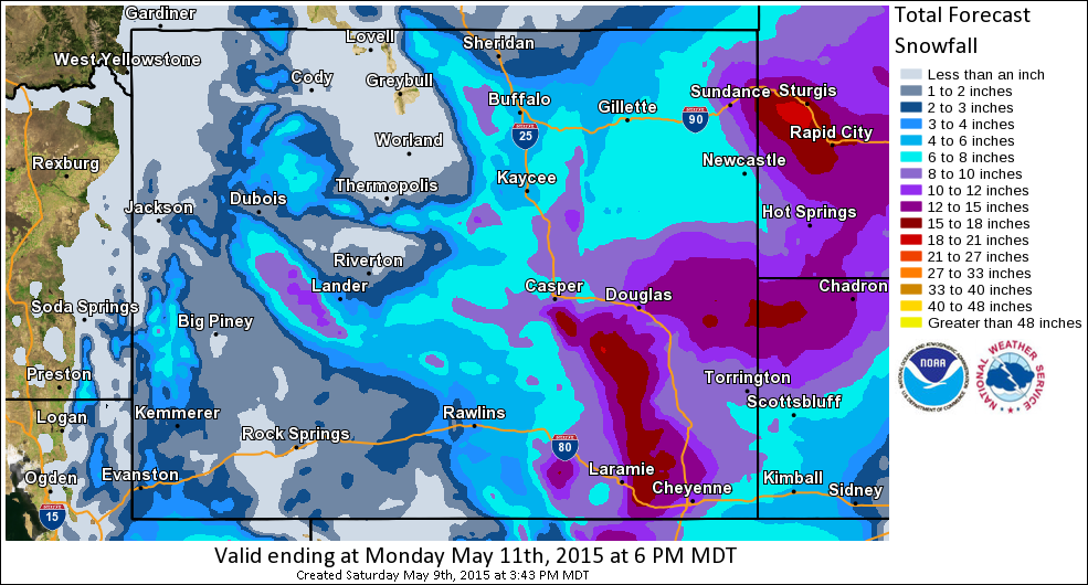
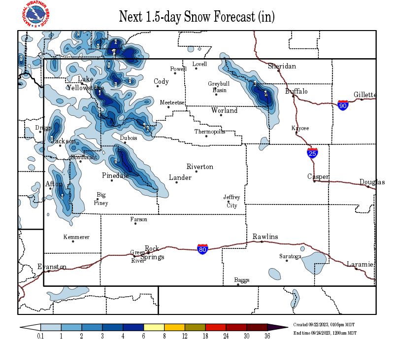
SYNOPSIS: A slow-moving storm will track across Colorado this weekend. Moisture and cold air on the north side of this system will deposit as much as a foot of very wet snow in the central mountains during the period. Even some lower elevations can also expect significant accumulating snow.
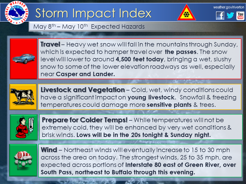
Several waves of rain and snow will move through the region through midday Sunday. Snow levels will begin around 6000 feet, but drop to around 4,500 feet by midnight. The heaviest snow and rain will fall through this evening, with the exception of Johnson and Natrona counties where the heavy snow will continue through tonight. The snow will gradually decrease from northwest to southeast through the daylight hours on Sunday.
 |
|
Click Image To Enlarge |
IMPACTS: South Pass, Casper Mountain, Powder River Pass, and Togwotee Pass (especially toward Dubois) will be impacted through Sunday, with the highest impact expected through early Sunday morning. Expect winter driving conditions with roads becoming extremely slick and snow packed at pass level. Slushy roads are possible along Interstate 25 and around Casper on Sunday. The accumulating snow tonight may also impact US 20/26 between Casper and Riverton, US 287 from Mudday Gap to Lander, and Wind River Canyon. Expect areas of fog and a few icy roads early Monday morning.
|
|
|
|
|
|
|
|
High Wind Statement |
|
Multimedia Briefing |
 |
 |
|
Click Image To Enlarge |
Click Image To Enlarge |
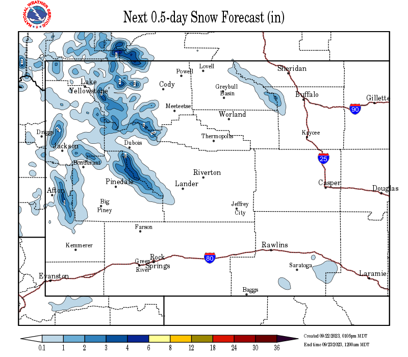
Snow and Wind Forecasts - Update Every 3 Hours
 |
 |
|
12 Hour Snow Accumulation Forecast |
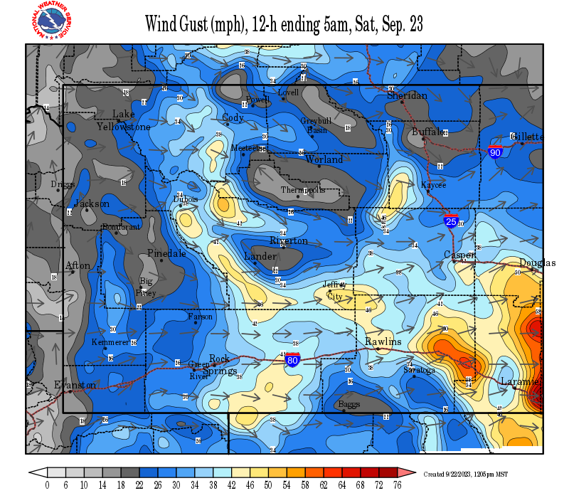
12 Hour Peak Wind Gusts |
 |
 |
|
24 Hour Snow Accumulation Forecast |
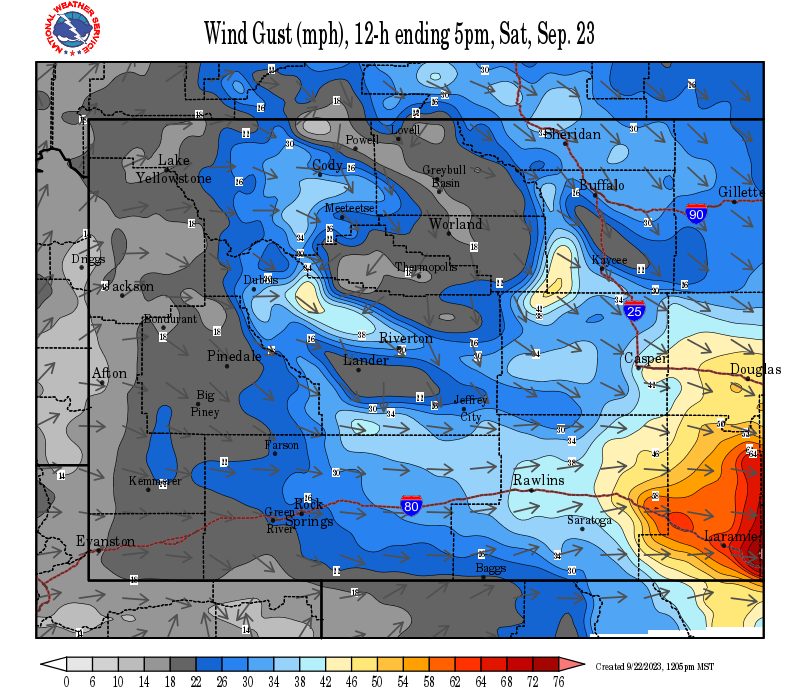
12-24 Hour Peak Wind Gusts |
 |
 |
|
36 Hour Snow Accumulation Forecast |
24-36 Hour Peak Wind Gusts |
Summary | Forecast | Travel Center | Monitoring & Reporting | Safety
|
|
|
|
|
|
|
|
 |
 |
 |
 |
|
|
|
|
|
 |
 |
 |
 |
|
|
|
|
|
 |
 |
 |
|
If you plan to travel, we recommend checking road conditions along your route and staying on top of road closures here. If you are on Twitter, follow the hashtag: #WyoRoad (or look below) for the latest weather affecting roads and road conditions in and around Wyoming.
| Tweets by @NWSRiverton | #WyoRoad Tweets |
|
Get the play-by-play on this storm and contribute your own snow reports to #wywx |
On the road? Tweet road conditions to #WyoRoad!
|

Summary | Forecast | Travel Center | Monitoring & Reporting | Safety
PLEASE SEND US YOUR SNOW REPORTS (CLICK HERE)
 |
Monitor our Severe Weather Summary Page for current Warnings, Watches, and Advisories. What's the difference? |
 |
Check the latest Weather Story graphic for an overview of the area forecast. |
 |
Check out what's on the radar. Riverton | Pocatello | Cheyenne | Billings | Salt Lake City | Rapid City | Mosaic |
 |
Submit storm reports/images and keep up to date with us on Facebook! |
 |
Submit storm reports/images and keep up to date with us on Twitter! |
 |
Other reporting methods include submitting an online report, email (cr.wxriw@noaa.gov), or by phone at 1-800-211-1448. |
 |
Check the latest Public Information Statement for the latest storm reports. |
 |
Monitor current road conditions by visiting the Wyoming Dept. of Transportation (WYDOT) or by calling 5-1-1. |
Summary | Forecast | Travel Center | Monitoring & Reporting | Safety
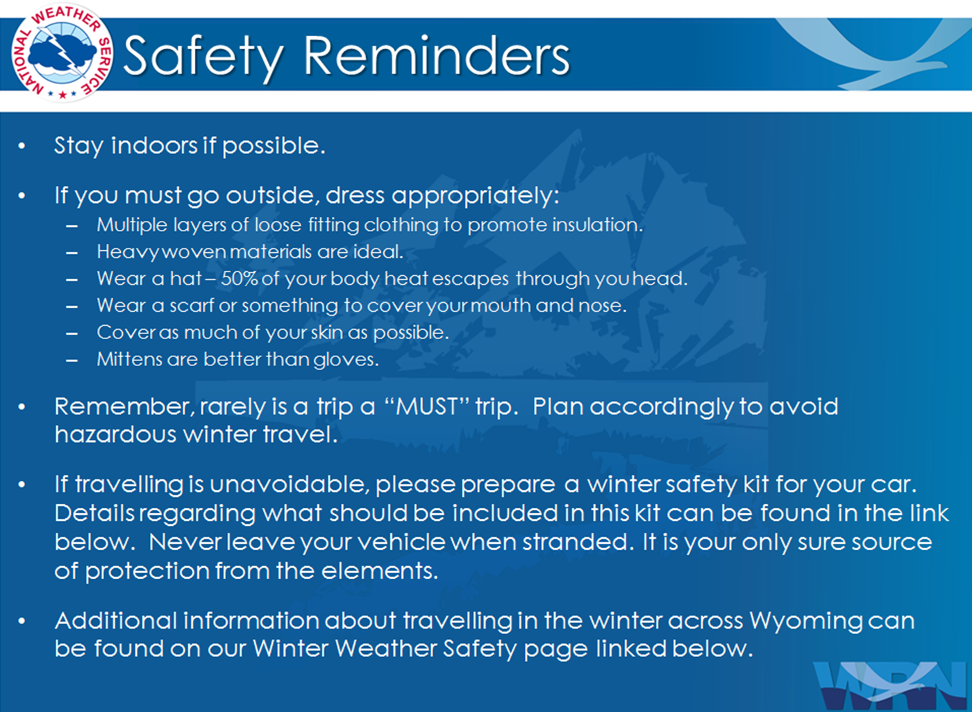
Winter Safety Kit | Winter Weather Safety
 |
Learn more about the National Weather Service's efforts to build a Weather-Ready Nation! |